Summary
- Start
Fukuoka Airport or Hakata Station - Finish
Fukuoka Airport or Hakata Station - Mileage
Total 700km
140km per day - Travel Pace
Relaxing - Onsen Stay
Max.4 nights - Recommended Seasons
Jan,Feb,Mar,Apr,May,Jun,Jul,Aug,Sep,Oct,Nov,Dec
This itinerary takes 4 days to circle northeast Kyushu. By staying consecutive nights in 2 cities, you can travel at a relaxing pace.
If you want to stay in Fukuoka after the road trip, it is also possible to return your car around near Hakata station.
Yufuin/Beppu – Yufuin/Beppu
Start:Yufuin/Beppu (由布院/別府)
Finish:Yufuin/Beppu (由布院/別府)
Mileage:70km
Travel Pace: Relaxed
The mileage on this day is about 70km, so you can relax and enjoy the sights.
1
Inn in Yufuin/Beppu
Parking MAPCODE:
9:00
On this day, though you will leisurely explore the city of Beppu and Yufuin, we recommend that you leave around 9:00.
20min
2
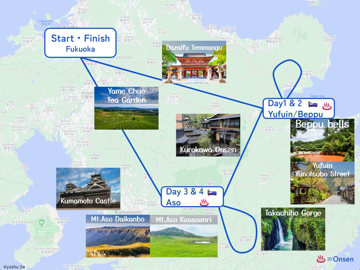
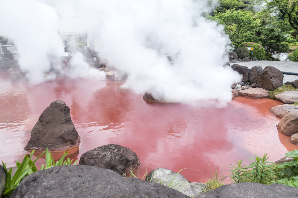
Beppu Jigoku Meguri
Parking MAPCODE:
9:20
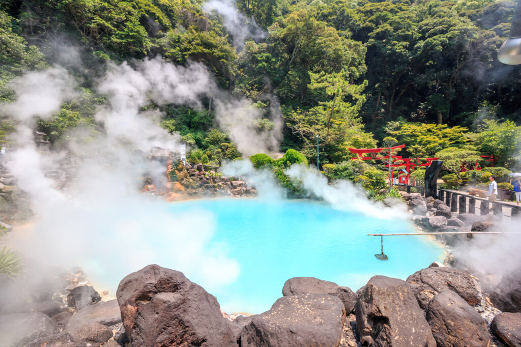
We recommend the Beppu Jigoku Meguri (Beppu Hell Tour) at the beginning of the day. It is a tour where you can feel the hot spring power of Beppu Onsen. By using a car, you can efficiently visit the following seven sites.
●Umi Jigoku (Time required: 40 minutes) MAPCODE: 46 521 411
●Oniishibozu Jigoku (Time required:15 minutes) You can walk since it’sLocated between Umi Jigoku and the parking lot.
Kamado Jigoku (Time required: 15 minutes) MAPCODE: 46 522 481
●Oniyama Jigoku (Time required: 20 minutes) You can walk from Kamado Jigoku since it’s located about 100m there.
●Shiraike Jigoku (Time required: 20 minutes) MAPCODE: 46 522 396
●Chinoike Jigoku (Time required: 10 minutes) MAPCODE: 46 552 802
●Tatsumaki Jigoku (Time required: 10 minutes) You can walk from Chinoike Jigoku since it’s located about 100m there.
15min
3
Lunch
Parking MAPCODE:
46 495 045What is MAPCODE?
12:30
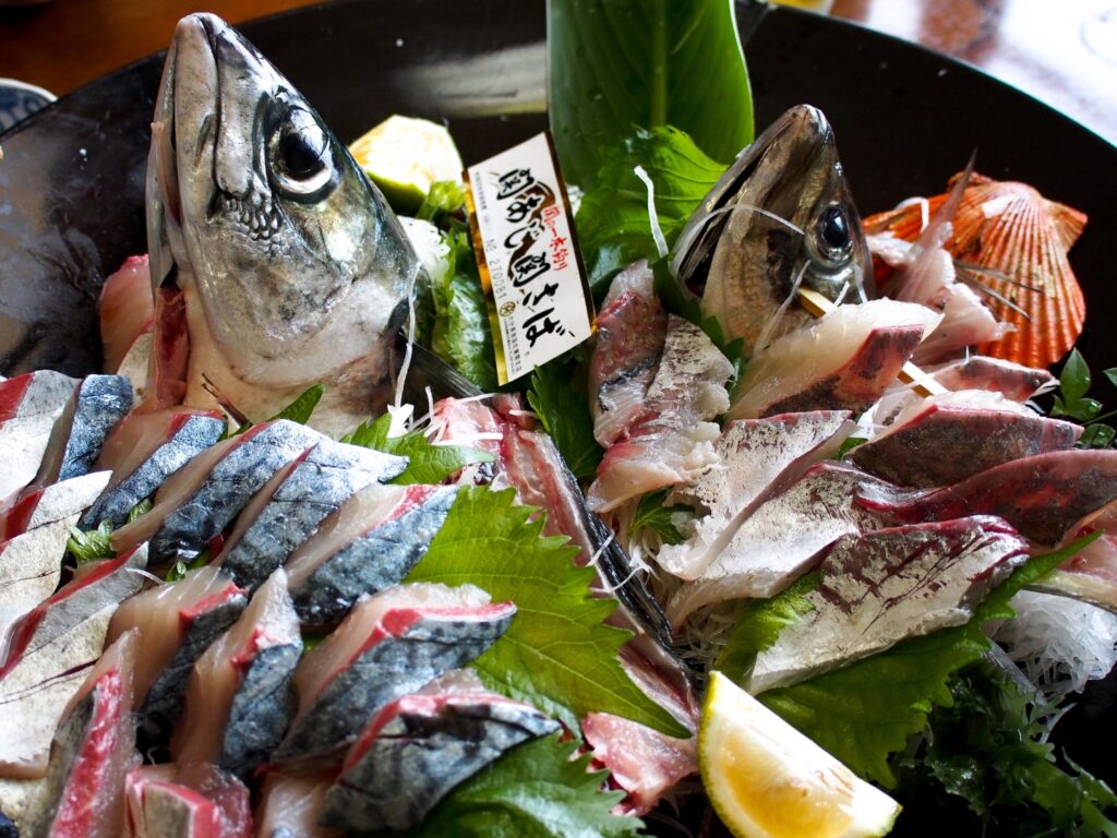
We recommend ‘Seki-saba’ for lunch on this day. There are many restaurants on the east side of Beppu Station. Mackerel and horse mackerel caught in the Bungo Channel, where the tide flows quickly, are called ‘Seki-saba’ and ‘Seki-aji’. Because of its deliciousness and crunchiness, it is valued as a luxury fish.
15min
4
Beppu Ropeway
Parking MAPCODE:
46 369 840What is MAPCODE?
13:50
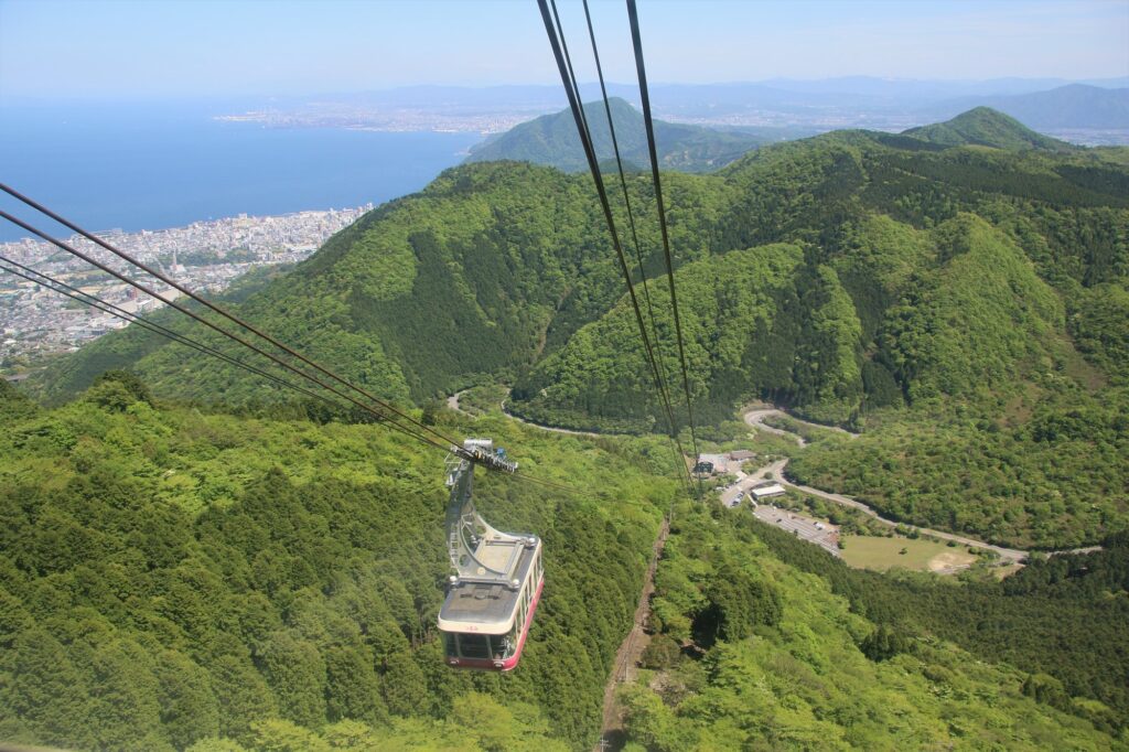
Next, you will head to Beppu Ropeway. It takes about 10 minutes from the foot of the mountain to the summit of Mt. Tsurumi, where you can enjoy a 360-degree panorama at an altitude of 1,375m. From there, you can see Beppu City, Beppu Bay, Lake Shidaka, Kijima Plateau, and the mountains of Shikoku. Cherry blossom season (Bgn Apr-End Apr) and autumn foliage season (End Oct-Mid Nov) are especially recommended.
20min
5
Yunotsubo Kaido
Parking MAPCODE:
269 359 660What is MAPCODE?
15:40
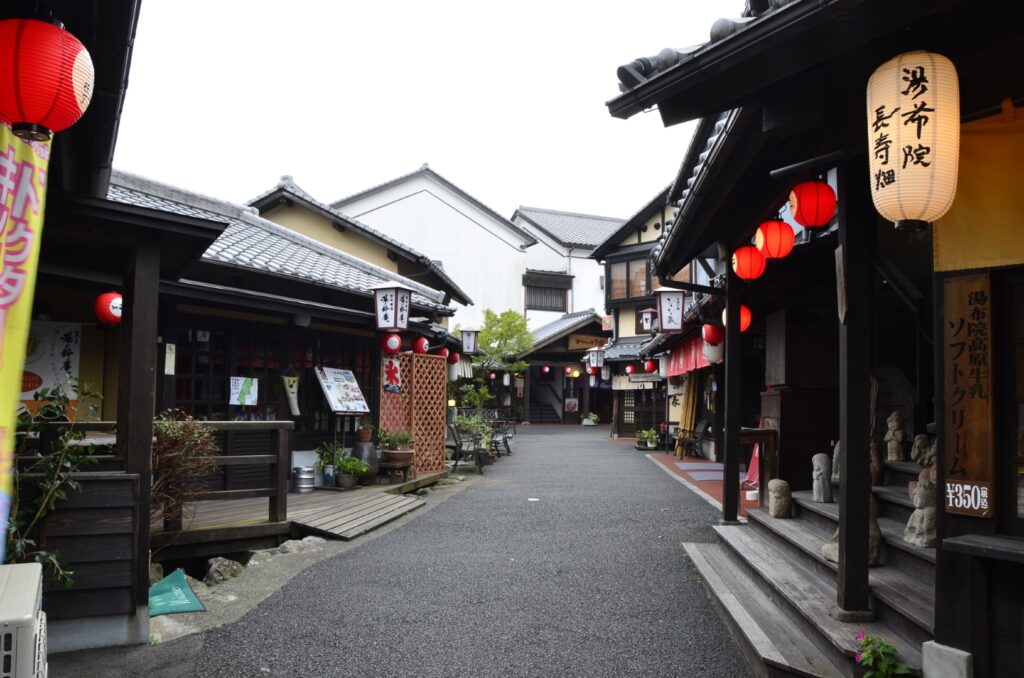
Next, you will head to Yunotsubo Kaido in Yufuin. Yunotsubo Kaido is a very popular spot with many shops where you can enjoy eating while walking and sightseeing. We also recommend walking around Lake Kinrin.
35min
6
Inn in Yufuin/Beppu
Parking MAPCODE:
Please head to the hotel you bookedWhat is MAPCODE?
17:50
Please spend a relaxing second night in Yufuin/Beppu with gorgeous onsen.
The following sites are recommended for travelers with children.
Harmonyland is a theme park where you can meet Sanrio characters, including the popular Hello Kitty. Adults and children alike can enjoy gorgeous live shows such as the daily parade, as well as many attractions.
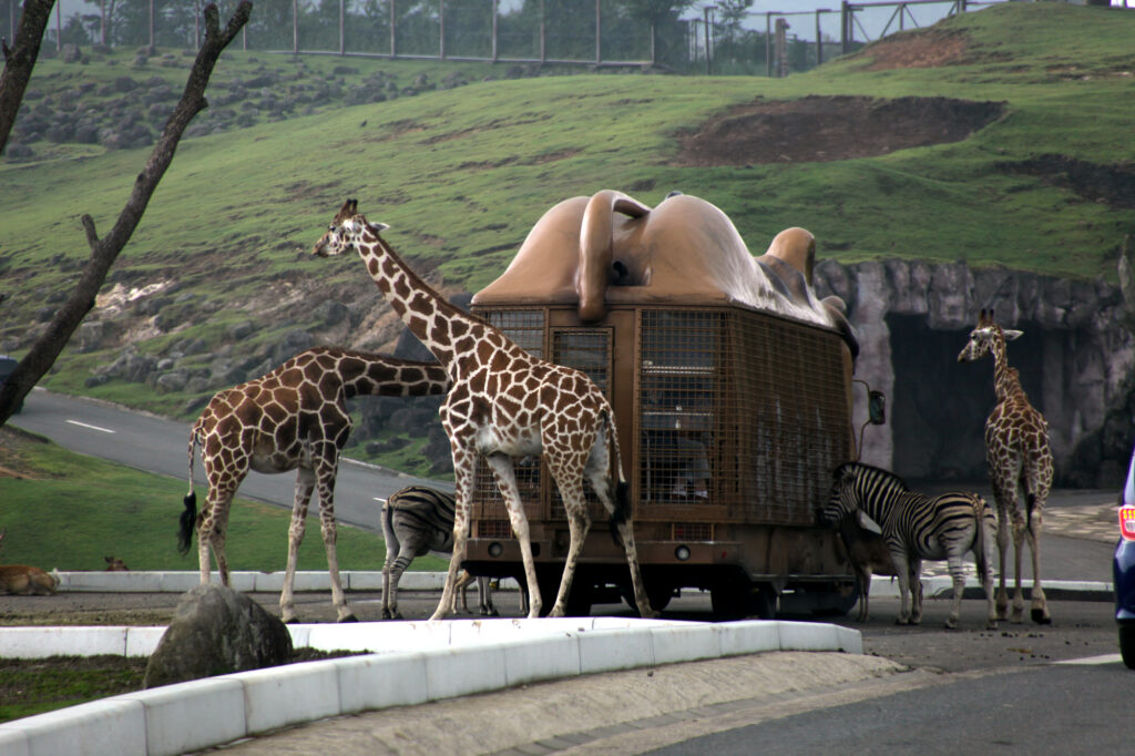
Kyushu Natural Zoological Park African Safari is the only safari park in Kyushu where wild animals live freely in a vast prairie of 1.15 million square meters.
The driving map will show additional 10-20 spots for the day! You will travel only to your favorite spots.
Check pin color and MAPCODE usage.
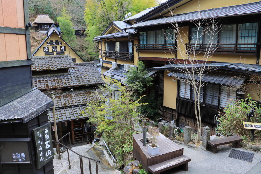
On this day, you will stay in either Yufuin town or Beppu city. It is 20km and takes about 30min. Both of them are nationally famous Onsen areas.
①Yufuin(湯布院)
Yufuin is small but has many luxury Onsen Ryokans.
- Inn Type
Most of these inns are 4 to 5-star Japanese-style Ryokans with Onsen facilities. - Parking
Most inns will offer free parking. - Onsen
This town is famous for Onsens and most of the inns have one. - Meal Plan Reservations
There are a few restaurants in this area, so be sure to make a reservation with a plan that includes dinner and breakfast.
②Beppu(別府)
Beppu is a Bigger City and has More Inexpensive Inns.
- Inn Type
Most of these inns are 3 to 5-star Japanese-style Ryokans with Onsen facilities. - Parking
Most inns have official parking but in addition to the accommodation fee, the parking lot fee will be charged separately. - Onsen
Beppu is famous for Onsens and most of the inns have one. - Meal Plan Reservations
As many restaurants are open till midnight, it is recommended to book your inns with breakfast only or without meals.
Yufuin/Beppu – Aso
Start:Yufuin(湯布院) or Beppu(別府)
Finish: Aso(阿蘇)
Mileage:140km
Travel Pace: Normal
On this day, you will head from Yufuin/Beppu to Aso.
The driving distance is about 140 km. This is a day where you can enjoy three of Kyushu’s most spectacular driving roads.
1
Inn in Yufuin or Beppu
Parking MAPCODE:
9:00
Because there are so many pots to see, we recommend leaving by 8-9 am if you want to travel without rushing.
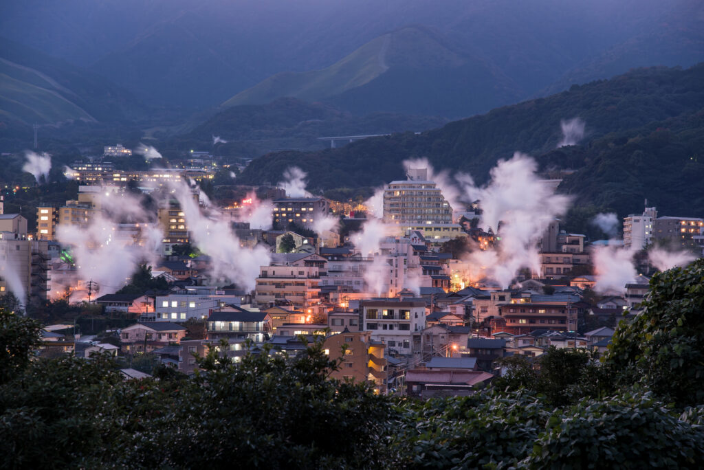
If you are staying in Beppu, go to the “Yukemuri Observatory” first, and you will see the typical Beppu scene of steam rising.
60min
2
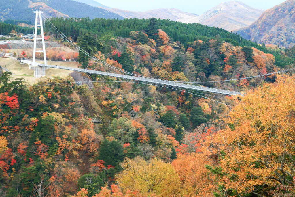
Kokonoe Suspension Bridge-九重夢大吊橋
Parking MAPCODE:
440 882 875What is MAPCODE?
10:20
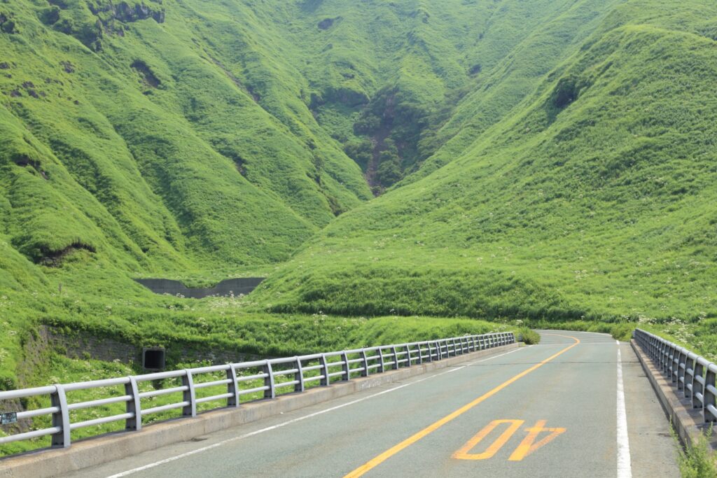
The first destination is the Kokonoe Suspension Bridge. It is the highest suspension bridge for pedestrians in Japan and is a must-see, especially during the season of fresh green leaves and autumn foliage.
40min
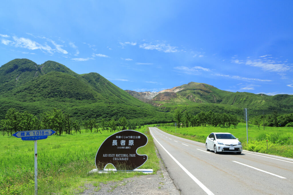
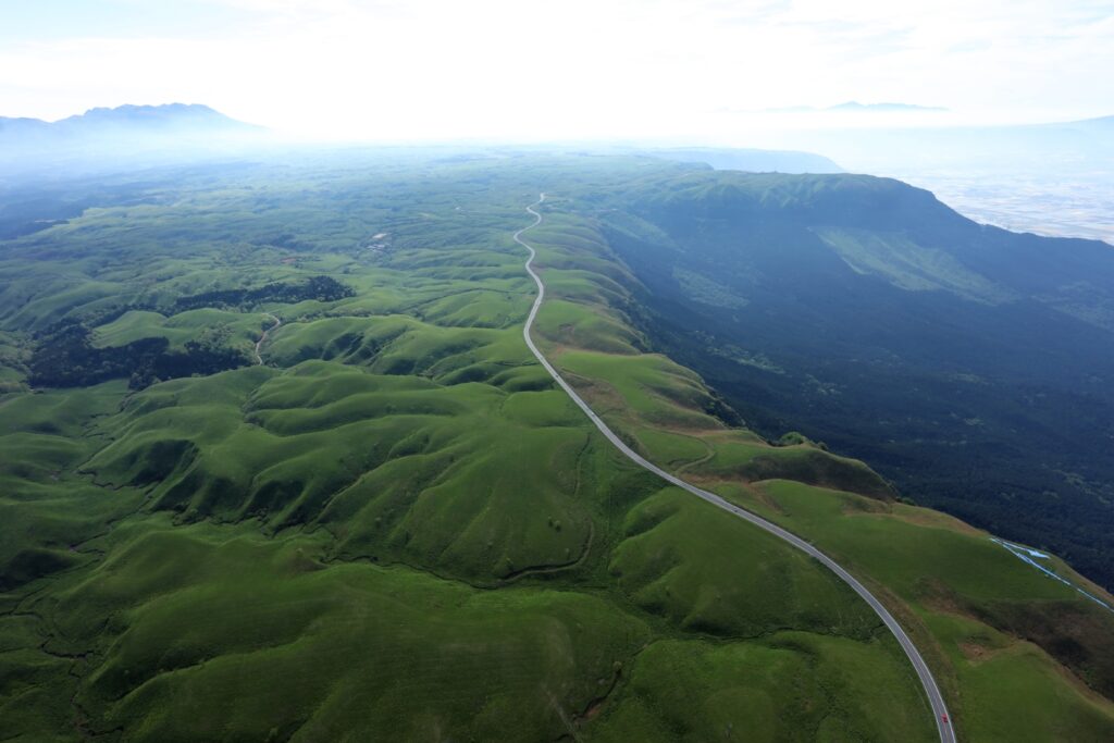
Head south on the Yamanami Highway, the third most popular driving route in Japan. On the way, you can enjoy a fresh yogurt drink at a ranch and a 1km walk in the marshland at Chojabaru. Please refer to the driving map.
Note that Yamanami Highway is a nickname and is actually a public road, not an expressway.
3
Kurokawa Onsen town-黒川温泉
Parking MAPCODE:
440 542 879*52What is MAPCODE?
12:00
Kurokawa Onsen is a great place for lunch. There are nice curry shops and excellent cream puffs. This spot is also very crowded on holidays. Beyond Kurokawa Onsen, there are a number of soba noodle shops called Oguni Soba Road, which is also recommended. Please refer to the driving map.
35min
4
Nishiyunouraenchi Observatory-西湯浦園地展望所
Parking MAPCODE:
256 871 176What is MAPCODE?
14:15
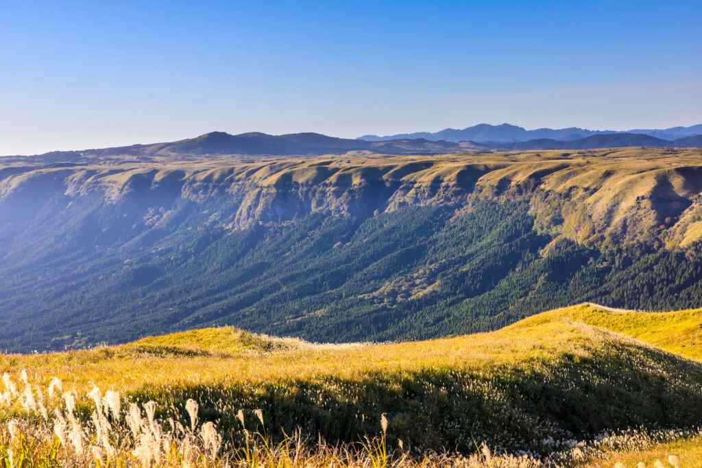
Further south down the Yamanami Highway is the “Nishiyunouraenchi Observatory”. Although not very famous, this is Drive Japan’s best lookout point overlooking the Mt.Aso caldera.
10min
The “Milk Road” from Nishiyunouraenchi Observatory to Daikanbo is the most spectacular road of this road trip, passing by the edge of the caldera of Mt.Aso. The most pleasant drive will make you want to scream, and it will surely be a memory you will cherish forever.
5
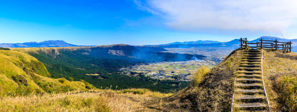
Daikanbo Observatory-大観峰
Parking MAPCODE:
256 878 383What is MAPCODE?
14:45
This is the most famous observatory in the Mt.Aso caldera. Enjoy a 1 km round trip walk on the plateau from the parking lot to the observatory.
30min
6
Mt.Aso(Kusasenri)-草千里
Parking MAPCODE:
256 456 832What is MAPCODE?
16:15
If you still have time, head to Mt. Aso.
You can drive “Panorama Line” road, which was ranked No. 1 in Japan in a motorcycle magazine, will greet you with the sight of vast grasslands.
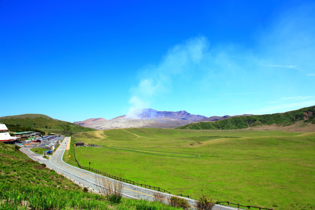
If there are no restrictions on volcanic gases, you can visit the crater. You can take the Aso Park toll road (800 yen) to the parking lot next to the crater.
Please check current restrictions before your visit.
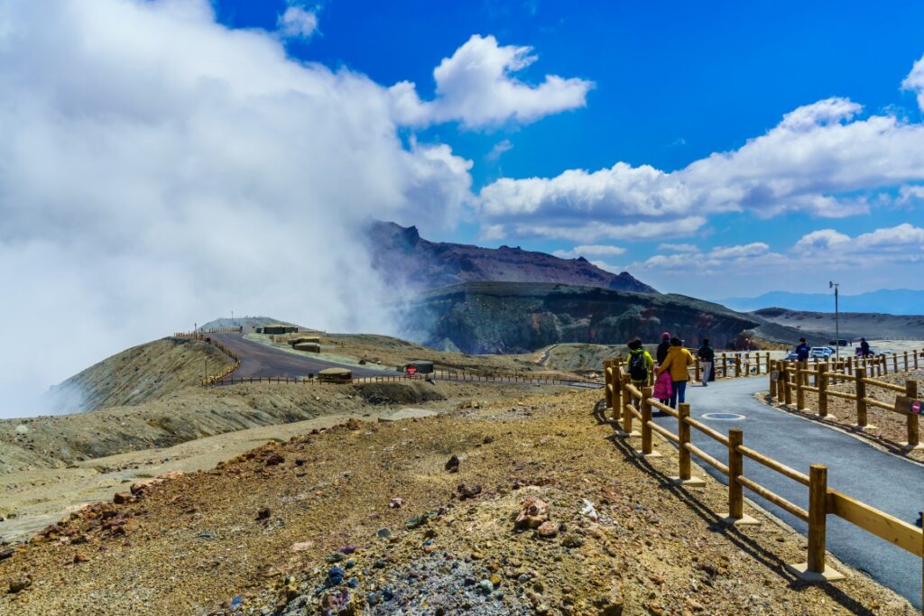
Information on restrictions for the Aso Volcano Center
30min
There are also flower gardens such as “Gandhi Farm” and “Kujyu Flower Park” on this day. If you are traveling during the best time for flowers, give priority to this area.

7
Inn in Aso
The driving map will show additional 10-20 spots for the day! You will travel only to your favorite spots.
Check pin color and MAPCODE usage.
Aso town is a small town located inside the vast caldera of Mt.Aso. The inns are spread over a wide area around Mt. Aso.
- Inn Type
There are a variety of inns from 3-star western-style hotels to 5-star Japanese Ryokans. Please book at your preferred type of inn. - Parking
Most inns will offer free parking. - Onsen
Some luxury Ryokans have Onsen. - Meal Plan Reservations
Aso is a rural area and there are few restaurants. Be sure to make a reservation with a plan that includes dinner and breakfast.
Aso – Aso
Start: Aso(阿蘇)
Finish: Aso(阿蘇)
Mileage:130km
Travel Pace: Relaxing
This will be a day trip from Aso as we will be staying in Aso for a couple of nights.
The driving distance will vary depending on the destination, but in the case of the recommended round trip to Takachiho, it will be about 130 km. If you do not go to Takachiho, we recommend a relaxing trip around Mt.Aso.
1
Inn in Aso
Parking MAPCODE:
10:00
Due to the short driving distance, it is okay to depart at a leisurely pace.
However, if you did not visit “Mt.Aso” yesterday, leave early and go there first. Driving up the Aso Panorama Line Road, which was ranked No. 1 in the national driving road rankings, you will be greeted by the sight of vast grasslands and an active volcano!
75min
2
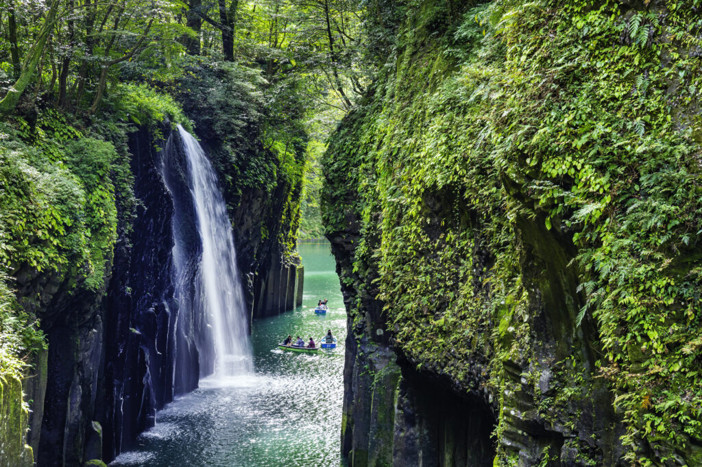
Takachiho Gorge-高千穂峡
Parking MAPCODE:
330 711 730*31What is MAPCODE?
11:15
First, let’s move on at once to visit “Takachiho Gorge”. It is one of the most beautiful gorges in all of Japan and one of the most recommended spots on this entire road trip.
Boat rentals are very popular and sometimes crowded, but highly recommended!
10min
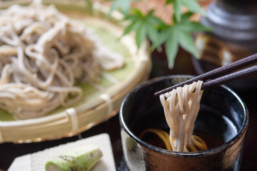
There are not many restaurants in Takachiho, but please refer to the driving map for recommended soba restaurants and Takachiho beef restaurants.
3
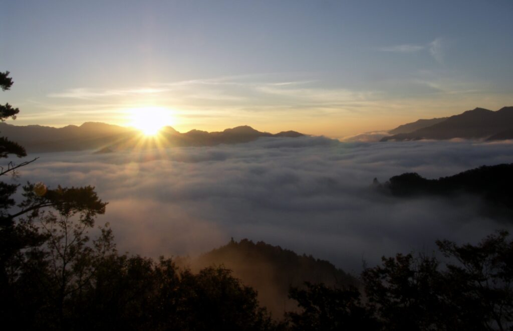
Kunimigaoka Observatory-国見ヶ丘展望台
Parking MAPCODE:
330 768 798What is MAPCODE?
13:15
“Kunimigaoka Observatory” near Takachiho Gorge is also worth a visit. It is hard to describe from the picture, but from this 513-meter-high hill, you can see the Takachiho Basin to the east and Mount Aso to the west, and Takachiho, a town said to be the home of the gods, can be seen from all directions. It is famous for the sea of clouds, but it is also a sight to behold at other times of the year.
20min
4
Amanoiwato Shrine-天岩戸神社
Parking MAPCODE:
330 837 575*60What is MAPCODE?
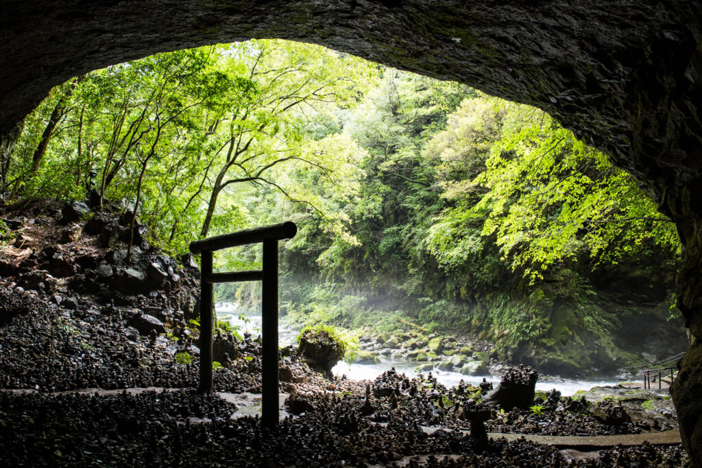
14:30
10km away from Takachiho Gorge, the “Amanoiwato Shrine” is also recommended. A 10-minute walk along a riverside path called “Amanoyasukawara” will lead you to a fantastic torii gate in a cave.
60min
5
Shirakawa Suigen-白川水源
Parking MAPCODE:
256 251 381What is MAPCODE?
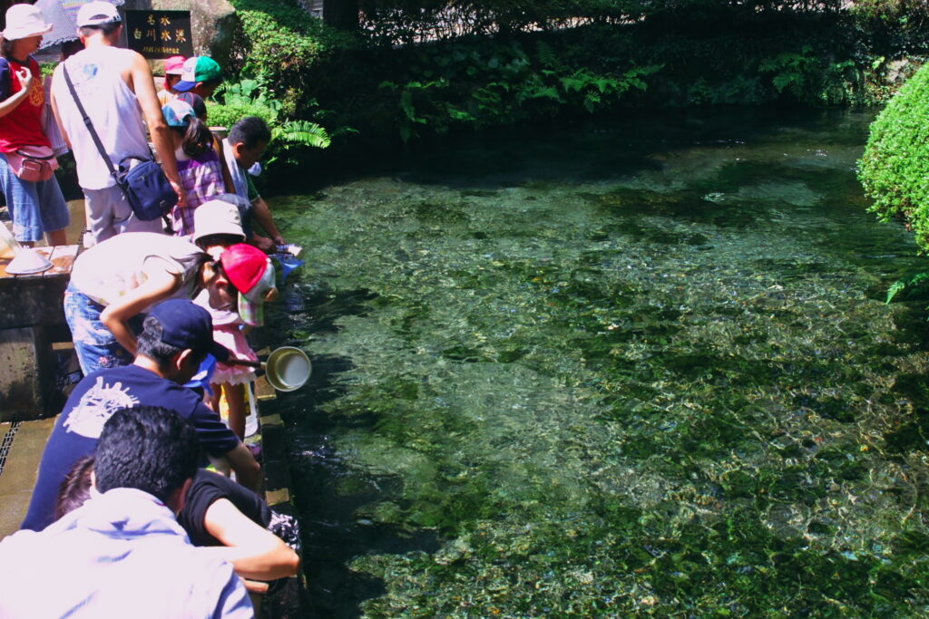
16:30
Back to Aso and if you still have time, stop by “Shirakawa Suigen”. You can draw natural water from the foot of Mt. Aso.
30min
There are some cherry blossom viewing spots along the route on this day. If you visit during the cherry blossom season, please refer to the driving map.
6
Inn in Aso
Parking MAPCODE:
Please head to the hotel you reserved.What is MAPCODE?
Let’s return to the same inn in Aso as the previous day.
The driving map will show additional 10-20 spots for the day! You will travel only to your favorite spots.
Check pin color and MAPCODE usage.
Aso town is a small town located inside the vast caldera of Mt.Aso. The inns are spread over a wide area around Mt. Aso.
- Inn Type
There are a variety of inns from 3-star western-style hotels to 5-star Japanese Ryokans. Please book at your preferred type of inn. - Parking
Most inns will offer free parking. - Onsen
Some luxury Ryokans have Onsen. - Meal Plan Reservations
Aso is a rural area and there are few restaurants. Be sure to make a reservation with a plan that includes dinner and breakfast.
Aso – Fukuoka
Start:Aso(阿蘇)
Finish:Fukuoka(福岡)
Mileage:200km
Travel Pace: Fast
On this day, we will return to Fukuoka from Kumamoto.
The distance traveled is about 200 km. The second half of the trip will be on the expressway for about 50 km.
1
Inn in Aso
Parking MAPCODE:
9:00
If you are not staying in Fukuoka today and will be taking the Shinkansen or airplane, please arrange your schedule so that you can return the rental car to the rental store at least one and a half hours before your flight.
If you want to go to [Mt.Aso], you should allow 1.5 hours to move around and visit, so we recommend leaving before 8:00 am.
2
Kumamoto Castle-熊本城
Parking MAPCODE:
29 489 225What is MAPCODE?
First, we will head to Kumamoto Castle, the symbol of Kumamoto, which was damaged by the Kumamoto Earthquake in 2016, but restoration work on the castle tower was completed in March 2021.
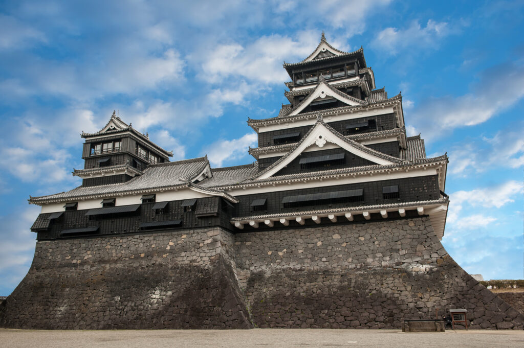
80min
3
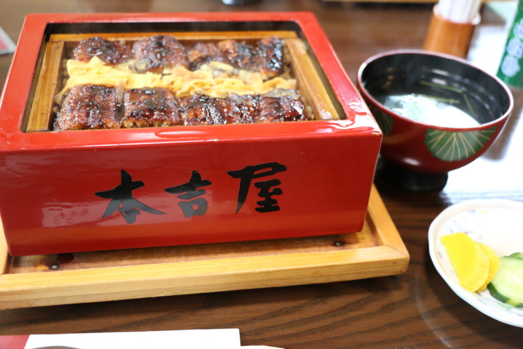
Ganso Motoyoshiya-元祖本吉屋
Parking MAPCODE:
69 874 678*52What is MAPCODE?
13:00
Yanagawa is famous for its eels. Among them, Motoyoshiya has been in business for 300 years and serves the best eels. There is also a cheap and tasty udon restaurant nearby, which is also recommended.
5min
4
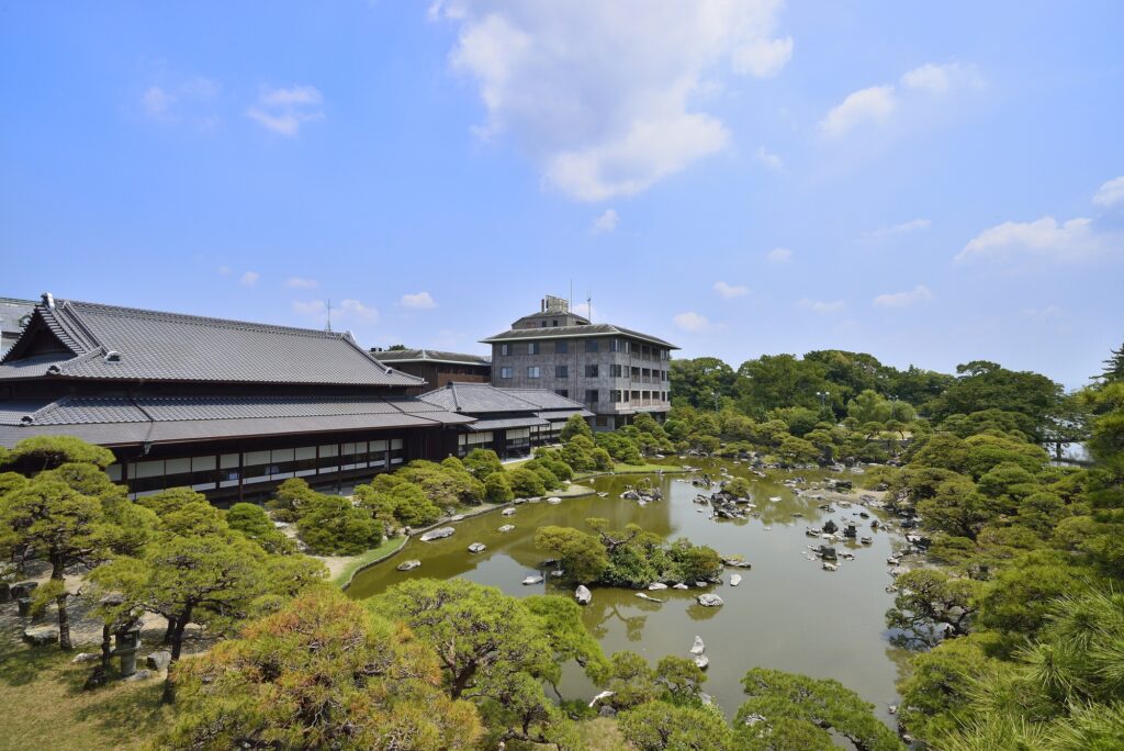
Ohana Shotoen-御花・松涛園
Parking MAPCODE:
69 843 570What is MAPCODE?
14:10
Ohana Shotoen is a former domain lord’s residence with a splendid garden that has been selected as a national place of scenic beauty.
60min
5
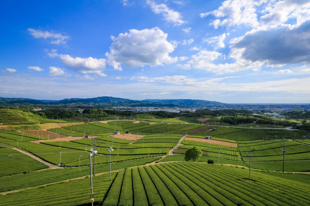
Yame Chuo Tea garden-ハ女中央大茶園 展望所
Parking MAPCODE:
37 267 224*20What is MAPCODE?
16:10
The last highlight of the day was the Yame Chuo Tea garden. This area is the production area of “Yame-cha”, one of the finest teas in Japan. This is an observatory from which you can look out over the vast tea fields as far as the eye can see. This is a spot that cannot be reached by public transportation or even by bus tours, but only by a road trip.
From here, let’s take the expressway (E3) to Fukuoka. It is about 50 km, or 1 hour and 10 minutes.
70min
6
Inn in Rental car branch at Fukuoka airport or Hakata station
Parking MAPCODE:
Please head to the rental car branchWhat is MAPCODE?
17:45
This concludes your Kyushu road trip.
When you return to Fukuoka, refuel and then return the car to the car rental branch. Use the MAPCODE on the driving map for the nearest gas stations at Hakata Station and Fukuoka Airport.
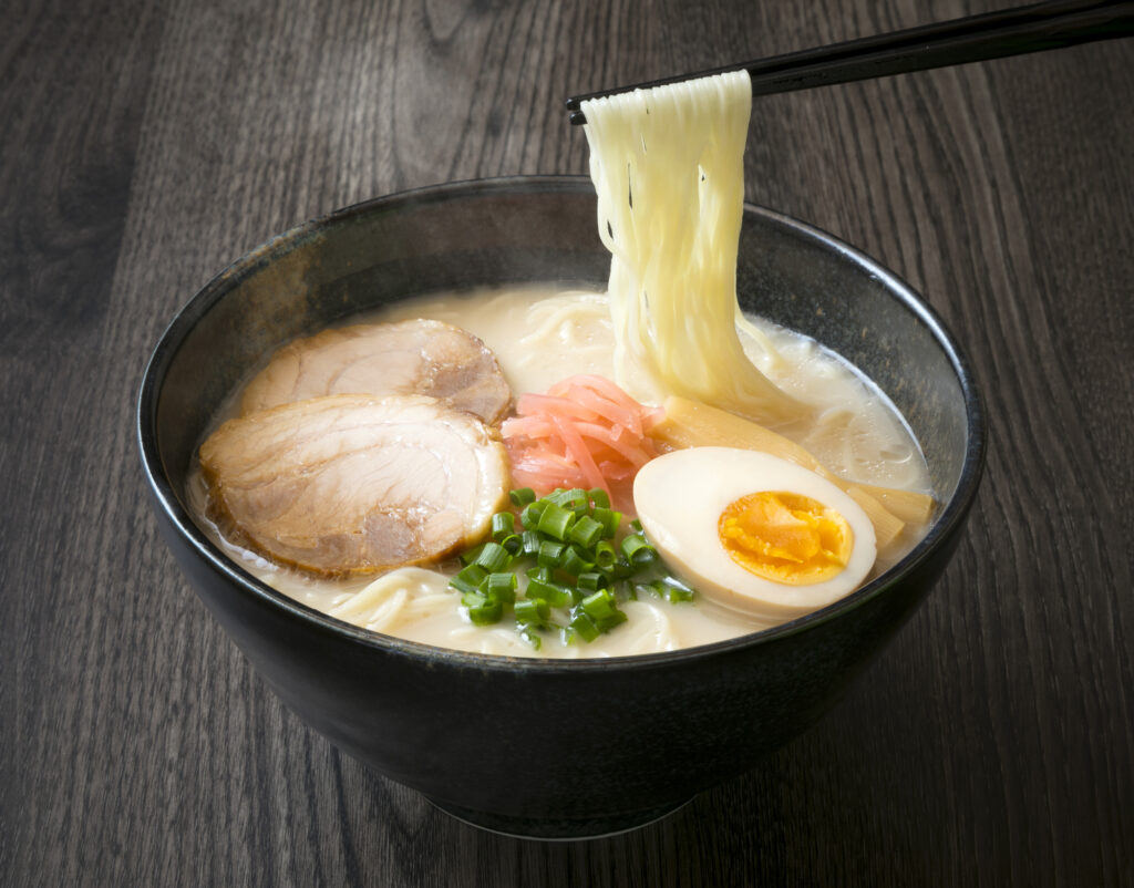
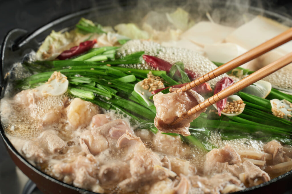
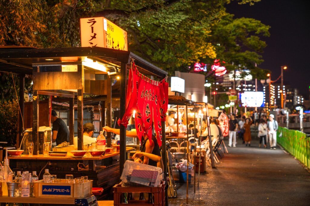
Fukuoka offers a wide variety of culinary delights. For dinner, try Hakata ramen, Motsu nabe (Motsu hot pot), and other local Fukuoka foods, or even try one of the famous Yatai stalls.
The driving map will show additional 10-20 spots for the day! You will travel only to your favorite spots.
Check pin color and MAPCODE usage.
Fukuoka is the biggest city in Kyushu and the gateway of Kyushu Travel. It takes 15min to Fukuoka Airport by subway. There are hundreds of accommodations around “Hakata Station”, Nakasu downtown area, and Tenjin Station.
- Inn Type
Most of these inns are 2 to 5-star western-style hotels. - Parking
Some inns have official parking but in addition to the accommodation fee, the parking lot fee will be charged separately. - Onsen
There is no Onsen in this town and no inns have Onsens. - Meal Plan Reservations
As many restaurants are open till midnight, it is recommended to book your inns with breakfast only or without meals.