Summary
- Start
Kansai Airport, Osaka, or Kyoto - Finish
Kansai Airport, Osaka, or Kyoto - Mileage
Total 1150km
190km per day - Travel Pace
Fast - Onsen Stay
Max.2 night
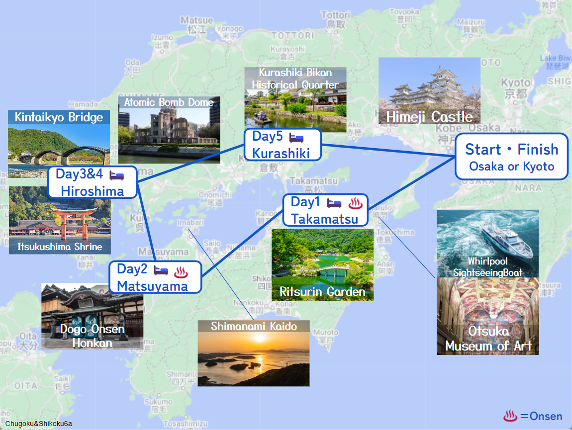
This 6-day itinerary will take you to Chugoku & Shikoku areas only 3% of foreign tourists visit! It focuses for the Seto Inland Sea area and can across several bridges, and visit hidden gems and local foods.
Daily mileage is long (190km) and the travel pace is fast. But consecutive stays at Hiroshima give you enough time for Itsukushima Shrine.
Osaka – Takamatsu
Start: Osaka (大阪京都)
Finish: Takamatsu (高松)
Mileage:
From Kyoto: 245km
From Osaka: 210km
From Kansai Arirpot: 240km
Travel Pace: Fast
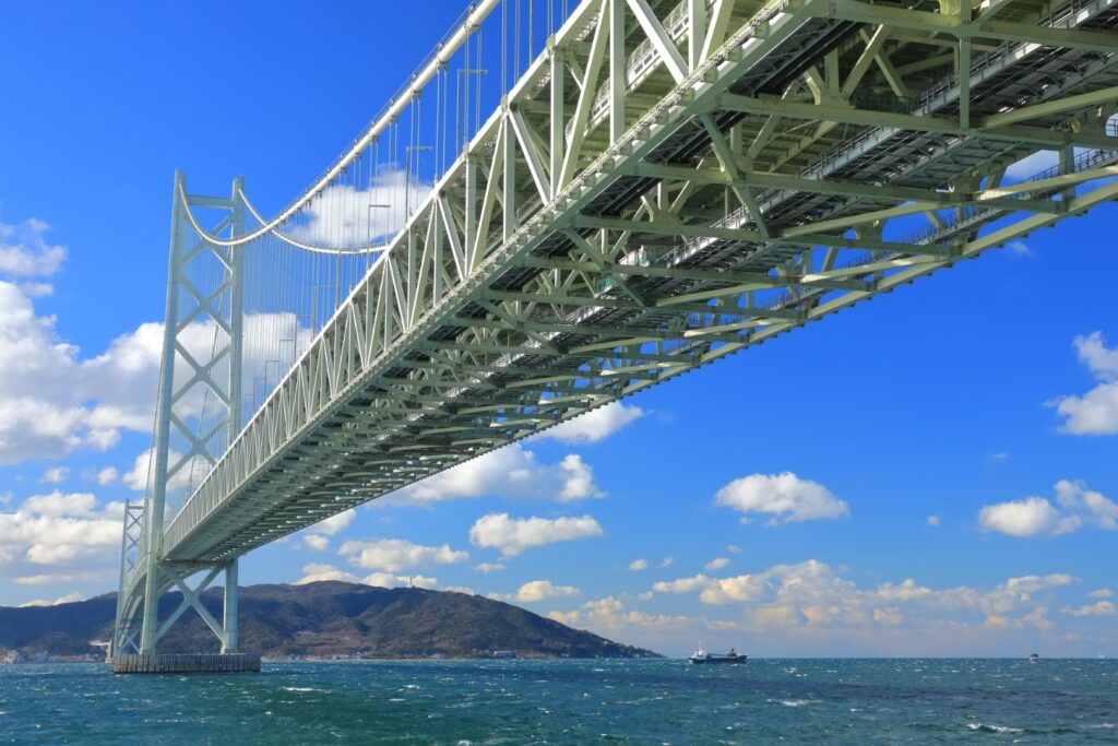
On this day, you will head from Osaka to Takamatsu via Akashi Kaikyo Bridge and Awaji Island.
1
Inn in Osaka or Kyoto
Parking MAPCODE:
9:00
Although it depends on the departure point, it is recommended to start as early as possible because the mileage is 245km. Also, use the expressway as much as possible to reduce travel time.
140 min
When you depart, take the expressway (4, 5, and E28) directly to Awaji Island.
The [Akashi Kaikyo Bridge] that passes on the way has a beautiful view and you can enjoy comfortable driving.
2
Uzu no Michi & Eddy Memorial Hall
Parking MAPCODE:
406 212 782*48What is MAPCODE?
11:20
Immediately after arriving at Awaji Island, Akashi Kaikyo Bridge (Awaji SA) has a wonderful view and is perfect for a break.
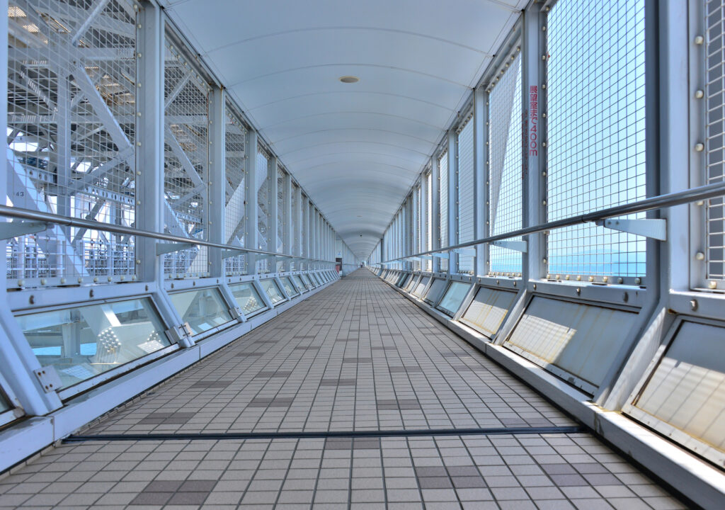
After passing Awaji Island, you will arrive at the first destination of the day, [Uzu no Michi & Eddy Memorial Hall]. Here you can enjoy the whirlpools of Naruto and the Onaruto Bridge.
[Uzu no Michi] is a promenade installed under the road of Onaruto Bridge, and you can enjoy whirlpools while taking a walk in the air for about 500m.
[Eddy Memorial Hall] is a facility where you can experience the Naruto Ohashi Bridge and whirlpools in a simulated manner using virtual technology.
5 min
3
Whirlpools Sightseeing Boats
Parking MAPCODE:
12:30
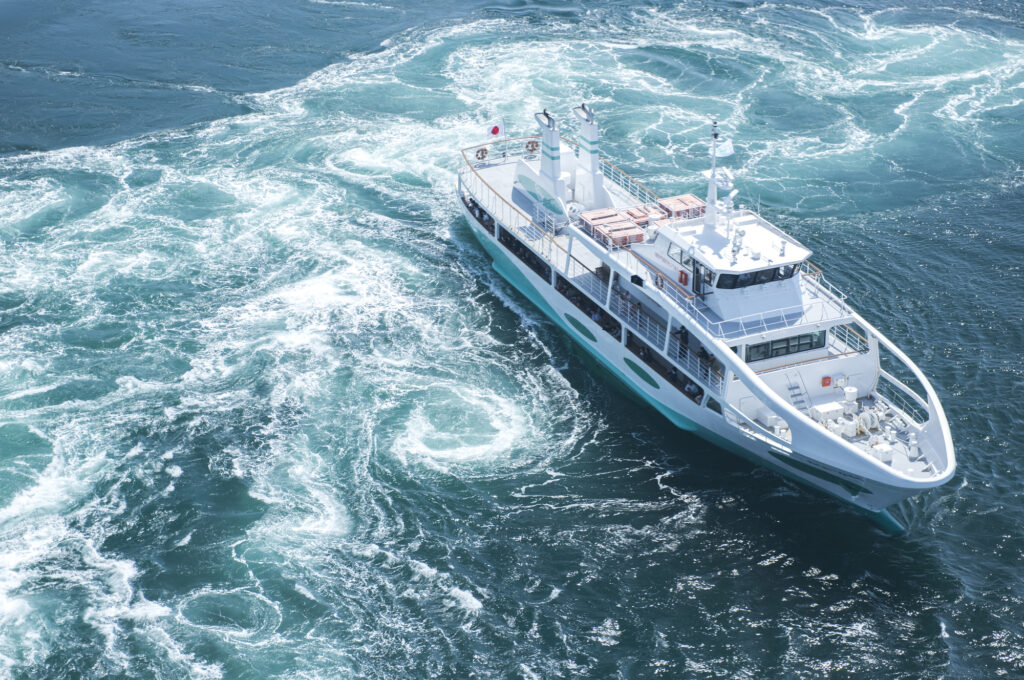
There is a platform for [Whirlpools Sightseeing Boats] where you can see the whirlpools of Naruto in front of you. Experience the famous Naruto Whirlpools from the top of the ship.
Small boats are recommended on weekdays, and large boats are recommended on weekends and holidays.
[Weekday]
Uzushio Kisen (small 25 minutes) is recommended
MAPCODE: 406 211 567
[Weekend or Holiday]
Wanda Naruto (large 30 minutes) is recommended
MAPCODE: 406 210 211
Uzushio Kisen
Wonder Naruto
5 min
4
Otsuka Museum of Art
Parking MAPCODE:
406 211 331*85What is MAPCODE?
14:30
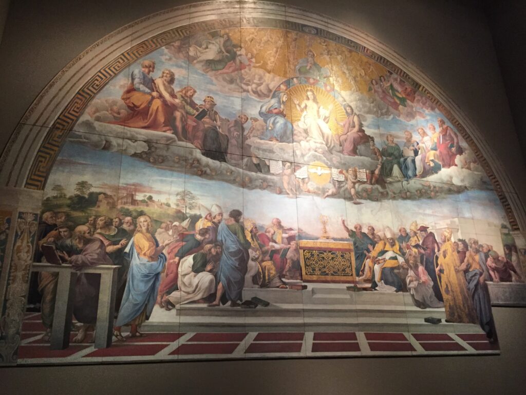
After enjoying the whirlpools of Naruto, let’svisit [Otsuka Museum of Art].
This is a museum that reproduces the world’s masterpieces in full size, created by the Otsuka Group, known for its Pocari Sweat. All the masterpieces that everyone has seen in textbooks are recreated from ceramic plates, so you can touch them directly. You will be overwhelmed by the extraordinary number of exhibits.
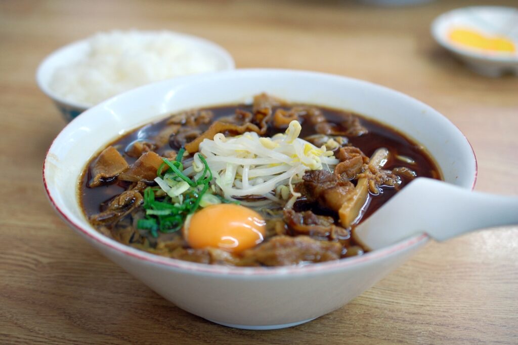
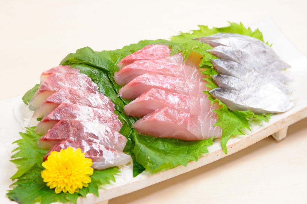
There are many delicious restaurants around Naruto.
Choose your favorite restaurants such as seafood, Tokushima ramen, and Naruto udon.
60 min
5
Inn in Takamatsu
Parking MAPCODE:
Please head to the hotel you reserved.What is MAPCODE?
17:40
After enjoying Naruto, take the expressway (E11) again and head toward Takamatsu.
You will stay in Takamatsu on this day.
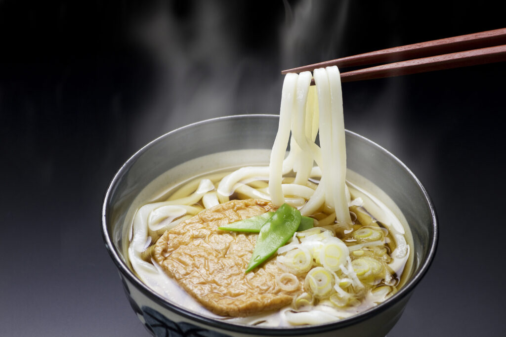
There are many hotels in Takamatsu on the south side of Takamatsu Station, but restaurants are especially concentrated around Takamatsu Castle. Enjoy local gourmet food such as bone-in chicken and olive dishes as well as Sanuki udon.
On this day, you will also pass near [National Akashi Kaikyo Park] where various flowers such as tulips and cherry blossoms bloom all year round, and [Awaji Hanasajiki] where you can see rape blossoms in spring and cosmos fields in autumn. If you are traveling during this time of the year, we recommend that you adjust the time and stop by.

The driving map will show additional 10-20 spots for the day! You will travel only to your favorite spots.
Check pin color and MAPCODE usage.
The inns are concentrated south side of Takamatsu station.
- Inn Type
Most of these inns are 3 to 4-star western-style hotels. - Parking
Some inns have official parking but in addition to the accommodation fee, the parking lot fee will be charged separately. - Onsen
There is no Onsen in this town and most inns don’t have Onsens. - Meal Plan Reservations
As many restaurants are open till midnight, it is recommended to book your inns with breakfast only or without meals.
Takamatsu – Matsuyama
Start:Takamatsu (高松)
Finish:Matsuyama (松山)
Mileage:180km
Travel Pace: Normal
On this day you are heading from Takamatsu to Matsuyama.
1
Inn in Takamatsu
60 min
2
Kotohiragu(Konpiragu) Shrine
Parking MAPCODE:
77 383 197*07What is MAPCODE?
10:00
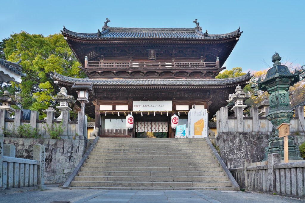
The first place to visit is the famous [Kotohiragu], which is synonymous with Kagawa Prefecture. Known as “Sanuki no Konpira-san” for a long time, and the long stone steps (785 steps to the main shrine and 1368 steps to the inner shrine) are especially famous.
40 min
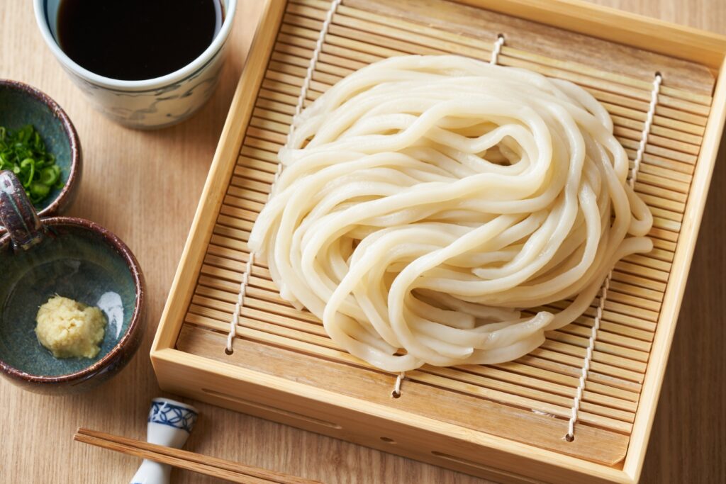
Kagawa Prefecture is called “Udon Noodle Prefecture” and there are more than 500 Udon restaurants! Enjoy different styles of their “Sanuki Udon”. Check the famous restaurants on the Driving map. But you will have to wait long queue, especially on weekend. It is also exciting to find unknown nice udon restaurants beside the map.

3
Takaya Shrine
Parking MAPCODE:
77 274 031*15What is MAPCODE?
13:00
After that, we recommend two famous Instagram spots.
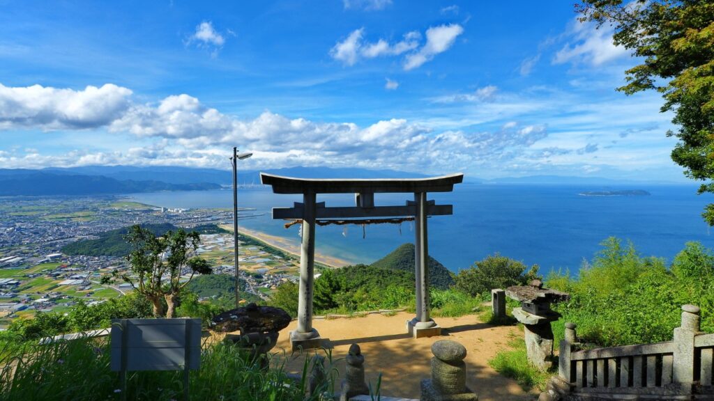
[Takaya Shrine] is famous as “Torii in the Sky” and you can take wonderful pictures.
30 min
4
Zenigata sand picture Observatory
Parking MAPCODE:
77 152 625*28What is MAPCODE?
14:00
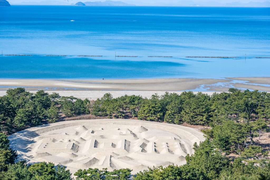
This is a sand painting of a coin used in Japan 400 years ago.
It measures 122 meters from east to west and 90 meters from north to south. Incredibly, it has been preserved by the local people for more than 300 years.
110min
After Zenigata sand picture, there are not many attraction and recommended to take expressway(E11) to Matsuyama city, tonight’s lodging. Be careful that although it is long driving on the express way there are only 2 rest area.
- Irino PA (入野PA)
- Ishizuchiyama SA(石槌山SA)
5
Matsuyama Castle
Parking MAPCODE:
53 316 658*85What is MAPCODE?

16:30
If you are on time, go to [Matsuyama Castle], one of the original castle towers. The castle was built on a mountain in the middle of the flat land of the city of Matsuyama, and the view from the castle is also the best.
Please take note that the last entry for Matsuyama castle is early and try to reach by 16:30.
Matsuyama Castle
10 min
6
Inn in Matsuyama
Parking MAPCODE:
Please head to the hotel you reserved.What is MAPCODE?
17:30
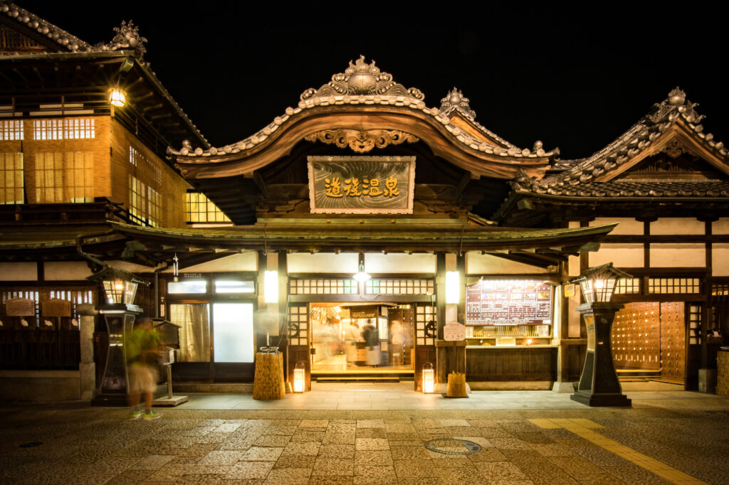
On this day you will stay in Matsuyama city which is famous for Dogo Onsen. It is the oldest hot spring in Japan, said to have been in existence for 3,000 years! It was also loved by Soseki Natsume, a famous novelist whose portrait was also on the old 1,000-yen bill.
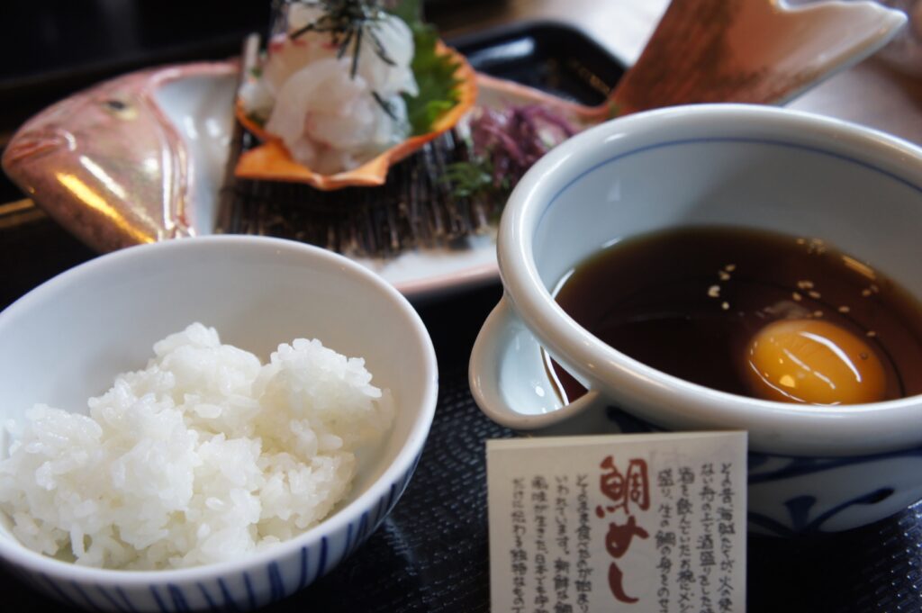
“Taimeshi(Sea bream on the rice)” is recommended for dinner.
Citrus fruits such as mandarin oranges and ponkan are also recommended.

The driving map will show additional 10-20 spots for the day! You will travel only to your favorite spots.
Check pin color and MAPCODE usage.
On this day, you will stay in Matsue city which is famous for the oldest Dogo Onsen.
Many inns are concentrated in the following two areas.
①Matsuyama city
The inns are concentrated south side of Matsuyama Castle. This area is convenient for dinner and visiting Matsuyama castle but no inns offer Onsen.
Please take note that around Matsuyama station is inconvenient and not recommended.
- Inn Type
Most of these inns are 3 to 4-star western-style hotels. - Parking
Most inns have official parking but in addition to the accommodation fee, the parking lot fee will be charged separately. - Onsen
There is no Onsen in this town and no inns have Onsens. - Meal Plan Reservations
As many restaurants are open till midnight, it is recommended to book your inns with breakfast only or without meals.
②Dogo Onsen(道後温泉)
This hot spring resort area is located 3km northeast of Matsuyama. Dogo Onsen is said to have a history of 3,000 years and is called the oldest hot spring all over Japan.
- Inn Type
There are a variety of inns from 3-star western-style hotels to 5-star Japanese Ryokans. Please book at your preferred type of inn. - Parking
Some inns have official parking but in addition to the accommodation fee, the parking lot fee will be charged separately. - Onsen
Most inns provide Onsen. Additionally, it is also a unique experience to visit the public bathhouse “Dogo Onsen Honkan”. - Meal Plan Reservations
There are many restaurants in and around the hotel for dinner, so please make reservations according to your preference.
Matsuyama – Hiroshima
Start:Matsuyama (松山)
Finish:Hiroshima (広島)
Mileage:230km
Travel Pace:Fast
On this day you will head from Matsuyama to Hiroshima via the photogenic Shimanami Kaido.
1
Inn in Matsuyama
Parking MAPCODE:
9:00
The mileage is 230km, which is very long, and there are many sites you want to see, so it is recommended that you leave at around 8 o’clock or at the latest by 9 o’clock. We also recommend using the expressway (E2) from Onomichi to Hiroshima so that you can spend your time more on the Shimanami Kaido, which is the highlight of the day.
If you want to visit Matsuyama castle, let’s visit before you depart Matsuyama.

85 min
-大-1024x683.jpg)
If you drive 45km from Matsuyama for about 1 hour and 25 minutes, you will reach the main part of the day, Shimanami Kaido. The world-famous cyclist’s sanctuary, this road is the best drive route with six islands connected by bridges.
2
Kirosan Observatory Park
Parking MAPCODE:
381 124 071What is MAPCODE?
10:30
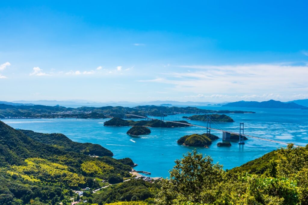
The first destination of the day is Drive Japan’s highly recommended [Mt.Kirosan Observatory Park]. With a panoramic view of the Kurushima Strait and the Kurushima Strait Bridge, which are known for their rapid tides, it is the No. 1 observatory on the Shimanami Kaido. The observatory itself is also unique and was designed by Kengo Kuma, who is famous for designing the Olympic Stadium in Tokyo. On the way, you will pass a narrow mountain road, so please drive carefully.
50 min
3
Kosanji Temple & The Hill of Hope
Parking MAPCODE:
12:00
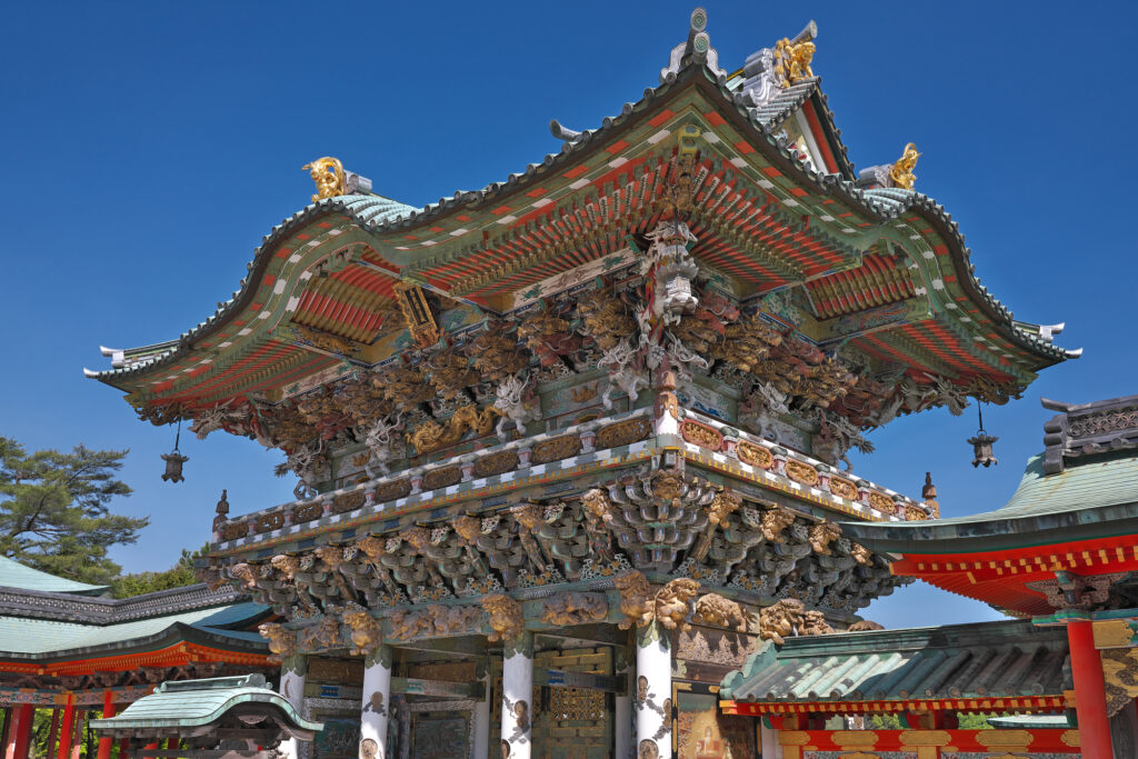
If you cross the Tatara Bridge, which is one of the most beautiful bridges on the Shimanami Kaido, you will arrive at Ikuchijima Island. Please go to [Kosanji Temple & The Hill of Hope] there. [Kosanji Temple] is a place like a museum of shrines and temples, with buildings that imitate famous shrines and temples.
[The Hill of Hope] is a southern European-style white marble garden on the grounds of Kosanji Temple, and is a photogenic place with a wonderful contrast between the white rocks and the blue sea.
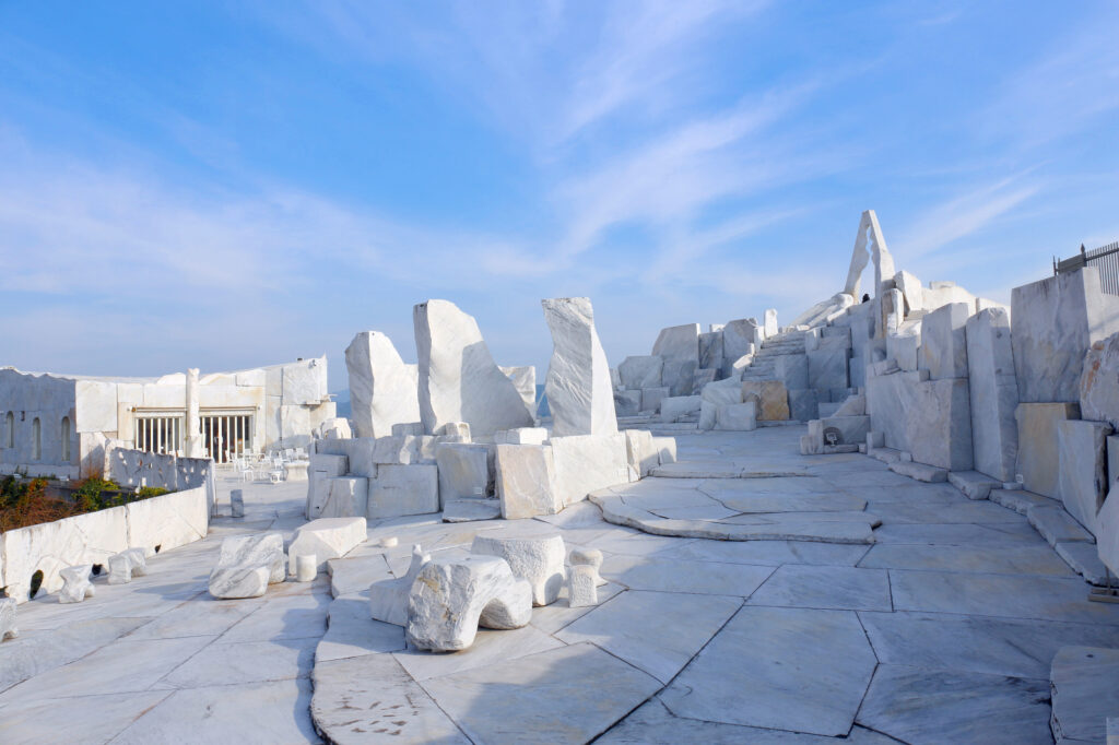
40 min
Onomichi ramen is recommended for lunch. The soy sauce ramen with chicken stock and dried sardines is delicious. Please refer Driving Map to find the famous restaurant.
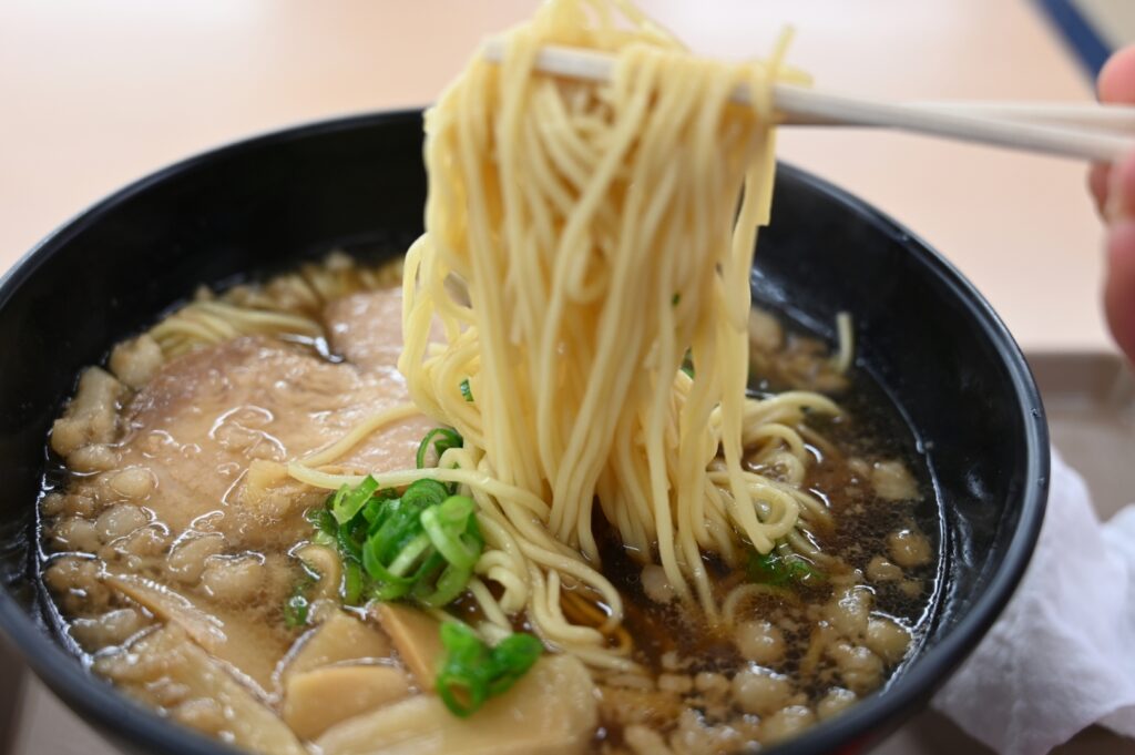
4
Senkoji Temple
Parking MAPCODE:
48 248 862*52What is MAPCODE?

14:30
The next spot is [Senkoji Temple]. It stands on a hill at an altitude of 140m and overlooks the city, Onomichi Port, and the sea from the precincts.

90 min
From Senkoji Temple to Hiroshima, it takes about 85km by expressway (E2), which is about an hour and a half.
5
Hiroshima Atomic Bomb Dome & Peace Memorial Park
Parking MAPCODE:
22 189 897*36What is MAPCODE?
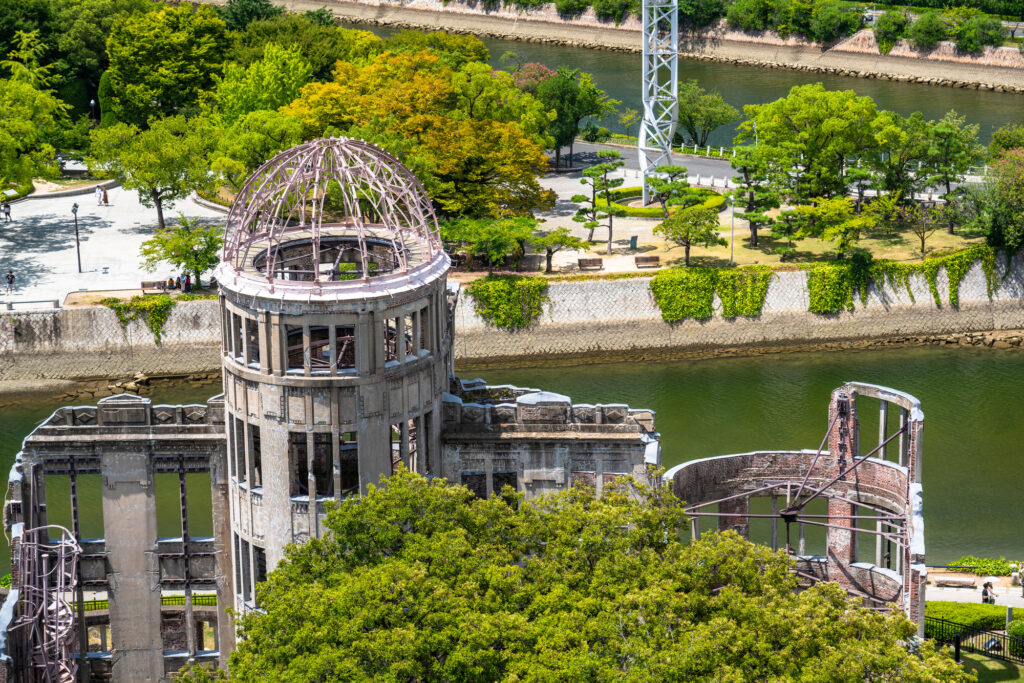
17:00
If you have time on this day, go to the World Heritage Atomic Bomb Dome and Peace Memorial Park. [Atomic Bomb Dome] is a former Hiroshima Prefectural Industrial Promotion Center that miraculously survived the atomic bomb, and is widely known as a symbol of the Hiroshima atomic bomb.
[Peace Memorial Park] was built in this place near the hypocenter of the atomic bomb, hoping for permanent peace in the world. If you go to the Peace Memorial Museum, you can feel the ugliness of the atomic bomb through the displays of the remains of the atomic bomb survivors, photographs, and materials showing the tragedy of the atomic bomb.
It takes about 30 minutes to walk around the Atomic Bomb Dome and Peace Park, and about 1 hour to the museum.

5 min
6
Inn in Hiroshima
Parking MAPCODE:
Please head to the hotel you reserved.What is MAPCODE?
18:30
On this day you will stay in Hiroshima.
There are many hotels between Hiroshima Station and Peace Park. The “Hatchobori” and “Nagarekawa” areas on the east side of Peace Park are downtown areas of Hiroshima, and restaurants are concentrated. It is convenient to book a hotel within walking distance to Peace Park and the Atomic Bomb Dome.
Speaking of Hiroshima gourmet, okonomiyaki and oysters are famous. We recommend that you try both.


On this day, we will also pass near Hakata Island [Kaizan Flower Park]. If the cherry blossom spots (Bgn April-Mid April) are suitable for your trip, we recommend adjusting the time and stopping by.
The driving map will show additional 10-20 spots for the day! You will travel only to your favorite spots.
Check pin color and MAPCODE usage.
Hiroshima is the biggest city in the Chugoku&Shikoku area. The inns are concentrated between Hiroshima Station and Peace Park.
- Inn Type
Most of these inns are 3 to 5-star western-style hotels. - Parking
Some inns have official parking but in addition to the accommodation fee, the parking lot fee will be charged separately. - Onsen
There is no Onsen in this town and no inns have Onsens. - Meal Plan Reservations
As many restaurants are open till midnight, it is recommended to book your inns with breakfast only or without meals.
Hiroshima – Hiroshima
Start: Hiroshima (広島)
Finish: Hiroshima (広島)
Mileage:110km
Travel Pace: Relax
On this day, you will drive from Hiroshima to the World Heritage Site “Itsukushima Shrine” in Miyajima island, Kintaikyo Bridge and return to Hiroshima.
Miyajima offer not only Itsukushima Shrine, but also many other sights, such as Mt.Misen. Please use the following as a guide for the time required.
| 3 hours | Ferry, Shrine & lunch |
| 4 hours | Ferry, Shrine, Ropeway & lunch |
| 5.5 hours | Ferry, Shrine, Ropeway,Mt.Misen Climbing to the top & lunch |
1
Inn in Hiroshima
Parking MAPCODE:
9:00
The mileage is a short 110km. If you want to spend plenty of time in Miyajima, especially thinking to climb Mt.Misen, it is better to depart earlier.
35 min
2
Itsukushima Shrine(Miyajima island)
Parking MAPCODE:
103 501 771*81What is MAPCODE?

9:35
The first place to visit is [Miyajima island], which is famous for World Heritage [Itsukushima Shrine]. Vermilion-painted Otorii gate that juts out into the sea is famous as Japan’s icon.
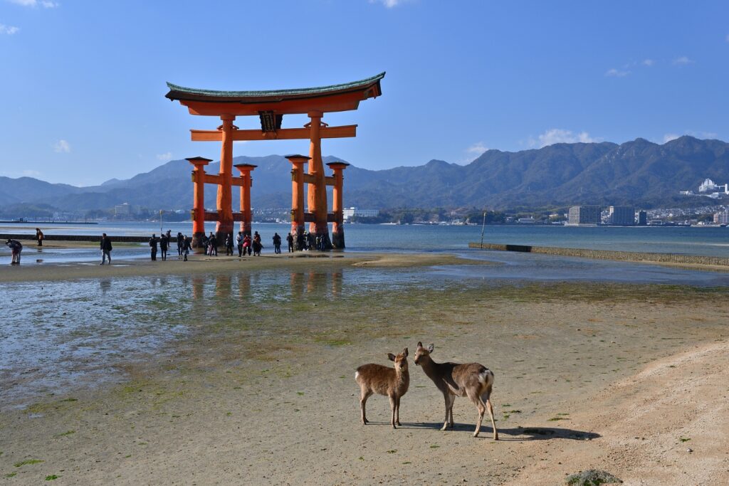
You need to take a ferry to the island. There are many parking lots at the ferry terminal, but the parking lot indicated by the MAPCODE is recommended.
There are two ferries, JR West Ferry and Matsudai Ferry. Both of them are almost same but if you want to visit Mt.Misen, Matsudai ferry & ropeway combination tickets are recommended.
| JR West Ferry | Matsudai Ferry | |
| Round Trip Fare |
Adult JPY360 Child JPY180 |
Adult JPY360 Child JPY180 |
| Cruise time | 10min | 10min |
| First departure | 6:25 | 7:15 |
| Feature | Ferry after 9:00 pass by the Torii Gate |
JPY1800 for Ferry & Ropeway combination tickets |
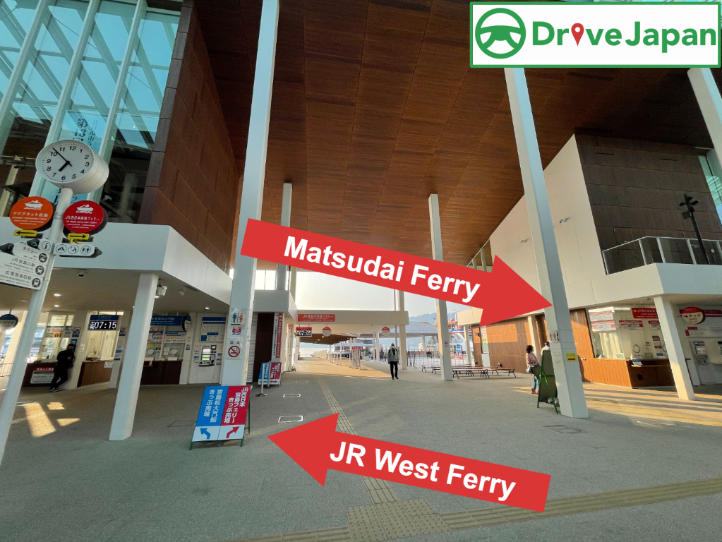
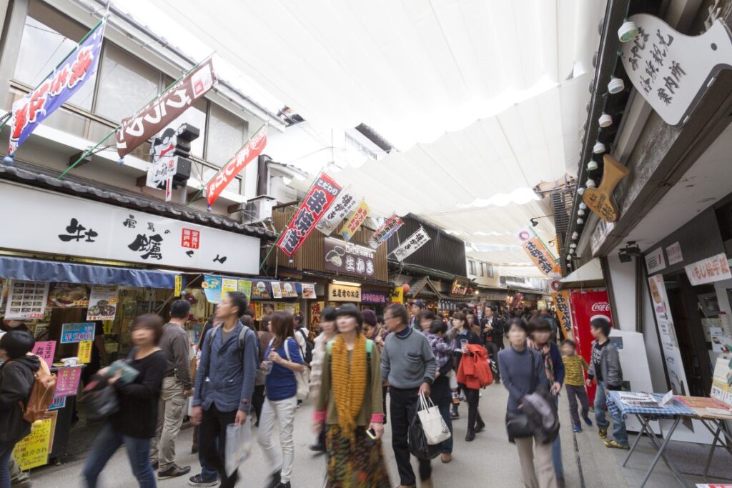
Around shrine, there are many attractions such as Senjokaku (Toyokuni Shrine) and Omotesando Shopping Street.


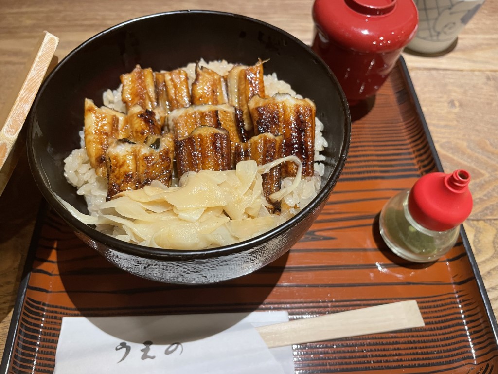
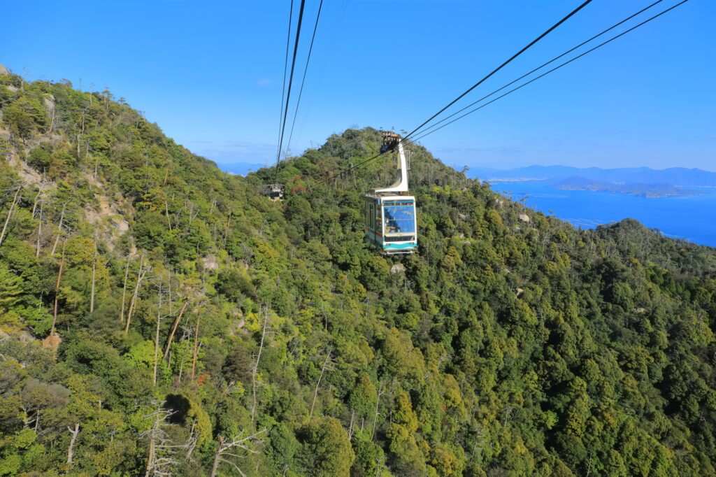
Another highlight of Miyajima is climbing Mt. Misen. At the top of the mountain, there are many natural giant rocks and unusual stones. You can also enjoy the view of Itsukushima Shrine and the Seto Inland Sea from the 360-degree panoramic observatory.
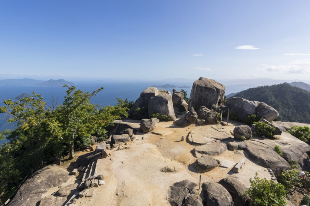
Miyajima is also a famous spot for autumn leaves in the Chugoku region. Miyajima Momijidani Park, a 5-minute walk from Itsukushima Shrine, is located at the foot of the Misen Primitive Forest, and during the season (End October-End November), about 700 autumn leaves color the park.
Google Town Map for Miyajima island
40 min
3
Kintaikyo Bridge
Parking MAPCODE:
115 891 532*56What is MAPCODE?
14:30
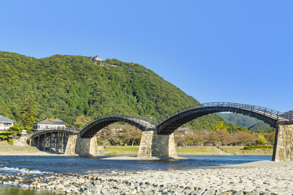
After enjoying Miyajima, head to Kintaikyo Bridge, one of the three famous bridges in Japan. This bridge has five arches and is a rare wooden arch bridge in the world where no nails are used.
80 min
4
Hiroshima Atomic Bomb Dome&Peace Memorial Park
Parking MAPCODE:
22 189 461*58What is MAPCODE?

16:30
Next, return from Kintaikyo Bridge to Hiroshima, which is about an hour and 20 minutes drive.
If you haven’t been to [Atomic Bomb Dome and Peace Memorial Park] yet, be sure to visit.
It takes about 30 minutes to walk around the Atomic Bomb Dome and Peace Park, and about 1 hour to the museum.

Atomic bomb dome & Peace Park map
10 min
5
Inn in Hiroshima
Parking MAPCODE:
Please head to the hotel you reserved.What is MAPCODE?
On this day, you are staying in Hiroshima, following the previous day. Please relax and enjoy the night in Hiroshima.


The driving map will show additional 10-20 spots for the day! You will travel only to your favorite spots.
Check pin color and MAPCODE usage.
Hiroshima is the biggest city in the Chugoku&Shikoku area. The inns are concentrated between Hiroshima Station and Peace Park.
- Inn Type
Most of these inns are 3 to 5-star western-style hotels. - Parking
Some inns have official parking but in addition to the accommodation fee, the parking lot fee will be charged separately. - Onsen
There is no Onsen in this town and no inns have Onsens. - Meal Plan Reservations
As many restaurants are open till midnight, it is recommended to book your inns with breakfast only or without meals.
Hiroshima – Kurashiki
Start: Hiroshima (広島)
Finish: Kurashiki (倉敷)
Mileage:200km
Travel Pace: Fast
On this day you are heading from Hiroshima to Kurashiki.
1
Inn in Hiroshima
Parking MAPCODE:
9:00
The mileage is 200km, so it is recommended to leave by 9 o’clock. Also, save time by using the expressway (E2) on the way. If you haven’t visited Hiroshima Peace Memorial Museum, it is recommended to visit before you depart Hiroshima.
60 min
2
Senkoji Temple
Parking MAPCODE:
48 248 862*52What is MAPCODE?

10:00
The next place to visit is [Senkoji Temple] in Onomichi City. Senkoji Temple is located on a hill at an altitude of 140m and from the precincts, you can see the city, Onomichi Port, and the Onomichi Channel where ships come and go.

50 min

Onomichi ramen is recommended for lunch. The soy sauce ramen with chicken stock and dried sardines is delicious. Please refer Driving Map to find the famous restaurant.
3
Tomonoura
Parking MAPCODE:
465 451 490*77What is MAPCODE?

13:00
After leaving Senkoji Temple, head to Tomonoura, which is known as a location for various movies. It is one of the most scenic spots in the Seto Inland Sea and is dotted with places related to Ryoma Sakamoto, a famous person in Japanese history.
In Tomonoura, please stop by [Homeishu Store] while enjoying a walk in a narrow alley. Beginning with medicinal liquor made by soaking 16 kinds of herbs, the unique flavor becomes addictive.
70 min
Your last visit on this day is [Kurashiki Bikan Historical Quarter]. It takes about 1 hour and 10 minutes to drive on the expressway (E2).
Kurashiki is a place to enjoy walking around town, so it is recommended to check in your inn first!
4
Inn in Kurashiki
Parking MAPCODE:
Please head to the hotel you reserved.What is MAPCODE?
15:15
You will stay in Kurashiki on this day.
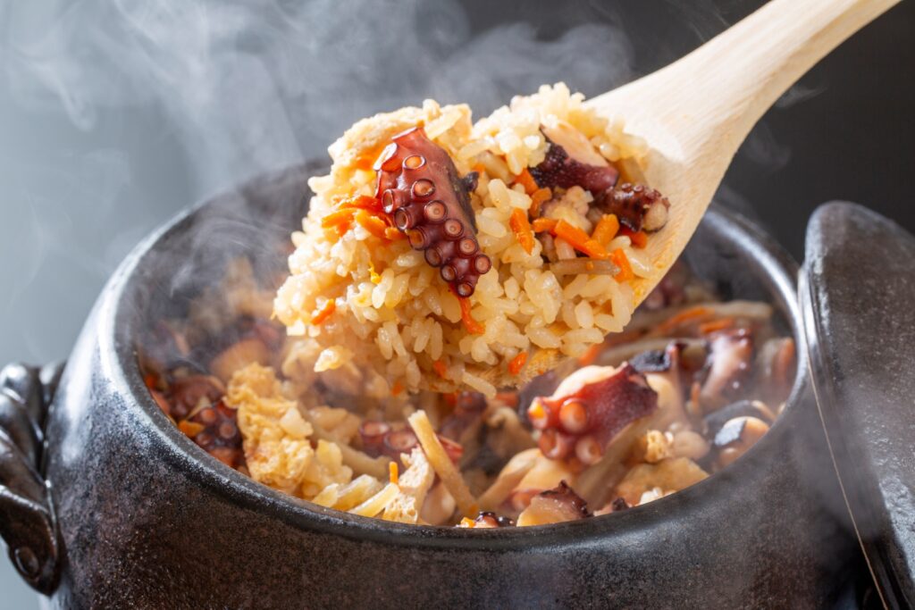
In Kurashiki, hotels are concentrated between Kurashiki Station and the Bikan Historical Quarter, but it is recommended to stay as close to the Historical Quarter as possible. Enjoy a fantastic night walk in the Kurashiki Bikan Historical Quarter. Also enjoy local gourmet food such as Takomeshi.
walking
5
Kurashiki Bikan Historical Quarter
Parking MAPCODE:
Walk from your inn or 19 632 049*68What is MAPCODE?
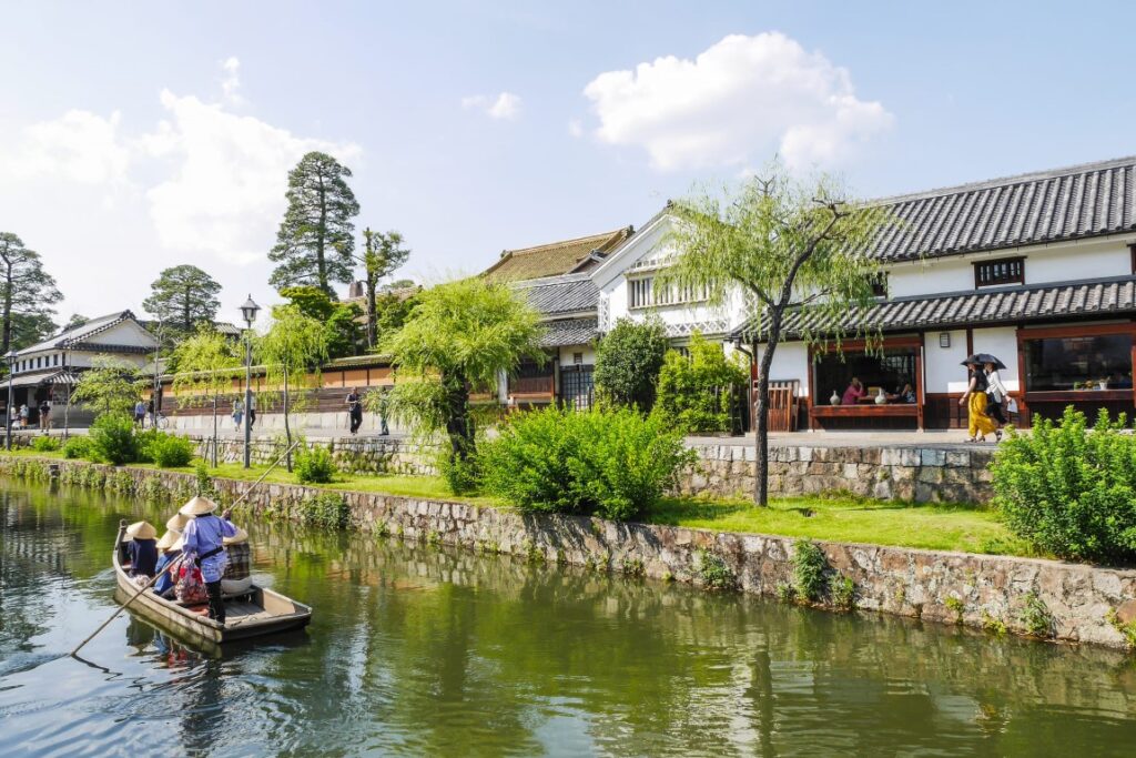
Your last visit on this day is [Kurashiki Bikan Historical Quarter].
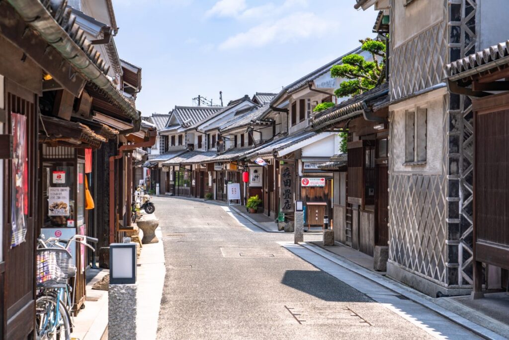
Traditional white-walled buildings, quaint Kurashiki River, willows, and bridges harmonize beautifully, leaving the beauty of a good old Japanese town and making you want to walk for hours. In addition, it is a town full of various attractions such as the Ohara Museum of Art.

The Kurashiki Bikan Historical Quarter is an overwhelmingly spectacular place among the many old townscapes in Japan. However, many shops close around 17:00, so if you want to spend more time in Kurashiki, make sure to arrive by around 14:00.
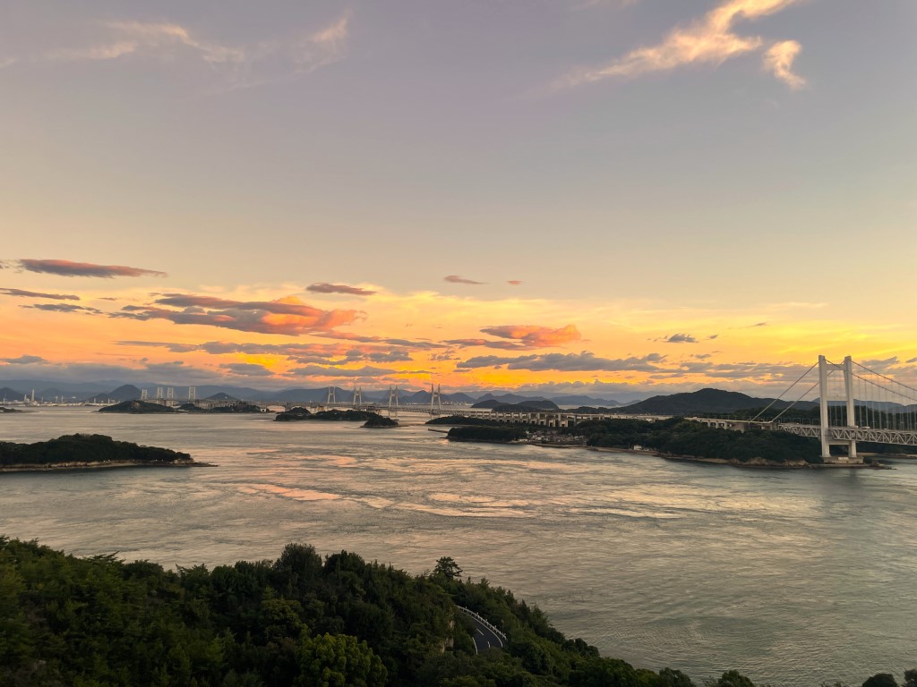
Another recommended spot is [Mt. Washuzan Observatory]. From the observatory, visitors can enjoy a spectacular view of the islands of the Seto Inland Sea and the Seto-ohashi Bridge stretching as far as Shikoku Island.
It is one of the best observatories in Chugoku & Shikoku regions.
The driving map will show additional 10-20 spots for the day! You will travel only to your favorite spots.
Check pin color and MAPCODE usage.
On this day, you will stay in Kurashikia(倉敷) City which is famous for its old townscape.
Many inns are concentrated between Kurashiki station and the “Bikan Historical Quarter” area.
- Inn Type
There are a variety of inns like western-style hotels and Japanese Ryokans. Please book at your preferred type of inn. - Parking
Most inns have official parking but in addition to the accommodation fee, the parking lot fee will be charged separately. - Onsen
There is no Onsen in this town and no inns have Onsens. - Meal Plan Reservations
As many restaurants are open till midnight, it is recommended to book your inns with breakfast only or without meals.
Kurashiki – Osaka
Start: Kurashiki (倉敷)
Finish: Osaka (大阪京都)
Mileage:
To Kyoto: 260km
To Osaka: 235km
To Kansai Airport: 260km
Travel Pace: Fast
On this day you will back from Kurashiki to Osaka, Kyoto or Kansai airport.
1
Inn in Kurashiki
Parking MAPCODE:
9:00
Driving mileage is very long, more than 230km so it is recommended to leave by about 8 o’clock or at the latest around 9 o’clock. Please also take the expressway along the way to save time.
The following itinerary is for reference only. Please plan your schedule according to your car return location and your schedule.
40 min
2
Korakuen Garden & Okayama Castle
Parking MAPCODE:
19 892 222*07What is MAPCODE?

9:40
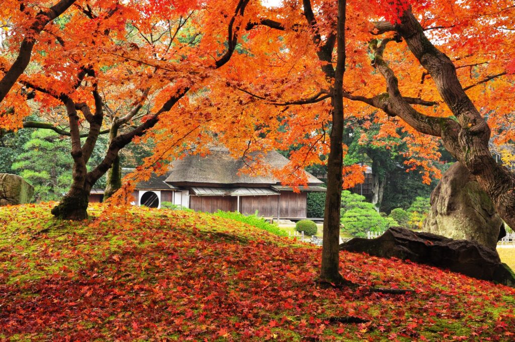
After leaving Kurashiki, head to [Korakuen Garden & Okayama Castle]. Korakuen Garden is one of the three most famous gardens in Japan along with [Kenrokuen garden] in Kanazawa and [Kairakuen garden] in Mito. You can see Okayama Castle from the splendid Japanese garden.
The flowers of Korakuen Garden are beautiful, especially during the cherry blossoms (late March-early April) and autumn leaves (mid-November-early December) are recommended.
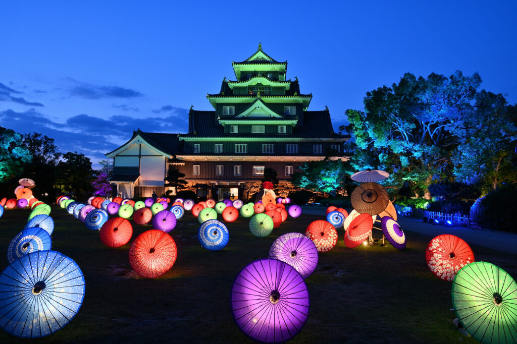
[Okayama Castle] has a black appearance and is also called a Karasu (crow) castle, and is sometimes contrasted with Himeji Castle (Shirasagi Castle), which has a white appearance. You will go to Himeji Castle after Okazaki Castle, so it may be interesting to compare the appearance of both.
60 min
3
Tamachan
Parking MAPCODE:
541 576 241*40What is MAPCODE?
12:30
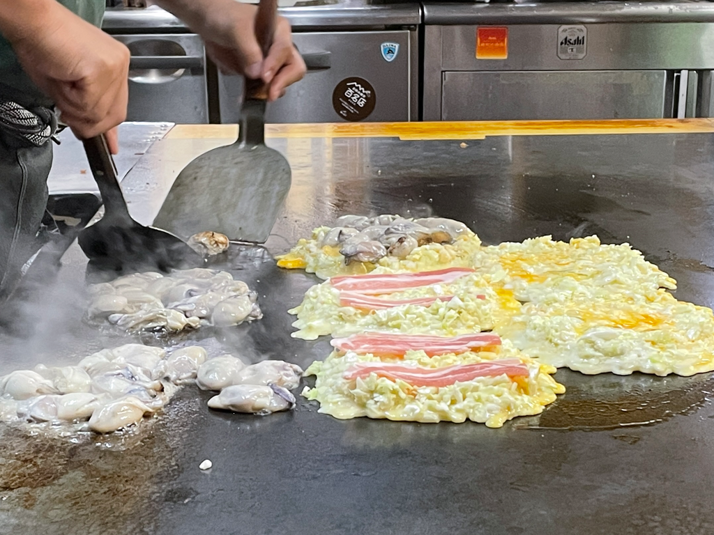
We would definitely recommend “Kakioko” for lunch on this day! Kakioko is Okonomiyaki(savory Japanese pancake dish) that has oysters in it. Tamachan is the most famous Kakioko restaurant but you will have to wait long queue. If you visit on the weekend or on holiday, please refer driving map and consider other restaurants.
60
4
Himeji Castle
Parking MAPCODE:
24 278 873*31What is MAPCODE?
14:45
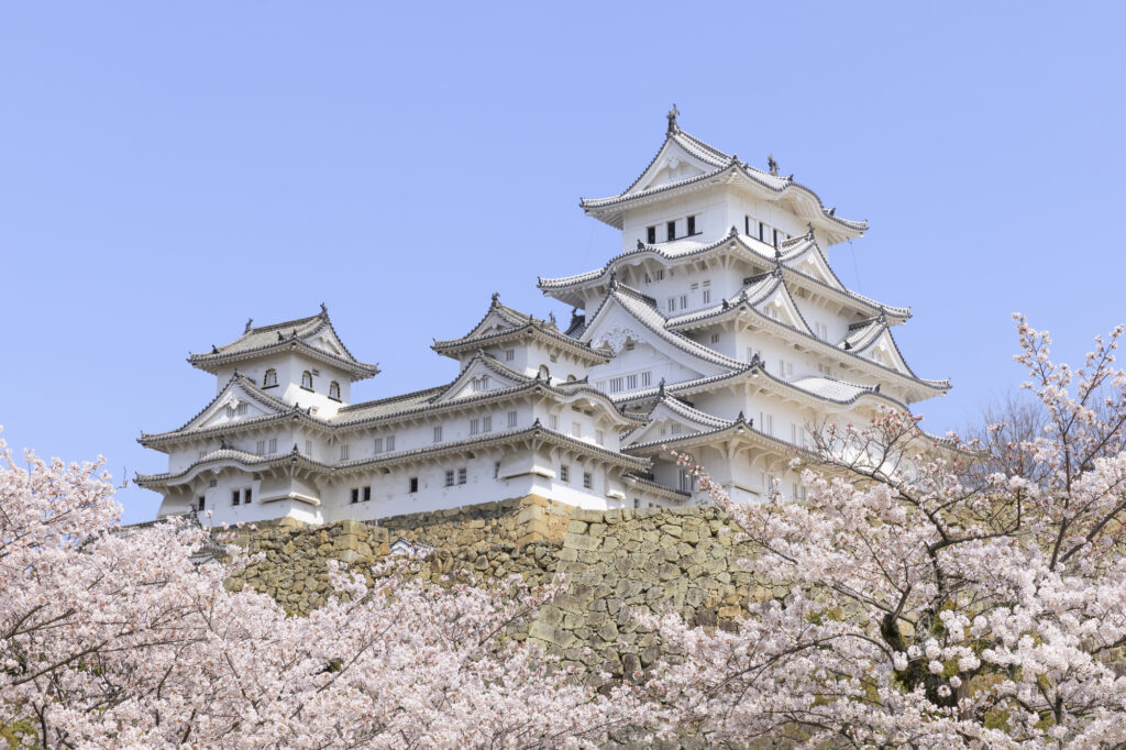
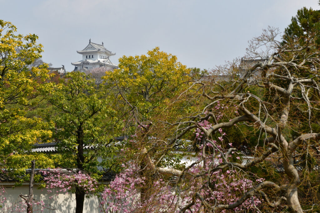
Next, take the expressway (E2) to [Himeji Castle]. The castle was registered as first World Heritage in Japan and, is the biggest highlight of the day. The cherry blossoms at Himeji Castle have also been selected as one of the “100 Best Cherry Blossom Spots in Japan” and are visited by a large number of people from late March to early April.
If time permits, we also recommend the Kokoen Garden located on the west side of Himeji Castle. Kokoen is a Japanese garden with a view of Himeji Castle. It is often used as a location for Japanese historical drama.
70 min
5
Mt.Rokko(Garden Terrace)
Parking MAPCODE:
12 644 204*33What is MAPCODE?
18:00
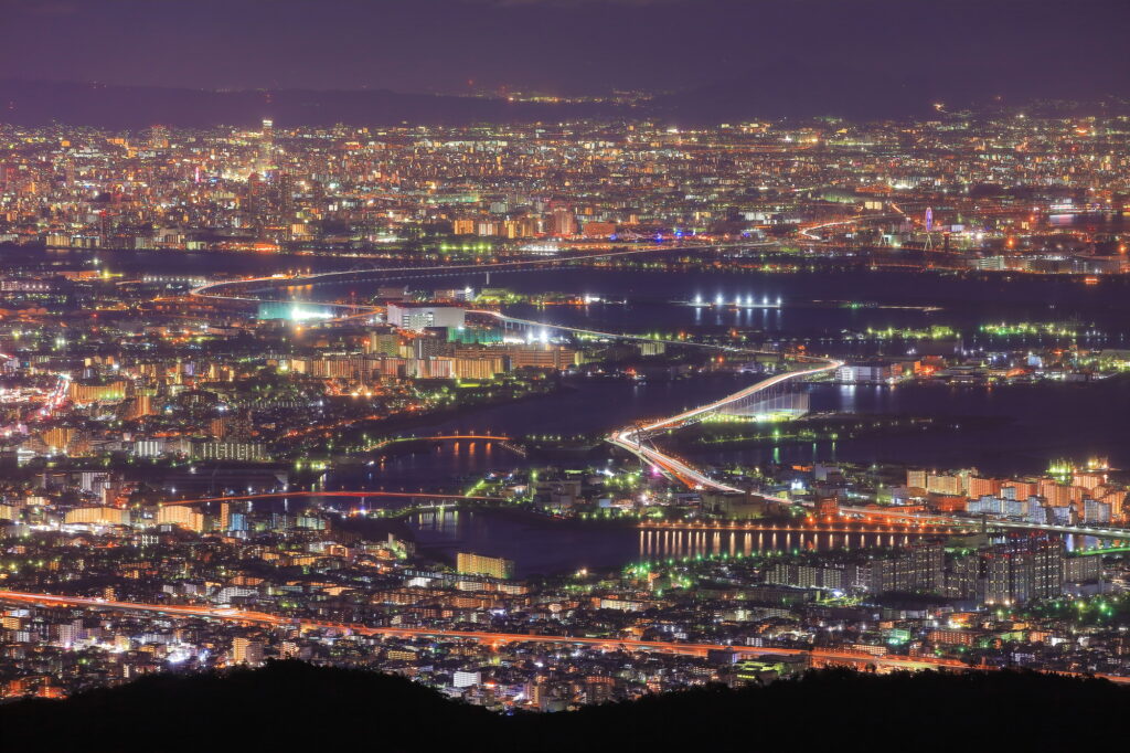
Your last stop on this day is [Mt. Rokko (Garden Terrace)] on Mt. Rokko in Kobe. Use the expressway (E2) for this section as well.
This is famous as one of Japan’s three major night views, and the vast night view from Kobe to Osaka along Osaka Bay is beautiful.
5
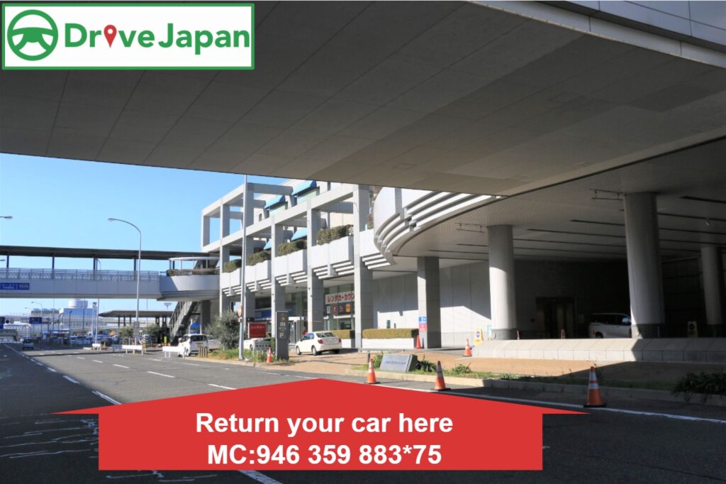
Rental car branch at Kansai Airport, Osaka or Kyoto
Parking MAPCODE:
Please refer driving mapWhat is MAPCODE?
The distance and time from the observatory to the goal are as follows.
Umeda (Osaka) Station: 40km / 70 minutes
Shin-Osaka Station: 40km / 70 minutes
Kyoto Station: 80km / 80 minutes
Kansai International Airport: 80km / 90 minutes
①Returning a car in Osaka or Kyoto
When you return to Osaka or Kyoto, refuel and then return the car to the car rental branch. Use the MAPCODE on the driving map for the nearest gas stations near Osaka Station or Kyoto.
Traffic jams often occur in Osaka and Kyoto because they are both large cities. Be sure to return your car with plenty of time to spare.
Osaka and Kyoto offers a wide variety of culinary delights! For dinner, try Takoyaki, Okonomiyaki and other local food.
②Returning a car at Kansai Airport
When heading to Kansai airport, the distance from Osaka station is about 75 km, about 1.5 hour by expressway(5&4). Make sure you arrive at the car rental company branch 2 hours before your flight.
Additionally, there are no gas stations on the Kansai International Airport island. If you do not have enough time before your flight, we strongly recommend that you head to the airport and settle the missing gasoline bill at a rental car branch instead of trying to force yourself to refuel.

The driving map will show additional 10-20 spots for the day! You will travel only to your favorite spots.
Check pin color and MAPCODE usage.
If you are planning to stay in Osaka or Kyoto, we recommend the following places.
Osaka
There is 2 recommended area in Osaka to stay in.
1. Around Osaka Umeda Station
Many people misunderstand, but Osaka and Umeda are the same places. It is 20min to USJ and10min to “Shin-Osaka Station” for Shinkansen train.
2. Around Nanba Station
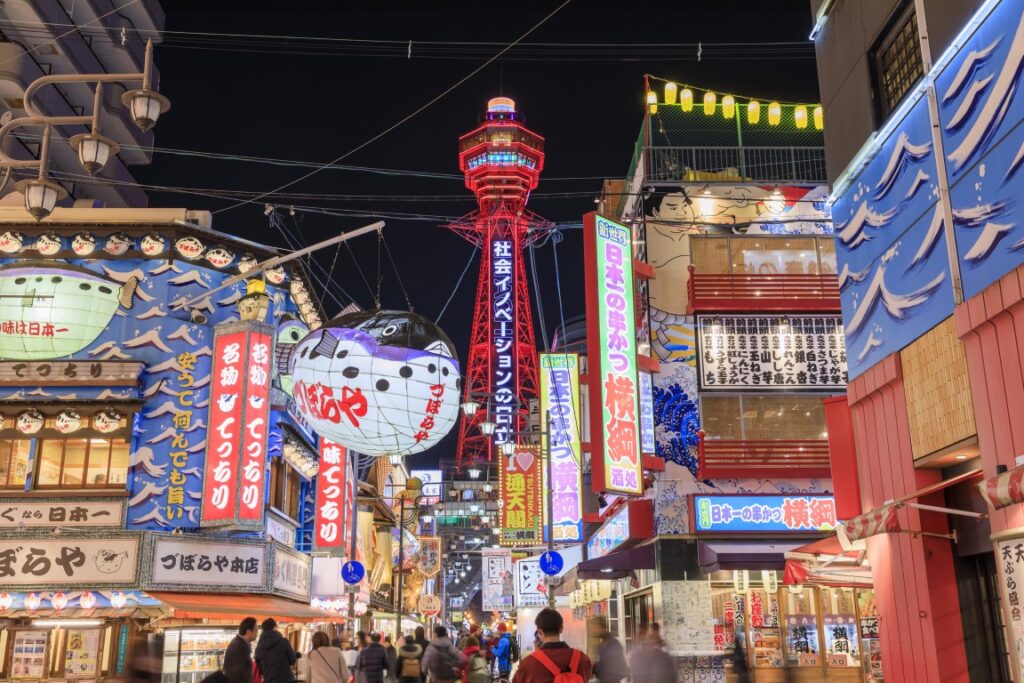
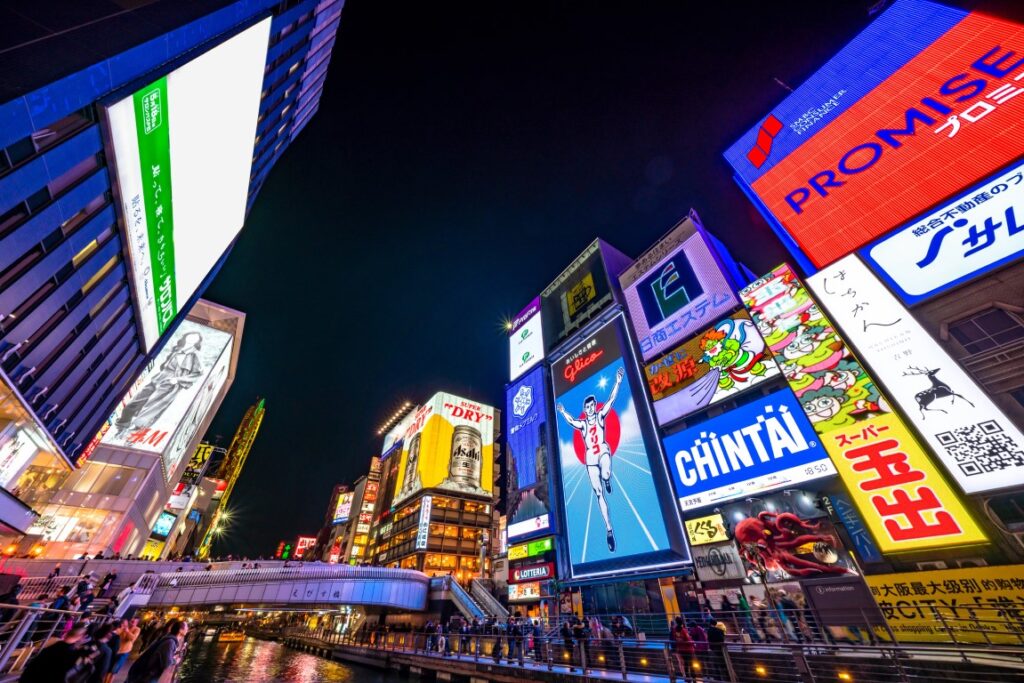
It is located within walking distance of the famous “Dotonbori” and “Tsutenkaku” areas and is recommended for travelers who want to go sightseeing in Osaka.
- Inn Type
There are about 1,600 inns in Osaka. Please book at your preferred type of inn. - Parking
Some inns have official parking but in addition to the accommodation fee, the parking lot fee will be charged separately.
It is inconvenient to travel in Osaka by car. - Onsen
Most of inns don’t have Onsens. - Meal Plan Reservations
There are 60,000 restaurants in Osaka. As many restaurants are open till midnight, it is recommended to book your inns with breakfast only or without meals.
Kyoto
There is 2 recommended area in Kyoto to stay in.
1. Around Kyoto Station
There are many buses to all areas in Kyoto and convenient.
2. Higashiyama area
The most famous area in Kyoto because of good access to “Kiyomizu Temple” and Gion area.
- Inn Type
There are about 1,600 inns in Kyoto. Please book at your preferred type of inn. - Parking
Some inns have official parking but in addition to the accommodation fee, the parking lot fee will be charged separately.
It is inconvenient to travel in Kyoto by car. - Onsen
A few inns provide Onsens. - Meal Plan Reservations
There are 9,000 restaurants in Kyoto. As many restaurants are open till midnight, it is recommended to book your inns with breakfast only or without meals.

