Summary
- Start
Chubu Centrair International Airport or Nagoya Station - Finish
Chubu Centrair International Airport or Nagoya Station - Mileage
Total 1380km
180km per day - Travel Pace
Relaxing - Onsen Stay
Max. 7 nights - Recommended Seasons
All year round
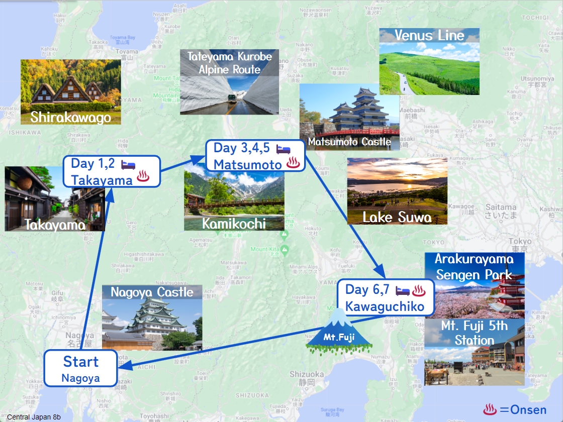
This itinerary takes 8 days to circle around the central Japan area.
Although daily mileage is very long, by staying consecutive nights in 3 cities, you can travel at a relaxing pace.
Nagoya – Takayama(Sample)
Start: Nagoya (名古屋)
Finish: Takayama (高山)
Mileage:220km
Travel Pace: Fast
On this day you will head from Nagoya to Takayama.
1
Inn in Nagoya
Parking MAPCODE:
9:00
Today’s mileage is long about 220km. Please try to shorten the travel time by using expressways as much as possible.
120 min
2
Monet’s Pond
Parking MAPCODE:
289 518 742*24What is MAPCODE?
11:00
First of all, you will go from Nagoya Airport to Mino IC on the expressway for about 100km.
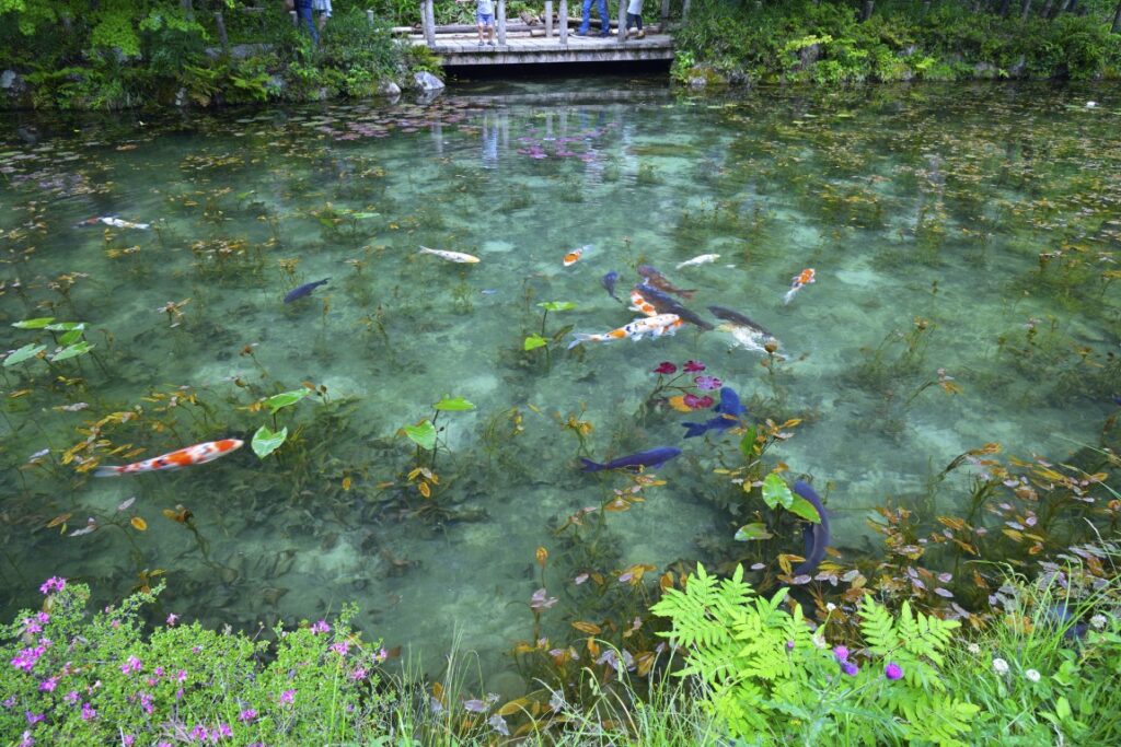
The first destination is [Monet’s Pond]. The water lilies blooming in the highly transparent spring water are very beautiful, and the appearance of Nishikigoi swimming elegantly in the pond is like Monet’s masterpiece “Water Lilies”.
(Note) Nishikigoi is a general term for carp breeds that have been improved for ornamental fish, and is characterized by its colorful body color.
If the weather is bad or if you are traveling in winter, we recommend skipping here to save time.
30 min
3
Gujo Hachiman
Parking MAPCODE:
289 895 728*50What is MAPCODE?
12:30
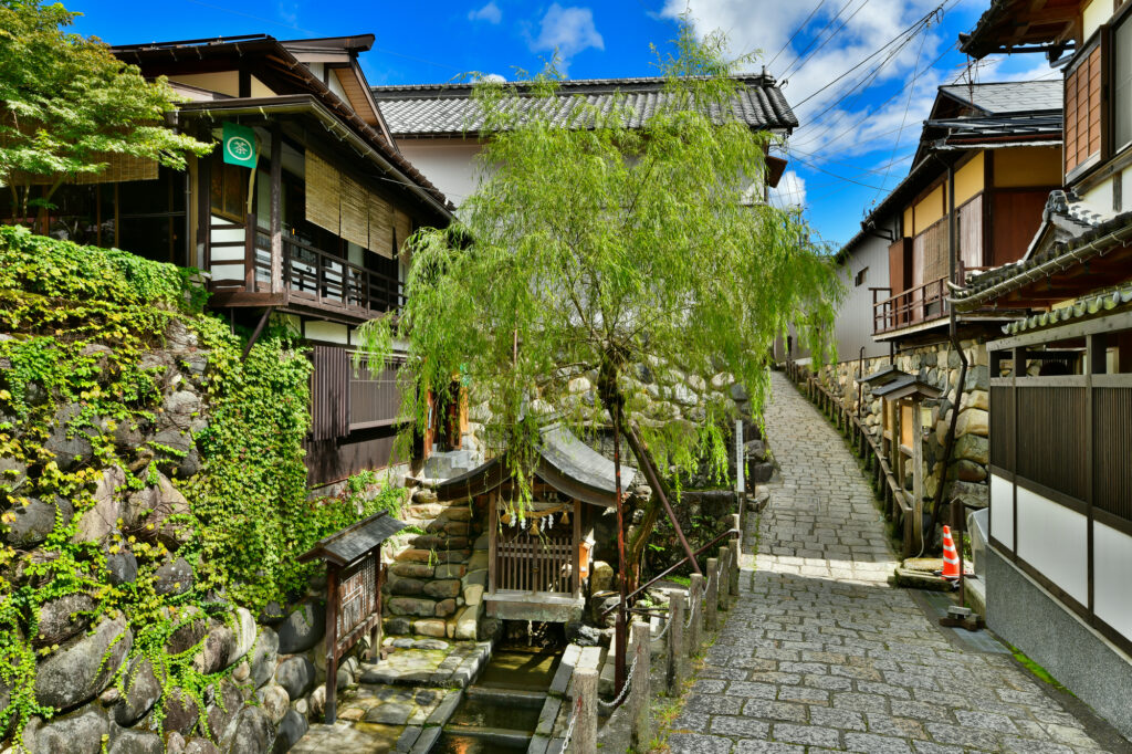
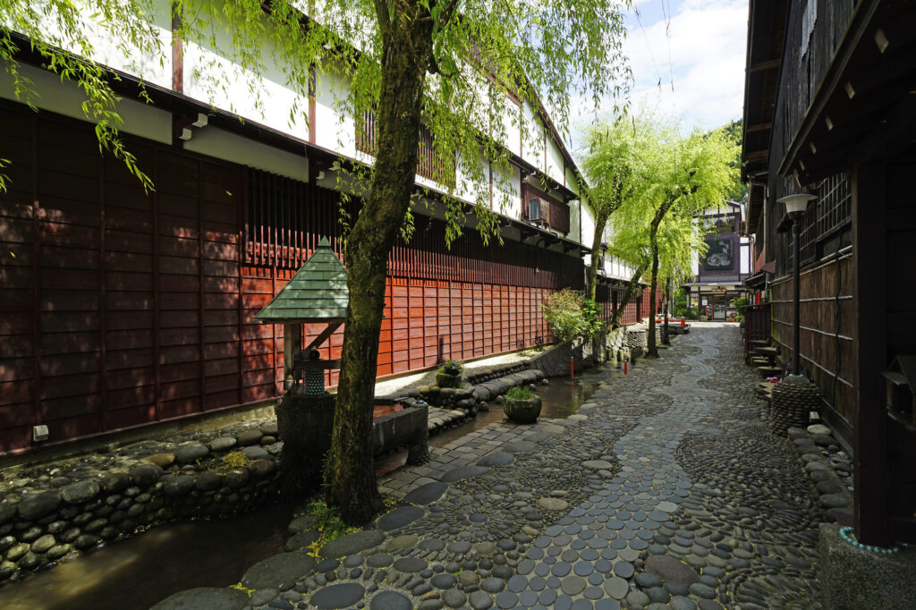
After that, the highlight of the day is [Gujo Hachiman]. Spring waters and waterways spread out in the old townscape designated as an important traditional buildings preservation district of the country, and it has a wonderful atmosphere. There are many attractions such as Sogi-sui, Yanaka-Mizu no Komichi, Igawa Komichi, and Gujo Hachiman Castle, so it is recommended that you spend as much time as possible in Gujo Hachiman.
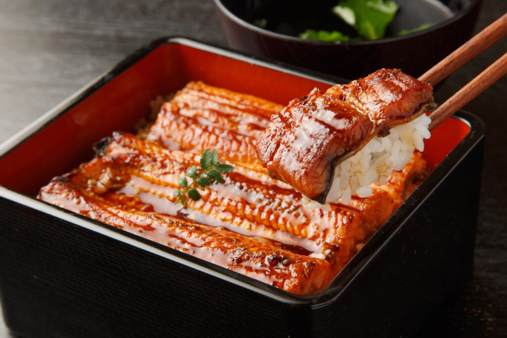
We recommend having an eel lunch at Gujo Hachiman. You can refer to the recommended restaurant on the day-by-day Driving Map
70 min
4
Inn in Takayama
Parking MAPCODE:
Please head to the hotel you reserved.What is MAPCODE?

15:30
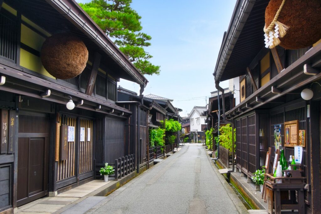
On this day, you are staying at [Hida Takayama], the center of the Hida region where you can feel the history and culture. If you book inn near Old town, it is good idea to check-in your inn first.
After checking in at the hotel, please take a leisurely stroll around the old town.
5
Takayama Old Town
Parking MAPCODE:
On foot or 191 196 559*62What is MAPCODE?
If your inn is located far from old town, please use above MAPCODE for convenient parking.
15:00
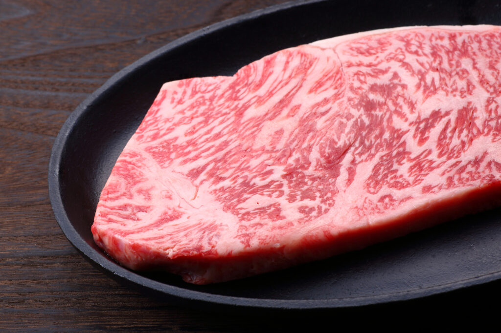
After check-in, enjoy walking in the [Takayama Old Town] called “Little Kyoto”. The appearance of castle towns and commercial towns in the Edo period (1603-1868) is preserved. Shopping while looking at the old cityscape, a tour of the sake brewery, eating Hida beef, minced meat cutlet, pudding, etc. are fun, and time passes in no time.

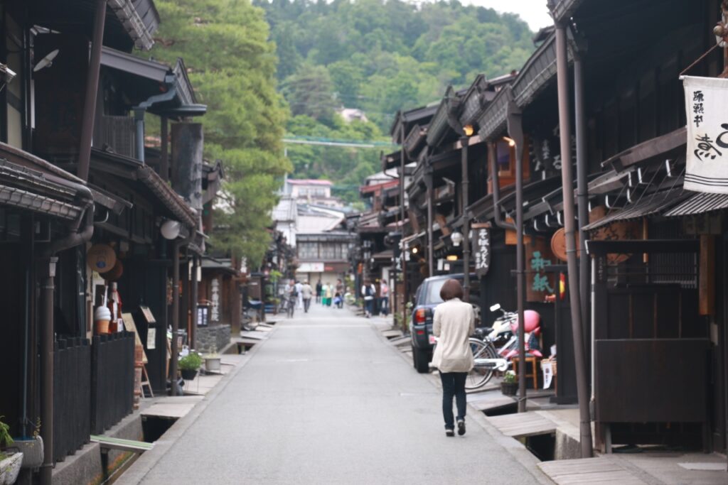
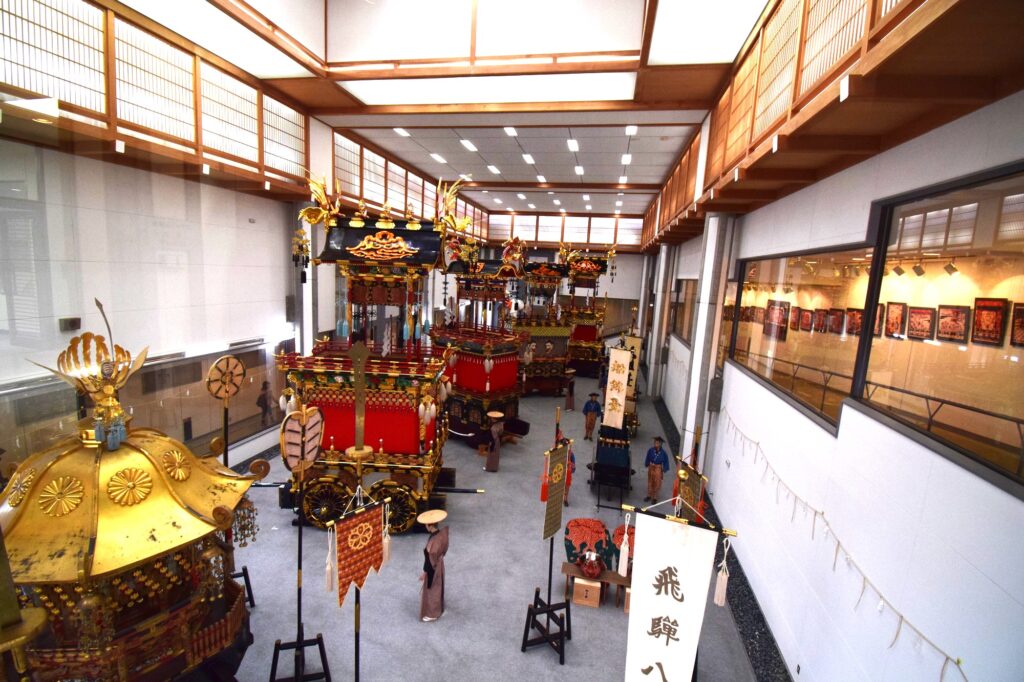
Please drop in at [Takayama Matsuri Yatai Kaikan]. The stalls used at the nationally famous Takayama Festival are always on display.
5 min
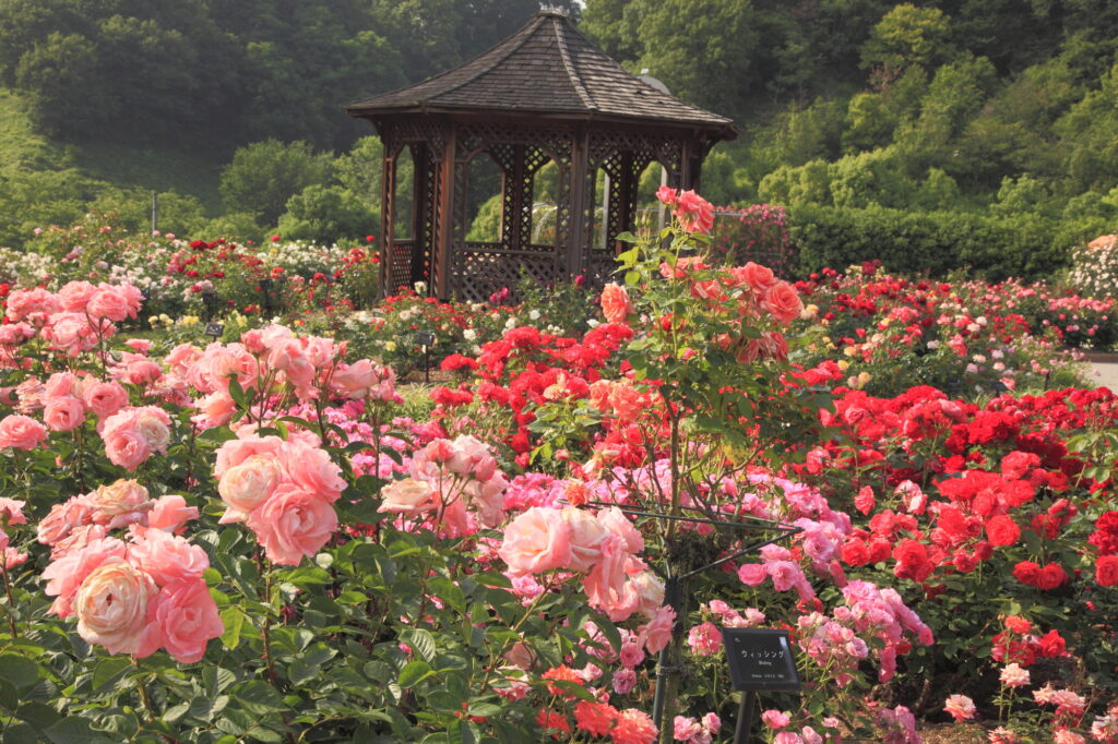
There is one of the world’s largest rose gardens, [Gifu World Rose Garden], on the way to the spot on this day. You can enjoy flowers such as roses, sunflowers, and cosmos all year round. The rose season (mid-May-early June, late October-early November) is especially recommended.
The driving map will show additional 10-20 spots for the day! You will travel only to your favorite spots.
Check pin color and MAPCODE usage.
On this day, you will stay in Takayama(高山) city which is famous for its old townscape.
Many inns are concentrated between Takayama station and Miyagawa river.
- Inn Type
There are a variety of inns like 3-star western-style hotels and 5-star Japanese Ryokans. Please book at your preferred type of inn. - Parking
Luxury Ryokans provides free parking. But middle-range hotels may ask you to park in a nearby public paid parking lot. - Onsen
Many of the inns provide Onsen. However, some western-style hotels don’t have it. - Meal Plan Reservations
There are many restaurants in and around the hotel for dinner, so please make reservations according to your preference.
Takayama – Takayama
Start: Takayama (高山)
Finish: Takayama (高山)
Mileage:160km
Travel Pace:Normal
It is a day to fully enjoy the world heritage Shirakawago and Gokayama, which is the best highlights of the Central Japan.
1
Inn in Takayama
Parking MAPCODE:
9:00
The mileage is not very long 160km, but due to many attractions, it is recommended to leave by 9 o’clock.
80 min
2
Shirakawago Village
Parking MAPCODE:
549 018 350What is MAPCODE?

10:20
The highlights of the day are [Shirakawago Village] and [Gokayama Village], which are World Heritage Sites. First, head to Shirakawago Village to avoid crowds.
In Shirakawago Village, general vehicles are not allowed to enter the center of the village. Please park your car in the Seseragi Park parking lot, cross the river, and stroll through the village while looking at the gassho-style houses.
You can also see the inside of some houses, so be sure to visit them.

The Ogimachi Castle Ruins Observatory on the hill is a great spot with a famous panoramic view of Shirakawago Village. It is recommended to walk from the village but those who have bad legs can also drive. Please refer driving map.
Be sure to visit!
40 min
It is recommended to drive NOT expressway(E41) but normal route156 from Shirakawago village to Ainokura. The travel time is almost same and you can drive scenic mountain roads.
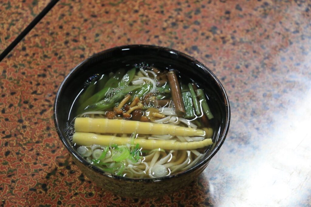
Both Shirakawago and Gokayama have restaurants housed in Gassho-Zukuri buildings, allowing you to enjoy lunch while experiencing the unique history and culture of these world heritages.
3
Gokayama Ainokura Village
Parking MAPCODE:
549 622 832What is MAPCODE?

13:30
Next, you will go to [Ainokura Village] in Gokayama town, another World Heritage Site. Although it is smaller than Shirakawago Village, there are fewer tourists, and you can feel the original scenery of Japan with gassho-style houses.

110 min
When you go back to Takayama, it is recommended to take expressway(E41).
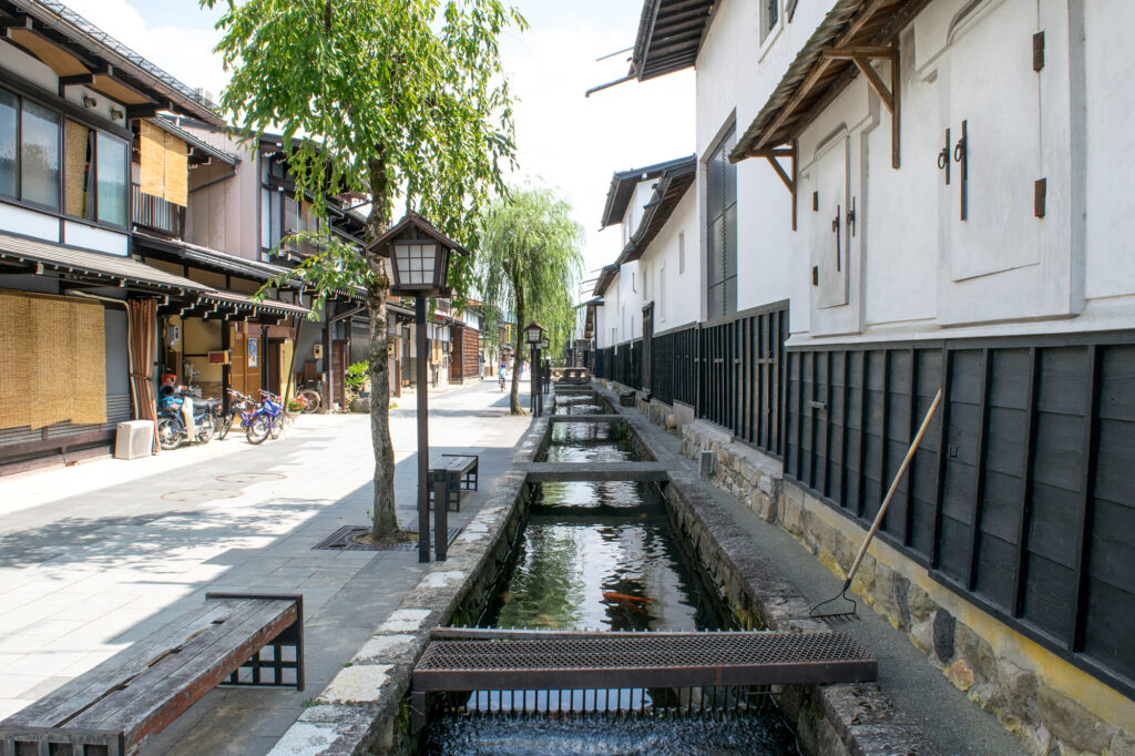
If you haven’t visited Hida Furukawa town or Utsue 48 Waterfalls yet, it is also good idea to stop by.

5
Inn in Takayama
Parking MAPCODE:
Please head to the hotel you reserved.What is MAPCODE?
16:45
On this day you will stay in Takayama for consecutive nights following yesterday. Please spend a relaxing time at the hotel.
The driving map will show additional 10-20 spots for the day! You will travel only to your favorite spots.
Check pin color and MAPCODE usage.
On this day, you will stay in Takayama(高山) city which is famous for its old townscape.
Many inns are concentrated between Takayama station and Miyagawa river.
- Inn Type
There are a variety of inns like 3-star western-style hotels and 5-star Japanese Ryokans. Please book at your preferred type of inn. - Parking
Luxury Ryokans provides free parking. But middle-range hotels may ask you to park in a nearby public paid parking lot. - Onsen
Many of the inns provide Onsen. However, some western-style hotels don’t have it. - Meal Plan Reservations
There are many restaurants in and around the hotel for dinner, so please make reservations according to your preference.
Takayama – Matsumoto
Start: Takayama (高山)
Finish: Matsumoto (松本)
Mileage:140km
Travel Pace:Relax
You are heading from Takayama to Matsumoto on this day. Enjoy walking in the beautiful Kamikochi highland!
1
Inn in Takayama
Parking MAPCODE:
8:45
The mileage is about 140km, which is short. The highlight of the day is walking in Kamikochi one of the most famous highland in all over Japan.
It is recommended to leave Takayama at 8:45 to catch the 9:50 bus from “Akandana Parking”.
50 min
2
Kamikochi
Parking MAPCODE:
620 712 064What is MAPCODE?
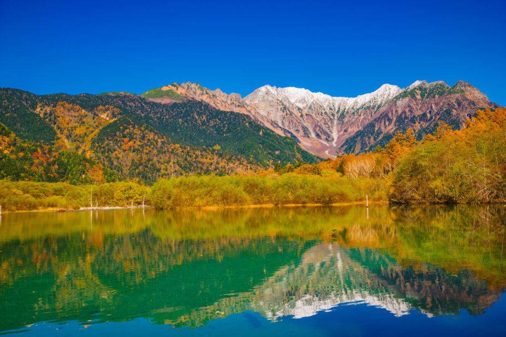
9:35
The first is today’s highlight [Kamikochi] highland.
Kamikochi is restricted to private cars throughout the year, so park your car at the “Akandana Parking Lot” and head for it by shuttle bus. Buses depart at 20 and 50 minutes per hour.

The recommended course is to get off at “Taisho Pond” and walk to “Kappa Bridge”. Even children can walk on the road for about 1 hour and half at a slower pace, and you can enjoy the most pleasant walk.
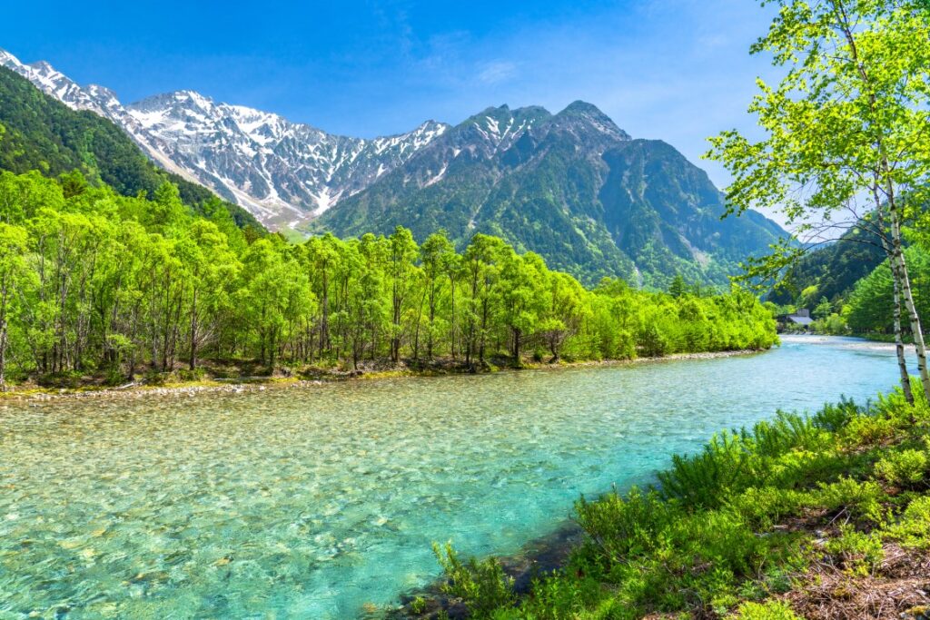

Once you reach Kappa bridge, you can walk 6min to bus terminal. Additionally, there are some restaurants around Kappa bridge and nice for lunch.

Kamikochi is also known for its beautiful autumn colors (Mid-Oct-End October). Please note that it will be closed in winter from Mid-Nov to End-Apr.
30 min
3
Shinhodaka Ropeway
Parking MAPCODE:
898 115 331What is MAPCODE?

13:30
Next, if the weather is nice, head to the [Shinhodaka Ropeway]. Japan’s first two-story gondola is in operation, and you can enjoy a large panorama of the Northern Alps. The autumn leaves season (Mid-Oct-End Oct) is especially recommended.
The ropeway departs at 15 and 45 minutes per hour.
You can check the weather from live camera
100 min
4
Matsumoto Castle
Parking MAPCODE:
75 851 375What is MAPCODE?

16:00
It takes about 50km, 1 hour, and 40 minutes to reach the next Matsumoto city.
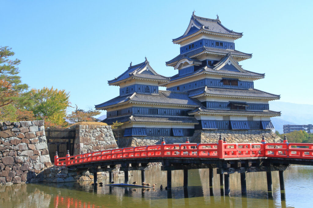
[Matsumoto Castle] is the symbol of Matsumoto and is a national treasure where the original castle tower remains. Known for its beautiful contrast of black and white, the castle has a wonderful landscape against the backdrop of the mountains of the Alps. The last entry is 16:30.
10 min
5
Inn in Matsumoto
Parking MAPCODE:
Please head to the hotel you reserved.What is MAPCODE?
17:00
You are staying at Matsumoto on this day. There are many hotels on the east side of the station, and there are plenty of restaurants.
In addition, Asama Onsen is located just east of Matsumoto City. This is recommended if you want to stay at a hot spring inn.
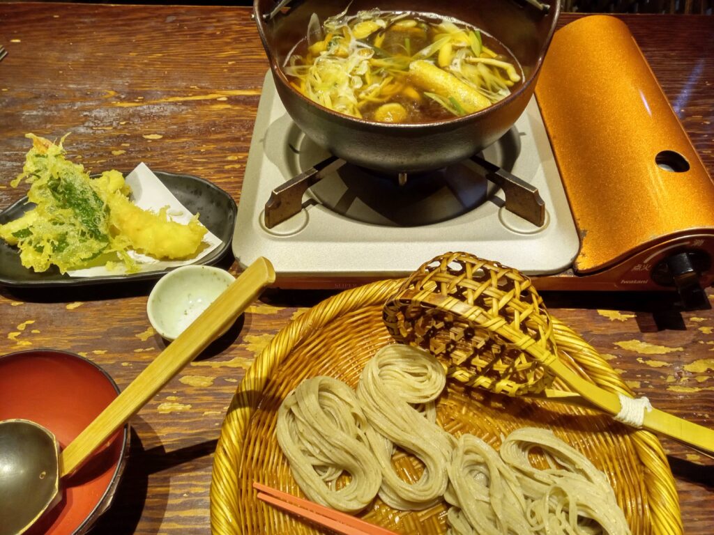
Enjoy local gourmet food such as Toji soba noodles and Sanzoku-yaki (Chicken thigh dish).
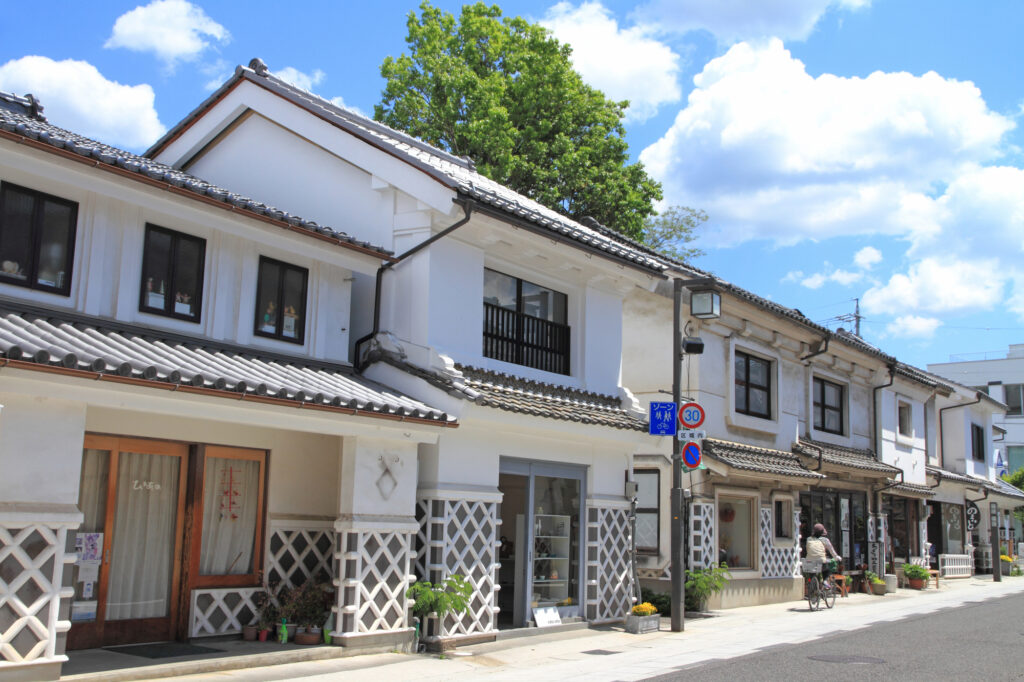
If you have time, we recommend taking a walk along Nakamachi-dori road, which is lined with buildings with Namako walls.
The driving map will show additional 10-20 spots for the day! You will travel only to your favorite spots.
Check pin color and MAPCODE usage.
On this day, you will stay in Matsumoto (松本) city.
Many inns are concentrated in the following two areas.
①Around Matsumoto Station
The inns are concentrated east side of Matsumoto Station. This area is convenient for dinner and visiting Matsumoto castle but no inns offer Onsen.
- Inn Type
Most of these inns are 3 to 5-star western-style hotels. - Parking
Most inns have official parking but in addition to the accommodation fee, the parking lot fee will be charged separately. - Onsen
There is no Onsen in this town and no inns have Onsens. - Meal Plan Reservations
As many restaurants are open till midnight, it is recommended to book your inns with breakfast only or without meals.
②Asama Onsen(浅間温泉)
This hot spring resort area is located 4km north of Matsumoto station. If you would like to stay in better accommodation with Onsen, here is recommended.
- Inn Type
Most of these inns are 3 to 5-star Japanese-style Ryokans with Onsen facilities. - Parking
Most inns will offer free parking. - Onsen
This area is famous for Onsen and most of the inns have one. - Meal Plan Reservations
There are few restaurants in this area and be sure to make a reservation with a plan that includes dinner and breakfast.
Matsumoto- Matsumoto
Start : Matsumoto (松本)
Finish : Matsumoto (松本)
Mileage : 100km
Travel Pace : Fast
On this day you will stay in Matsumoto for consecutive nights following yesterday. And you will enjoy Tateyama Kurobe Alpine Route on a day trip.
If you prefer another place, Japan Alps “Kamikochi” is recommended too.
1
Inn in Matsumoto
Parking MAPCODE:
9:00
The mileage is as short as 100km, but it’s better to leave early to enjoy Tateyama Kurobe Alpine Route fully.
75 min
2
Tateyama Kurobe Alpine Route
Parking MAPCODE:
691 491 628What is MAPCODE?
10:15

Today’s first destination is Tateyama Kurobe Alpine Route, the biggest highlight today. First, please aim for Ogizawa, which has the entrance on the Nagano side.
After parking the car in the Ogizawa parking lot, take a trolley bus and head to Kurobe Dam. The bus goes through a narrow and dark tunnel.
At Kurobe Dam, please enjoy the huge Kurobe Dam, which is known as the highest dam in Japan. Especially powerful water discharge is great. If you are confident in your legs, we recommend to go to an observatory located in a high place.
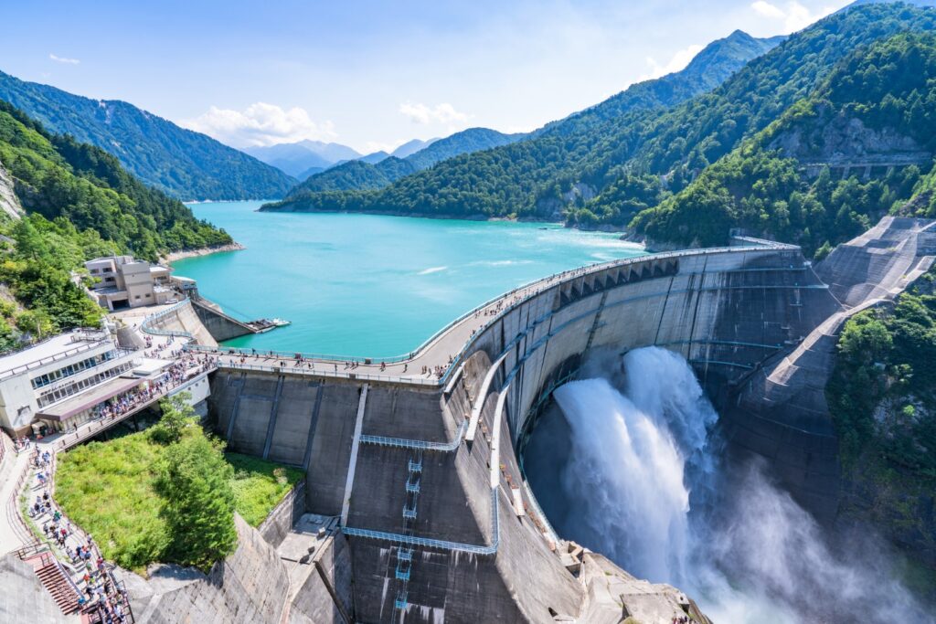
After that, please walk on the dam and head to Kurobe Lake Station of the Kurobe cable car on the other side. And you will take the cable car to Kurobeidaira Station.
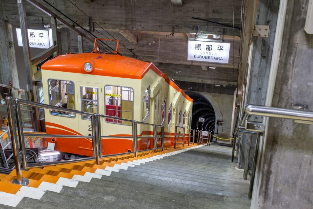
At Kurobedaira Station, you will change to Tateyama Ropeway and head to Daikanbo. This ropeway is 1700m long and has no pillars on the way, and the longest ropeway in Japan. And Lake Kurobe and the surrounding mountains are so beautiful that you will feel like you are flying in the air of the alpine route.
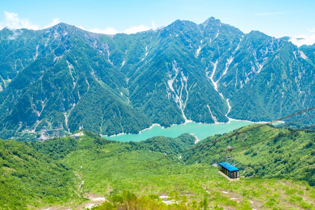
At Daikanbo, please change to a trolley bus. At that time, please don’t forget to go to the rooftop observatory at the station. Lake Kurobe and the large panoramic view of the Alpen Route are one of the best beauties.
The trolleybus then arrives at Murodo, the highest point of the Tateyama Alpine Route. In Murodo, please enjoy the Yuki-no-Otani (mid-April to mid-June), Mikurigaike Pond walk, and more.

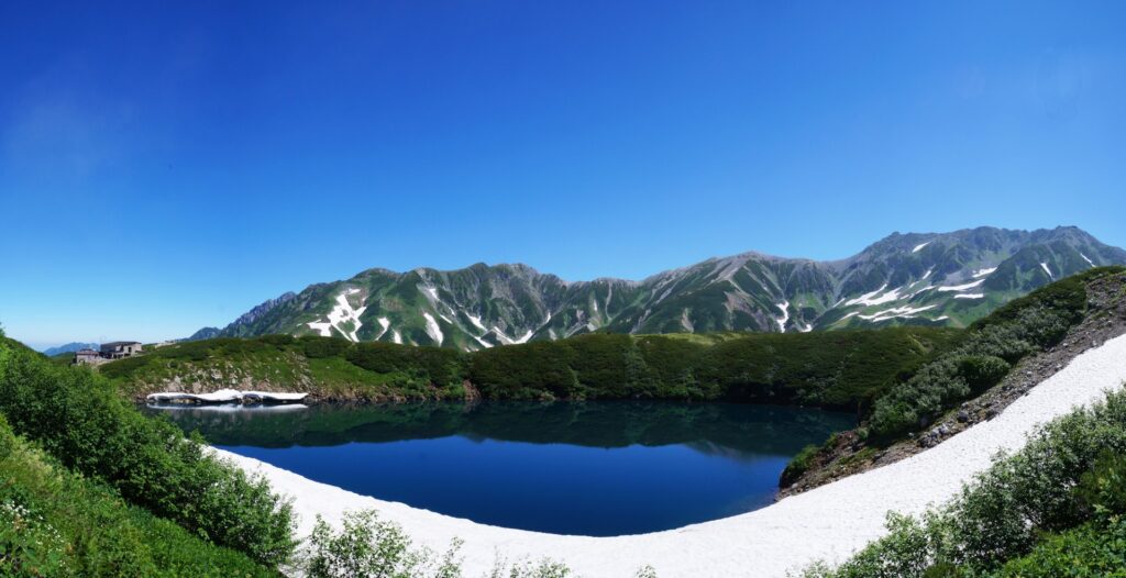
After enjoying Murodo, please return to Ogizawa the way you just came, without going further in the direction of Tateyama.
50min
3
Daio Wasabi Farm
Parking MAPCODE:
158 319 338What is MAPCODE?
16:00
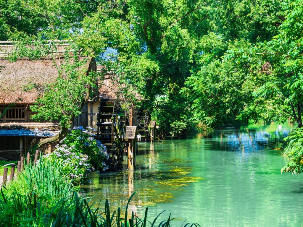
Next, you will head to the Daio Wasabi Farm. This is known as the best wasabi garden in Japan, and many tourists visit. After walking around, please try wasabi soft-serve ice cream.
30min
4
Inn in Matsumoto
Parking MAPCODE:
Please head to the hotel you reserved.What is MAPCODE?
17:30
It takes about 15km to Matsumoto. Please go back to the same inn. Please spend a relaxing time.
If you prefer another place, Japan Alps “Kamikochi” is recommended too.
You can enjoy 30min – 1.5 hour of walking in the breathtaking scenery.


The driving map will show additional 10-20 spots for the day! You will travel only to your favorite spots.
Check pin color and MAPCODE usage.
On this day, you will stay in Matsumoto (松本) city.
Many inns are concentrated in the following two areas.
①Around Matsumoto Station
The inns are concentrated east side of Matsumoto Station. This area is convenient for dinner and visiting Matsumoto castle but no inns offer Onsen.
- Inn Type
Most of these inns are 3 to 5-star western-style hotels. - Parking
Most inns have official parking but in addition to the accommodation fee, the parking lot fee will be charged separately. - Onsen
There is no Onsen in this town and no inns have Onsens. - Meal Plan Reservations
As many restaurants are open till midnight, it is recommended to book your inns with breakfast only or without meals.
②Asama Onsen(浅間温泉)
This hot spring resort area is located 4km north of Matsumoto station. If you would like to stay in better accommodation with Onsen, here is recommended.
- Inn Type
Most of these inns are 3 to 5-star Japanese-style Ryokans with Onsen facilities. - Parking
Most inns will offer free parking. - Onsen
This area is famous for Onsen and most of the inns have one. - Meal Plan Reservations
There are few restaurants in this area and be sure to make a reservation with a plan that includes dinner and breakfast.
Matsumoto- Matsumoto
Start: Matsumoto (松本)
Finish: Matsumoto (松本)
Mileage:130km
Travel Pace: Normal
On this day you will stay in Matsumoto for consecutive nights following yesterday. Enjoy exhilarating driving on Venus Line road, one of the most scenic road in Japan.
1
Inn in Matsumoto
Parking MAPCODE:
10:00
The mileage is as short as 130km, but about 50km of it is a mountain road.
If you haven’t visited Matsumoto castle yet, let’s visit before you leave Matsumoto. It open from 8:30.

60 min
2
Utsukushigahara Open Air Museum
Parking MAPCODE:
468 527 302What is MAPCODE?

11:00
When you leave Matsumoto, you first go up the mountain road called Azalea Line to [Utsukushigahara Open Air Museum]. The museum itself is wonderful and the amazing view is a must-see.
25 min
3
Mitsumine Viewing Platform
Parking MAPCODE:
468 286 293What is MAPCODE?

12:20
After that, you will finally be on the [Venus Line] drive.
Please drop in at [Mitsumine Viewing Platform]. You can take a break while gazing at the superb view.
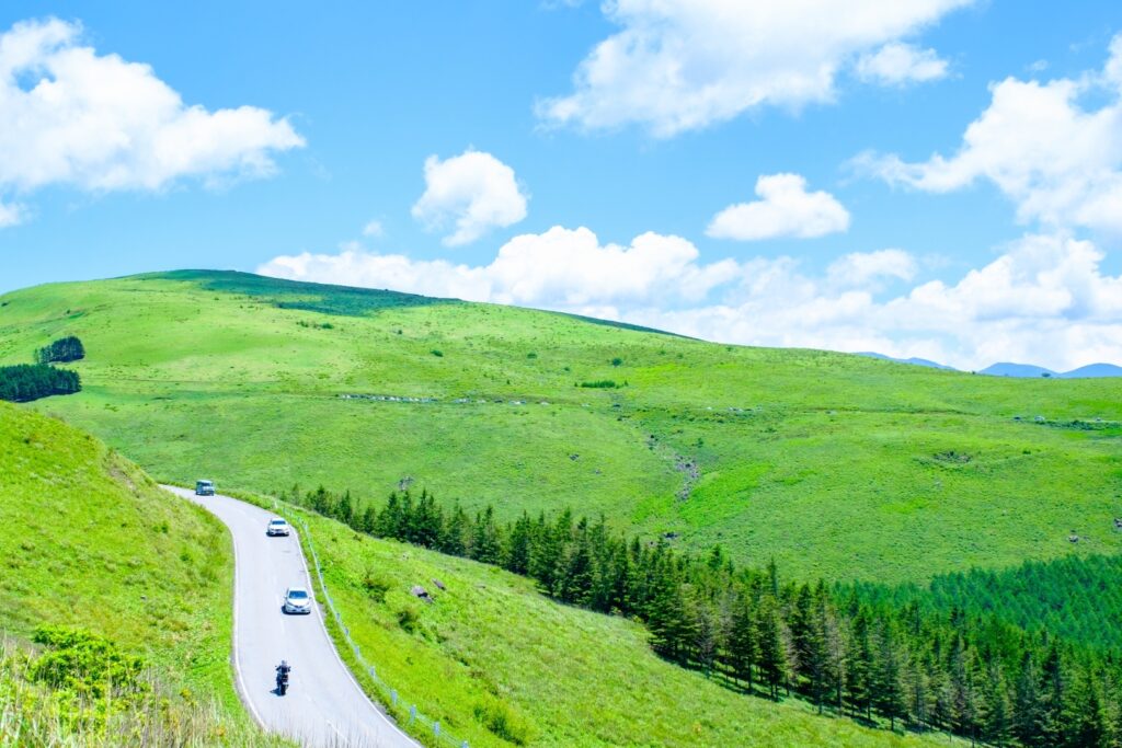
15 min
4
Yashima Wetlands
Parking MAPCODE:
468 139 076What is MAPCODE?

13:00
Next is [Yashima Wetlands], which spreads over a plateau at an altitude of 1,630m. This marsh is designated as a national natural monument, and about 400 species of subalpine plants can be observed throughout the year.
Short walking course:800m/15min
Marshland round trip course:3.6km/1.5hours
20 min
5
Kurumayama Highland
Parking MAPCODE:
468 055 716What is MAPCODE?

14:00
The biggest highlight of the day is [Kurumayama Highland]. A truly incredible 360-degree view spreads out. You need to take a lift to the top of the mountain, but you will never regret it, so please visit.
Some restaurants and cafes are at the bottom and middle of the mountain. And it is also a good idea to buy sandwiches or a lunch box and eat at the TOP of the mountain.
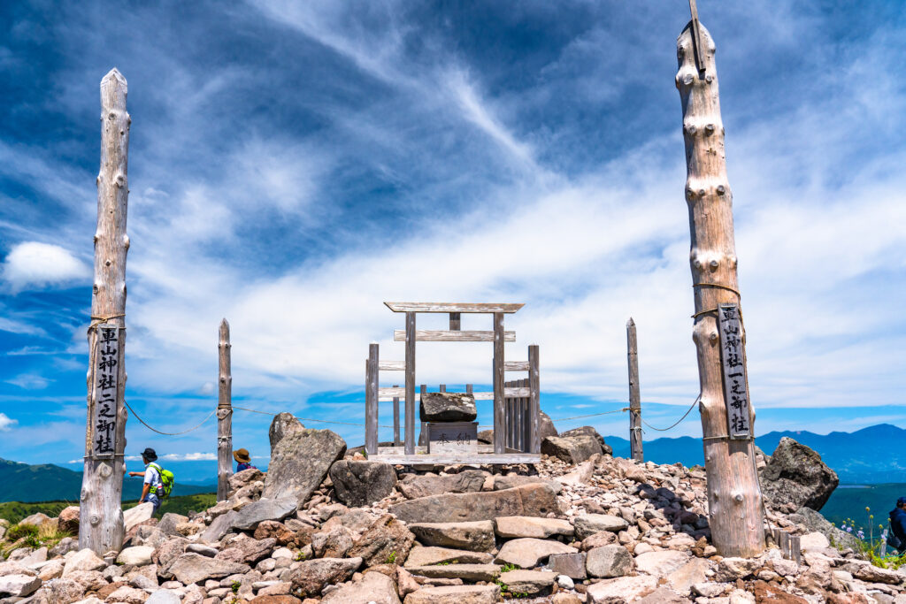
30 min
After Kurumayama Highland, return a little to the road you came from and head toward Suwa Lake.
6
Lake Suwa Observatory(Tateishi Park)
Parking MAPCODE:
218 780 003What is MAPCODE?
16:30
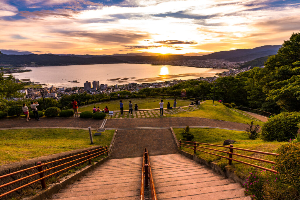
After that, [Lake Suwa Observatory (Tateishi Park)].
It is a panoramic observatory where you can look down Lake Suwa. It became famous as a sacred place for the animated movie “Your Name”, and is especially recommended to see the sunset.
70 min
7
Inn in Matsumoto
Parking MAPCODE:
Please head to the hotel you reserved.What is MAPCODE?
16:30
It is about 40km to Matsumoto. Please go back to same inn. Please spend a relaxing time.
The driving map will show additional 10-20 spots for the day! You will travel only to your favorite spots.
Check pin color and MAPCODE usage.
On this day, you will stay in Matsumoto (松本) city.
Many inns are concentrated in the following two areas.
①Around Matsumoto Station
The inns are concentrated east side of Matsumoto Station. This area is convenient for dinner and visiting Matsumoto castle but no inns offer Onsen.
- Inn Type
Most of these inns are 3 to 5-star western-style hotels. - Parking
Most inns have official parking but in addition to the accommodation fee, the parking lot fee will be charged separately. - Onsen
There is no Onsen in this town and no inns have Onsens. - Meal Plan Reservations
As many restaurants are open till midnight, it is recommended to book your inns with breakfast only or without meals.
②Asama Onsen(浅間温泉)
This hot spring resort area is located 4km north of Matsumoto station. If you would like to stay in better accommodation with Onsen, here is recommended.
- Inn Type
Most of these inns are 3 to 5-star Japanese-style Ryokans with Onsen facilities. - Parking
Most inns will offer free parking. - Onsen
This area is famous for Onsen and most of the inns have one. - Meal Plan Reservations
There are few restaurants in this area and be sure to make a reservation with a plan that includes dinner and breakfast.
Matsumoto – Mt.Fuji
Start: Matsumoto (松本)
Finish:Mt.Fuji(Lake Kawaguchiko)(河口湖)
Mileage:180km
Travel Pace: Fast
On this day you will head from Matsumoto to Mt.Fuji.
1
Inn in Matsumoto
Parking MAPCODE:
9:00
The mileage is relatively long at 180km, so it is recommended that you leave the hotel by 9 o’clock at the latest. Also, use the expressway as much as possible to reduce driing time.
If you haven’t visited Matsumoto castle yet, let’s visit before you leave Matsumoto. They open from 8:30.
80 min
2
Lake Suwa Observatory(Tateishi Park)
Parking MAPCODE:
218 780 003What is MAPCODE?

10:50
The first destination is [Lake Suwa Observatory (Tateishi Park)]. It is a place visited by many tourists with a wonderful view of Lake Suwa and the city of Suwa.
80 min
3
Shosenkyo Gorge
Parking MAPCODE:
59 848 186*53What is MAPCODE?

12:40
Next, you will move to Yamanashi Prefecture and visit [Shosenkyo], which is said to be “the best valley beauty in Japan”. It is about 75km, about 1 hour and 30 minutes drive using the Chuo Expressway (E20).

You can enjoy the natural beauty of cliffs, special-looking rocks, and beautiful water streams from the well-maintained promenade.
80 min
4
Oishi Park
Parking MAPCODE:
59 089 355*27What is MAPCODE?
15:40
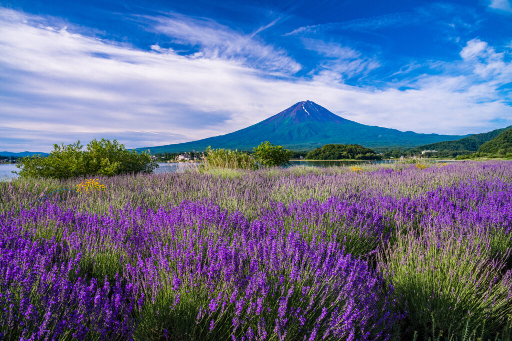
After Shosenkyo, you will go to [Oishi Park] where you can see Mt. Fuji and Kawaguchiko which is one of the Fuji Five Lakes at the same time. It is about 65km, about 1 hour and 15 minutes drive using the Chuo Expressway (E20). The flowers of the four seasons are also beautiful here, especially during the lavender season (mid-June-mid-July).
10 min
5
Inn in Lake Kawaguchi
Parking MAPCODE:
Please head to the hotel you reserved.What is MAPCODE?
16:50
We recommend staying around Lake Kawaguchi or Lake Yamanaka on this day. After checking in at the hotel, you can enjoy local gourmet food such as Hoto or Yoshida udon, which are local dishes of Yamanashi prefecture, while strolling along the lakeside. At dusk on Lake Yamanaka, you may be able to capture the lake, Mt. Fuji, and the setting sun in one photo.
On this day, you can enjoy beautiful flowers if the seasons match. We recommend that you adjust the time and stop by, such as [Jindai Zakura], [Sunflower field of Akeno], and [Lake Yamanaka Flower Park].


The driving map will show additional 10-20 spots for the day! You will travel only to your favorite spots.
Check pin color and MAPCODE usage.
Lake Kawaguchiko, located on the northern side of Mt. Fuji, is one of the Fuji Five Lakes and is also famous for its Onsen. Many inns line the eastern shore of the lake.
- Inn Type
There are a variety of inns like 3-star western-style hotels and 5-star Japanese Ryokans. - Parking
Most inns will offer free parking. - Onsen
This town is famous for Onsen and some of the inns have one. Some hotels provide you can enjoy an open-air Onsen with a Mt.Fuji view.
There is no Onsen in this town and no inns have Onsens. - Meal Plan Reservations
As many restaurants are open till midnight, it is recommended to book your inns with breakfast only or without meals.
There are a few restaurants around in this area but it is recommended to make a reservation with a plan that includes dinner and breakfast.
Mt.Fuji – Mt.Fuji
Start:Mt.Fuji(Lake Kawaguchiko)(河口湖)
Finish:Mt.Fuji(Lake Kawaguchiko)(河口湖)
Mileage:80km
Travel Pace: Relax
On this day, you will stay at Lake Kawaguchiko as you did yesterday and tour around the Fuji Five Lakes.
1
Inn in Lake Kawaguchiko
Parking MAPCODE:
10:00
The mileage is about 80km even if you go to the 5th station of Mt. Fuji, so it is a day when you can travel comfortably.
10 min
2
Mt.Arakurayama Sengen Park
Parking MAPCODE:
161 276 580*54What is MAPCODE?
10:10
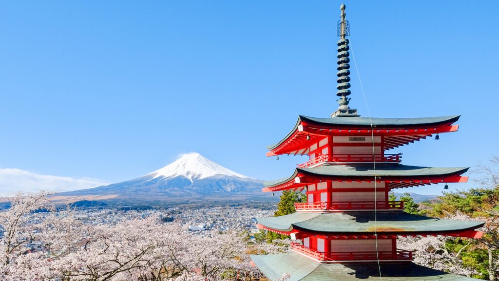
First of all, if you haven’t visited yet, please visit [Mt.Arakurayama Sengen Park] near Lake Kawaguchi. It is a popular spot where you can see Mt. Fuji and the five-storied pagoda as a set, so the first visit in the morning is recommended.
20 min
3
Oshino Hakkai
Parking MAPCODE:
Please check belowWhat is MAPCODE?

11:30
After that, you will drive toward Lake Yamanakako and head for the very famous [Oshino Hakkai].
[Oshino Hakkai] near Lake Yamanakako are the eight springs that make the underground water of Mt. Fuji come up. It is registered as a World Cultural Heritage along with Mt. Fuji.
Please use either of the following parking lots.
Hinodeya Parking Lot(ひのでや駐車場): MAPCODE 161 130 608
Ikemoto Parking Lot(池本駐車場): MAPCODE 161 130 849
15 min
4
Lunch
Parking MAPCODE:
12:40
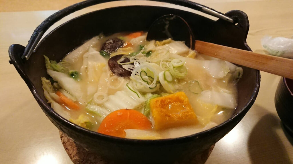
Speaking of lunch in Yamanashi, hoto is recommended. Please refer driving map. In particular, there are many hoto restaurants around Lake Kawaguchiko.
Also, the map introduces famous hamburger shops and robatayaki restaurants with a nice atmosphere, so please refer to them.
At the western confectionery and coffee shop [Abend] (MAPCODE: 161 215 436), you can enjoy anmitsu, waffles, and specialty curry made from Fuji’s famous water.
35 min
5
Fuji Subaru Line 5th station
Parking MAPCODE:
689 223 008What is MAPCODE?
14:20
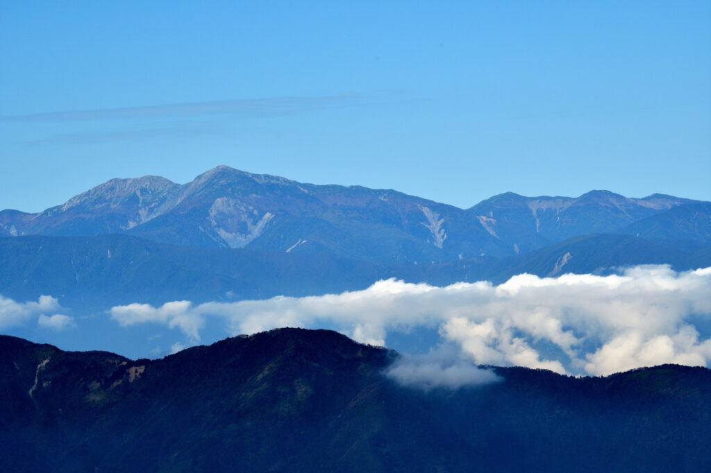
After lunch, you’re finally heading to today’s highlight, Mt.Fuji. After drivinging the [Fuji Subaru Line] for about 30km from the Mt. Fuji World Heritage Center, you will arrive at the [Mt. Fuji Subaru Line 5th Station]. Located at an altitude of about 2300 meters, it offers wonderful views of the Fuji Five Lakes and the mountains of the Alps.
* General vehicles cannot run from mid-July to mid-September. Please be careful. Also, the 5th station is 10 ℃ colder than the base, so be sure to bring warm clothes.
60 min
6
Saiko Iyashi no sato NENBA
Parking MAPCODE:
59 019 045What is MAPCODE?

16:15
If you still have time to go down to the foot of the mountain, we recommend [Saiko Iyashi no sato NENBA] near Saiko. The restored thatched-roof houses are lined up, and it is truly a world of old Japanese tales.
20 min
There are numerous tourist destinations scattered around the Fuji Five Lakes.
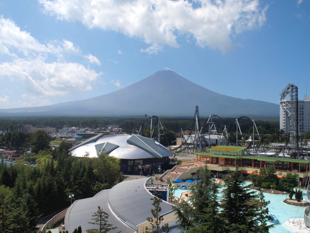
You can play for a whole day at [Fuji-Q Highland] and [Museum of Music and Forests], and in spring and autumn there are many famous spots for flowers and autumn leaves, so please visit according to the weather.


7
Inn in Lake Kawaguchiko
Parking MAPCODE:
Please head to the hotel you reserved.What is MAPCODE?
17:30
It will be a long-distance drive tomorrow, so please take a rest and save your energy at the hot springs of Lake Kawaguchiko.
The driving map will show additional 10-20 spots for the day! You will travel only to your favorite spots.
Check pin color and MAPCODE usage.
Lake Kawaguchiko, located on the northern side of Mt. Fuji, is one of the Fuji Five Lakes and is also famous for its Onsen. Many inns line the eastern shore of the lake.
- Inn Type
There are a variety of inns like 3-star western-style hotels and 5-star Japanese Ryokans. - Parking
Most inns will offer free parking. - Onsen
This town is famous for Onsen and some of the inns have one. Some hotels provide you can enjoy an open-air Onsen with a Mt.Fuji view. - Meal Plan Reservations
There are some restaurants around in this area but it is recommended to make a reservation with a plan that includes dinner and breakfast.
Mt.Fuji – Tokyo
Start:Mt.Fuji(Lake Kawaguchiko)(河口湖)
Finish: Tokyo (東京)
Mileage:150km
Travel Pace: Normal
On this day you will return to Tokyo from Lake Kawaguchiko.
1
Inn in Mt.Fuji(Lake Kawaguchiko)
Parking MAPCODE:
9:00
The mileage is about 150km, which is normal. However, there are many attractions around the Fuji Five Lakes and there is a very high possibility of traffic jams in Tokyo. Please allow 2-3 hours for a return trip to Tokyo, especially if you travel on Sundays and the last day of consecutive holidays.

20 min
2
Saiko Iyashi no sato NENBA
Parking MAPCODE:
59 019 045What is MAPCODE?

9:20
The first recommendation is [Saiko Iyashi no Sato NENBA]. The restored thatched-roof houses are lined up, and it is truly a world of old Japanese tales.
20 min
3
Mt.Fuji(Fuji Subaru Line 5th station)
Parking MAPCODE:
689 223 008What is MAPCODE?

10:10
After that, you will head to the highlight of the day [Mt.Fuji(Fuji Subaru Line 5th station)]. It is about 20km and 40 minutes from the Mt. Fuji World Heritage Center at the foot of the mountain. Also, general vehicles cannot run from mid-July to mid-September, so use the bus during that time.
35 min
4
Lunch
Parking MAPCODE:

12:50
Speaking of lunch in Yamanashi, “Hoto” is recommended. Please refer driving map. In particular, there are many Hoto restaurants around Lake Kawaguchiko, so be sure to visit them.
20 min
5
Oshino Hakkai
Parking MAPCODE:

14:10
[Oshino Hakkai] near Lake Yamanakako are eight springs where the underground water of Mt. Fuji comes up. It is registered as a World Cultural Heritage along with Mt. Fuji.
Please use either of the following parking lots.
Hinodeya Parking Lot(ひのでや駐車場): MAPCODE 161 130 608
Ikemoto Parking Lot(池本駐車場): MAPCODE 161 130 849
100 min
It is about 120km from Oshino Hakkai to Tokyo. If there is no traffic jam, it takes about 1 hour and 30 minutes on the Chuo Expressway(E68 & E20).
6
Rental car branch at Haneda Airport, Narita Airport or Tokyo
Parking MAPCODE:
Please refer driving mapWhat is MAPCODE?
17:30
This is the end of this road trip.
①Returning a car at Haneda Airport
They provide a free shuttle bus from the branch to the airport. Normally it takes 15-20 min but may take up to 1 hour during busy times.
②Returning a car at Narita Airport
If you use Narita Airport, please be aware that it is about 70km from central Tokyo and about 1 hour by expressway. They provide a free shuttle bus from the branch to the airport. Normally it takes 15-30 min but may take up to 1 hour during busy times.
③Returning a car in Tokyo
Traffic jams often occur in Tokyo. Be sure to return your car with plenty of time to spare.
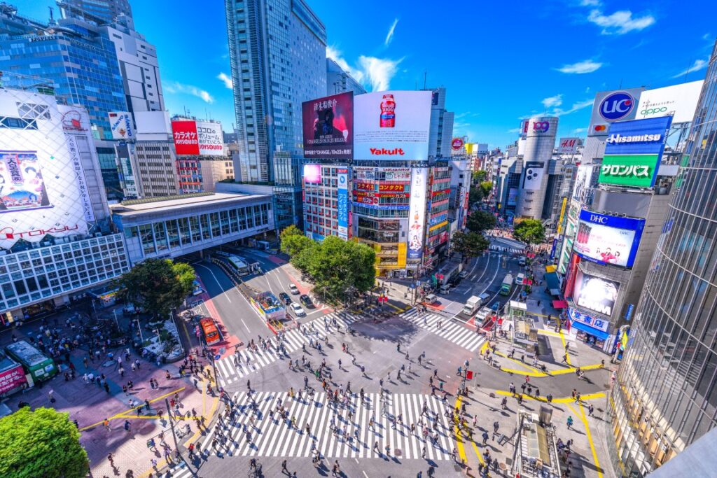
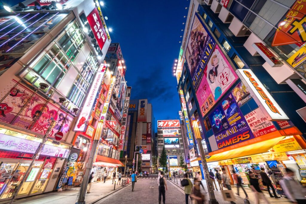
There are 80,000 restaurants in Tokyo! Enjoy your last Japanese meal before returning to your home country as much as you want!
The driving map will show additional 10-20 spots for the day! You will travel only to your favorite spots.
Check pin color and MAPCODE usage.
If you are planning to stay overnight in Tokyo, we recommend the following places.
①Shinjuku Station
Convenient for sightseeing, shopping, and eating.
②Shibuya Station
Convenient for sightseeing, shopping, and eating.
③Tokyo Station
Recommended for travelers who will take Shinkansen.
④Haneda Airport
There are some huge hotels at the airport.
⑤Narita Airport
As you may know, Narita Airport is located 80km away from Tokyo and takes about 2 hours by car. Please travel well in advance of your schedule.
- Inn Type
There are about 3,000 inns in Tokyo. Please book at your preferred type of inn. - Parking
Some inns have official parking but in addition to the accommodation fee, the parking lot fee will be charged separately. - Onsen
A few inns provide onsen. - Meal Plan Reservations
There are 80,000 restaurants in Tokyo. As many restaurants are open till midnight, it is recommended to book your inns with breakfast only or without meals.

