Summary
- Start
Haneda airport or Tokyo/Shinjuku/Shibuya Station - Finish
Haneda airport or Tokyo/Shinjuku/Shibuya Station - Mileage
Total 1120km
140km per day - Travel Pace
Fast - Onsen Stay
Max.6 nights - Recommended Seasons
Beg May – Beg Nov
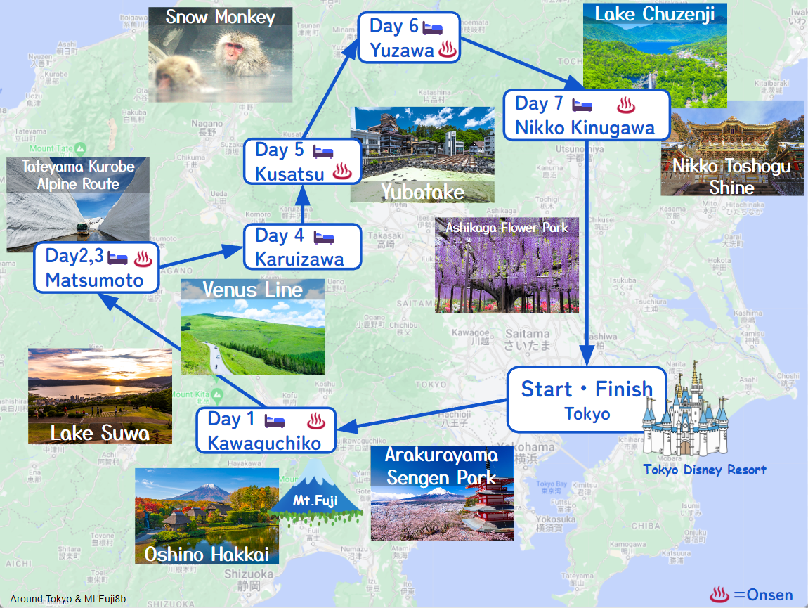
This itinerary takes 8 days to circle around Tokyo and Mt.Fuji.
Daily mileage is standard but by staying consecutive nights in 1 city only, the travel pace is fast.
If you want to stay in Tokyo after the road trip, you can return the car not to the airport but to Tokyo. Due to traffic jams and lack of parking, walking and the train are more convenient for sightseeing in Tokyo.
Day 1 Tokyo – Mt.Fuji(Sample)
Start: Tokyo (東京)
Finish:Mt.Fuji(Lake Kawaguchiko)(河口湖)
Mileage:150km
Travel Pace: Normal
On this day you will head from Tokyo to Lake Kawaguchiko near Mount Fuji.
1
Rental car branch at Haneda airport, Narita airport or Tokyo
Parking MAPCODE:
10:00
The mileage is about 150km, which is standard. There are many sightseeing spots around Fuji Five Lakes, including Lake Kawaguchiko, so if you want to visit many sightseeing spots, please start early.
There are not many spots between Tokyo and Mt.Fuji area. We strongly recommend that you take the expressway(E20) and drive all the way to the Kawaguchiko area, where there are many sights to see at once.
100 min
2
Mt.Arakurayama Sengen Park
Parking MAPCODE:
161 276 580*54What is MAPCODE?
11:40
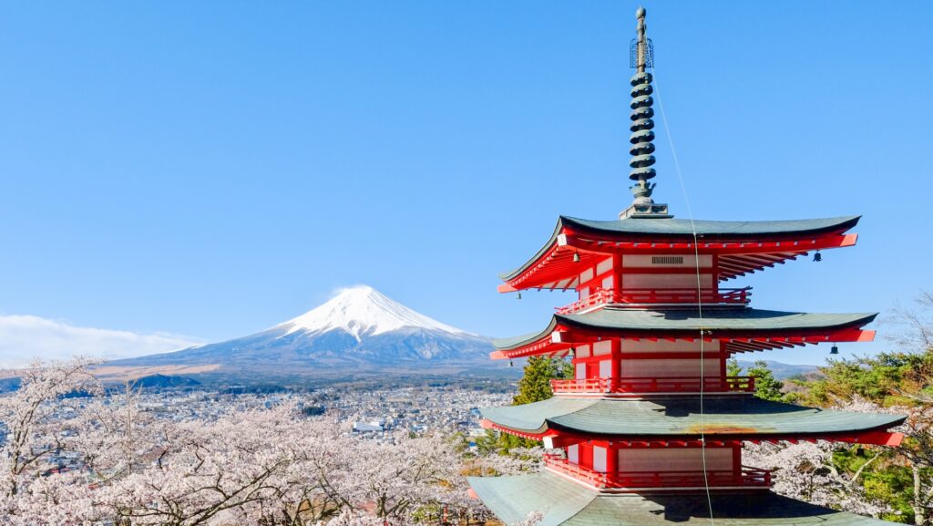
First of all, we recommend [Mt.Arakurayama Sengen Park] near Lake Kawaguchiko. It is a popular spot where you can see Mt. Fuji and the five-storied pagoda as a set, so the first visit in the morning is recommended.
20 min
3
Oshino Hakkai
Parking MAPCODE:
Please check belowWhat is MAPCODE?

13:00
After that, you will drive toward Lake Yamanakako and head for the very famous [Oshino Hakkai].
Oshino Hakkai located between Lake Yamanakako and Lake Kawaguchiko is where eight springs of the underground water of Mt. Fuji meet and shoot up. It is registered as a World Cultural Heritage along with Mt. Fuji.
Please use either of the following parking lots.
Hinodeya Parking Lot(ひのでや駐車場): MAPCODE 161 130 608
Ikemoto Parking Lot(池本駐車場): MAPCODE 161 130 849
40 min
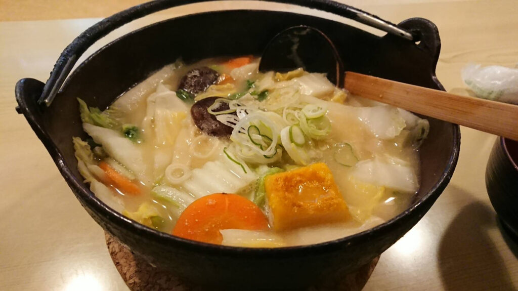
Our recommendation for lunch in Yamanashi is hoto. In particular, there are many hoto restaurants around Lake Kawaguchi, so be sure to visit them. Please refer driving map.
4
Mt.Fuji(Fuji Subaru Line 5th station)
Parking MAPCODE:
689 223 008What is MAPCODE?
15:00
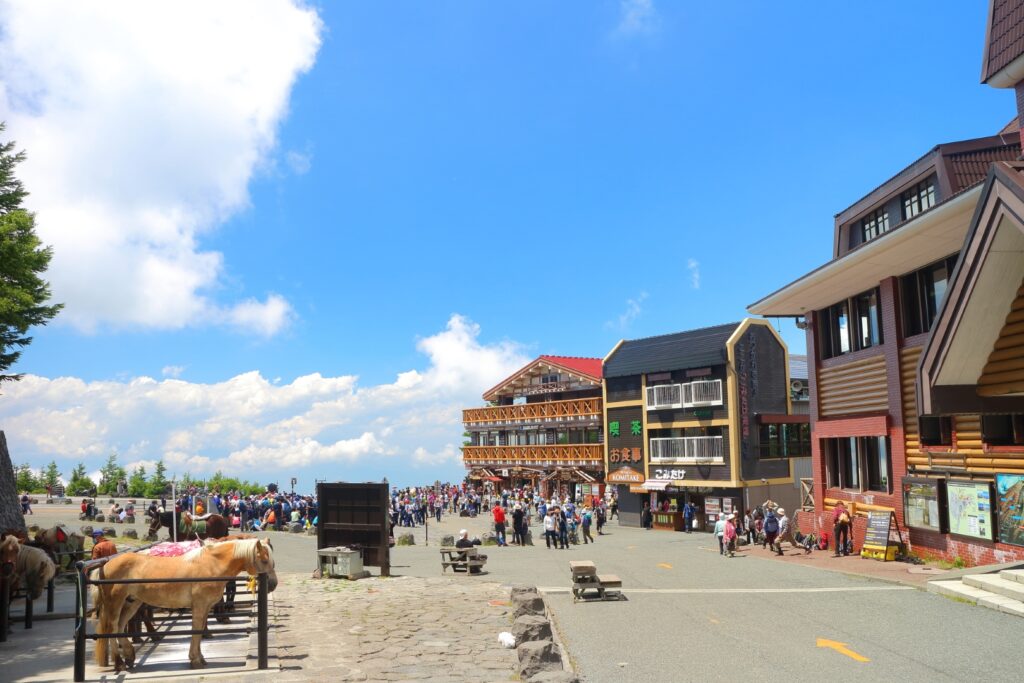
If you have time, head to [Mt.Fuji(Fuji Subaru Line 5th station)]. It is about 20km and 40 minutes from the Mt. Fuji World Heritage Center at the foot of the mountain. Also, please note that general vehicles are not allowed to run from mid-July to mid-September.
35 min
5
Inn in Lake Kawaguchiko
Parking MAPCODE:
Please head to the hotel you reserved.What is MAPCODE?
16:40
The area around Lake Kawaguchiko is a famous hot spring resort. It will be a long-distance drive tomorrow, so please take a rest and save your energy at the hot springs of Lake Kawaguchiko.
There are many famous spots for flowers and autumn leaves around Mt. Fuji that can only be reached by car. These are must-visit places if you visit in spring or autumn.


The driving map will show additional 10-20 spots for the day! You will travel only to your favorite spots.
Check pin color and MAPCODE usage.
Lake Kawaguchiko, located on the northern side of Mt. Fuji, is one of the Fuji Five Lakes and is also famous for its Onsens. Many inns line the eastern shore of the lake.
- Inn Type
There are a variety of inns like 3-star western-style hotels and 4 to 5-star Japanese Ryokans. - Parking
Most inns will offer free parking. - Onsen
This town is famous for onsens and some of the inns have one. Some hotels provide you with an open-air onsen to enjoy accompanied by a breathtaking view of Mt.Fuji. - Meal Plan Reservations
There are a few restaurants around in this area but it is recommended to make a reservation with a plan that includes dinner and breakfast.
Day 2 Mt.Fuji – Matsumoto
Start:Mt.Fuji(Lake Kawaguchiko)(河口湖)
Finish:Matsumoto (松本)
Mileage:190km
Travel Pace:Fast
On this day you will head from Lake Kawaguchiko to Matsumoto.
1
Inn in Lake Kawaguchiko
Parking MAPCODE:
9:00
The mileage is long, about 180km. Please use the expressway if the car navigation system recommends it to save time.
10 min
2
Mt.Arakurayama Sengen Park
Parking MAPCODE:
161 276 580*54What is MAPCODE?

9:10
First of all, if you haven’t visited yet, please visit [Mt.Arakurayama Sengen Park] near Lake Kawaguchiko. It is a popular spot where you can see Mt. Fuji and the five-storied pagoda as a set, so the first visit in the morning is recommended.
80 min
3
Shosenkyo Gorge
Parking MAPCODE:
59 848 186*53What is MAPCODE?

11:30
After that, you will head to [Shosenkyo Gorge]. Here you can enjoy a stroll through the valley of strange rocks and rivers.
50 min
4
Seisenryo
Parking MAPCODE:
359 005 538What is MAPCODE?
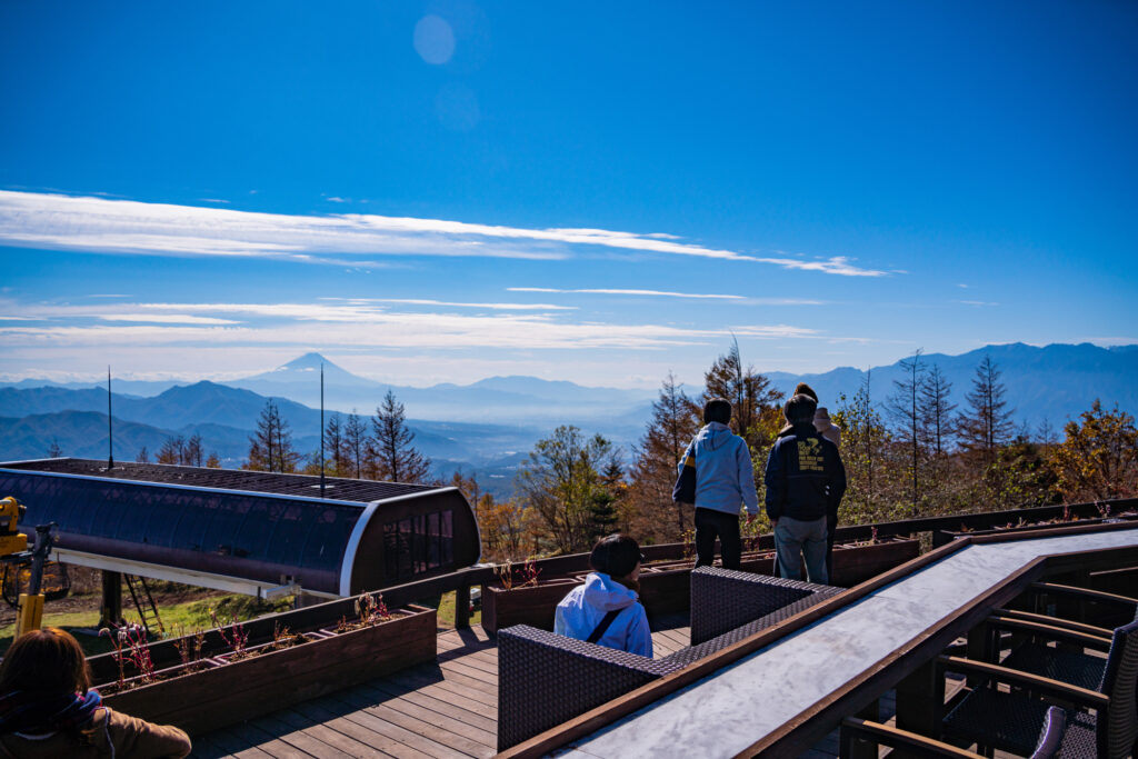
14:20
Then you will head north to Yatsugatake. Please use the expressway (E20) to reduce travel time.
Around Kiyosato, there is soft serve ice cream made from rich jersey milk and nice restaurants making it a perfect spot for lunch.

40 min
5
Lake Suwa Observatory(Tateishi Park)
Parking MAPCODE:
218 780 003What is MAPCODE?
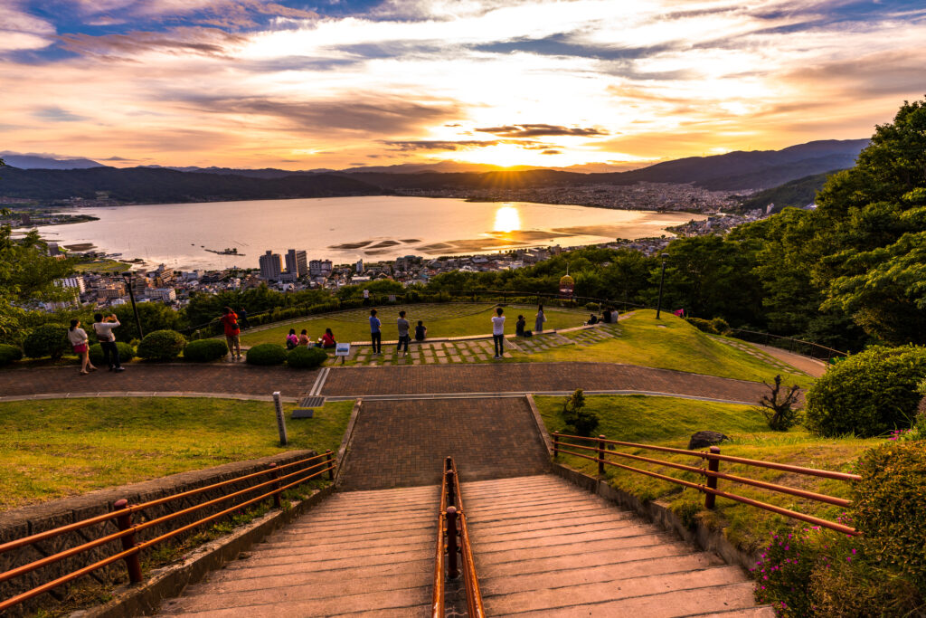
15:30
After that, you will head to the highlight of the day, [Lake Suwa Observatory (Tateishi Park)]. Please use the expressway (E20) to reduce travel time.
It is a place that became famous as a sacred place for the animated movie “Your Name”, and you can enjoy a wonderful sight, especially at dusk.
50 min
6
Matsumoto Castle
Parking MAPCODE:
75 851 375What is MAPCODE?

16:50
The final destination of the day is [Matsumoto Castle], which is synonymous with Matsumoto. Please use the expressway (E19) to reduce travel time.
You can see the inside of the castle tower, which is one of the few original castle towers in Japan. However, please note that the final admission time is 16:30 – 17:30 depending on the seasons.
Matsumoto castle
10 min
7
Inn in Matsumoto
Parking MAPCODE:
Please head to the hotel you reserved.What is MAPCODE?
18:00
Matsumoto, the largest city in Nagano prefecture. Many restaurants are open until night, so you don’t have to worry about dinner.
If you have time, we recommend taking a walk along “Nakamachi-Dori street”, which is lined with buildings with Namako walls.
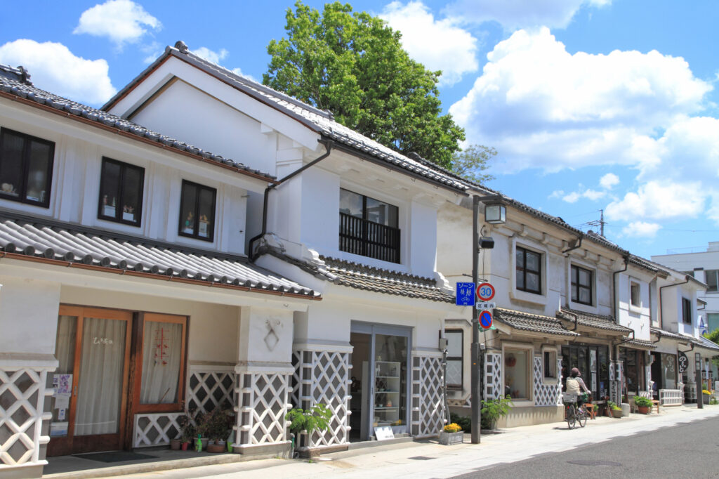
The driving map will show additional 10-20 spots for the day! You will travel only to your favorite spots.
Check pin color and MAPCODE usage.
On this day, you will stay in Matsumoto (松本) city.
Many inns are concentrated in the following two areas.
①Around Matsumoto Station
The inns are concentrated east side of Matsumoto Station. This area is convenient for dinner and visiting Matsumoto castle but no inns offer Onsens.
- Inn Type
Most of these inns are 3 to 5-star western-style hotels. - Parking
Most inns have official parking but in addition to the accommodation fee, the parking lot fee will be charged separately. - Onsen
There is no Onsen in this town and no inns have Onsens. - Meal Plan Reservations
As many restaurants are open till midnight, it is recommended to book your inns with breakfast only or without meals.
②Asama Onsen(浅間温泉)
This hot spring resort area is located 4km north of Matsumoto station. If you would like to stay in better accommodation with Onsen, here is recommended.
- Inn Type
Most of these inns are 3 to 5-star Japanese-style Ryokans with onsen facilities. - Parking
Most inns will offer free parking. - Onsen
This area is famous for onsen and most of the inns have one. - Meal Plan Reservations
There are few restaurants in this area and be sure to make a reservation with a plan that includes dinner and breakfast.
Day 3 Matsumoto- Matsumoto
Start : Matsumoto (松本)
Finish : Matsumoto (松本)
Mileage : 100km
Travel Pace : Fast
On this day you will stay in Matsumoto for consecutive nights following yesterday. And you will enjoy Tateyama Kurobe Alpine Route on a day trip.
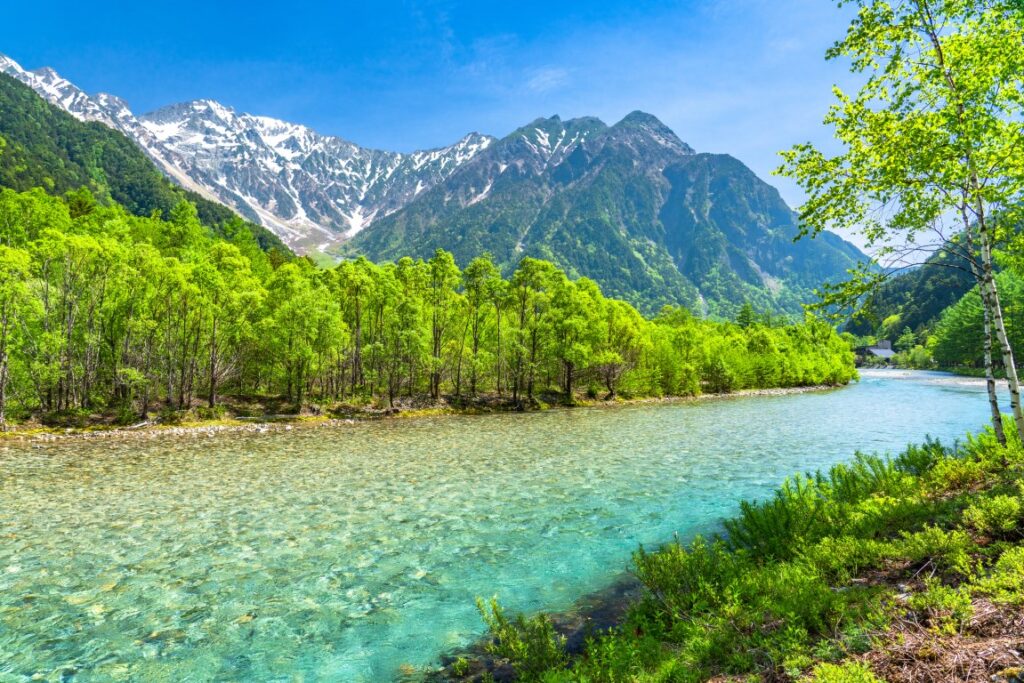
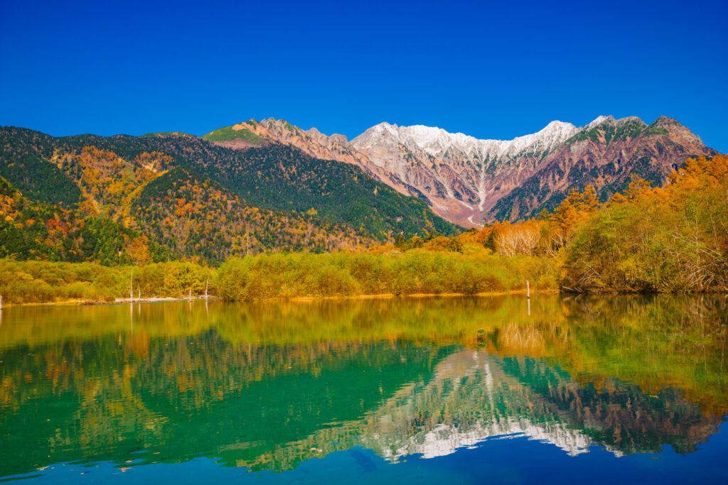
If you prefer another place, Japan Alps “Kamikochi” is recommended too.
1
Inn in Matsumoto
Parking MAPCODE:
9:00
The mileage is as short as 100km, but it’s better to leave early to enjoy Tateyama Kurobe Alpine Route fully.
75 min
2
Tateyama Kurobe Alpine Route
Parking MAPCODE:
691 491 628What is MAPCODE?
10:15

Today’s first destination is Tateyama Kurobe Alpine Route, the biggest highlight today. First, please aim for Ogizawa, which has the entrance on the Nagano side.
After parking the car in the Ogizawa parking lot, take a trolley bus and head to Kurobe Dam. The bus goes through a narrow and dark tunnel.
At Kurobe Dam, please enjoy the huge Kurobe Dam, which is known as the highest dam in Japan. Especially powerful water discharge is great. If you are confident in your legs, we recommend to go to an observatory located in a high place.
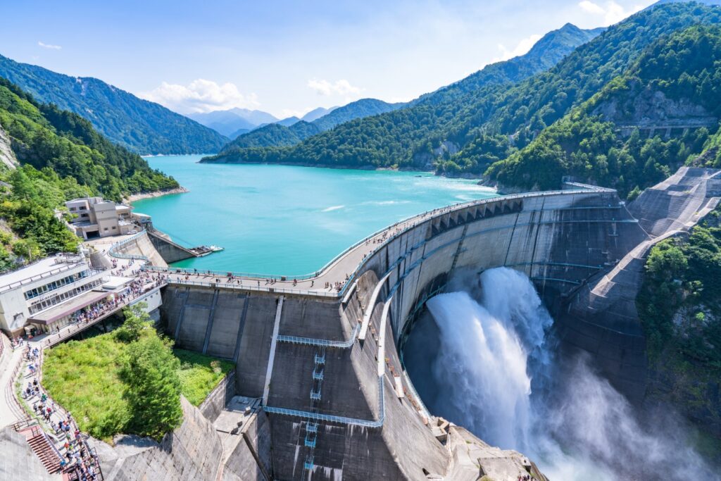
After that, please walk on the dam and head to Kurobe Lake Station of the Kurobe cable car on the other side. And you will take the cable car to Kurobeidaira Station.
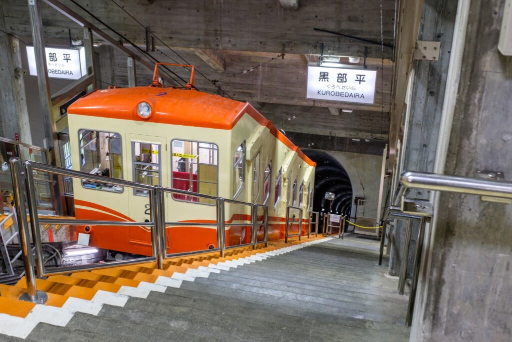
At Kurobedaira Station, you will change to Tateyama Ropeway and head to Daikanbo. This ropeway is 1700m long and has no pillars on the way, and the longest ropeway in Japan. And Lake Kurobe and the surrounding mountains are so beautiful that you will feel like you are flying in the air of the alpine route.
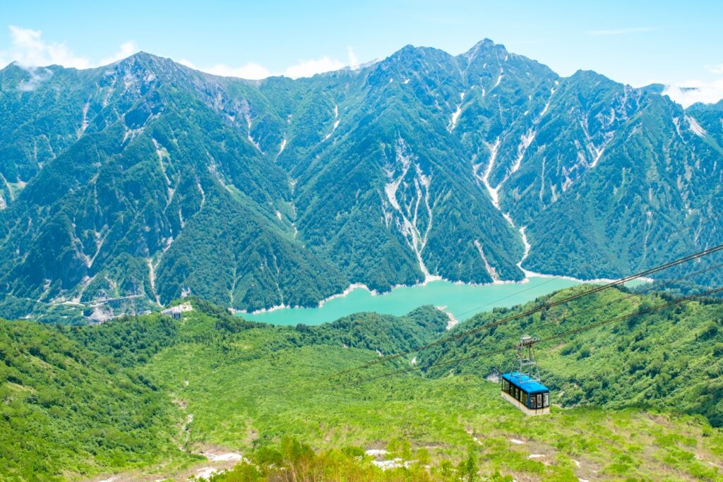
At Daikanbo, please change to a trolley bus. At that time, please don’t forget to go to the rooftop observatory at the station. Lake Kurobe and the large panoramic view of the Alpen Route are one of the best beauties.
The trolleybus then arrives at Murodo, the highest point of the Tateyama Alpine Route. In Murodo, please enjoy the Yuki-no-Otani (mid-April to mid-June), Mikurigaike Pond walk, and more.

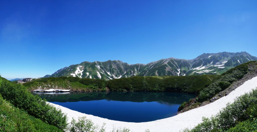
After enjoying Murodo, please return to Ogizawa the way you just came, without going further in the direction of Tateyama.
50min
3
Daio Wasabi Farm
Parking MAPCODE:
158 319 338What is MAPCODE?
16:00
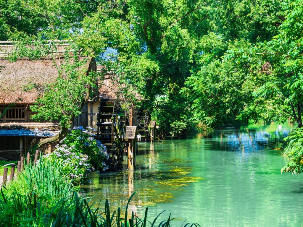
Next, you will head to the Daio Wasabi Farm. This is known as the best wasabi garden in Japan, and many tourists visit. After walking around, please try wasabi soft-serve ice cream.
30min
4
Inn in Matsumoto
Parking MAPCODE:
Please head to the hotel you reserved.What is MAPCODE?
17:30
It takes about 15km to Matsumoto. Please go back to the same inn. Please spend a relaxing time.
If you prefer another place, Japan Alps “Kamikochi” is recommended too.
You can enjoy 30min – 1.5 hour of walking in the breathtaking scenery.

The driving map will show additional 10-20 spots for the day! You will travel only to your favorite spots.
Check pin color and MAPCODE usage.
On this day, you will stay in Matsumoto (松本) city.
Many inns are concentrated in the following two areas.
①Around Matsumoto Station
The inns are concentrated east side of Matsumoto Station. This area is convenient for dinner and visiting Matsumoto castle but no inns offer Onsen.
- Inn Type
Most of these inns are 3 to 5-star western-style hotels. - Parking
Most inns have official parking but in addition to the accommodation fee, the parking lot fee will be charged separately. - Onsen
There is no Onsen in this town and no inns have Onsens. - Meal Plan Reservations
As many restaurants are open till midnight, it is recommended to book your inns with breakfast only or without meals.
②Asama Onsen(浅間温泉)
This hot spring resort area is located 4km north of Matsumoto station. If you would like to stay in better accommodation with Onsen, here is recommended.
- Inn Type
Most of these inns are 3 to 5-star Japanese-style Ryokans with Onsen facilities. - Parking
Most inns will offer free parking. - Onsen
This area is famous for Onsen and most of the inns have one. - Meal Plan Reservations
There are few restaurants in this area and be sure to make a reservation with a plan that includes dinner and breakfast.
Day 4 Matsumoto – Karuizawa
Start: Matsumoto (松本)
Finish: Karuizawa (軽井沢)
Mileage:130km
Travel Pace: Normal
On this day, you will head from Matsumoto to Karuizawa via the Venus Line, one of Japan’s leading tourist mountain roads. This is one of the biggest highlights of this road trip.
1
Inn in Matsumoto
Parking MAPCODE:
9:00
The mileage is short, about 130km, but about 50km of it is a mountain road. There are also many attractions and places to go for a walk, so it is recommended that you start early.
55 min
2
Utsukushigahara Open Air Museum
Parking MAPCODE:
468 527 302What is MAPCODE?

9:55
When you leave Matsumoto, you first go up the mountain road called Azalea Line to [Utsukushigahara Open Air Museum]. The museum itself is wonderful and the amazing view is a must-see.
25 min
3
Mitsumine Viewing Platform
Parking MAPCODE:
468 286 293What is MAPCODE?

11:20
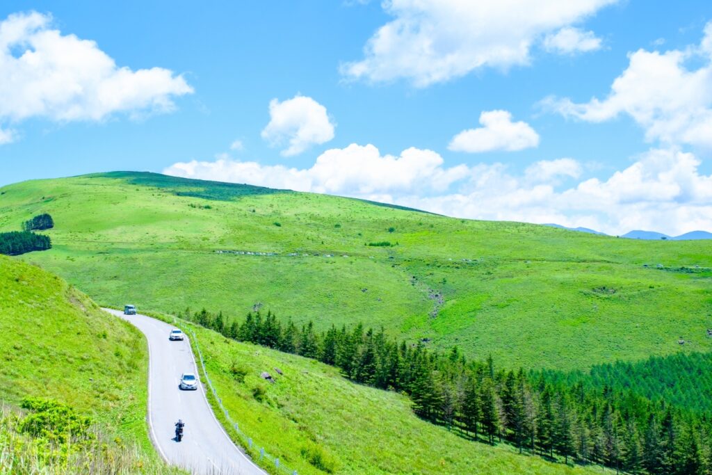
After that, you will finally be on the [Venus Line] drive.
Please drop in at [Mitsumine Viewing Platform]. You can take a break while gazing at the superb view.
35 min
4
Yashima Wetlands
Parking MAPCODE:
468 139 076What is MAPCODE?

12:40
You then head to [Yashima Wetlands]. You can take a walk in the marshland, which stretches over a plateau at an altitude of 1600 m, and is full of rare plants and flowers.
15 min
5
Kurumayama Highland
Parking MAPCODE:
468 055 716What is MAPCODE?

13:50
After Yashima wetlands, you will enter the most beautiful section of the Venus Line. There are some shops to take a rest and observatories along the way, so stop by and enjoy a drive.
After that, it is the biggest highlight of the day [Kurumayama Highland]. A truly awesome 360-degree view spreads out. You need to take a lift to the top of the mountain, but you will never regret it. Highly recommended.
90 min
After leaving Kurumayama Highland, you will go down to [Shirakaba Lake], then leave the Venus Line and head toward Karuizawa.
6
Inn in Karuizawa
Parking MAPCODE:
Please head to the hotel you reserved.What is MAPCODE?
16:55
There are many nice restaurants in Karuizawa where you will stay on this day, but all of them are closed from 8 to 9 pm due to regulations. The convenience stores also close at 23:00. Please make sure you arrive at the inn by about 6 pm so you don’t miss your dinner.
A walk in the town of Karuizawa will be tomorrow.
The driving map will show additional 10-20 spots for the day! You will travel only to your favorite spots.
Check pin color and MAPCODE usage.
On this day, you will stay in Karuizawa city(軽井沢) which is famous for its summer and snow resorts.
The inns are spread over a wide area around Karuizawa Station.
And when you stay in Karuizawa, be aware of the strict town ordinances. All restaurants close by 21:00 and all convenience stores also close at 23:00.
- Inn Type
Most of these inns are 3 to 5-star western-style hotels. - Parking
Most inns will offer free parking. - Onsen
Most inns don’t have onsen. If you would like to stay at an inn with an onsen, “Karuizawa Prince hotel” is recommended. - Meal Plan Reservations
There are many nice restaurants for dinner around the hotel. And some inns also provide nice dinner too. Therefore, please make reservations according to your preference. Due to the town ordinances, most of the restaurants close around 20:00-21:00. Please note that there is no place where you can eat dinner at a late time.
Day 5 Karuizawa – Kusatsu
Start: Karuizawa (軽井沢)
Finish: Kusatsu (草津)
Mileage:60km
Travel Pace: Relaxed
On this day you will head from Karuizawa to Kusatsu Onsen.
1
Inn in Karuizawa
Parking MAPCODE:
10:00
The mileage is as short as about 60km, so you can travel comfortably even if you depart late.
10 min
2
Karuizawa Lake Garden
Parking MAPCODE:
292 464 474*42What is MAPCODE?

10:10
The first destination is [Karuizawa Lake Garden]. Especially the rose season in spring and autumn and the season of autumn leaves are breathtaking.
15 min
3
Kyukaruizawa Ginza Street
Parking MAPCODE:
292 676 492*30What is MAPCODE?

11:25
After that, you will return to the town of Karuizawa and walk on [Kyukaruizawa Ginza Street]. It is the main street of Karuizawa, a historic summer resort. You can enjoy walking around the cute church and the bakery where John Lennon attended. It is also recommended for lunch.
25 min
4
Shiraito Waterfalls(Karuizawa)
Parking MAPCODE:
292 851 679What is MAPCODE?

12:50
Departing from Karuizawa, there is [Shiraito Waterfalls(Karuizawa)] along the Shiraito Highland Way on the toll road. There is no river upstream, and it is a mysterious waterfall where the water seeps out from the mountain surface and flows down.
10 min
From there you will comfortably drive through the woods of Kitakaruizawa. You can also enjoy sweets if you take a break on the way. Please refer driving map.

5
Mt.Asama magma stone park(Onioshidashi Volcanic Park)
Parking MAPCODE:
737 064 896What is MAPCODE?

14:00
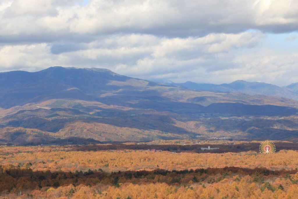
We also recommend [Mt. Asama magma stone park (Onioshidashi Volcanic Park)]. You can take a walk for about 30 minutes in the desolate scenery of the cold and solidified lava of Mt. Asama. In autumn, you can enjoy the beautiful autumn leaves from here.
30 min
6
Inn in Kusatsu Onsen
Parking MAPCODE:
Please head to the hotel you reserved.What is MAPCODE?

16:00
On this day, you will stay at Kusatsu Onsen, one of the most famous Onsen town in all over Japan.
Kusatsu is full of highlights such as walking around the symbols [Yubatake] and [Sainokawara Park], and a hot spring fir show at [Netsunoyu]. Arrive at the inn around 16:00 and enjoy walking around the city after checking in at the inn.
The next day you will be traveling a long distance, so take a rest in the hot springs to save energy.


Please check hot spring show time at Netsunoyu
The driving map will show additional 10-20 spots for the day! You will travel only to your favorite spots.
Check pin color and MAPCODE usage.
Kusatsu is one of the most famous onsen town in all over Japan.
Drive Japan recommends an inn within walking distance of the symbolic “Yubatake” hot spring field.
- Inn Type
Most of these inns are 3 to 5-star Japanese-style Ryokans with onsen facilities.
There are a variety of inns like western-style hotels and Japanese Ryokans. Please book at your preferred type of inn. - Parking
Most inns will offer free parking. But some of their parking is far from the inn and they provide a free shuttle bus. - Onsen
Of course, most of the inns have onsen. - Meal Plan Reservations
There are some restaurants around the hotel for dinner, so please make reservations according to your preference.
Day 6 Kusatsu – Yuzawa
Start:Kusatsu (草津)
Finish:Yuzawa (湯沢)
Mileage:140km
Travel Pace:Fast
On this day, you will head to Yuzawa in Niigata Prefecture from Kusatsu Onsen via National Route 292 (Shiga Kusatsu Road), a breathtakingly scenic road through the highest elevation in Japan. This is one of the biggest highlights of this road trip.
1
Inn in Kusatsu Onsen
Parking MAPCODE:
9:00
The mileage is about 140km, but about 50km of this is a mountain road, so it takes time. There are some spots such as Jigokudani Wild Monkey Park that take time, so if you want to visit many sightseeing spots, we recommend that you leave at 9:00 at the latest.
25 min
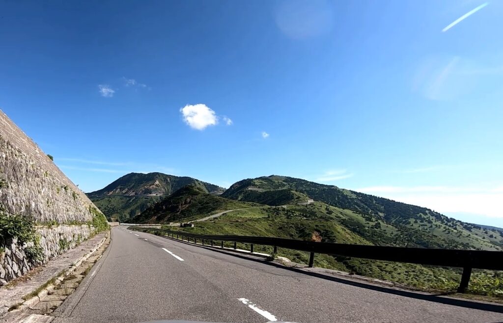
As soon as you leave Kusatsu, you will enter [Shiga Kusatsu Road]. The area around Sassho-gawara just after entering Shiga Kusatsu Road is prohibited from parking or driving with the windows open due to gas caused by active volcanic activity. Please proceed with caution.

As you drive the Shiga Kusatsu Road, you will exceed the forest limit and get a better view. There are many observatories along the way, so stop by and enjoy the most exhilarating drive.
2
Highest point of Japan National Route
Parking MAPCODE:
341 559 798What is MAPCODE?

9:25
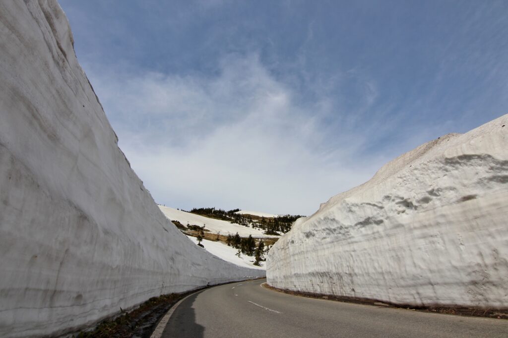
When you go further, you will arrive at [Highest point of Japan National Route]. At the best viewpoint on the Shiga Kusatsu Road, you can enjoy a magnificent view.
5 min
3
Mt.Yokote observatory
Parking MAPCODE:
341 618 039*45What is MAPCODE?

10:00
About 2km from there, you will arrive at [Mt. Yokote observatory].
If you have time, you can also use the skylator and lift to climb the summit of Mt. Yokote.
Mt.Yokote Summit has a Crumpet Cafe with a wonderful view. Also, about 50m away from there, there is the Yokote Summit Hut, and the bakery there is very famous. On this day, we recommend having lunch at one of these restaurants.


35 min
4
Jigokudani Monkey Park
Parking MAPCODE:
341 820 603What is MAPCODE?

12:15
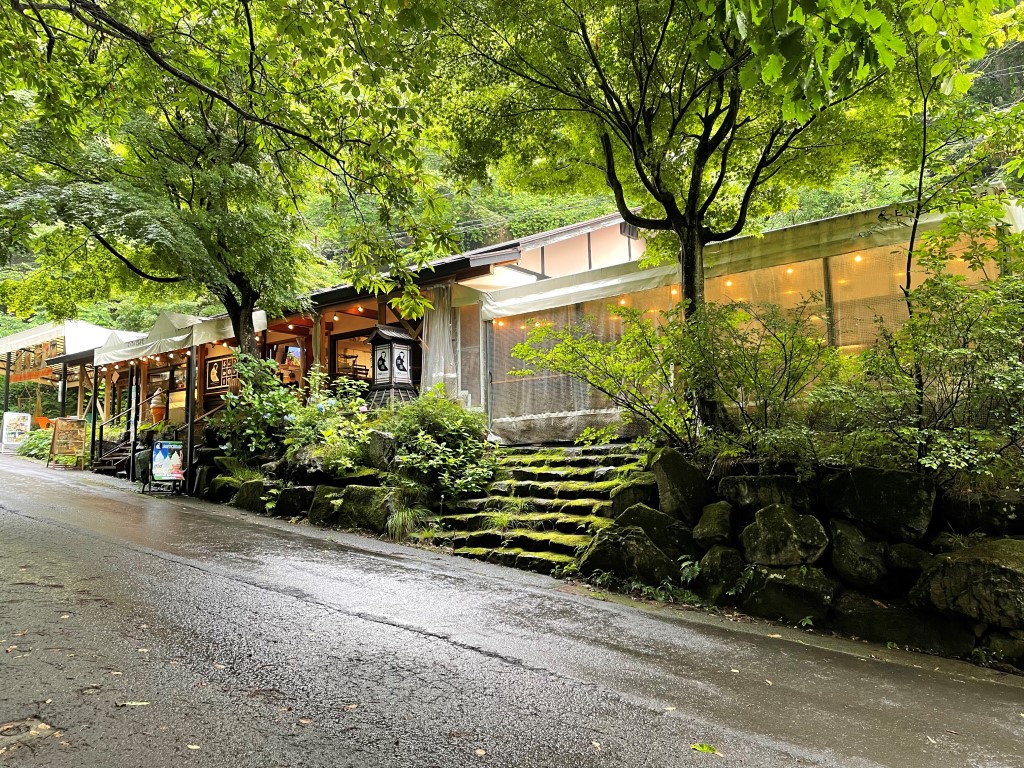
After that, when you go down the mountain and pass the Shiga highland, you will arrive at [Jigokudani Monkey Park], which is very popular with foreign tourists.
There is nice cafe near the park and good for lunch.
100min
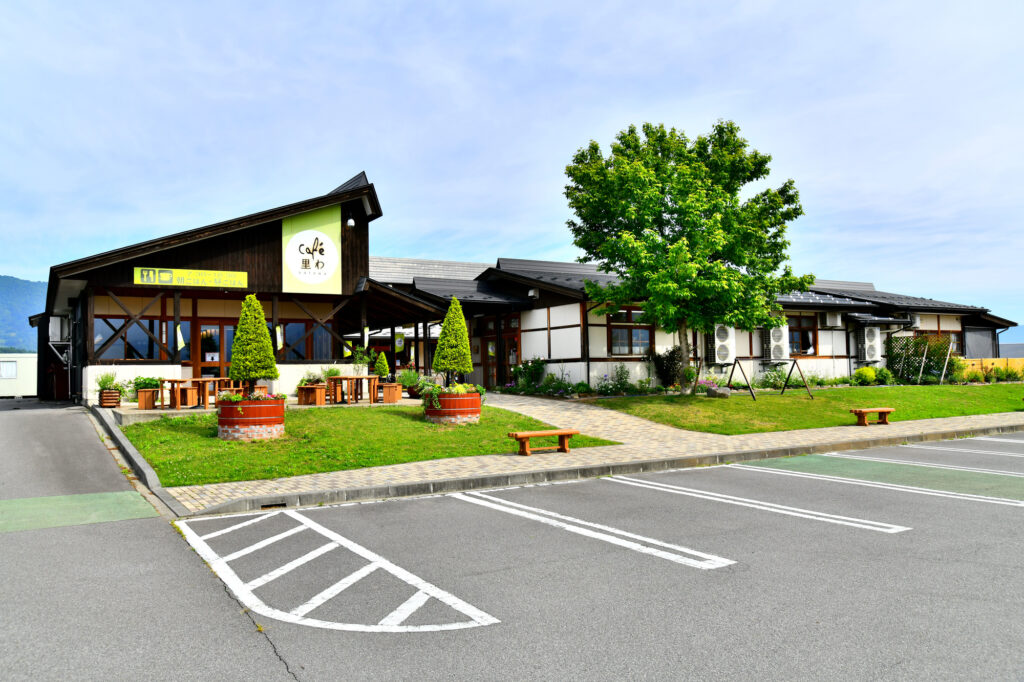
It takes about 90km and about 2 hours from Monkey Park to Yuzawa. Please drive along the Chikuma River while taking a break at the roadside station.
5
Kiyotsukyo Gorge Tunnel
Parking MAPCODE:
253 195 489*35What is MAPCODE?
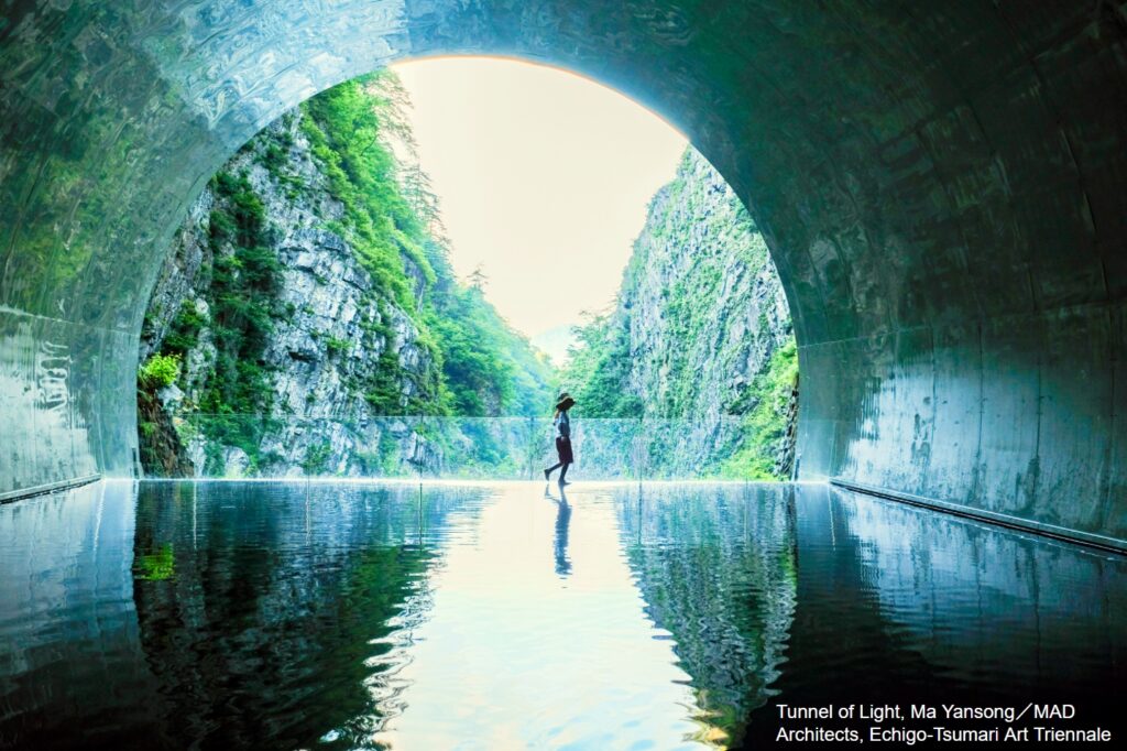
16:00
Especially in this area, we recommend the Kiyotsukyo Gorge Tunnel, where you can take photogenic photos.
25 min
There are nice flowers and autumn foriage spots along the way.
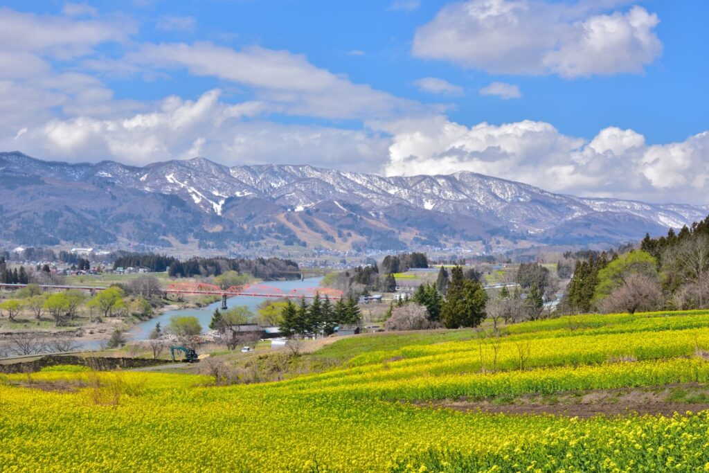
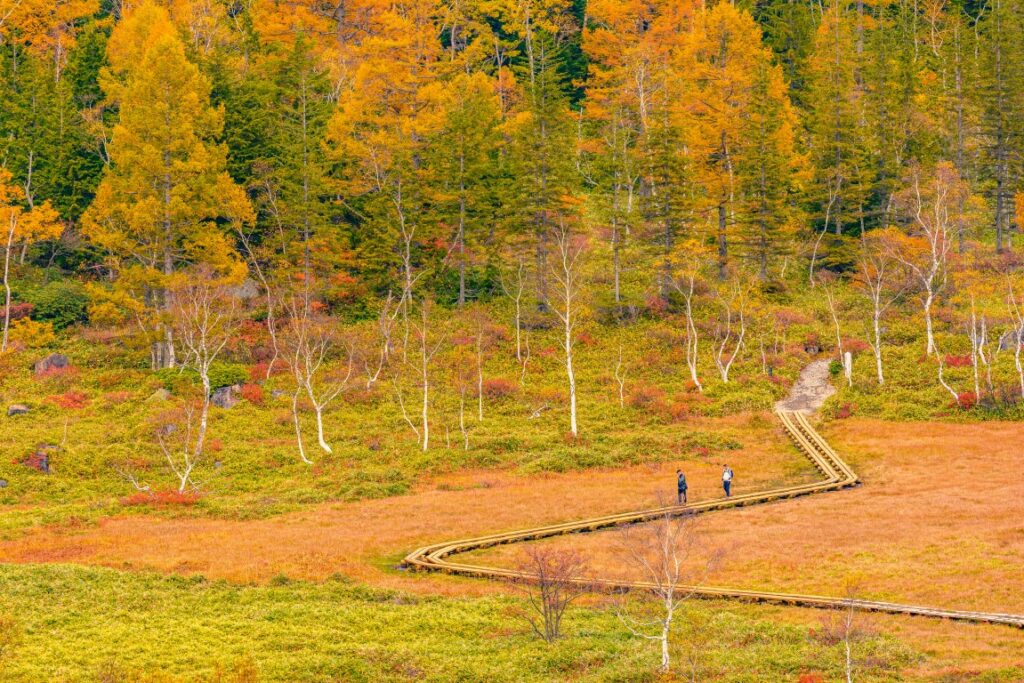
6
Inn in Yuzawa
Parking MAPCODE:
Please head to the hotel you reserved.What is MAPCODE?
17:15
Yuzawa, where you stay on this day, is also a famous onsen town.
Also, if you drive from Echigo Yuzawa on the Kan-Etsu Expressway for about 30km and 40 minutes, you will reach Minakami Onsen. Many inns are of a slightly higher grade, and the mileage the next day will be shorter, so this is also recommended.
The driving map will show additional 10-20 spots for the day! You will travel only to your favorite spots.
Check pin color and MAPCODE usage.
On this day, you will stay in either Yuzawa town or Minakami town. It is 35km and takes about 30min away across the very long Kanetsu Tunnel on the expressway. Both of them are famous for their Onsen and Minakami town is known to have more luxurious inns.
- Inn Type
Most of these inns are 3 to 5-star Japanese-style Ryokans with onsen facilities. - Parking
Most inns will offer free parking. - Onsen
This town is famous for onsens and most of the inns have one. - Meal Plan Reservations
Both towns don’t have many restaurants and recommended to make a reservation with a plan that includes dinner and breakfast.
Day 7 Yuzawa – Nikko
Start: Yuzawa (湯沢)
Finish: Nikko (日光) or Kinugawa(鬼怒川)
Mileage:150km
Travel Pace: Normal
On this day, you will head to Nikko from Yuzawa through three waterfalls called Oku-Nikko three major Waterfalls, Senjogahara, and Irohazaka.
1
Inn in Yuzawa
Immediately after leaving Yuzawa, take the Kan-Etsu Expressway and head to Minakami through the Kan-Etsu Tunnel. Be sure to drive expressway (E17) as it is a very detour and a waste of time on ordinary roads.
2
Fukiware Waterfall
Parking MAPCODE:
Please check belowWhat is MAPCODE?
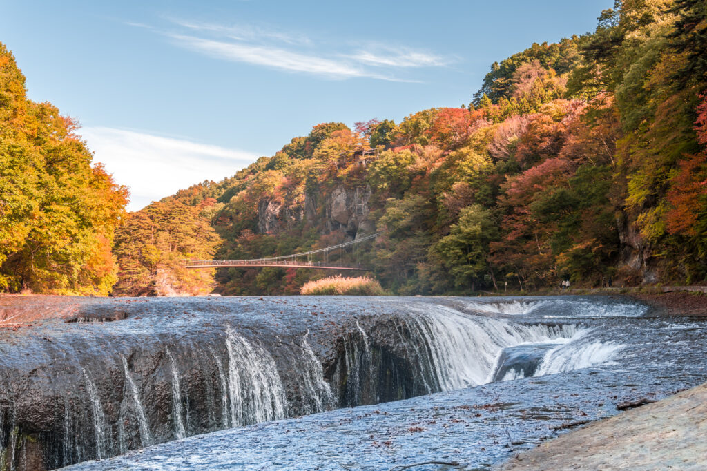
10:00
Your first destination on this day is [Fukiwari Waterfall]. It is a very mysterious waterfall formed by the river eroding over a long period of time from the rock formed by the solidification of lava.
Please use one of the following parking lots.
① Takinoeki Fukiware-滝の駅吹割
MAPCODE: 540 115 493
② Kyaraen-伽羅園
MAPCODE: 540 115 701
55 min
3
Yudaki Falls & Lake Yunoko
Parking MAPCODE:
735 171 234What is MAPCODE?
11:55
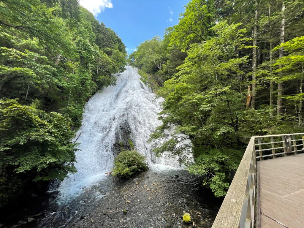
From there you cross Mt. Nikko-Shirane and head for Oku-Nikko. The next destination is [Yudaki Falls & Lake Yunoko].
The water flowing from Lake Yunoko becomes a huge Yudaki Falls with a height of 70m and a width of 25m. The view from the observatory just below the basin is impressive.
10 min
4
Lake Chuzenjiko
Parking MAPCODE:
947 239 339What is MAPCODE?
13:05
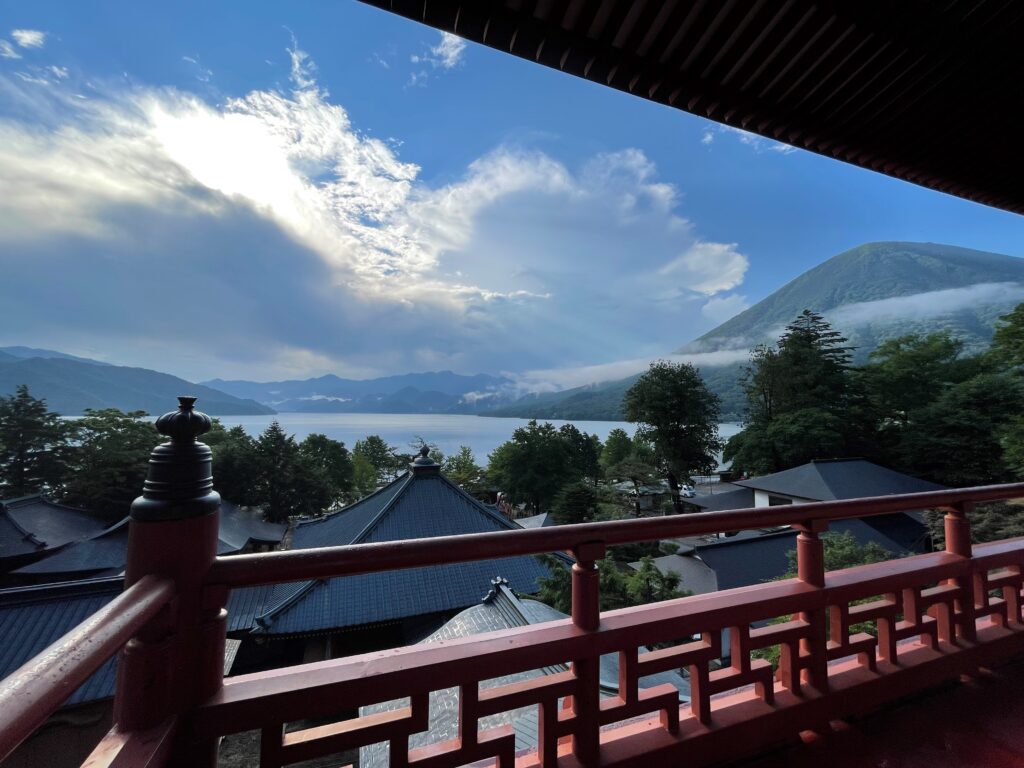
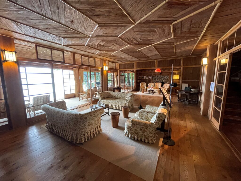
You will arrive at [Lake Chuzenjiko] from Yudaki via Senjogahara and Ryuzu Falls. From the lakeside parking lot, you can also enjoy a walk to [Chuzenji Temple], [British Embassy Villa], and [Italian Embassy Villa].
35 min
5
Akechidaira Ropeway
Parking MAPCODE:
367 242 043*82What is MAPCODE?
15:10
After leaving Lake Chuzenjiko, go down the famous Irohazaka (mountain road) to the Nikko city area.
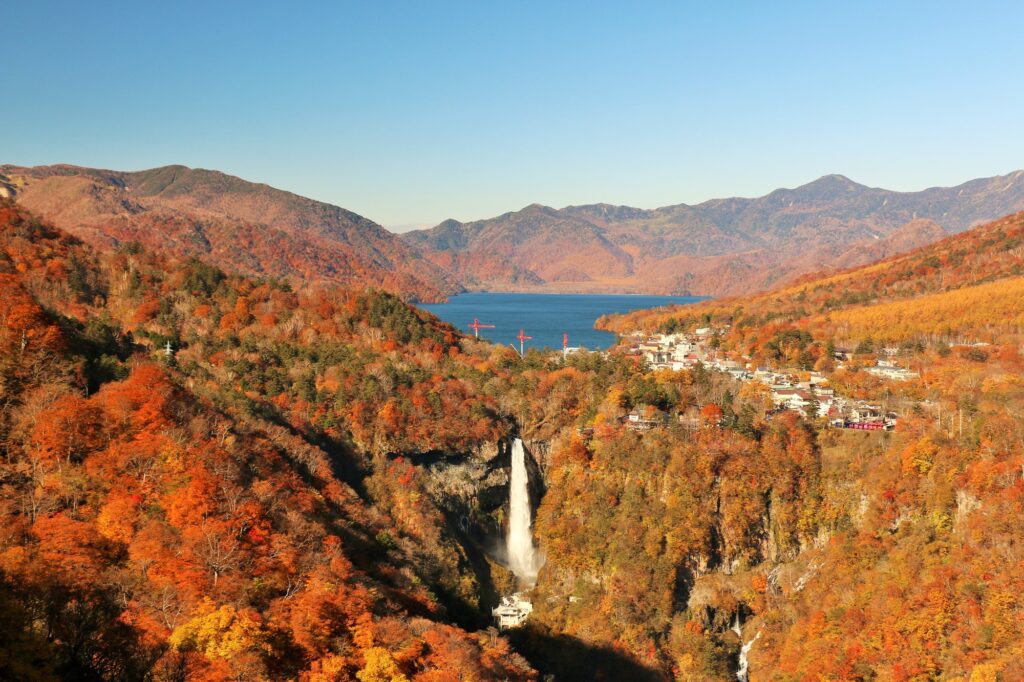
If you have time, we recommend the Akechidaira Ropeway Observatory. This is only accessible from the one-way Irohazaka climbing line, so you’ll have to go down once and then climb again. However, you can meet the magnificent view of Mt. Nantai, Lake Chuzenjiko, and the Kegon Falls that flow down from there.
25 min
6
Inn in Nikko
Parking MAPCODE:
Please head to the hotel you reserved.What is MAPCODE?
17:00
On this day you will stay in Nikko. An inn near Toshogu is convenient for sightseeing the next day. If you drive about 15km from Toshogu, you will reach Kinugawa, a hot spring resort that represents the Kanto region. There are many inns, and you can relax in the hot springs, so this is also recommended.
You will visit Nikko shrines and temples such as Toshogu tomorrow morning.
The driving map will show additional 10-20 spots for the day! You will travel only to your favorite spots.
Check pin color and MAPCODE usage.
On this day, you will stay in Nikko(日光) City. Many inns are concentrated in the following two areas.
①Around Toshogu Shrine
The biggest highlight of Nikko is “Toshogu Shrine” and many inns are concentrated near it.
- Inn Type
There are a variety of inns like 3-star Japanese Ryokan and 5-star historic western hotels. Please book at your preferred type of inn. - Parking
Most inns have official parking but in addition to the accommodation fee, the parking lot fee will be charged separately. - Onsen
Most inns don’t have onsens. - Meal Plan Reservations
There are few restaurants for dinner in this area and be sure to make a reservation with a plan that includes dinner and breakfast.
②Kinugawa Onsen(鬼怒川温泉) area
Kinugawa located 20km and takes 30min from the Toshogu shrine is famous for onsen.
- Inn Type
Most of these inns are 3 to 5-star Japanese-style Ryokans with onsen facilities. - Parking
Most inns will offer free parking. - Onsen
This town is famous for onsens and most of the inns have one. - Meal Plan Reservations
There are few restaurants in this area and be sure to make a reservation with a plan that includes dinner and breakfast.
Day 8 Nikko – Tokyo
Start: Nikko (日光) or Kinugawa(鬼怒川)
Finish: Tokyo (東京)
Mileage:200km
Travel Pace: Fast
On this day you will return to Tokyo from Nikko.
1
Inn in Nikko or Kinugawa
Parking MAPCODE:
9:00
The mileage is long at about 200km, but 100km or more is a drive on the expressway.
10 min
2
Shrines and Temples of Nikko(Toshogu Shrine)
Parking MAPCODE:
367 312 349*83What is MAPCODE?
9:10
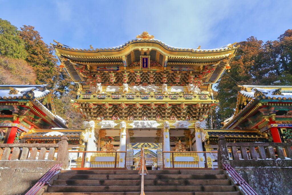
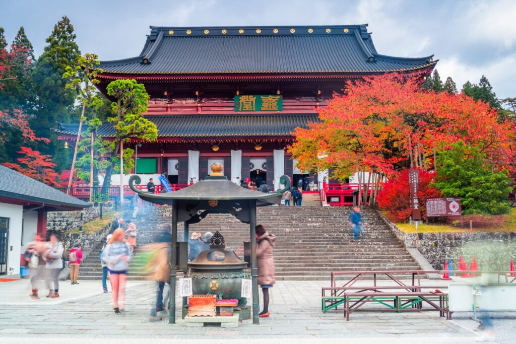
The first destination is the world heritage [Shrines and Temples of Nikko] including the Nikko Toshogu Shrine.
You will first go to [Nikko Toshogu Shrine], which enshrines Ieyasu Tokugawa, the founder of Edo, now the world city Tokyo. This shrine is too famous for the Yomeimon Gate and sleeping cats. [Futarasan Shrine], [Rinnoji Temple], and [Daiyuin], which enshrines Tokugawa Iemitsu, are also worth seeing.
25 min
3
Akechidaira Ropeway
Parking MAPCODE:
367 242 043*82What is MAPCODE?

11:00
If you have time, we recommend the Akechidaira Ropeway Observatory. Located on the hillside of Irohazaka, you can see the magnificent view of Mt. Nantai, Lake Chuzenjiko, and the Kegon Falls that flow down from there.
50 min
4
Oya Museum
Parking MAPCODE:
132 354 480*61What is MAPCODE?

13:00
After that, head to [Oya Museum]. Although it is named a museum, it is actually the site of a huge underground quarry of stone named Oya stone used for warehouses. You will be amazed at its size, which is like an underground city.
120min
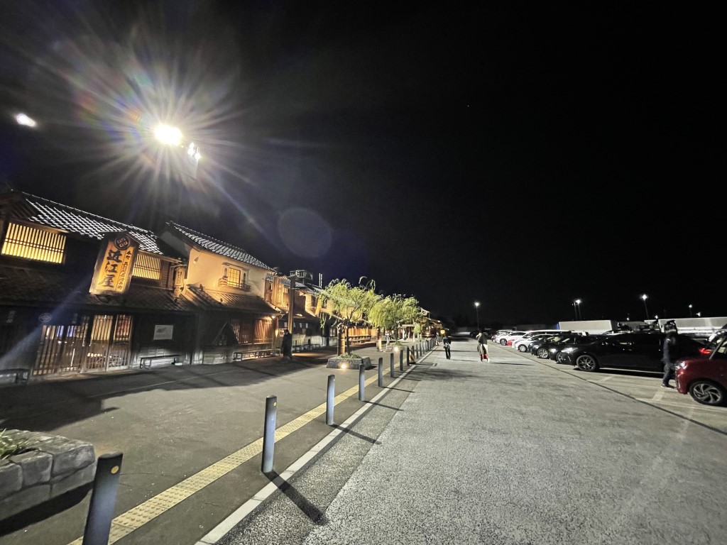
The distance from Oya to Tokyo is 120km on the Tohoku Expressway (E4), which takes about 2 hours.
Please drive safely taking a break in the service area on the way. We recommend the unique Hanyu parking area for a break.
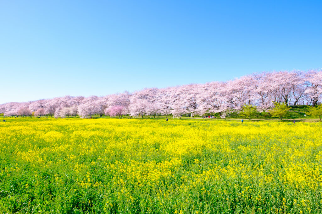
Also, along the route of the day, there is [Ashikaga Flower Park] where flowers bloom all year round, and [Gongendo Park] which is famous for cherry blossoms. If you are traveling during the flowering season, we recommend that you give priority to this.

6
Rental car branch at Haneda Airport, Narita Airport or Tokyo
Parking MAPCODE:
Please refer driving mapWhat is MAPCODE?
17:30
This is the end of this road trip.
①Returning a car at Haneda Airport
They provide a free shuttle bus from the branch to the airport. Normally it takes 15-20 min but may take up to 1 hour during busy times.
②Returning a car at Narita Airport
If you use Narita Airport, please be aware that it is about 70km from central Tokyo and about 1 hour by expressway. They provide a free shuttle bus from the branch to the airport. Normally it takes 15-30 min but may take up to 1 hour during busy times.
③Returning a car in Tokyo
Traffic jams often occur in Tokyo. Be sure to return your car with plenty of time to spare.
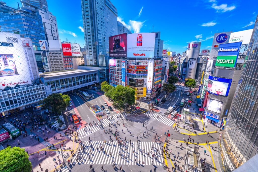
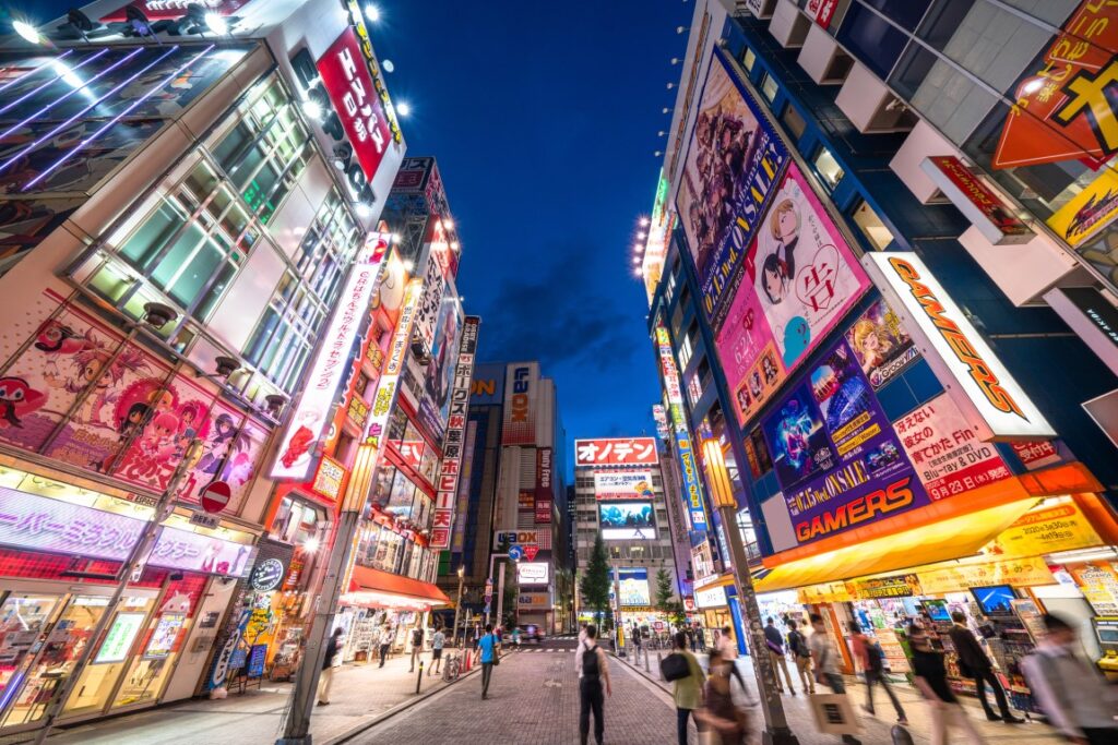
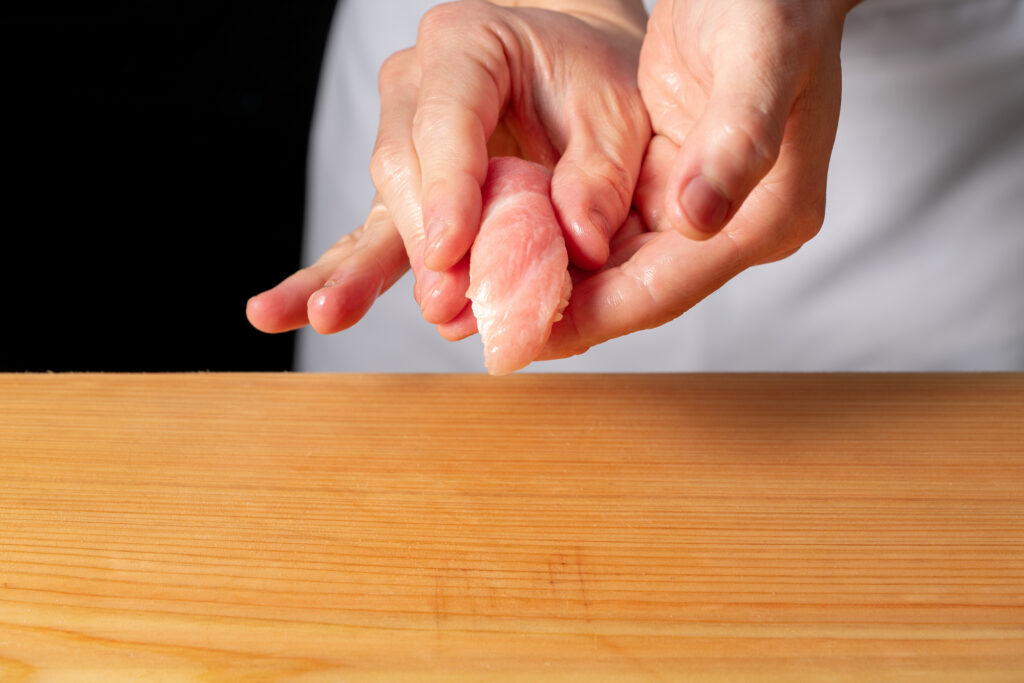
There are 80,000 restaurants in Tokyo! Enjoy your last Japanese meal before returning to your home country as much as you want!
The driving map will show additional 10-20 spots for the day! You will travel only to your favorite spots.
Check pin color and MAPCODE usage.
If you are planning to stay overnight in Tokyo, we recommend the following places.
①Shinjuku Station
Convenient for sightseeing, shopping, and eating.
②Shibuya Station
Convenient for sightseeing, shopping, and eating.
③Tokyo Station
Recommended for travelers who will take Shinkansen.
④Haneda Airport
There are some huge hotels at the airport.
⑤Narita Airport
As you may know, Narita Airport is located 80km away from Tokyo and takes about 2 hours by car. Please travel well in advance of your schedule.
- Inn Type
There are about 3,000 inns in Tokyo. Please book at your preferred type of inn. - Parking
Some inns have official parking but in addition to the accommodation fee, the parking lot fee will be charged separately. - Onsen
A few inns provide onsens. - Meal Plan Reservations
There are 80,000 restaurants in Tokyo. As many restaurants are open till midnight, it is recommended to book your inns with breakfast only or without meals.

