Summary
- Start
Chubu Centrair International Airport or Nagoya Station - Finish
Chubu Centrair International Airport or Nagoya Station - Mileage
Total 1730km
130km per day - Travel Pace
Relaxing - Onsen Stay
Max. 7 nights - Recommended Seasons
May,Jun,Jul,Aug,Sep,Oct
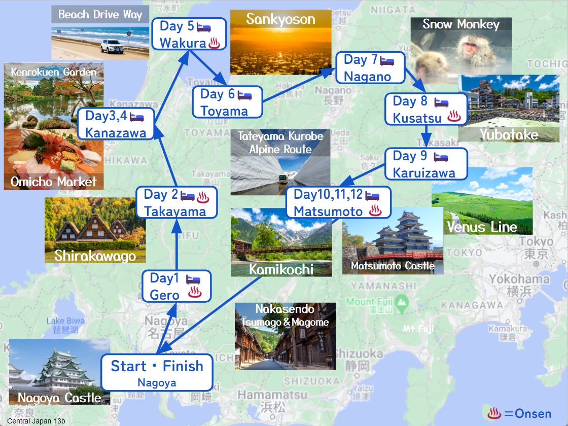
This itinerary takes 13 days to circle around the central Japan area.
Due to short daily mileage and by staying consecutive nights in 2 cities, you can travel at a relaxing pace.
Nagoya – Gero(Sample)
Start: Nagoya (名古屋)
Finish: Gero (下呂)
Mileage:140㎞
Travel Pace: Normal
On this day you are heading from Nagoya to Gero.
1
Inn in Nagoya
2
Nagoya Castle
Parking MAPCODE:
4 348 423What is MAPCODE?
9:10
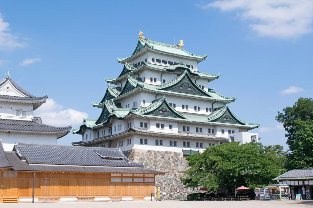
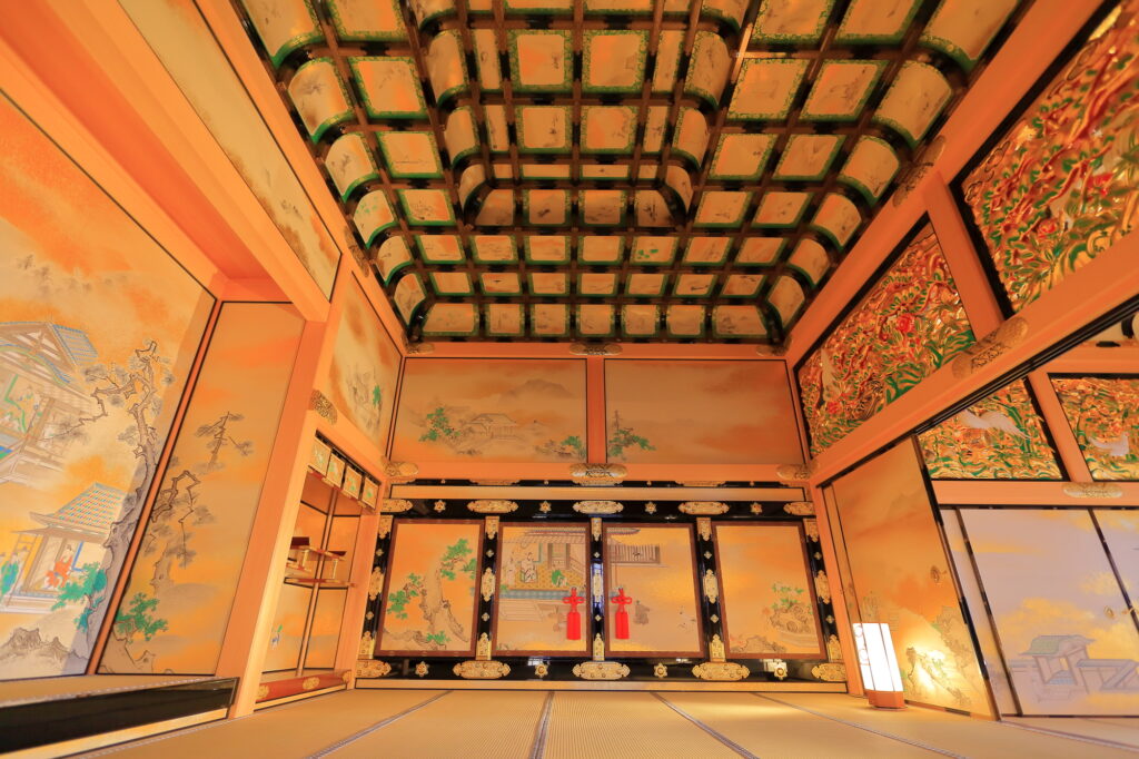
The first destination is [Nagoya Castle], which is famous for the golden Shachihoko(imaginary creature) statue on the roof. Nagoya Castle is recommended not only for its huge and majestic exterior but also for its interior, such as the ceiling and fusuma paintings inside the Honmaru Palace.
40 min
3
Inuyama Castle
Parking MAPCODE:
70 157 834What is MAPCODE?
10:50
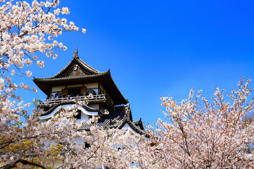
Next, you will head to [Inuyama Castle] on the south bank of the Kiso River. Inuyama Castle is known as the original castle tower, and Japan’s oldest castle tower is designated a national treasure. On the way from the parking lot to the castle, there is also Haritsuna Shrine and Sanko Inari Shrine with red torii gates, so you can enjoy a walk.
50 min
4
Miyachika
Parking MAPCODE:
289 413 044*37What is MAPCODE?
12:45
After visiting the Inuyama Castle, why not stop by a restaurant called [Miyachika], which boasts natural Gujo sweetfish, for lunch? The front glass is wide and open, and the feeling of liberation is outstanding. From the beginning of August to the end of October, you can also experience picking sweetfish on a bamboo gimmick called Yanaba in Nagaragawa river. Also recommended for children.
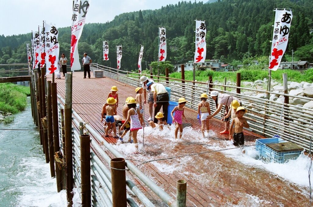
Sweetfish picking experience in Miyachika
25 min
5
Gujo Hachiman
Parking MAPCODE:
289 895 728*50What is MAPCODE?
14:10
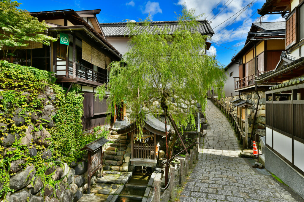
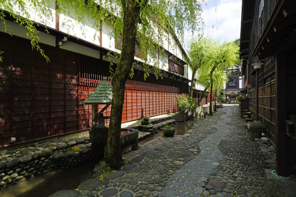
After that, the highlight of the day is [Gujo Hachiman]. Spring waters and waterways spread out in the old townscape designated as an important traditional buildings preservation district of the country, and it has a wonderful atmosphere. There are many attractions such as Sogi-sui, Yanaka-Mizu no Komichi, Igawa Komichi, and Gujo Hachiman Castle, so it is recommended that you spend as much time as possible in Gujo Hachiman.
60 min
6
Inn in Gero
Parking MAPCODE:
Please head to the hotel you reserved.What is MAPCODE?
16:40
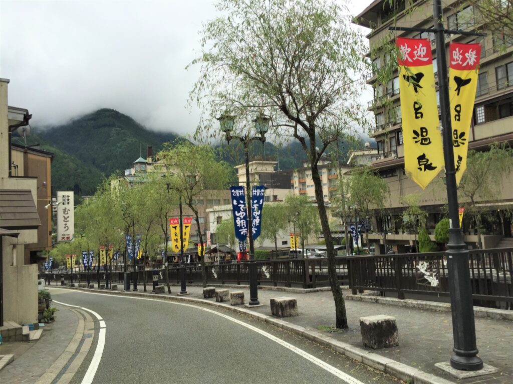
On this day you are staying at Gero Onsen. Here, enjoy Gero Onsen in Gifu Prefecture, which is called one of “the best three springs in Japan” along with Arima in Hyogo Prefecture and Kusatsu in Gunma Prefecture. Local gourmet foods such as Hida beef, Hoba miso, and soba are also attractive.

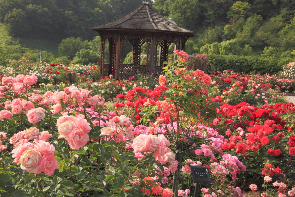
There is one of the world’s largest rose gardens, [Gifu World Rose Garden], on the way to the spot on this day. You can enjoy flowers such as roses, sunflowers, and cosmos all year round. The rose season (mid-May-early June, late October-early November) is especially recommended.
The driving map will show additional 10-20 spots for the day! You will travel only to your favorite spots.
Check pin color and MAPCODE usage.
On this day, you will stay in Gero town(下呂) which is the nationally famous Onsen town. The inns are spread over a wide area around Gero Station.
- Inn Type
Most of these inns are 3 to 5-star Japanese-style Ryokans with Onsen facilities. - Parking
Most inns will offer free parking. - Onsen
This town is famous for Onsen and most of the inns have one. - Meal Plan Reservations
There are few restaurants in this area and be sure to make a reservation with a plan that includes dinner and breakfast.
Gero – Takayama🔒
Start: Gero (下呂)
Finish: Takayama (高山)
Mileage:90km
Travel Pace: Relax
On this day you will head from Gero to Takayama.
1
Inn in Gero
Parking MAPCODE:
🔒Book rental car or hotelWhat is MAPCODE?
10:00
The mileage is as short as 90km, so it is a day when you can travel comfortably.
In the east of Gero Onsen Town, the [Ideyu Morning Market] is held every morning from mid-March to early December, so nice to stop by.
80 min
2
Hida Furukawa
Parking MAPCODE:
🔒Book rental car or hotelWhat is MAPCODE?
11:20
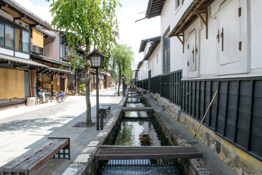
The first destination is [Hida Furukawa] town after passing Takayama. This is the Town of White-Walled Storehouses. There isn’t much to see along the road to Hida Furukawa, so let’s move around for about 1 hour and 20 minutes without stopping.
You can enjoy a leisurely stroll while gazing at the traditional white-walled storehouses that stand along the river. Hida Furukawa Station is also famous as the setting for the anime “Your Name.”
15 min
3
Utsue 48 Waterfalls
Parking MAPCODE:
🔒Book rental car or hotelWhat is MAPCODE?

12:30
Next, we recommend going to [Utsue Forty-eight Waterfall]. The various waterfalls are wonderful, and in the fall you can enjoy the collaboration between the waterfall and the autumn leaves (mid-October-early November).
30 min
4
Inn in Takayama
Parking MAPCODE:
Please head to the hotel you reserved.What is MAPCODE?

14:00
On this day, you are staying at [Hida Takayama], the center of the Hida region where you can feel the history and culture. If you book inn near Old town, it is good idea to check-in your inn first.
After checking in at the hotel, let’s take a leisurely stroll around the old town.
5
Takayama Old Town
Parking MAPCODE:
🔒Book rental car or hotelWhat is MAPCODE?
If your inn is located far from old town, please use above MAPCODE.
15:00
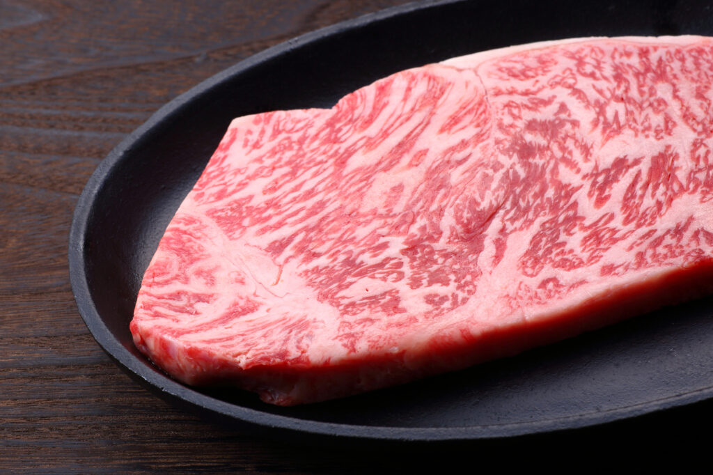
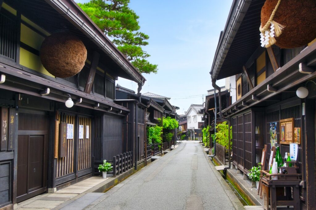
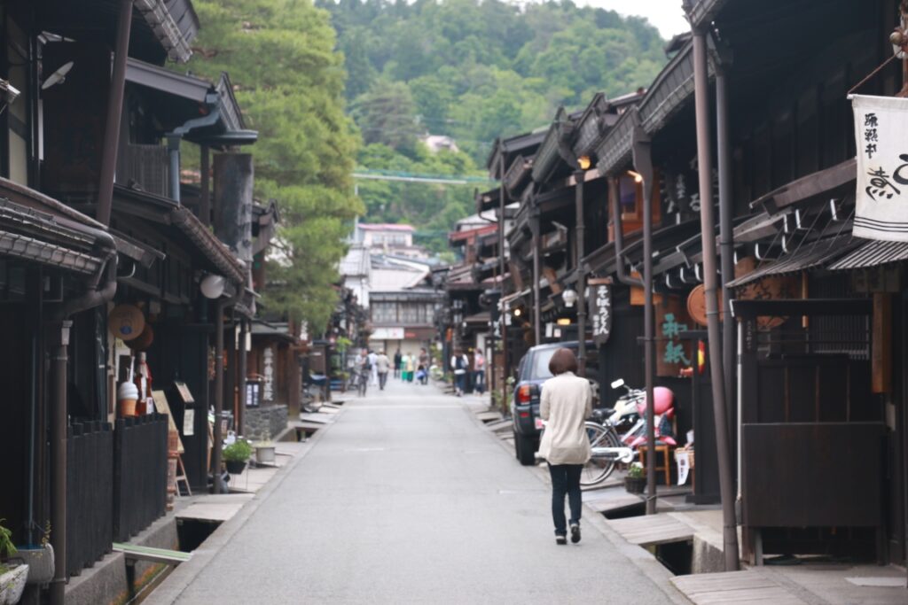
After check-in, enjoy walking in the [Takayama Old Town] called “Little Kyoto”. The appearance of castle towns and commercial towns in the Edo period (1603-1868) is preserved. Shopping while looking at the old cityscape, a tour of the sake brewery, eating Hida beef, minced meat cutlet, pudding, etc. are fun, and time passes in no time.

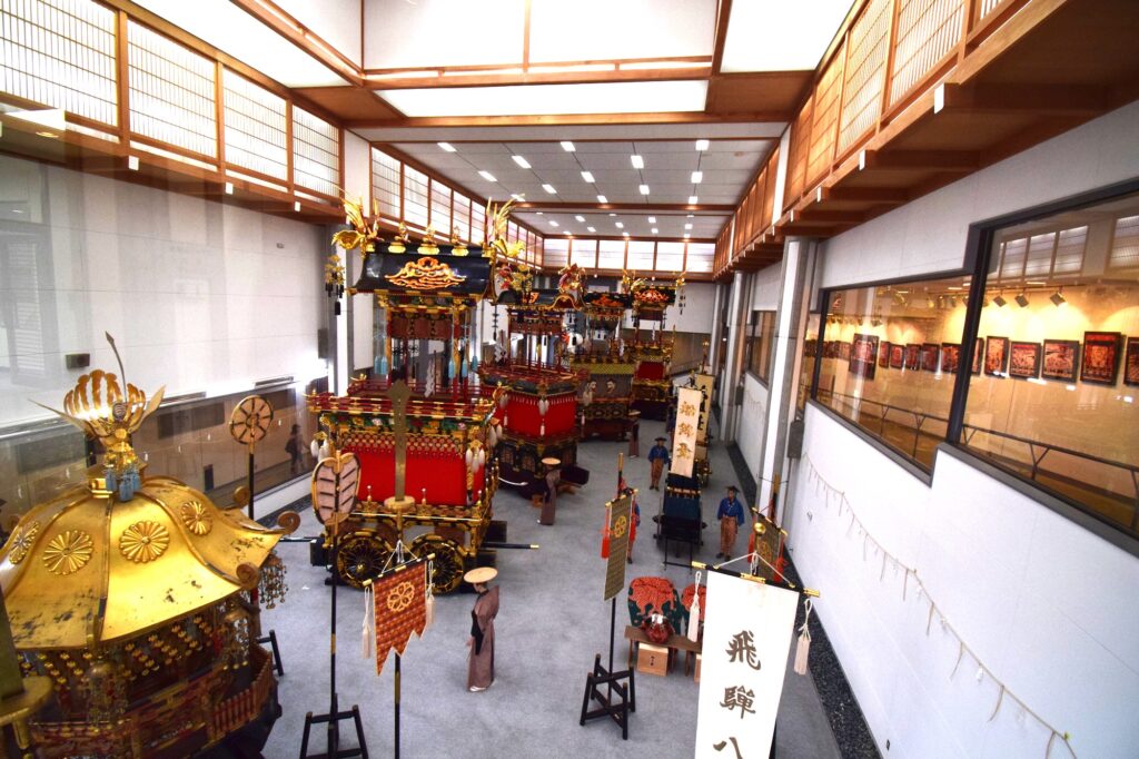
Please drop in at [Takayama Matsuri Yatai Kaikan]. The stalls used at the nationally famous Takayama Festival are always on display.
5 min
The driving map will show additional 10-20 sightseeing spots and local restaurants for the day!
You can travel freely, choosing only the spots you like!
Check pin color and MAPCODE usage.
On this day, you will stay in Takayama(高山) city which is famous for its old townscape.
Many inns are concentrated between Takayama station and Miyagawa river.
- Inn Type
There are a variety of inns like 3-star western-style hotels and 5-star Japanese Ryokans. Please book at your preferred type of inn. - Parking
Luxury Ryokans provides free parking. But middle-range hotels may ask you to park in a nearby public paid parking lot. - Onsen
Many of the inns provide Onsen. However, some western-style hotels don’t have it. - Meal Plan Reservations
There are many restaurants in and around the hotel for dinner, so please make reservations according to your preference.
Takayama – Kanazawa🔒
Start: Takayama (高山)
Finish: Kanazawa (金沢)
Mileage:140km
Travel Pace: Normal
You are heading from Takayama to Kanazawa on this day. It is a day to fully enjoy the world heritage Shirakawago and Gokayama, which is the best highlights of Central Japan.
1
Inn in Takayama
Parking MAPCODE:
🔒Book rental car or hotelWhat is MAPCODE?
9:00
The mileage on this day is 140km, which is standard, but if you want to see plenty of Shirakawago Village and Kanazawa City, we recommend that you leave around 9 o’clock.

Speaking of Takayama in the morning, please go to the morning market. Before checking out, please enjoy a walk in [Miyakawa Morning Market] or [Jinyamae Morning Market].
45 min
2
Shirakawago Village
Parking MAPCODE:
🔒Book rental car or hotelWhat is MAPCODE?

10:20
The highlights of the day are [Shirakawago Village] and [Gokayama village], which are World Heritage Sites. First, head to Shirakawago Village. There is not much to see along the road to Shirakawa-go, so move quickly for about 1 hour and 20 minutes.
In Shirakawago Village, general vehicles are not allowed to enter the center of the village. Please park your car in the Seseragi Park parking lot, cross the river, and stroll through the village while looking at the gassho-style houses.
You can also see the inside of some houses, so be sure to visit them.

The Ogimachi Castle Ruins Observatory on the hill is a great spot with a famous panoramic view of Shirakawago Village. It is recommended to walk from the village but those who have bad legs can also drive. Please refer driving map.
Be sure to visit!
40 min
It is recommended to drive NOT expressway(E41) but normal route156 from Shirakawago village to Ainokura. The travel time is almost the same and you can drive scenic mountain roads.
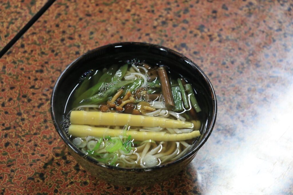
Both Shirakawago and Gokayama have restaurants housed in Gassho-Zukuri buildings, allowing you to enjoy lunch while experiencing the unique history and culture of these world heritages.
3
Gokayama Ainokura Village
Parking MAPCODE:
🔒Book rental car or hotelWhat is MAPCODE?

13:30
Next, you will go to [Ainokura Village] in Gokayama town, another World Heritage Site. Although it is smaller than Shirakawago Village, there are fewer tourists, and you can feel the original scenery of Japan with gassho-style houses.

60 min
There are not many spots to see from Ainokura to Kanazawa. It is recommended to drive the expressway(E41&E8).
4
Kenrokuen Garden
Parking MAPCODE:
🔒Book rental car or hotelWhat is MAPCODE?

15:30
At the beginning of Kanazawa, let’s visit [Kenrokuen Garden], which is widely known as one of the Three Great Gardens of Japan. It is a wonderful garden where you can enjoy the natural beauty of the four seasons and has been awarded three stars by Michelin Green Guide Japan.
The cherry blossoms (Bgn April) and autumn leaves (Bgn November-End November) in Kenrokuen are especially recommended.

Next to Kenrokuen, you can walk to [Kanazawa Castle], which was the residence of the feudal lord of this area during the Edo period (1603-1868). It is currently maintained as a park, and the turrets and stone walls make you feel the history.

10 min
5
Higashi Chaya District
Parking MAPCODE:
🔒Book rental car or hotelWhat is MAPCODE?

16:30
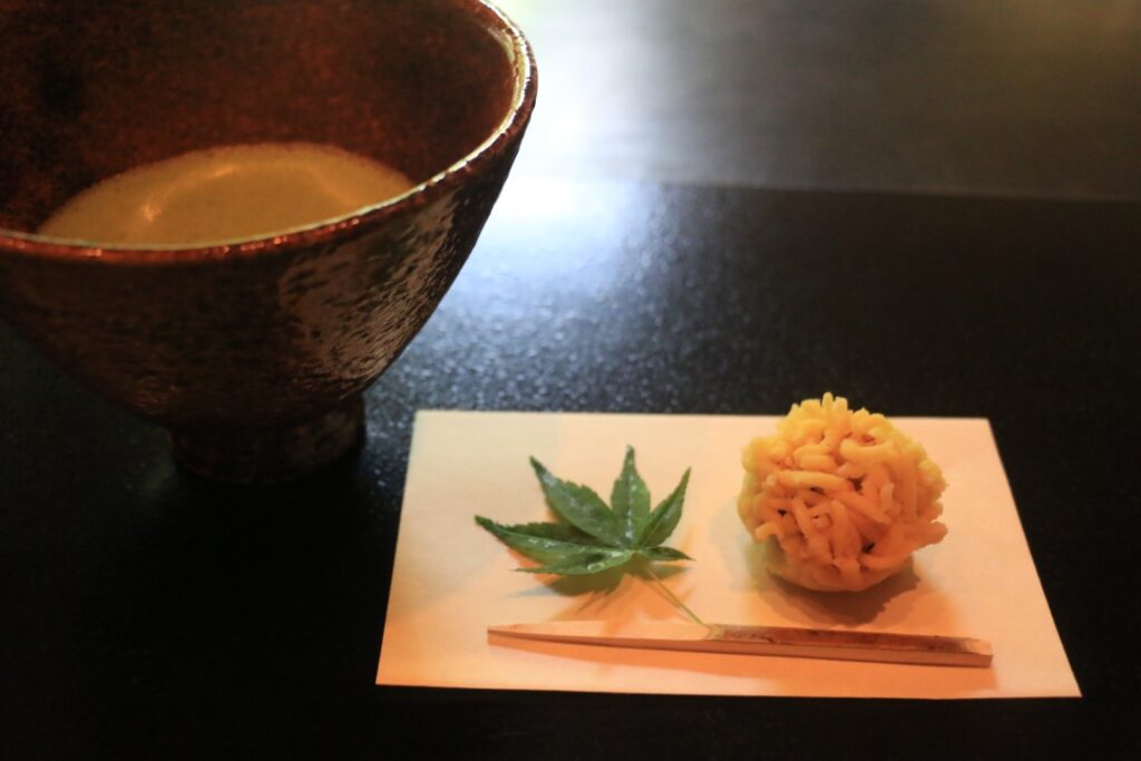
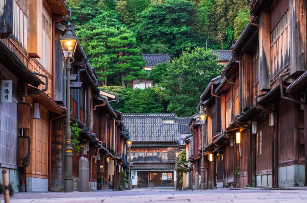
If you have time, stop by [Higashi Chaya District]. This is also one of the popular tourist spots in Kanazawa, and you can see the teahouse-style buildings that have been selected as an important traditional buildings preservation district of the country.

10 min
6
Inn in Kanazawa
Parking MAPCODE:
Please head to the hotel you reserved.What is MAPCODE?
18:30
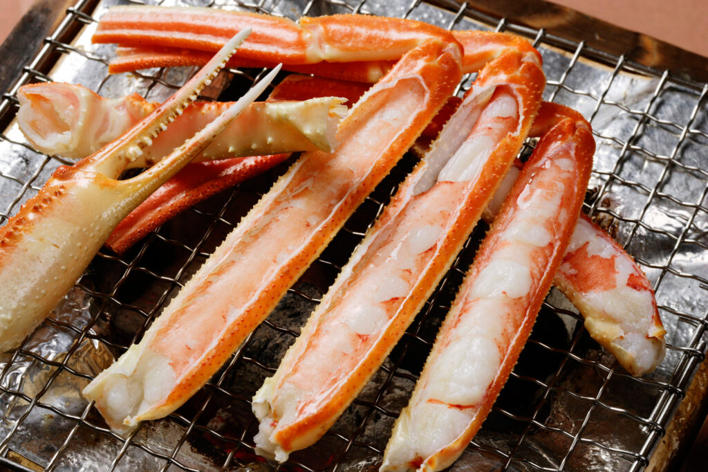
You are staying in Kanazawa on this day. In Kanazawa, there are many restaurants around Kanazawa station. Please try local gourmet food such as high-class fish “Nodoguro”, crab, and Kanazawa oden.
の刺身(湯引き)-大-1024x683.jpg)
The driving map will show additional 10-20 spots for the day! You will travel only to your favorite spots.
Check pin color and MAPCODE usage.

On this day, you will stay in Kanazawa city(金沢).
The inns are concentrated on the east side of Kanazawa Station.
- Inn Type
There are a variety of inns like 3-star western-style hotels and 5-star Japanese Ryokans. Please book at your preferred type of inn. - Parking
Most inns have official parking but in addition to the accommodation fee, the parking lot fee will be charged separately. - Onsen
There is no Onsen in this town and no inns have Onsens. - Meal Plan Reservations
As many restaurants are open till midnight, it is recommended to book your inns with breakfast only or without meals.
Kanazawa- Kanazawa🔒
Start:Kanazawa (金沢)
Finish:Kanazawa (金沢)
Mileage:10km
Travel Pace: Relaxing
On this day you will stay in Kanazawa for consecutive nights following yesterday.
1
Inn in Kanazawa
Parking MAPCODE:
10:00
This day is a day to visit sightseeing spots in Kanazawa city, so it is a relaxing day. The recommended itinerary assumes that you will be traveling by car, but if you park your car in a parking lot near Kenrokuen, you can walk (about 10km) to all of the sites. If your hotel is close to the sightseeing spots introduced, you can leave your car at the hotel and go sightseeing on foot.
10 min
2
Kenrokuen Garden
Parking MAPCODE:
🔒Book rental car or hotelWhat is MAPCODE?

10:10
If you haven’t been to Kenrokuen Garden yet, please go to [Kenrokuen Garden] first. It is widely known as one of the Three Great Gardens of Japan. It is a wonderful garden where you can enjoy the natural beauty of the four seasons and has been awarded three stars by Michelin Green Guide Japan.
The cherry blossoms (Beg April) and autumn leaves (Beg November-End November) in Kenrokuen are especially recommended.

Next to Kenrokuen, there is [Kanazawa Castle], which was the residence of the feudal lord of this area during the Edo period (1603-1868). It is currently maintained as a park, and the turrets and stone walls make you feel the history.

10 min
3
Omicho Market
Parking MAPCODE:
🔒Book rental car or hotelWhat is MAPCODE?

12:00
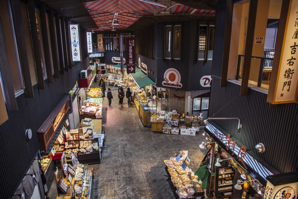
Next, you will head to Omicho Market. Please enjoy lunch with the famous Kaisendon (seafood rice bowl) here.
10 min
4
Nagamachi Samurai House district
Parking MAPCODE:
🔒Book rental car or hotelWhat is MAPCODE?

13:00
Then you will head to the Nagamachi Samurai House district. This is an area where earthen walls and stone-paved streets from the samurai era remain, and magnificent samurai residences line the streets.
10 min
5
21st Century Museum of Contemporary Art
Parking MAPCODE:
🔒Book rental car or hotelWhat is MAPCODE?
14:00
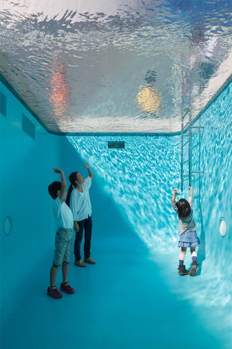
Afterward, you will go to the 21st Century Museum of Contemporary Art. This museum was built in the center of the lawn as a circular glass-enclosed building and has a mysterious structure that looks at the front from any direction. You can enter from any direction, and the area where you can enter for free is wide, and you can appreciate many works for free.
10 min
6
Higashi Chaya District
Parking MAPCODE:
🔒Book rental car or hotelWhat is MAPCODE?
15:00
Your final stop for the day is the [Higashi Chaya District]. It is located along the Asano River, which runs through the eastern side of the city, and once prospered as a teahouse district, it is one of the popular tourist spots in Kanazawa.


10 min
7
Inn in Kanazawa
Parking MAPCODE:
Please head to the hotel you reserved.What is MAPCODE?
16:30
On this day you will stay in Kanazawa for consecutive nights following yesterday. Please spend a relaxing time at the hotel. Please try local gourmet food such as phantom high-class fish “Nodoguro”, crab, and Kanazawa oden if you missed the previous day.
The driving map will show additional 10-20 spots for the day! You will travel only to your favorite spots.
Check pin color and MAPCODE usage.

On this day, you will stay in Kanazawa city(金沢).
The inns are concentrated on the east side of Kanazawa Station.
- Inn Type
There are a variety of inns like 3-star western-style hotels and 5-star Japanese Ryokans. Please book at your preferred type of inn. - Parking
Most inns have official parking but in addition to the accommodation fee, the parking lot fee will be charged separately. - Onsen
There is no Onsen in this town and no inns have Onsens. - Meal Plan Reservations
As many restaurants are open till midnight, it is recommended to book your inns with breakfast only or without meals.
Kanazawa- Wakura🔒
Start:Kanazawa (金沢)
Finish:Wakura (和倉)
Mileage:190km
Travel Pace: Fast
On this day you will head to Wakura from Kanazawa.
1
Inn in Kanazawa
Parking MAPCODE:
9:00
The mileage on this day is normal at 190km.
If your tour of Kanazawa city is not enough, please visit places in the city that you haven’t been to.

45 min
2
Chirihama Nagisa Driveway
Parking MAPCODE:
🔒Book rental car or hotelWhat is MAPCODE?

9:45
After leaving Kanazawa, you will head to Chirihama Nagisa Driveway which is a rare sandy beach that you can drive by car.
40 min
3
Ganmon Sea Cave
Parking MAPCODE:
🔒Book rental car or hotelWhat is MAPCODE?
11:00
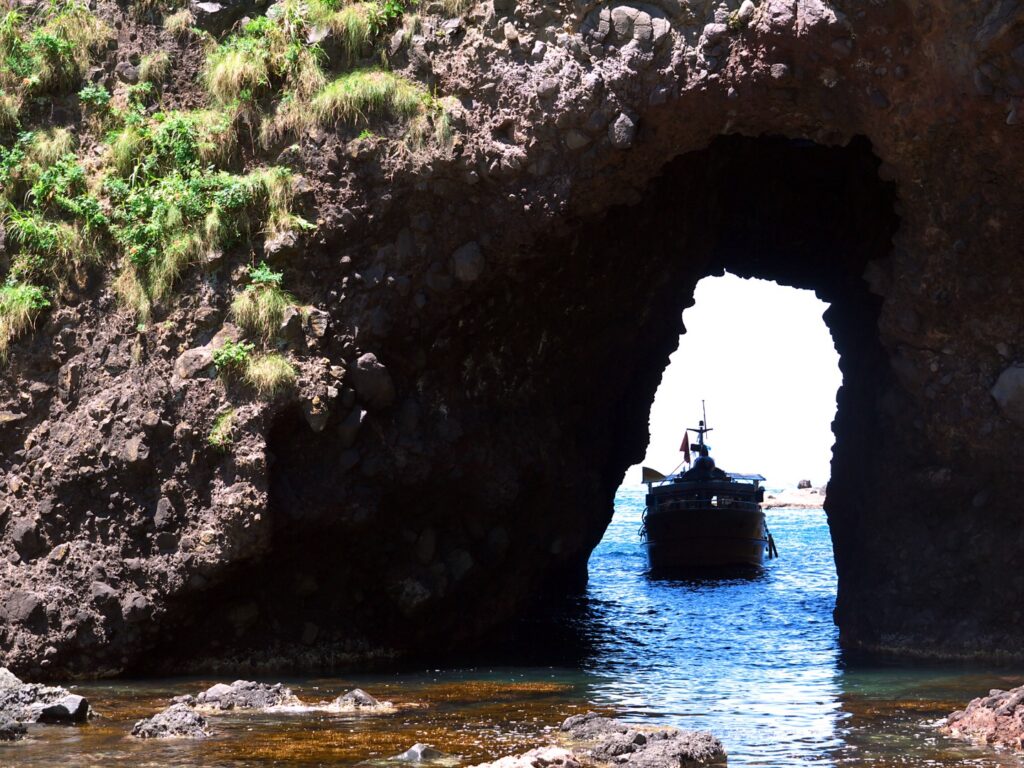
Next, you will head to [Ganmon] which is one of the representative existences in Noto Peninsula, and it is a tunnel that has been opened by erosion in the bedrock that protrudes into the sea. Here, we recommend taking a pleasure boat and enjoying a cruise on the sea.
10 min
4
Teraoka fusha
Parking MAPCODE:
🔒Book rental car or hotelWhat is MAPCODE?
13:00
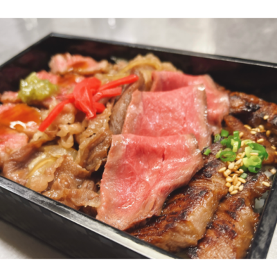
After Ganmon, how about a Noto beef lunch at Teraoka fusha?
5 min
5
Longest Bench in the World
Parking MAPCODE:
🔒Book rental car or hotelWhat is MAPCODE?

14:00
Next, you will head to [the Longest Bench in the World], on the west coast of the Noto Peninsula, which is as long as 460.9m. In 1989, it was listed in the Guinness Book of Records as the longest bench in the world.
70min
6
Shirayone Senmaida Rice Terrace
Parking MAPCODE:
🔒Book rental car or hotelWhat is MAPCODE?
16:00
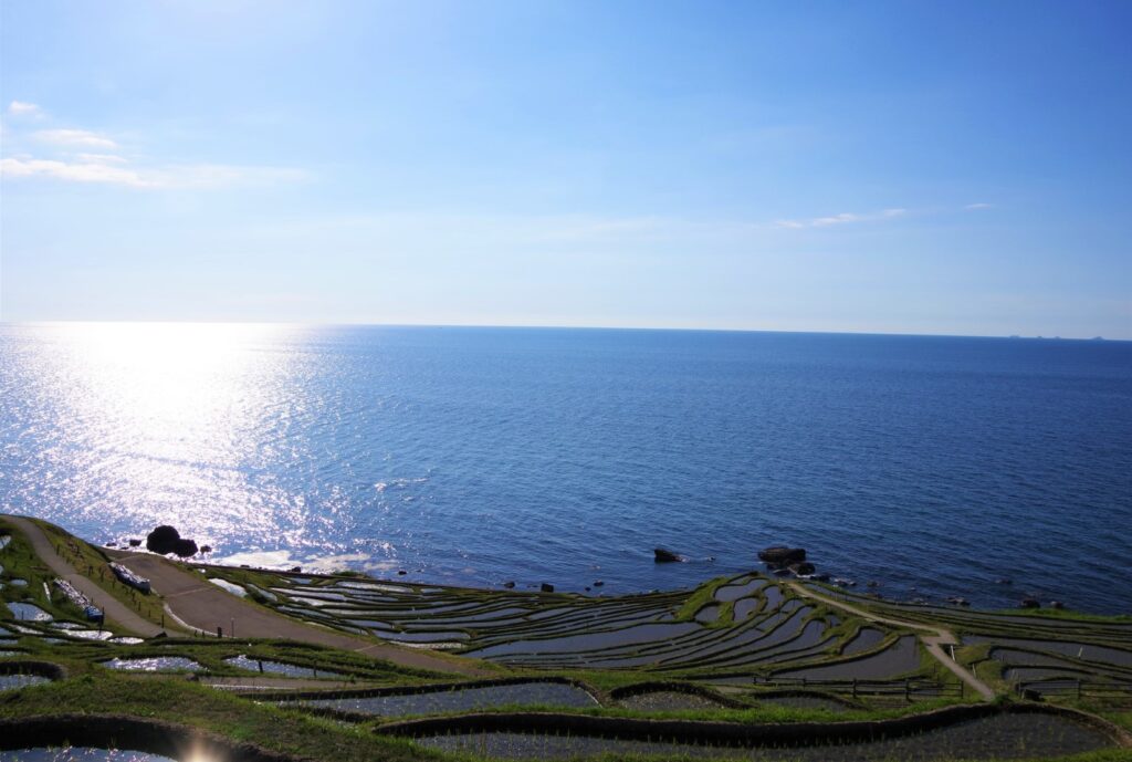
Your last visit for the day is Shirayone Senmaida. This is a terraced rice field on the west coast of the Noto Peninsula, and the superb view of the small rice fields that face the Sea of Japan and continue to the coast has been designated as one of Japan’s top 100 terraced rice fields.
After this, when heading to Wakura, where we will be staying for the day, please use the expressway (E41) as there is nothing to see on the way.
70 min
7
Inn in Wakura
Parking MAPCODE:
Please head to the hotel you reserved.What is MAPCODE?
18:00
Wakura, where you will stay overnight, is the largest hot spring resort in Noto, facing Nanao Bay. It is a historical hot spring with abundant salt water. It is popular as a base for sightseeing in Noto. Enjoy local gourmet food, sake, and hot spring.
The driving map will show additional 10-20 spots for the day! You will travel only to your favorite spots.
Check pin color and MAPCODE usage.

On this day, you will stay in Owakura Onsen town(和倉温泉).
It is known as one of the most exclusive hot spring resorts in Japan.
- Inn Type
Most of these inns are 4 to 5-star Japanese-style Ryokans with Onsen facilities. There are few reasonably priced inns in Wakura. However, they all offer excellent food and hot springs, so we recommend that you stay at a better inn in Wakura even if you save money on lodging in other towns. - Parking
Most inns will offer free parking. - Onsen
This town is famous for Onsen and most of the inns have one. You can enjoy an open-air Onsen and enjoy an Onsen with a magnificent view of Nanao Bay - Meal Plan Reservations
There are few restaurants in this area, so be sure to make a reservation with a plan that includes dinner and breakfast.
Wakura- Toyama🔒
Start:Wakura (和倉)
Finish:Toyama (富山)
Mileage:140km
Travel Pace: Normal
On this day you will head to Toyama from Wakura.
1
Inn in Wakura
Parking MAPCODE:
10:00
The mileage on this day is normal at 135km.
Before checking out, please visit Le Musée de H, a very famous sweet shop. Located in the hot spring town, you should be able to walk there.

45 min
2
Amaharashi Coast
Parking MAPCODE:
🔒Book rental car or hotelWhat is MAPCODE?

11:00
Next, you will head to [Amaharashi Coast] where you can view the Tateyama Mountain Range beyond Toyama Bay if the weather is good.
30 min
3
Zuiryuji Temple
Parking MAPCODE:
🔒Book rental car or hotelWhat is MAPCODE?
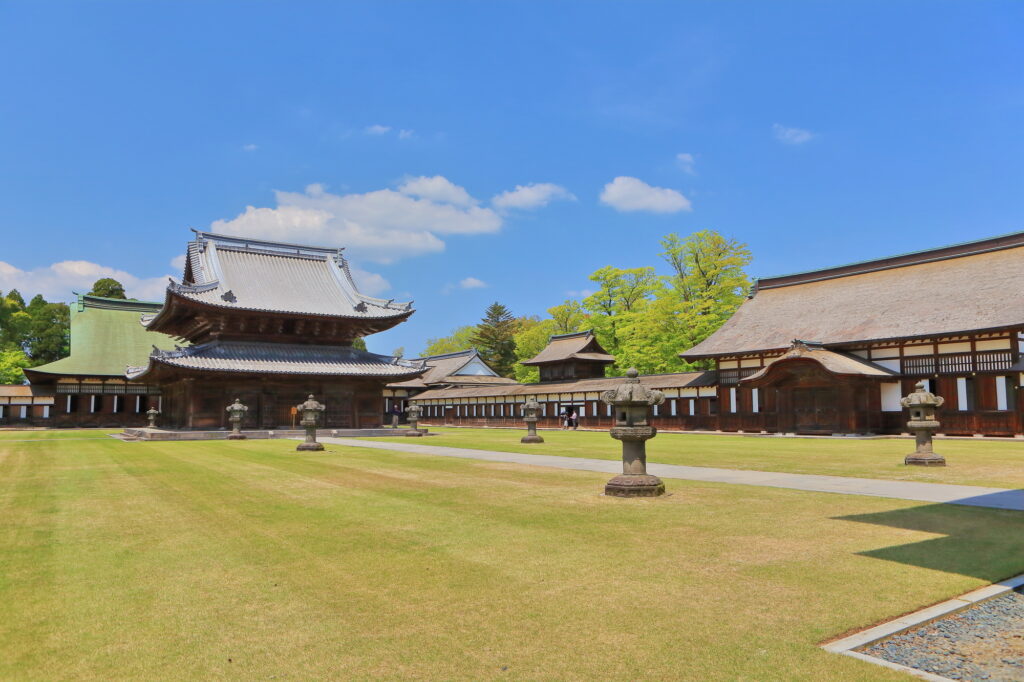
12:30
Next, please head to Zuiryuji Temple, which has a majestic and beautiful appearance where the financial strength of the former feudal lord can be seen.
30 min
4
Shin-minato Kittokito Market
Parking MAPCODE:
🔒Book rental car or hotelWhat is MAPCODE?
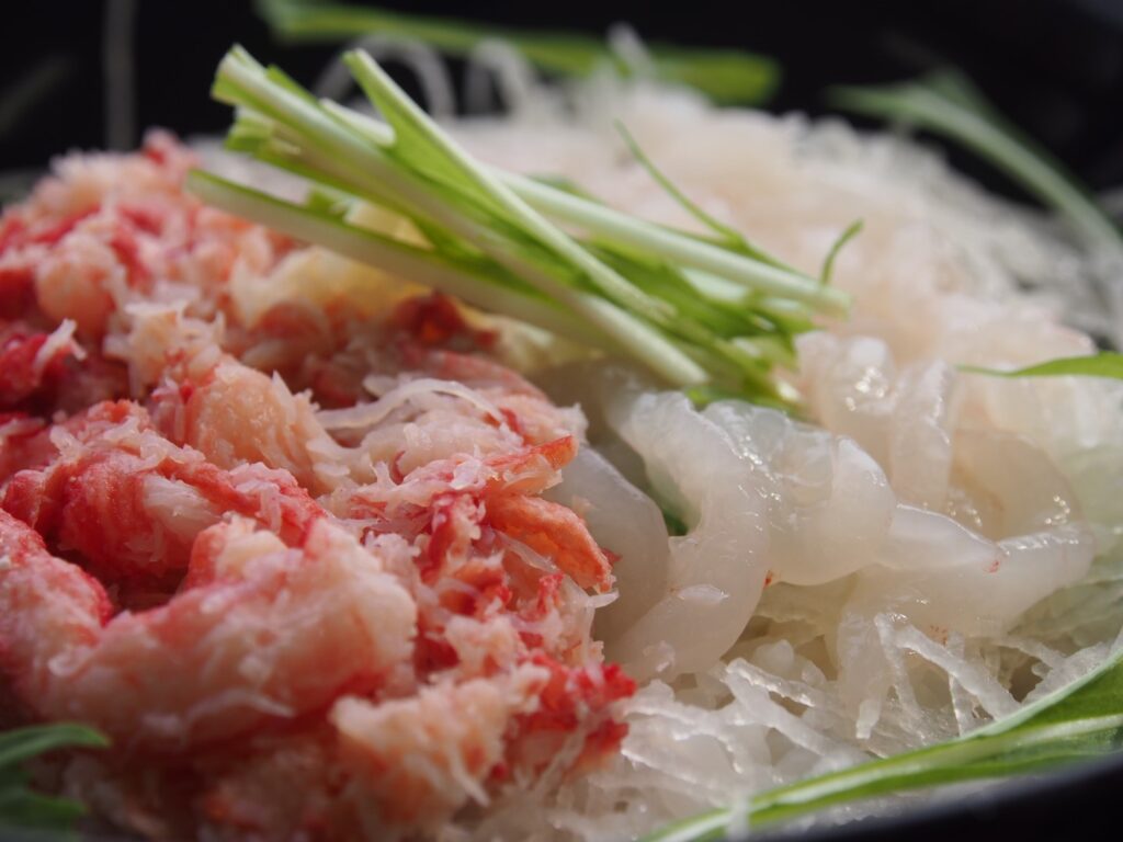
14:00
Next, you will head to Shin-minato Kittokito Market. Today’s lunch is a specialty fish dish using fresh seafood.
5 min
5
Kaiomaru Park
Parking MAPCODE:
🔒Book rental car or hotelWhat is MAPCODE?
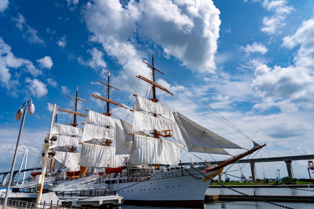
15:00
Please also stop by Kaiomaru Park, which is nearby. This is a resting bay area centered on the sailing ship Kaiomaru. You can safely experience the ship, the port and the sea, and play freely on the spacious grounds. You can also tour the inside of Kaiomaru.
50min
6
Sankyoson Observatory
Parking MAPCODE:
🔒Book rental car or hotelWhat is MAPCODE?

17:00
Next you head to the Sankyoson Observatory. This is a scenic spot where you can overlook the the beautiful rural scenery and Sankyoson village. The sunset seen from here is beautiful, especially around the beginning of May when the sun is reflected on the paddy fields. This place is a little-known hidden gem that only rent-a-car travelers can enjoy.
Please check here for sunrise and sunset times.
50 min
7
Inn in Toyama
Parking MAPCODE:
Please head to the hotel you reserved.What is MAPCODE?
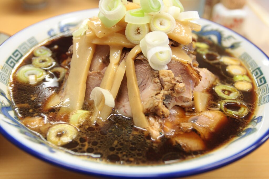
18:30
Toyama, where you stay on this day, has many hotels on the south side of Toyama Station, and there are many restaurants in the surrounding area. Enjoy local gourmet food such as Toyama black ramen, Himi udon, and Masuzushi, as well as delicious fish and sake.
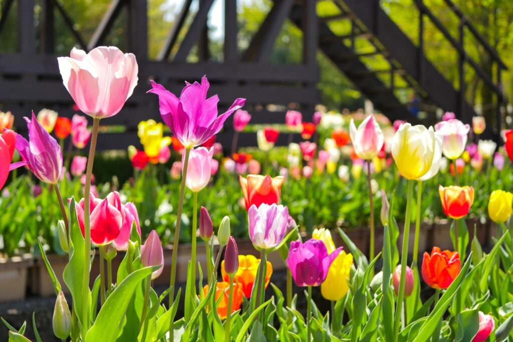
If you are traveling from mid-April to early May, Tonami Tulip Park is recommended. Three million tulips are in full bloom.
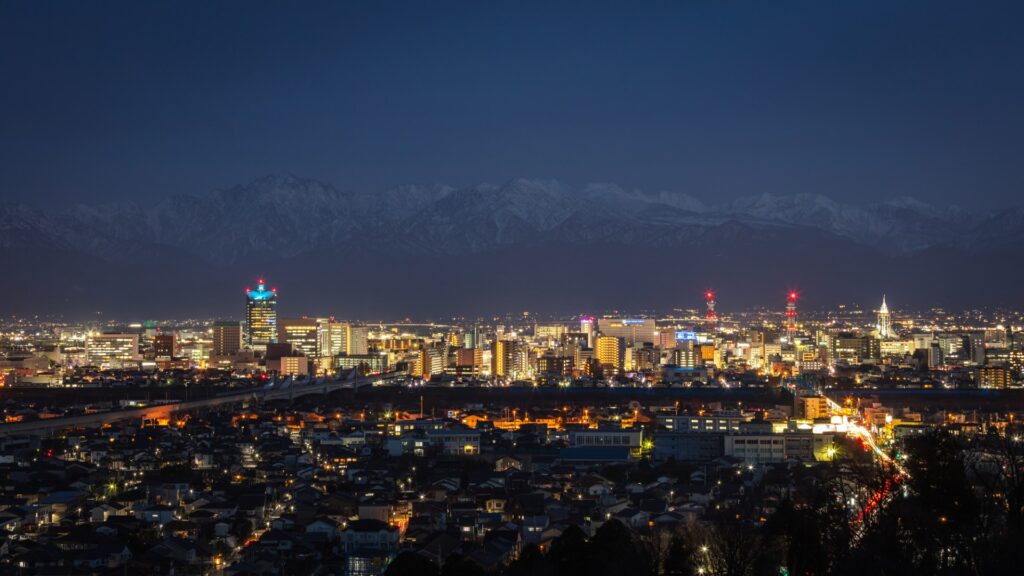
If you are traveling from late March to early April, we recommend the Kurehayama Park Observatory. You can see the collaboration of the beautiful cherry blossoms in full bloom and the superb view of the Tateyama mountain range with remaining snow. The night view is also beautiful here.
The driving map will show additional 10-20 spots for the day! You will travel only to your favorite spots.
Check pin color and MAPCODE usage.

On this day, you will stay in Toyama city(富山).
The inns are concentrated on the south side of Toyama Station.
- Inn Type
Most of these inns are 3 to 4-star western-style hotels. - Parking
Most inns have official parking but in addition to the accommodation fee, the parking lot fee will be charged separately. - Onsen
There is no Onsen in this town and no inns have Onsens. - Meal Plan Reservations
As many restaurants are open till midnight, it is recommended to book your inns with breakfast only or without meals.
Toyama – Nagano🔒
Start : Toyama (富山)
Finish : Nagano (長野)
Mileage : 210km
Travel Pace : Fast
On this day, you will head to Nagano from Toyama.
1
Inn in Toyama
Parking MAPCODE:
9:00
This day is a long drive of 210km, so please use the expressway (E8) to reduce travel time. Also, make sure to take regular breaks while driving.
120min
2
Takahashi Ameya
Parking MAPCODE:
🔒Book rental car or hotelWhat is MAPCODE?

11:00
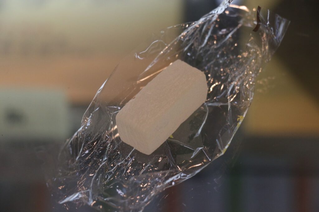
The first place to visit today is Takahashi Ameya. After leaving Toyama, drive on the expressway while looking at the Sea of Japan to the left, and Takahashi Ameya is just after exiting the highway at Joetsu IC.
This is the oldest candy store in Japan with nearly 400 years of history. Try traditional Japanese candy.
60min
3
Uzuraya
Parking MAPCODE:
🔒Book rental car or hotelWhat is MAPCODE?
12:30
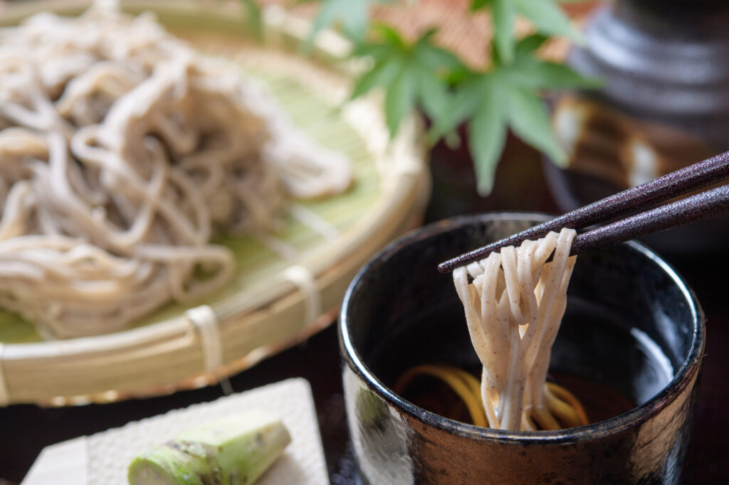
After that you will head towards Togakushi. You can find one of Togakushi’s most famous Soba (buckwheat noodles) restaurants on day-by-day Driving Map.
10 min
4
Togakushi Shrine Okusha(Main Shrine) Avenue of cedar trees
Parking MAPCODE:
🔒Book rental car or hotelWhat is MAPCODE?
13:30
Next, you will head to [Togakushi Shrine Okusha(Main Shrine)] which is famous for its beautiful cedar trees over 400 years old. The 300 cedar trees line up for 500m from the Zuishinmon Gate and a truly mysterious world spreads.

5 min
5
Kagamiike Pond
Parking MAPCODE:
🔒Book rental car or hotelWhat is MAPCODE?

15:00
Next you will stop at Kagami Pond. Kagami means mirror, and this pond reflects the mountains and clouds in the background like a mirror.
There is nice cafe near the park and good for lunch.
40min
5
Zenkoji Temple
Parking MAPCODE:
🔒Book rental car or hotelWhat is MAPCODE?
16:30

Next, you will head to Zenkoji Temple which is one of the most important and popular temples in Japan.
10min
6
Inn in Nagano
Parking MAPCODE:
Please head to the hotel you reserved.What is MAPCODE?
17:30
You will stay in Nagano on this day. Nagano has many hotels between Nagano Station and Zenkoji Temple. If you are going to go to Zenkoji Temple after checking in to the hotel, you may want to book a hotel as close as possible to the Temple.
If you are traveling from late July to mid-October, Kurohime Highland Cosmos garden is recommended. It is a flower garden where 1 million cosmos and 20,000 dahlias (50 types) are in full bloom.

If you are traveling in early to mid-April, the Spring Quartet(春の四重奏) is recommended. A quartet of cherry blossom trees, tulips, and rape blossoms can be seen miraculously against the background of Mt. Asahidake with remaining snow.
This site has been featured on TV several times and is extremely popular, so the area around it is very crowded. Therefore, on Saturdays and Sundays, access to the nearby parking lot is restricted, and you will have to park a little further away and access the site by shuttle bus.

The driving map will show additional 10-20 spots for the day! You will travel only to your favorite spots.
Check pin color and MAPCODE usage.

On this day, you will stay in Nagano(長野) City. Many inns are concentrated in the following two areas.
①Around Nagano Station
Many inns are located north of Nagano Station. Convenient for dinner and recommended for family.
- Inn Type
Most of these inns are 3 to 4-star Western-style Hotels. - Parking
Most inns have official parking but in addition to the accommodation fee, the parking lot fee will be charged separately. - Onsen
There is no Onsen in this town and no inns have Onsens. - Meal Plan Reservations
As many restaurants are open till midnight, it is recommended to book your inns with breakfast only or without meals.
②Shukubo Around Zenkoji Temple
Near Zenkoji Temple, there are small inns operated by Buddhist temples called “Shukubo(宿坊)”.
Some Shukubo provide special activity such as “Shakyo(写経)”sutra chanting. They also offer vegetarian meals for monks, called “Shojin Ryori(精進料理)”. Please take note that they are not normal inn and you need to follow their rules. Not recommended for small children.
Most of Shukubo cannot book via Online Travel Agency. Please search by yourself.
Nagano – Kusatsu🔒
Start: Karuizawa (長野)
Finish: Kusatsu (草津)
Mileage:130km
Travel Pace: Relax
On this day, you will head from Nagano to Kusatsu Onsen. You can enjoy on one of the most beautiful mountain road “Shiga Kusatsu Road (Route 292)” in Honshu island.
It is closed in winter (from mid-November to late April) and it required to take a big detour.
1
Inn in Nagano
Parking MAPCODE:
10:00
The mileage is short, about 125km, but about 40km of it is a mountain road. There are also many attractions and places to go for a walk, so it is recommended that you start early.
If you haven’t yet, we recommend going to Zenkoji Temple early in the morning before checkout. In that case, it would be a good idea to go for the Osaji (morning service) and experience it yourself. This is a memorial service held by all the priests of Zenkoji Temple, and the start time is one hour after sunrise, which changes every day (5:30-7:00). See the below link for more detail.

Schedule of Osaji (morning service) and Rosary Blessing
60min
2
Jigokudani Monkey Park
Parking MAPCODE:
🔒Book rental car or hotelWhat is MAPCODE?

11:00
The first destination for the day is [Jigokudani Monkey Park], which is worldwide famous for snow monkeys!
It is also nice to relax at the ENZA cafe near the parking for Monkey Park.
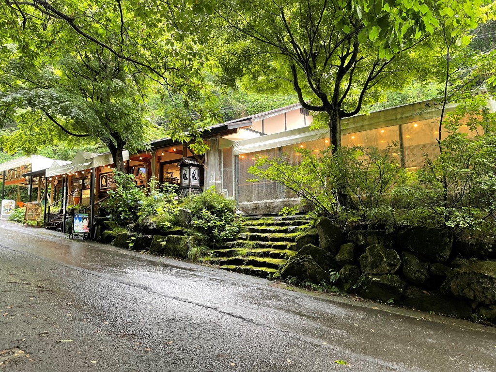
45 min
3
Mt.Yokote observatory
Parking MAPCODE:
🔒Book rental car or hotelWhat is MAPCODE?

13:00
Your next destination is [Mt. Yokote observatory].
If you have time, you can also use the skylator and lift to climb the summit of Mt. Yokote.
Mt.Yokote Summit has a Crumpet Cafe with a wonderful view. Also, about 50m away from there, there is the Yokote Summit Hut, and the bakery there is very famous. On this day, we recommend having lunch at one of these restaurants.


15 min
4
Highest point of Japan National Route
Parking MAPCODE:
🔒Book rental car or hotelWhat is MAPCODE?

16:00
About 15 minutes from Mt.Yokote observatory, there is the [Highest point of Japan National Route]. At the best viewpoint on the Shiga Kusatsu Road, you can enjoy a magnificent view.
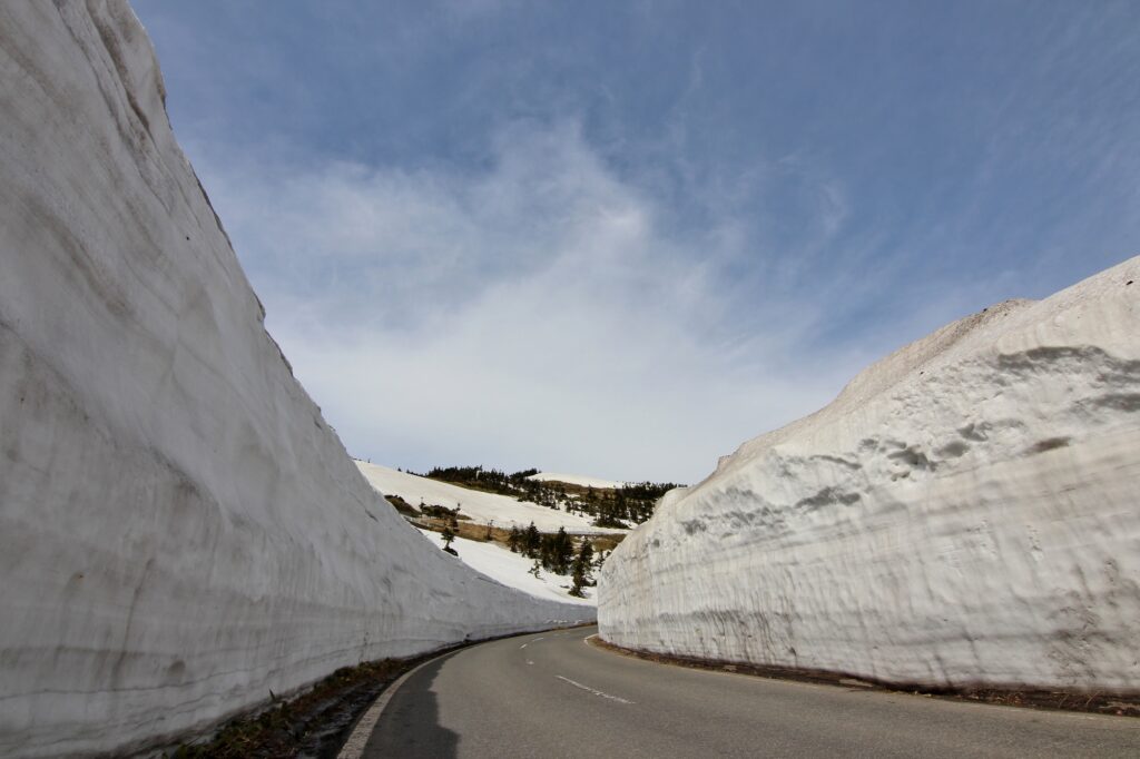
60 min
6
Inn in Kusatsu
Parking MAPCODE:
Please head to the hotel you reserved.What is MAPCODE?

17:30
On this day, you will stay at Kusatsu Onsen, one of the most famous Onsen town in all over Japan.
Kusatsu is full of highlights such as walking around the symbols [Yubatake] and [Sainokawara Park], and a hot spring fir show at [Netsunoyu]. Please enjoy walking around the city after checking in at the inn.


Please check hot spring show time at Netsunoyu
The driving map will show additional 10-20 spots for the day! You will travel only to your favorite spots.
Check pin color and MAPCODE usage.

Kusatsu is one of the most famous onsen town in all over Japan.
Drive Japan recommends an inn within walking distance of the symbolic “Yubatake” hot spring field.
- Inn Type
Most of these inns are 3 to 5-star Japanese-style Ryokans with onsen facilities.
There are a variety of inns like western-style hotels and Japanese Ryokans. Please book at your preferred type of inn. - Parking
Most inns will offer free parking. But some of their parking is far from the inn and they provide a free shuttle bus. - Onsen
Of course, most of the inns have onsen. - Meal Plan Reservations
There are some restaurants around the hotel for dinner, so please make reservations according to your preference.
Kusatsu – Karuizawa🔒
Start: Kusatsu (草津)
Finish: Karuizawa (軽井沢)
Mileage:60km
Travel Pace: Relax
On this day, you will head from Kusatsu to Karuizawa.
1
Inn in Kusatsu Onsen
30 min
2
Mt.Asama magma stone park(Onioshidashi Volcanic Park)
Parking MAPCODE:
🔒Book rental car or hotelWhat is MAPCODE?

10:30
We recommend [Mt. Asama magma stone park (Onioshidashi Volcanic Park)]. You can take a walk for about 30 minutes in the desolate scenery of the cold and solidified lava of Mt. Asama. In autumn, you can enjoy the beautiful autumn leaves from here.
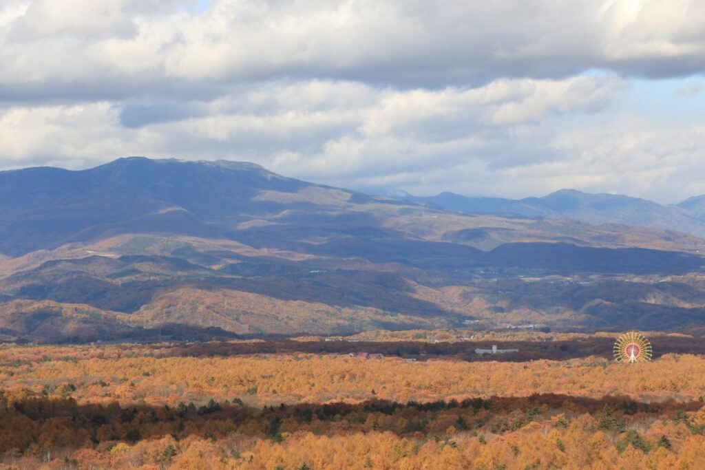
10 min
From there you will comfortably drive through the woods of Kitakaruizawa. You can also enjoy sweets if you take a break on the way. Please refer driving map.
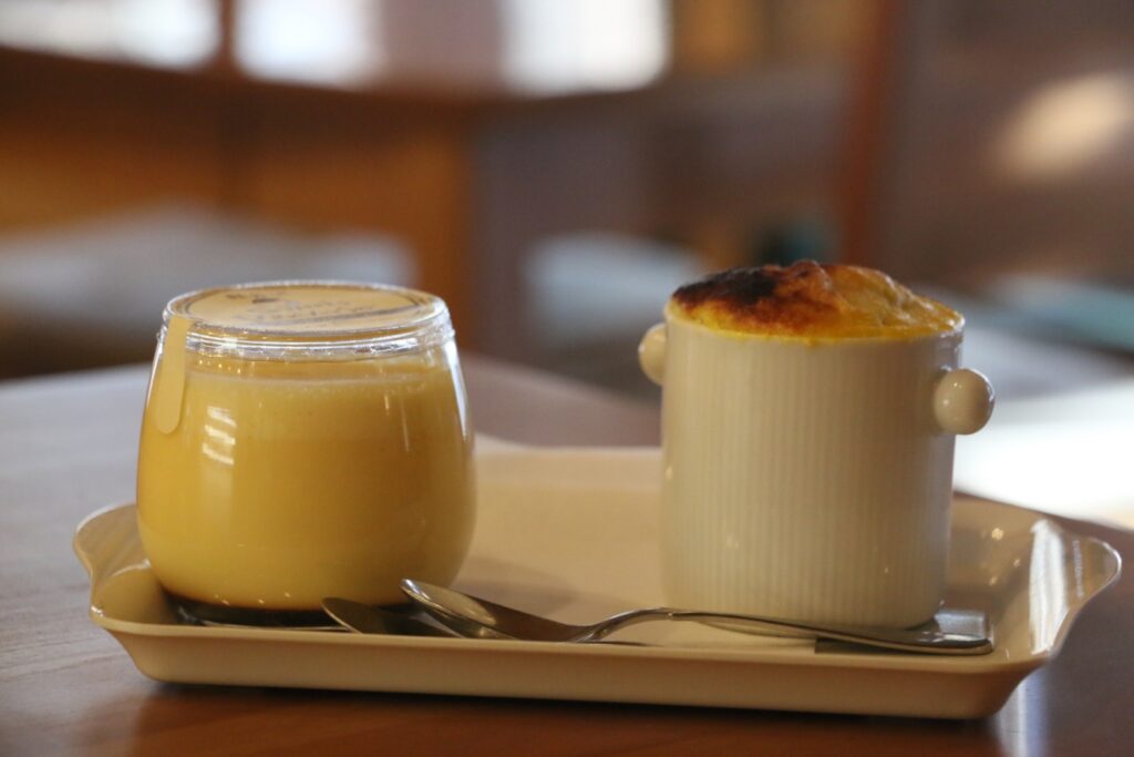
3
Shiraito Waterfalls(Karuizawa)
Parking MAPCODE:
🔒Book rental car or hotelWhat is MAPCODE?

12:00
Next, you will visit [Shiraito Waterfalls(Karuizawa)] along the Shiraito Highland Way on the toll road. There is no river upstream, and it is a mysterious waterfall where the water seeps out from the mountain surface and flows down.
25 min
4
Kyukaruizawa Ginza Street
Parking MAPCODE:
🔒Book rental car or hotelWhat is MAPCODE?

13:30
After that, you will go to the town of Karuizawa and walk on [Kyukaruizawa Ginza Street]. It is the main street of Karuizawa, a historic summer resort. You can enjoy walking around the cute church and the bakery where John Lennon attended. It is also recommended for lunch.
15 min
5
Karuizawa Lake Garden
Parking MAPCODE:
🔒Book rental car or hotelWhat is MAPCODE?

15:30
The last destination is [Karuizawa Lake Garden]. It is especially breathtaking in spring and fall, when the roses are in full bloom and the leaves are changing colors.
10 min
6
Inn in Karuizawa
Parking MAPCODE:
Please head to the hotel you reserved.What is MAPCODE?
17:00
There are many nice restaurants in Karuizawa where you will stay on this day, but all of them are closed from 8 to 9 pm due to town regulations. The convenience stores also close at 23:00. Please make sure you arrive at the inn by about 6 pm so you don’t miss your dinner.
A walk in the town of Karuizawa will be tomorrow.
The driving map will show additional 10-20 spots for the day! You will travel only to your favorite spots.
Check pin color and MAPCODE usage.

On this day, you will stay in Karuizawa city(軽井沢) which is famous for its summer and snow resorts.
The inns are spread over a wide area around Karuizawa Station.
And when you stay in Karuizawa, be aware of the strict town ordinances. All restaurants close by 21:00 and all convenience stores also close at 23:00.
- Inn Type
Most of these inns are 3 to 5-star western-style hotels. - Parking
Most inns will offer free parking. - Onsen
Most inns don’t have onsen. If you would like to stay at an inn with an onsen, “Karuizawa Prince hotel” is recommended. - Meal Plan Reservations
There are many nice restaurants for dinner around the hotel. And some inns also provide nice dinner too. Therefore, please make reservations according to your preference. Due to the town ordinances, most of the restaurants close around 20:00-21:00. Please note that there is no place where you can eat dinner at a late time.
Karuizawa – Matsumoto🔒
Start: Karuizawa (軽井沢)
Finish: Matsumoto (松本)
Mileage:130km
Travel Pace: Normal
On this day, you will head from Karuizawa to Matsumoto via the Venus Line, one of Japan’s leading tourist mountain roads. This is one of the biggest highlights of this road trip.
1
Inn in Karuizawa
Parking MAPCODE:
9:00
The mileage is short, about 130km, but about 50km of it is a mountain road. There are also many attractions and places to go for a walk, so it is recommended that you start early.
90 min
2
Kurumayama Highland
Parking MAPCODE:
468 055 716What is MAPCODE?

10:30
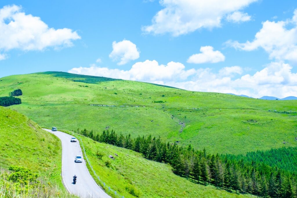
Firstly, you will head towards Lake Shirakaba and enter the Venus Line near Lake Shirakaba. We recommend eating lunch at Kurumayama on this day, so please buy a lunch box around Lake Shirakaba.
After Lake Shirakaba, you will enter the very beautiful Venus Line. There are some shops to take a rest and observatories along the way, so stop by and enjoy a drive.
After that, it is the biggest highlight of the day [Kurumayama Highland]. A truly awesome 360-degree view spreads out. You need to take a lift to the top of the mountain, but you will never regret it. Highly recommended. And don’t forget to bring your lunch!
15 min
3
Yashima Wetlands
Parking MAPCODE:
468 139 076What is MAPCODE?

12:45
You then head to [Yashima Wetlands]. You can take a walk in the marshland, which stretches over a plateau at an altitude of 1600 m, and is full of rare plants and flowers. Yashima Wetlands can be circumnavigated in about an hour and a half.
35 min
4
Mitsumine Viewing Platform
Parking MAPCODE:
468 286 293What is MAPCODE?

15:00
After that, you will head to [Mitsumine Viewing Platform]. You can take a break while gazing at the superb view. If you plan to visit the inside of Matsumoto Castle, we recommend leaving here by 15:15.
50 min
5
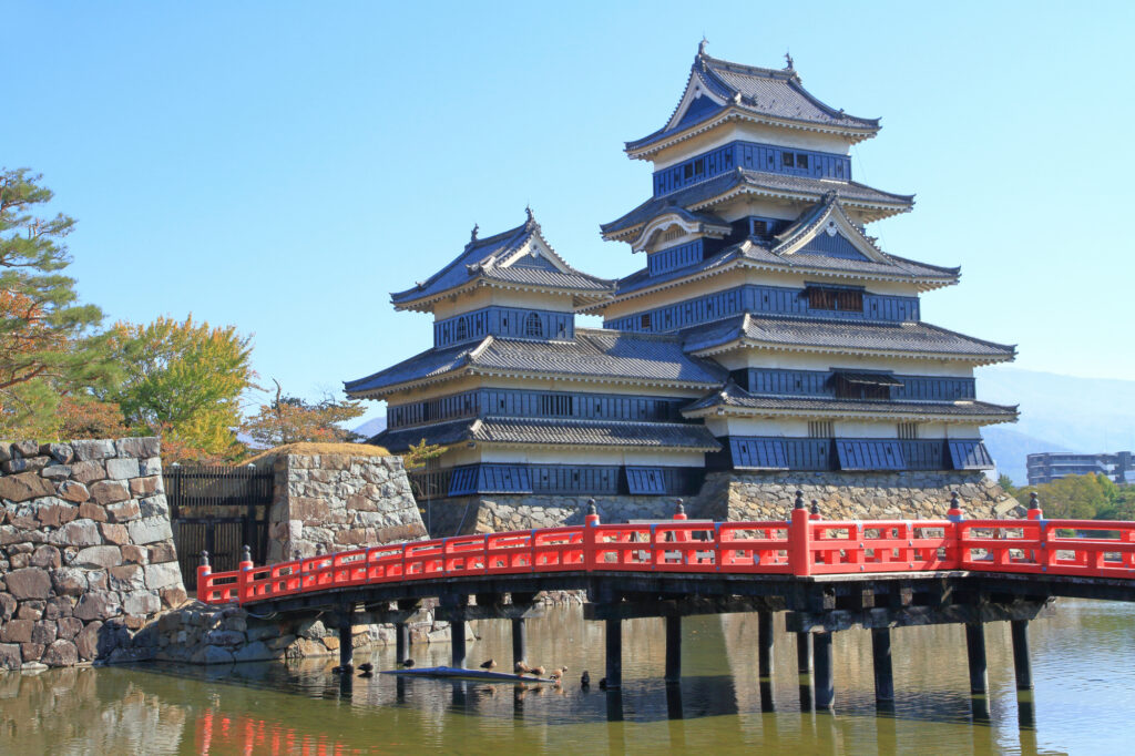
Matsumoto Castle
Parking MAPCODE:
75 851 375What is MAPCODE?

16:30
The final destination of the day is [Matsumoto Castle], which is synonymous with Matsumoto. Please use the expressway (E19) to reduce travel time.
You can see the inside of the castle tower, which is one of the few original castle towers in Japan. However, please note that the final admission time is 16:30 – 17:30 depending on the seasons.
Matsumoto castle
10 min
6
Inn in Matsumoto
Parking MAPCODE:
Please head to the hotel you reserved.What is MAPCODE?
18:00
Matsumoto, the largest city in Nagano prefecture. Many restaurants are open until night, so you don’t have to worry about dinner.
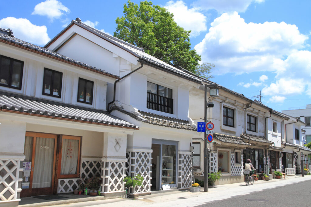
If you have time, we recommend taking a walk along “Nakamachi-Dori street”, which is lined with buildings with Namako walls.
The driving map will show additional 10-20 spots for the day! You will travel only to your favorite spots.
Check pin color and MAPCODE usage.

On this day, you will stay in Matsumoto (松本) city.
Many inns are concentrated in the following two areas.
①Around Matsumoto Station
The inns are concentrated east side of Matsumoto Station. This area is convenient for dinner and visiting Matsumoto castle but no inns offer Onsens.
- Inn Type
Most of these inns are 3 to 5-star western-style hotels. - Parking
Most inns have official parking but in addition to the accommodation fee, the parking lot fee will be charged separately. - Onsen
There is no Onsen in this town and no inns have Onsens. - Meal Plan Reservations
As many restaurants are open till midnight, it is recommended to book your inns with breakfast only or without meals.
②Asama Onsen(浅間温泉)
This hot spring resort area is located 4km north of Matsumoto station. If you would like to stay in better accommodation with Onsen, here is recommended.
- Inn Type
Most of these inns are 3 to 5-star Japanese-style Ryokans with onsen facilities. - Parking
Most inns will offer free parking. - Onsen
This area is famous for onsen and most of the inns have one. - Meal Plan Reservations
There are few restaurants in this area and be sure to make a reservation with a plan that includes dinner and breakfast.
Matsumoto- Matsumoto🔒
Start : Matsumoto (松本)
Finish : Matsumoto (松本)
Mileage : 100km
Travel Pace : Fast
On this day you will stay in Matsumoto for consecutive nights following yesterday. And you will enjoy “Tateyama Kurobe Alpine Route” on a day trip.
If you prefer another place, Japan Alps “Kamikochi” is recommended too.
1
Inn in Matsumoto
Parking MAPCODE:
9:00
The mileage is as short as 100km, but it’s better to leave early to enjoy Tateyama Kurobe Alpine Route fully.
75 min
2
Tateyama Kurobe Alpine Route
Parking MAPCODE:
🔒Book rental car or hotelWhat is MAPCODE?
10:15

Today’s first destination is Tateyama Kurobe Alpine Route, the biggest highlight today. First, please aim for Ogizawa, which has the entrance on the Nagano side.
After parking the car in the Ogizawa parking lot, take a trolley bus and head to Kurobe Dam. The bus goes through a narrow and dark tunnel.
At Kurobe Dam, please enjoy the huge Kurobe Dam, which is known as the highest dam in Japan. Especially powerful water discharge is great. If you are confident in your legs, we recommend to go to an observatory located in a high place.
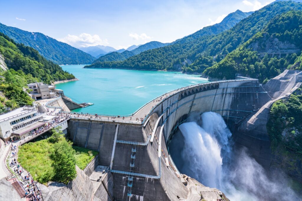
After that, please walk on the dam and head to Kurobe Lake Station of the Kurobe cable car on the other side. And you will take the cable car to Kurobeidaira Station.
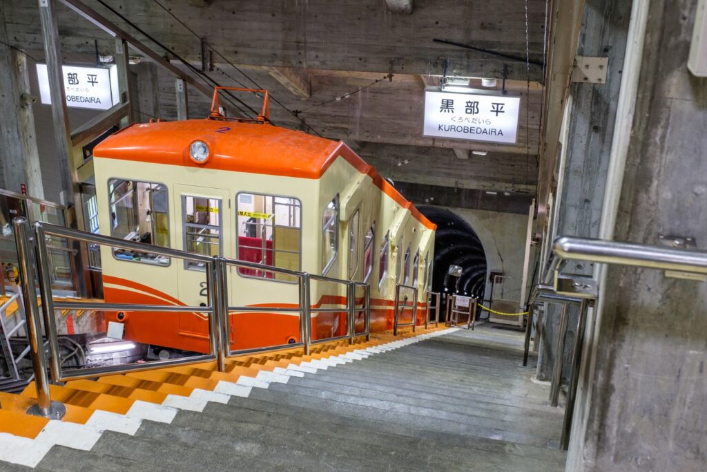
At Kurobedaira Station, you will change to Tateyama Ropeway and head to Daikanbo. This ropeway is 1700m long and has no pillars on the way, and the longest ropeway in Japan. And Lake Kurobe and the surrounding mountains are so beautiful that you will feel like you are flying in the air of the alpine route.
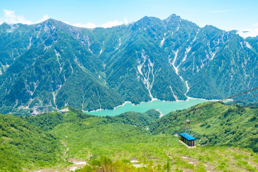
At Daikanbo, please change to a trolley bus. At that time, please don’t forget to go to the rooftop observatory at the station. Lake Kurobe and the large panoramic view of the Alpen Route are one of the best beauties.
The trolleybus then arrives at Murodo, the highest point of the Tateyama Alpine Route. In Murodo, please enjoy the Yuki-no-Otani (mid-April to mid-June), Mikurigaike Pond walk, and more.

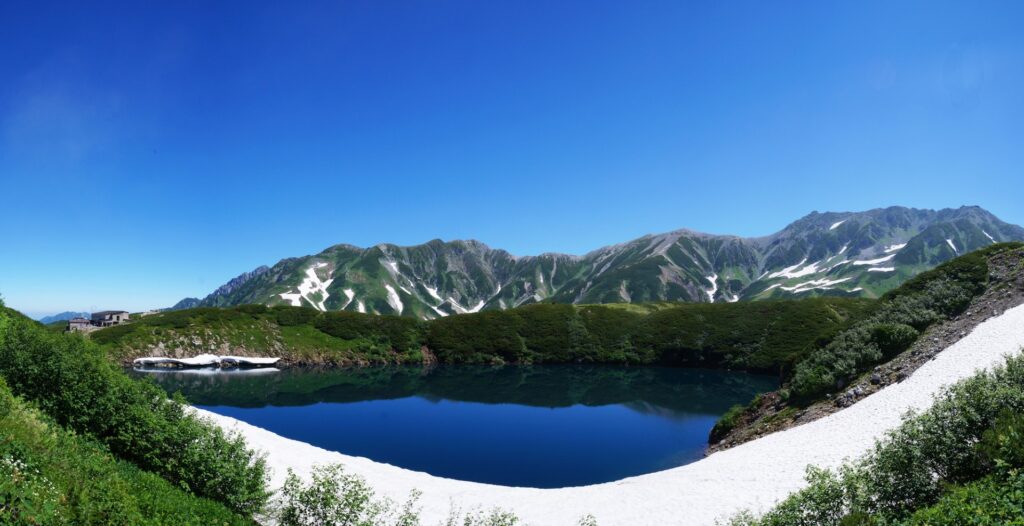
After enjoying Murodo, please return to Ogizawa the way you just came, without going further in the direction of Tateyama.
50min
3
Daio Wasabi Farm
Parking MAPCODE:
🔒Book rental car or hotelWhat is MAPCODE?
16:00
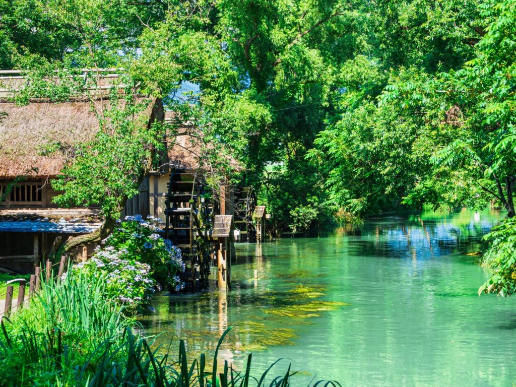
Next, you will head to the Daio Wasabi Farm. This is known as the best wasabi garden in Japan, and many tourists visit. After walking around, please try wasabi soft-serve ice cream.
30min
4
Inn in Matsumoto
Parking MAPCODE:
Please head to the hotel you reserved.What is MAPCODE?
17:30
It takes about 15km to Matsumoto. Please go back to the same inn. Please spend a relaxing time.
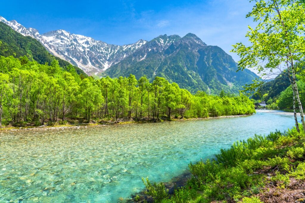
If you prefer another place, Japan Alps “Kamikochi” is recommended too.
You can enjoy 1 hour of walking in the breathtaking scenery.
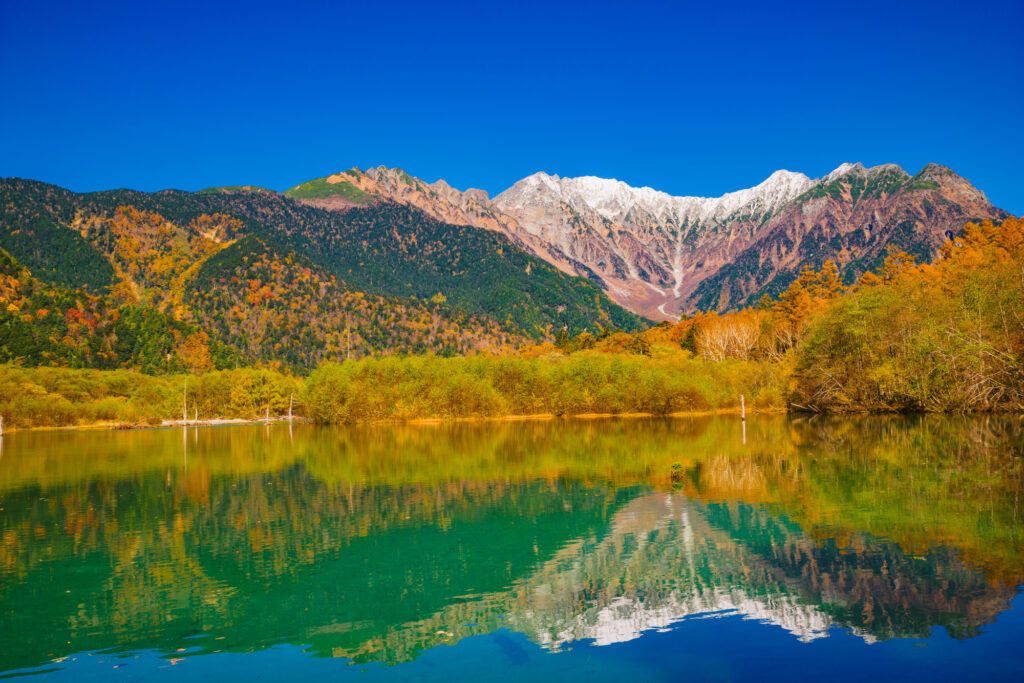

The driving map will show additional 10-20 spots for the day! You will travel only to your favorite spots.
Check pin color and MAPCODE usage.

On this day, you will stay in Matsumoto (松本) city.
Many inns are concentrated in the following two areas.
①Around Matsumoto Station
The inns are concentrated east side of Matsumoto Station. This area is convenient for dinner and visiting Matsumoto castle but no inns offer Onsen.
- Inn Type
Most of these inns are 3 to 5-star western-style hotels. - Parking
Most inns have official parking but in addition to the accommodation fee, the parking lot fee will be charged separately. - Onsen
There is no Onsen in this town and no inns have Onsens. - Meal Plan Reservations
As many restaurants are open till midnight, it is recommended to book your inns with breakfast only or without meals.
②Asama Onsen(浅間温泉)
This hot spring resort area is located 4km north of Matsumoto station. If you would like to stay in better accommodation with Onsen, here is recommended.
- Inn Type
Most of these inns are 3 to 5-star Japanese-style Ryokans with Onsen facilities. - Parking
Most inns will offer free parking. - Onsen
This area is famous for Onsen and most of the inns have one. - Meal Plan Reservations
There are few restaurants in this area and be sure to make a reservation with a plan that includes dinner and breakfast.
Matsumoto- Matsumoto🔒
Start : Matsumoto (松本)
Finish : Matsumoto (松本)
Mileage : 100km
Travel Pace : Fast
On this day you will stay in Matsumoto for consecutive nights following yesterday. And you will enjoy “Tateyama Kurobe Alpine Route” on a day trip.
If you prefer another place, Japan Alps “Kamikochi” is recommended too.
1
Inn in Matsumoto
Parking MAPCODE:
9:00
The mileage is as short as 100km, but it’s better to leave early to enjoy Tateyama Kurobe Alpine Route fully.
75 min
2
Tateyama Kurobe Alpine Route
Parking MAPCODE:
🔒Book rental car or hotelWhat is MAPCODE?
10:15

Today’s first destination is Tateyama Kurobe Alpine Route, the biggest highlight today. First, please aim for Ogizawa, which has the entrance on the Nagano side.
After parking the car in the Ogizawa parking lot, take a trolley bus and head to Kurobe Dam. The bus goes through a narrow and dark tunnel.
At Kurobe Dam, please enjoy the huge Kurobe Dam, which is known as the highest dam in Japan. Especially powerful water discharge is great. If you are confident in your legs, we recommend to go to an observatory located in a high place.

After that, please walk on the dam and head to Kurobe Lake Station of the Kurobe cable car on the other side. And you will take the cable car to Kurobeidaira Station.

At Kurobedaira Station, you will change to Tateyama Ropeway and head to Daikanbo. This ropeway is 1700m long and has no pillars on the way, and the longest ropeway in Japan. And Lake Kurobe and the surrounding mountains are so beautiful that you will feel like you are flying in the air of the alpine route.

At Daikanbo, please change to a trolley bus. At that time, please don’t forget to go to the rooftop observatory at the station. Lake Kurobe and the large panoramic view of the Alpen Route are one of the best beauties.
The trolleybus then arrives at Murodo, the highest point of the Tateyama Alpine Route. In Murodo, please enjoy the Yuki-no-Otani (mid-April to mid-June), Mikurigaike Pond walk, and more.


After enjoying Murodo, please return to Ogizawa the way you just came, without going further in the direction of Tateyama.
50min
3
Daio Wasabi Farm
Parking MAPCODE:
🔒Book rental car or hotelWhat is MAPCODE?
16:00

Next, you will head to the Daio Wasabi Farm. This is known as the best wasabi garden in Japan, and many tourists visit. After walking around, please try wasabi soft-serve ice cream.
30min
4
Inn in Matsumoto
Parking MAPCODE:
Please head to the hotel you reserved.What is MAPCODE?
17:30
It takes about 15km to Matsumoto. Please go back to the same inn. Please spend a relaxing time.
If you prefer another place, Japan Alps “Kamikochi” is recommended too.
You can enjoy 1 hour of walking in the breathtaking scenery.


The driving map will show additional 10-20 spots for the day! You will travel only to your favorite spots.
Check pin color and MAPCODE usage.

On this day, you will stay in Matsumoto (松本) city.
Many inns are concentrated in the following two areas.
①Around Matsumoto Station
The inns are concentrated east side of Matsumoto Station. This area is convenient for dinner and visiting Matsumoto castle but no inns offer Onsen.
- Inn Type
Most of these inns are 3 to 5-star western-style hotels. - Parking
Most inns have official parking but in addition to the accommodation fee, the parking lot fee will be charged separately. - Onsen
There is no Onsen in this town and no inns have Onsens. - Meal Plan Reservations
As many restaurants are open till midnight, it is recommended to book your inns with breakfast only or without meals.
②Asama Onsen(浅間温泉)
This hot spring resort area is located 4km north of Matsumoto station. If you would like to stay in better accommodation with Onsen, here is recommended.
- Inn Type
Most of these inns are 3 to 5-star Japanese-style Ryokans with Onsen facilities. - Parking
Most inns will offer free parking. - Onsen
This area is famous for Onsen and most of the inns have one. - Meal Plan Reservations
There are few restaurants in this area and be sure to make a reservation with a plan that includes dinner and breakfast.
Matsumoto – Nagoya🔒
Start: Matsumoto (松本)
Finish:Nagoya (名古屋)
Mileage:240km
Travel Pace: Fast
On this day, you will head from Matsumoto to Nagoya along Nakasendo (Route 19), a series of historic post towns.
1
Matsumoto
Parking MAPCODE:
🔒Book rental car or hotelWhat is MAPCODE?
9:00
It is recommended to leave around 8:00 or 9:00 at the latest, as the mileage is quite long at 240km. Also, please use the expressway on the way.
If you haven’t visited Matsumoto castle yet, please visit it before you leave Matsumoto. They open from 8:30.
55min
2
Naraijuku
Parking MAPCODE:
🔒Book rental car or hotelWhat is MAPCODE?

9:55
After leaving Matsumoto, you will drive along the Nakasendo Road and head to Naraijuku which is the Preservation District for Groups of Traditional Buildings. Naraijuku is a place where the townscape of the post town of the Edo period (1603-1868) has been almost completely preserved to this day.
40min
3
Nezame no Toko Gorge
Parking MAPCODE:
🔒Book rental car or hotelWhat is MAPCODE?

11:30
Next, you will visit [Nezame no Toko Gorge], which has been popular as a landmark of Kisoji. The contrast between the white rock surface and the emerald green river flow is wonderful.
40min
4
Tsumagojuku
Parking MAPCODE:
🔒Book rental car or hotelWhat is MAPCODE?

13:15
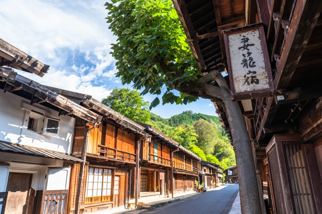
After Nezame no toko Gorge, you will go to [Tsumagojuku] where the vestiges of the Edo period (1603-1868) remain intact. Tsumagojuku was the first post town in Japan to preserve its old townscape, which was designated as an Important Preservation District for Traditional Buildingsand in 1976 for the first time in Japan.
The next post town, Magomejuku, is also popular.
However, since this day is the last day, you may not have enough time. In that case, we recommend skipping Tsumagojuku and then Eihoji Temple.
65min
5
Eihoji Temple
Parking MAPCODE:
🔒Book rental car or hotelWhat is MAPCODE?
15:15
After passing through Magome, you will come to Nakatsugawa City. It is known as the birthplace of chestnut kinton, and there are many Japanese confectionery shops where you can enjoy chestnut kinton and wonderful Mont Blanc.
The distance from Nakatsugawa to Nagoya is about 90km. It takes about 1 hour and 15 minutes on the Chuo Expressway.
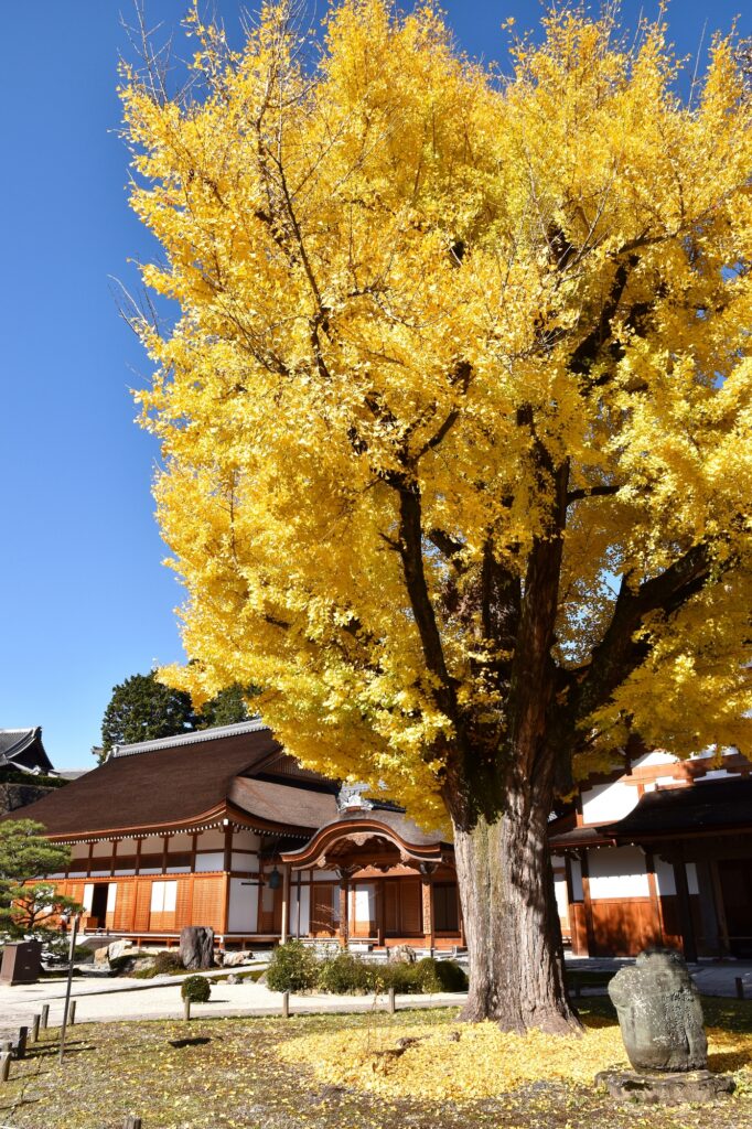
If you have time, please visit Eihoji Temple, which is known for its 700-year-old ginkgo tree. Especially during the fall foliage season, many people flock to see the wonderful scenery of the precincts dyed in yellow and red foliage.
65 min
6
Nagoya
Parking MAPCODE:
Please head to the rental car company branch you booked.What is MAPCODE?
16:30
This concludes your Chubu road trip.
For those who use Chubu Centrair International Airport, please pay attention to the time as the airport is about 45 km from Nagoya Station (center of Nagoya), about 40 minutes away on the highway.
Please use the map codes of the nearest gas stations at Nagoya Station and Chubu International Airport on the drive map.
Nagoya offers a variety of delicious gourmet foods. In particular, hitsumabushi, miso katsu, miso stewed udon, Nagoya cochin, and kishimen are recommended.
The driving map will show additional 10-20 spots for the day! You will travel only to your favorite spots.
Check pin color and MAPCODE usage.

Nagoya is the 3rd biggest city in Japan and the gateway of central Japan travel. Chubu Centrair International Airport and Nagoya station are 50km away and take 45min by expressway. There are hundreds of accommodations around Nagoya Station and the Sakae downtown area.
- Inn Type
Most of these inns are 3 to 5-star western-style hotels. - Parking
Some inns have official parking but in addition to the accommodation fee, the parking lot fee will be charged separately. - Onsen
There is no Onsen in this town and no inns have Onsens. - Meal Plan Reservations
As many restaurants are open till midnight, it is recommended to book your inns with breakfast only or without meals.
Unlock MAPCODE & Maps
We provide “Travel Kit” to make your journey much more attractive.
- Get “Hidden Gems” info along this itinerary
- Maximize travel time by parking MAPCODE for all spots
- Discover local delicacies with Restaurants List
Car Booking
Rental Car Booking
Please rent a car with below “Rentalcars.com” link.
- The abundant number of rental cars
- Price comparisons with several major car rental companies
- Free cancellation

Pick-up & Drop-off Location Guide
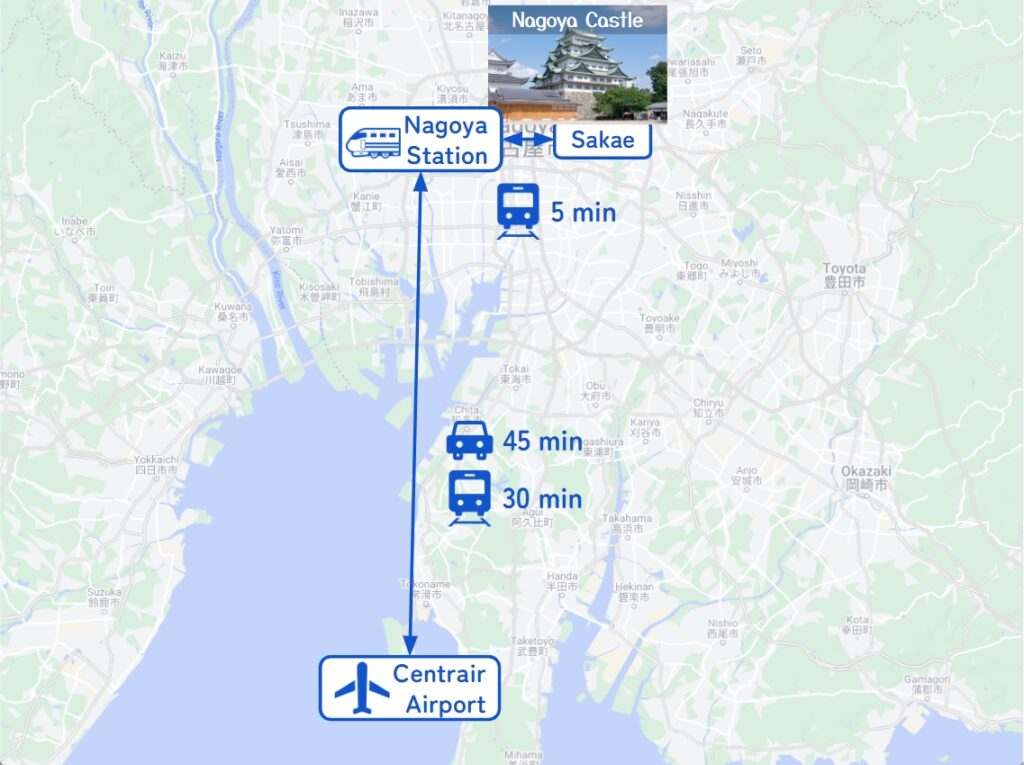
- Chubu Centrair International Airport
The main international airport in Central Japan. Recommended for Pick-up.
If you arrive after 13:00, consider staying overnight around the airport or in Nagoya and departing the next morning.
It takes 30-60 min to Nagoya station by train and 45 min by car. - Nagoya City
The capital of Aichi Prefecture and the 3rd biggest city in Japan. Most car rental shops are located around Nagoya Station.
Nagoya Station, a Shinkansen stop, and downtown Sakae Station are only 5 min by train.
Important reminder for renting a car
- GPS(Car Navigation System)
MAPCODE from Drive Japan navigates you precisely to the parking lot. GPS from major car rental companies(Nippon, ORIX, Nissan, Times) are always MAPCODE compatible. However, if you are renting a car from another company, we recommend that you check with the rental company after making a reservation, just to be sure. - One-way Rental
You can rent at Centrair Airport and return to Nagoya Station, and vice versa. Normally, the one-way charge is about JPY5000. - Child Seat
In Japan, the use of a child safety seat or baby seat is mandatory for children under 5 years old.
Be sure to request one from “Extras”. - Snow Tire
If you travel from the end of November to the end of March, you must book a car with snow tires.

