Summary
- Start
Fukuoka Airport or Hakata Station - Finish
Fukuoka Airport or Hakata Station - Mileage
Tota1060l km
180km per day - Travel Pace
Fast - Onsen Stay
Max. 4 nights - Recommended Seasons
All year round
This itinerary takes 6 days to circle whole Kyushu island except Nagasaki. It is the shortest itinerary for round the Kyushu island. However, due to long mileage and no consecutive stay, travel pace is very fast.
If you want to stay in Fukuoka after the road trip, it is also possible to return your car around near Hakata station.
Fukuoka – Yufuin/Beppu(Sample)
Start : Fukuoka (福岡)
Finish :Yufuin(湯布院) or Beppu(別府)
Mileage:160km
Travel Pace: Fast
On this day, you will head from Fukuoka to Yufuin or Beppu.
1
Rental car branch at Fukuoka airport or Hakata Station
Parking MAPCODE:
9:00
There are many highlight sites along today’s route. And most of the shops at Yufuin are the biggest highlight of the day close around 17:00. Therefore, we strongly recommend leaving from 8:00 to 9:00.
If your departure time is late, such as leaving in the afternoon, adjust your schedule by taking the expressway or skipping some spots.
30min
2
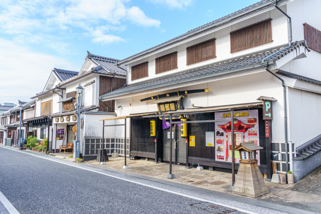
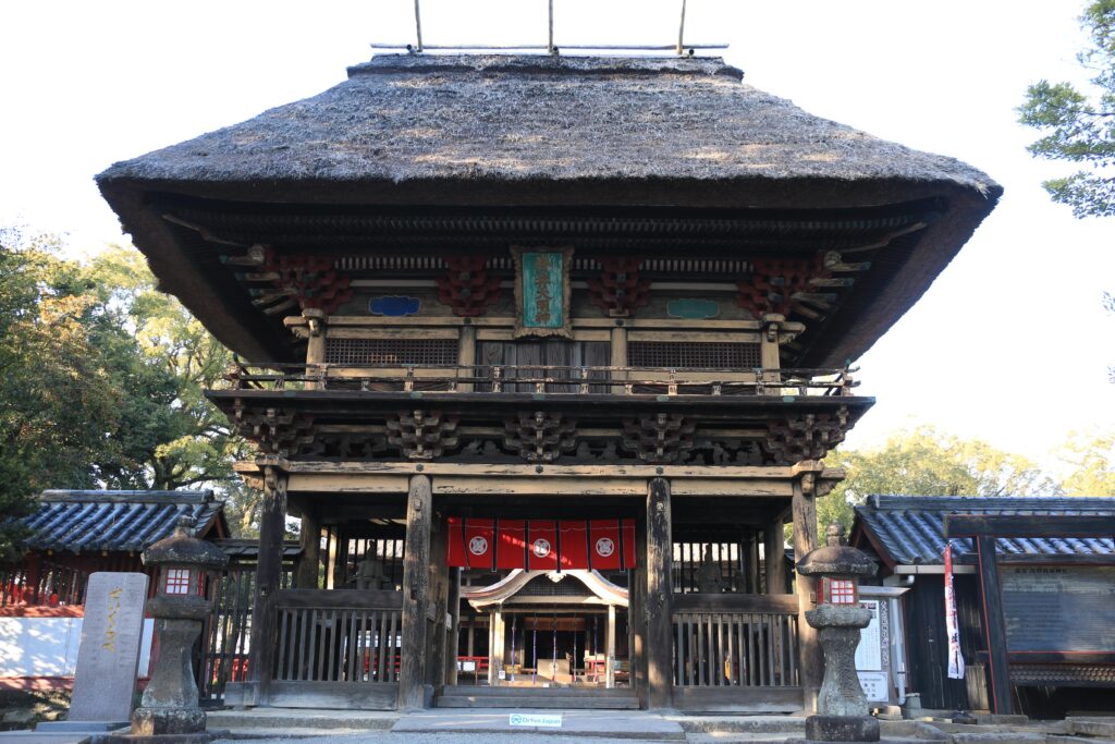
Dazaifu Tenmangu shrine-太宰府天満宮
Parking MAPCODE:
55 333 771*40What is MAPCODE?
9:30
The first destination is “Dazaifu Tenmangu Shrine”, nationally famous throughout Japan as the god of learning.
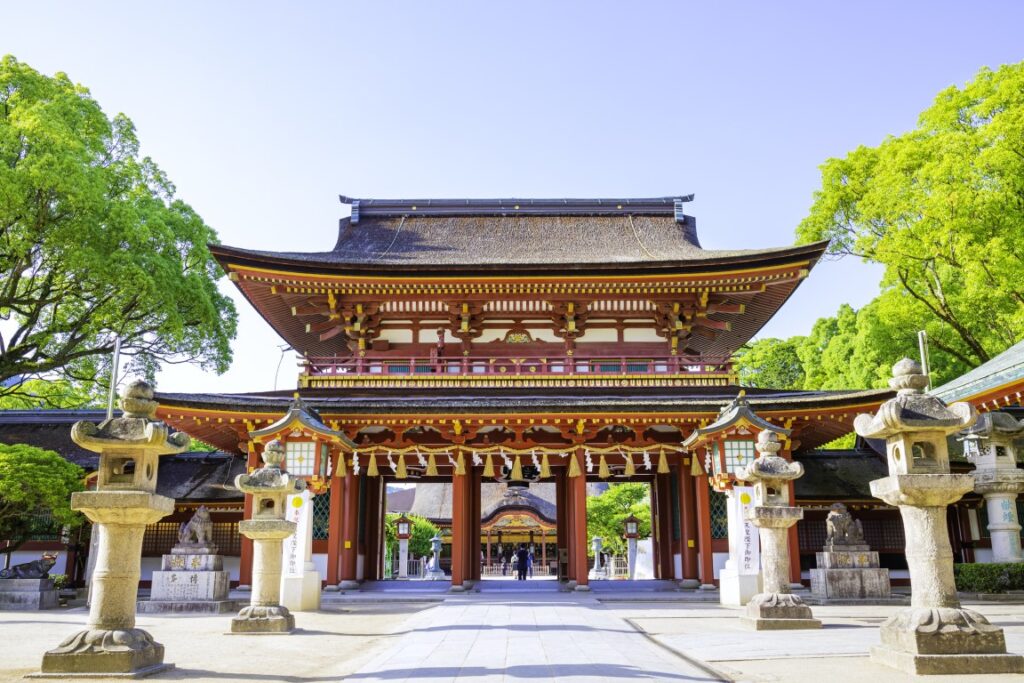
The approach from the parking lot to Tenmangu Shrine is called “Tenjin-sama-dori” avenue, which is crowded with many souvenir stores and restaurants.
If you like sweets and fruits, you can also enjoy fruit picking after visiting Tenmangu Shrine. Please refer to the driving map.
70min
3
Sofuren-想夫恋本店
Parking MAPCODE:
202 788 789What is MAPCODE?
12:00
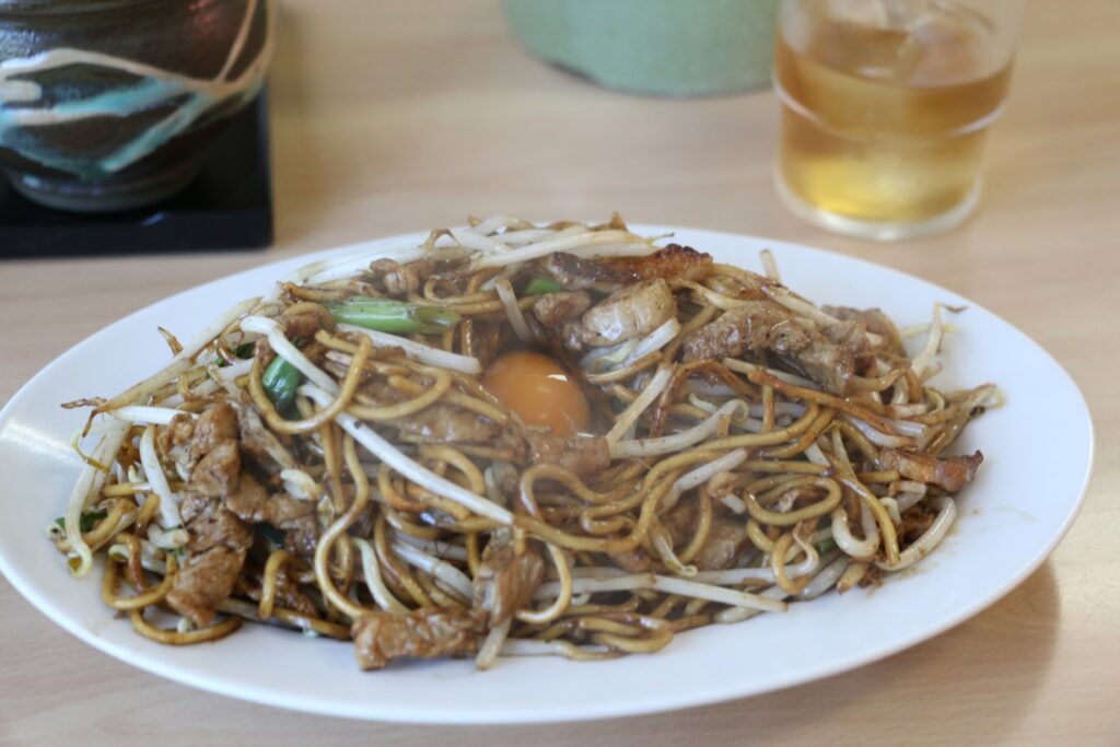
Recommended lunch is “Hita Yakisoba”, a local grilled noodle. If you have time, stop by the nearby “Hita Old Town” as it has a charming atmosphere.
After that, let’s head to Yufuin.
There are no spots between Hita and Yufuin. It is recommended to drive on the highway (E34).
50min
4
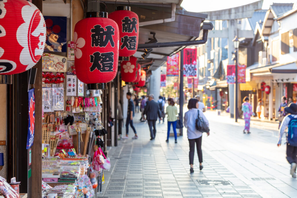
Yufuin Yunotsubo Street-湯布院湯の坪街道
Parking MAPCODE:
269 359 660*80What is MAPCODE?

13:45
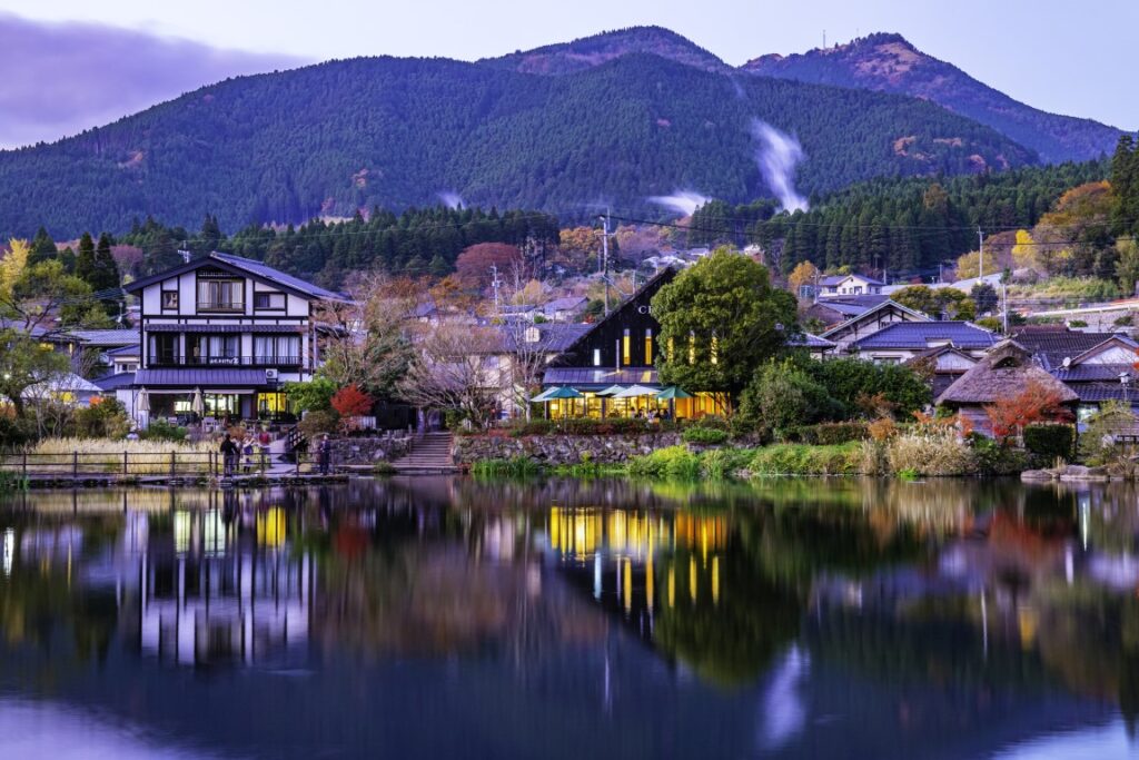
Once you arrive in Yufuin, we recommend strolling along the Yufuin Yunotsubo Kaido (Yufuin Yunotsubo Street), lined with souvenir stores and cute little sweet stores. Enjoy eating and walking to Kinrin-ko Lake at the road’s eastern end.
Another highlight of the day, the “Beppu Jigoku Hells”, will close at 17:00. If you wish to visit it, leave Yufuin by 3:30 p.m. at the latest.
30min
It is a 25-km, 30-minute drive from Yufuin to Beppu. The drive through the foot of Mt. Yufudake is exhilarating.

5
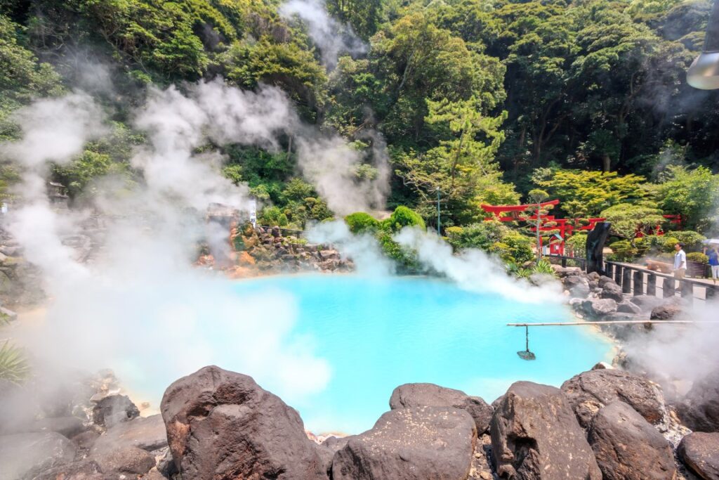
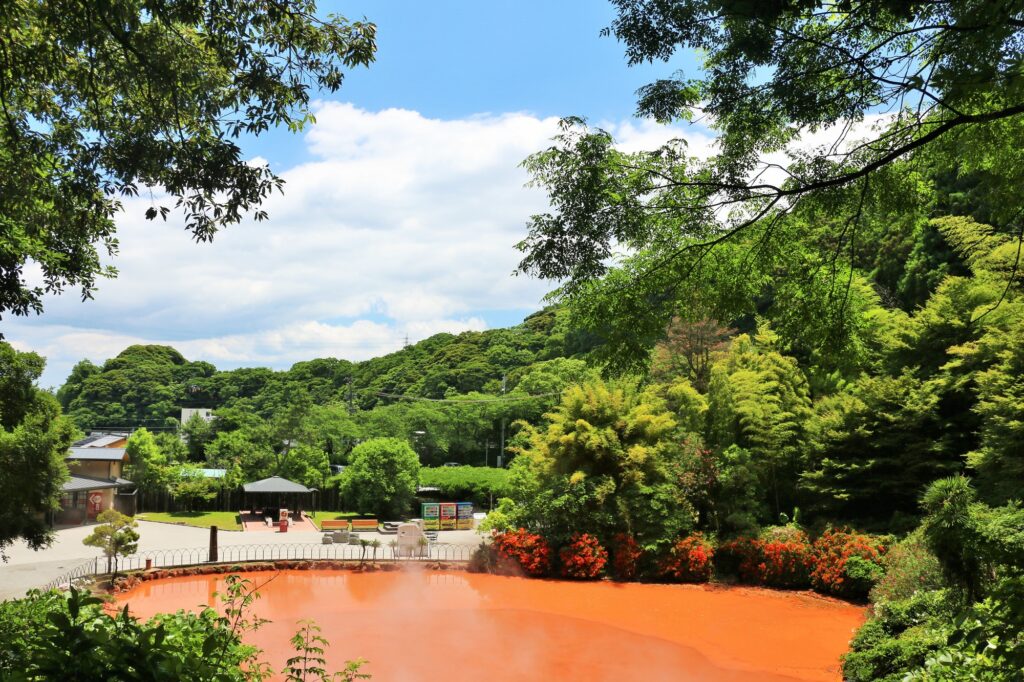
Beppu Jigoku Hells-べっぷ地獄めぐり
Parking MAPCODE:
46 521 411*30(Umi Jigoku)What is MAPCODE?
Onsen town Beppu symbolizes the “Beppu Jigoku Hells”, where hot water of various colors boils over! Five of the seven hells are within walking distance.
Be aware that the tour closes at 17:00 p.m.
15min
6
Inn in Yufuin or Beppu
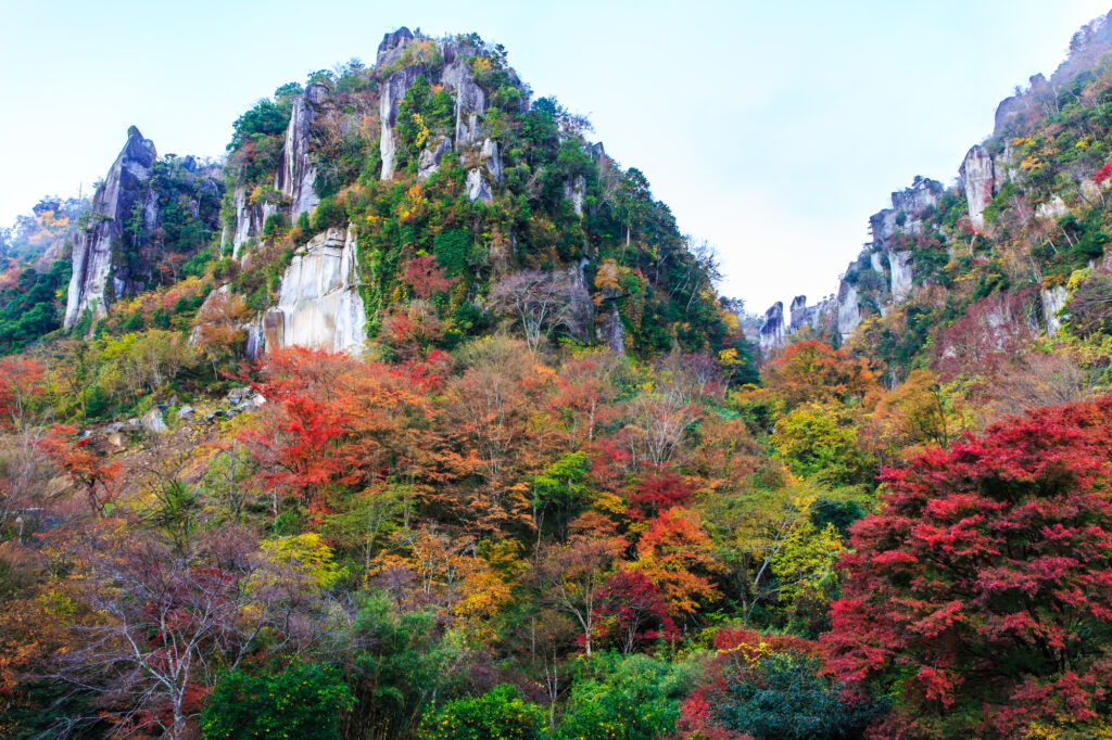
In addition, there are [Shin Yabakei Gorge(HitomeHakkei)] one of the best autumn-colored leave spot in Kyushu along the route of the day.
If you are traveling from end Oct-Mid Nov, we strongly recommend visiting.
The driving map will show additional 10-20 spots for the day! You will travel only to your favorite spots.
Check pin color and MAPCODE usage.
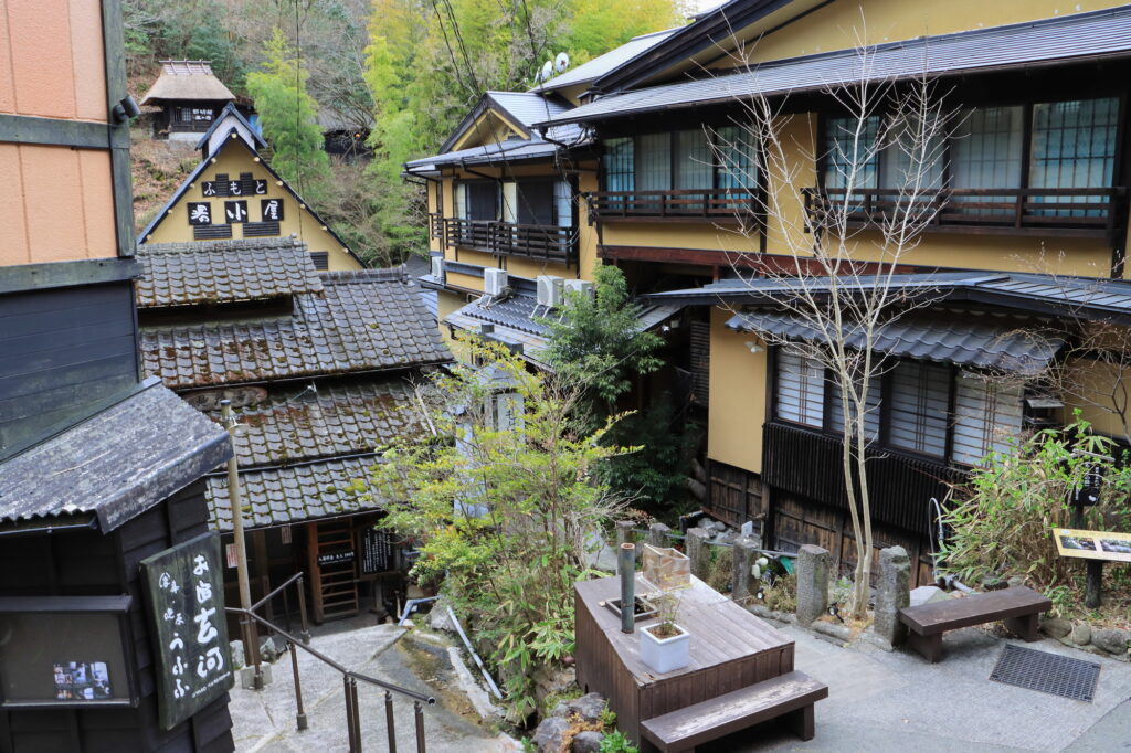
On this day, you will stay in either Yufuin town or Beppu city. It is 20km and takes about 30min. Both of them are nationally famous Onsen areas.
①Yufuin(湯布院)
Yufuin is small but has many luxury Onsen Ryokans.
- Inn Type
Most of these inns are 4 to 5-star Japanese-style Ryokans with Onsen facilities. - Parking
Most inns will offer free parking. - Onsen
This town is famous for Onsens and most of the inns have one. - Meal Plan Reservations
There are a few restaurants in this area, so be sure to make a reservation with a plan that includes dinner and breakfast.
②Beppu(別府)
Beppu is a Bigger City and has More Inexpensive Inns.
- Inn Type
Most of these inns are 3 to 5-star Japanese-style Ryokans with Onsen facilities. - Parking
Most inns have official parking but in addition to the accommodation fee, the parking lot fee will be charged separately. - Onsen
Beppu is famous for Onsens and most of the inns have one. - Meal Plan Reservations
As many restaurants are open till midnight, it is recommended to book your inns with breakfast only or without meals.
Yufuin/Beppu – Aso🔒
Start:Yufuin(湯布院) or Beppu(別府)
Finish: Aso(阿蘇)
Mileage:140km
Travel Pace: Normal
On this day, you will head from Yufuin/Beppu to Aso.
The driving distance is about 140 km. This is a day where you can enjoy three of Kyushu’s most spectacular driving roads.
1
Inn in Yufuin or Beppu
Parking MAPCODE:
🔒Book rental car or hotelWhat is MAPCODE?
9:00
Because there are so many pots to see, we recommend leaving by 8-9 am if you want to travel without rushing.
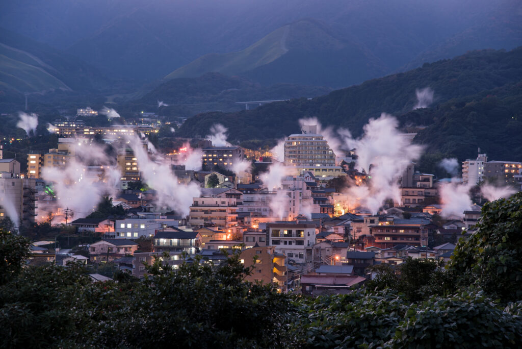
If you are staying in Beppu, go to the “Yukemuri Observatory” first, and you will see the typical Beppu scene of steam rising.
60min
2
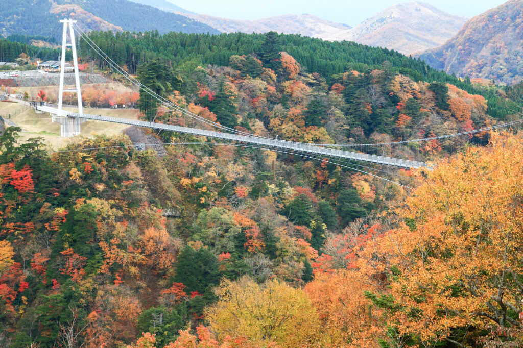
Kokonoe Suspension Bridge-九重夢大吊橋
Parking MAPCODE:
🔒Book rental car or hotelWhat is MAPCODE?
10:20
The first destination is the Kokonoe Suspension Bridge. It is the highest suspension bridge for pedestrians in Japan and is a must-see, especially during the season of fresh green leaves and autumn foliage.
40min
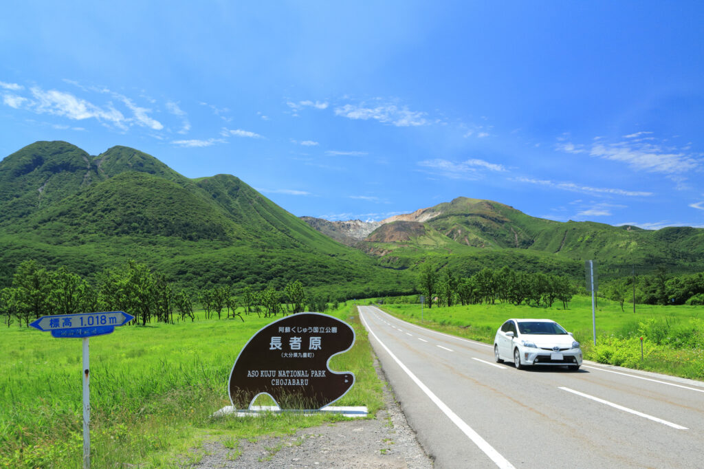
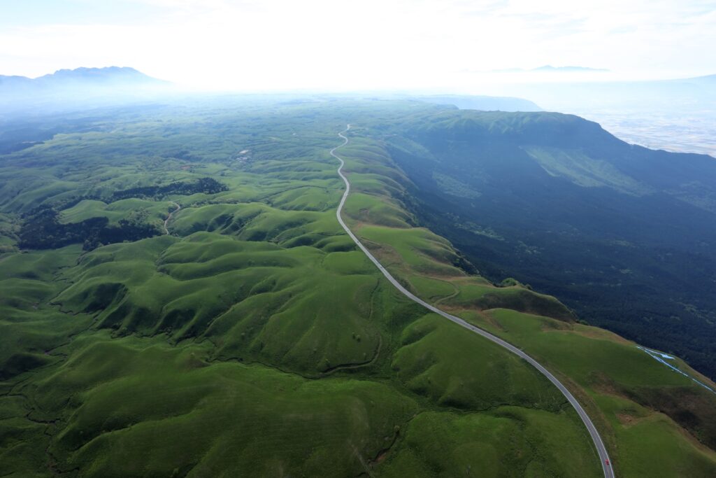
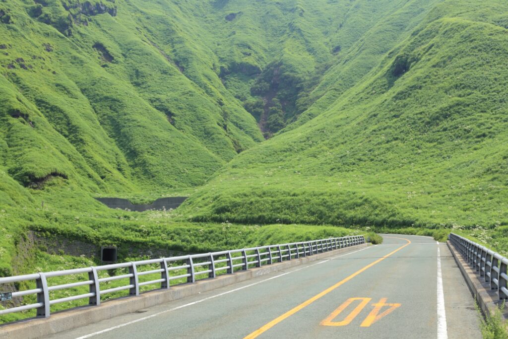
Head south on the Yamanami Highway, the third most popular driving route in Japan. On the way, you can enjoy a fresh yogurt drink at a ranch and a 1km walk in the marshland at Chojabaru. Please refer to the driving map.
Note that Yamanami Highway is a nickname and is actually a public road, not an expressway.
3
Kurokawa Onsen town-黒川温泉
Parking MAPCODE:
🔒Book rental car or hotelWhat is MAPCODE?
12:00
Kurokawa Onsen is a great place for lunch. There are nice curry shops and excellent cream puffs. This spot is also very crowded on holidays. Beyond Kurokawa Onsen, there are a number of soba noodle shops called Oguni Soba Road, which is also recommended. Please refer to the driving map.
35min
4
Nishiyunouraenchi Observatory-西湯浦園地展望所
Parking MAPCODE:
🔒Book rental car or hotelWhat is MAPCODE?
14:15
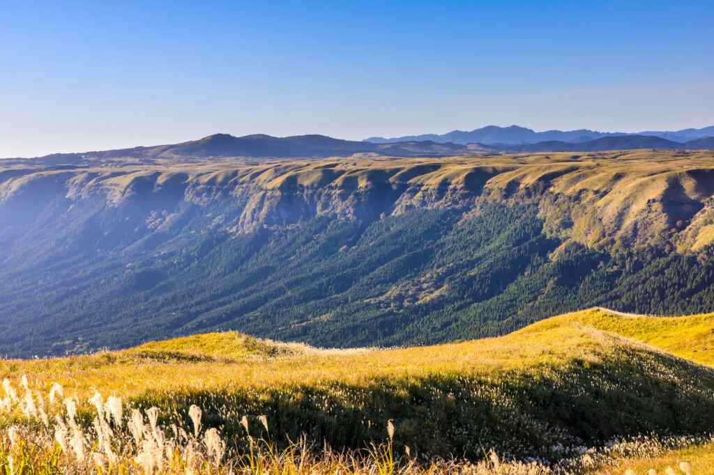
Further south down the Yamanami Highway is the “Nishiyunouraenchi Observatory”. Although not very famous, this is Drive Japan’s best lookout point overlooking the Mt.Aso caldera.
10min
The “Milk Road” from Nishiyunouraenchi Observatory to Daikanbo is the most spectacular road of this road trip, passing by the edge of the caldera of Mt.Aso. The most pleasant drive will make you want to scream, and it will surely be a memory you will cherish forever.
5
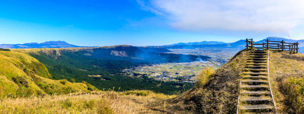
Daikanbo Observatory-大観峰
Parking MAPCODE:
🔒Book rental car or hotelWhat is MAPCODE?
14:45
This is the most famous observatory in the Mt.Aso caldera. Enjoy a 1 km round trip walk on the plateau from the parking lot to the observatory.
30min
6
Mt.Aso(Kusasenri)-草千里
Parking MAPCODE:
🔒Book rental car or hotelWhat is MAPCODE?
16:15
If you still have time, head to “Kusasenri” on Mt. Aso.
Panorama Line Road, which was ranked No. 1 in Japan in a motorcycle magazine, will greet you with the sight of vast grasslands.
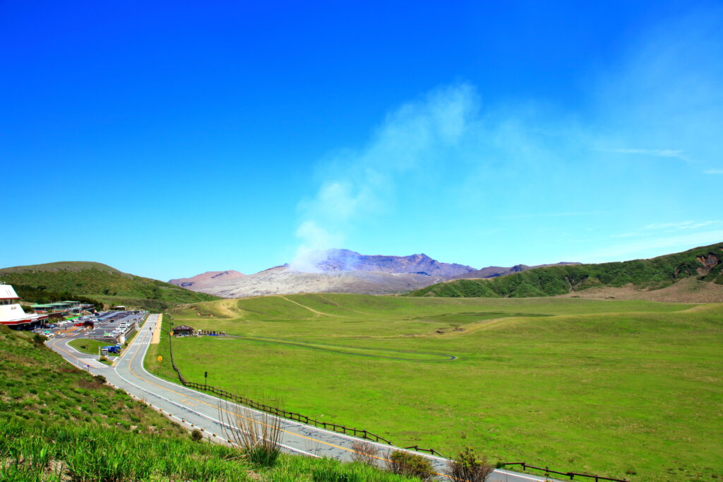
If there are no restrictions on volcanic gases, you can visit the crater. You can take the Aso Park toll road (800 yen) to the parking lot next to the crater.
Please check current restrictions before your visit.
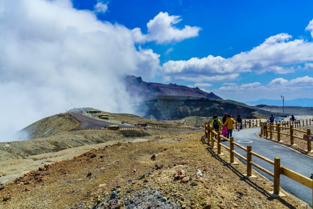
Information on restrictions for the Aso Volcano Center
30min
There are also flower gardens such as “Gandhi Farm” and “Kujyu Flower Park” on this day. If you are traveling during the best time for flowers, give priority to this area.

7
Inn in Aso
The driving map will show additional 10-20 hidden gems and local restaurants for the day!
You can travel freely, choosing only the spots you like!
Check pin color and MAPCODE usage.
Aso town is a small town located inside the vast caldera of Mt.Aso. The inns are spread over a wide area around Mt. Aso.
- Inn Type
There are a variety of inns from 3-star western-style hotels to 5-star Japanese Ryokans. Please book at your preferred type of inn. - Parking
Most inns will offer free parking. - Onsen
Some luxury Ryokans have Onsen. - Meal Plan Reservations
Aso is a rural area and there are few restaurants. Be sure to make a reservation with a plan that includes dinner and breakfast.
Aso – Miyazaki🔒
Start: Aso(阿蘇)
Finish: Miyazaki(宮崎)
Mileage:210km
Travel Pace: Fast
The driving distance on this day is very long, approximately 210 km.
The second half of that 70 km will be on the expressway.
1
Inn in Aso
Parking MAPCODE:
🔒Book rental car or hotelWhat is MAPCODE?
9:00
This is a long drive on this day, so if you want to travel without rushing, we recommend leaving by 8-9 am.
75min
2
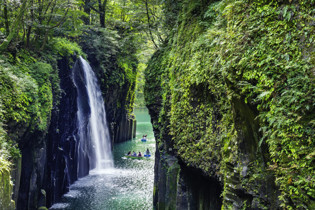
Takachiho Gorge-高千穂峡
Parking MAPCODE:
🔒Book rental car or hotelWhat is MAPCODE?
11:15
First, let’s move on at once to visit “Takachiho Gorge”. It is one of the most beautiful gorges all over Japan and one of the most recommended spots on this entire road trip.
Boat rentals are very popular and sometimes crowded, but highly recommended!
10min
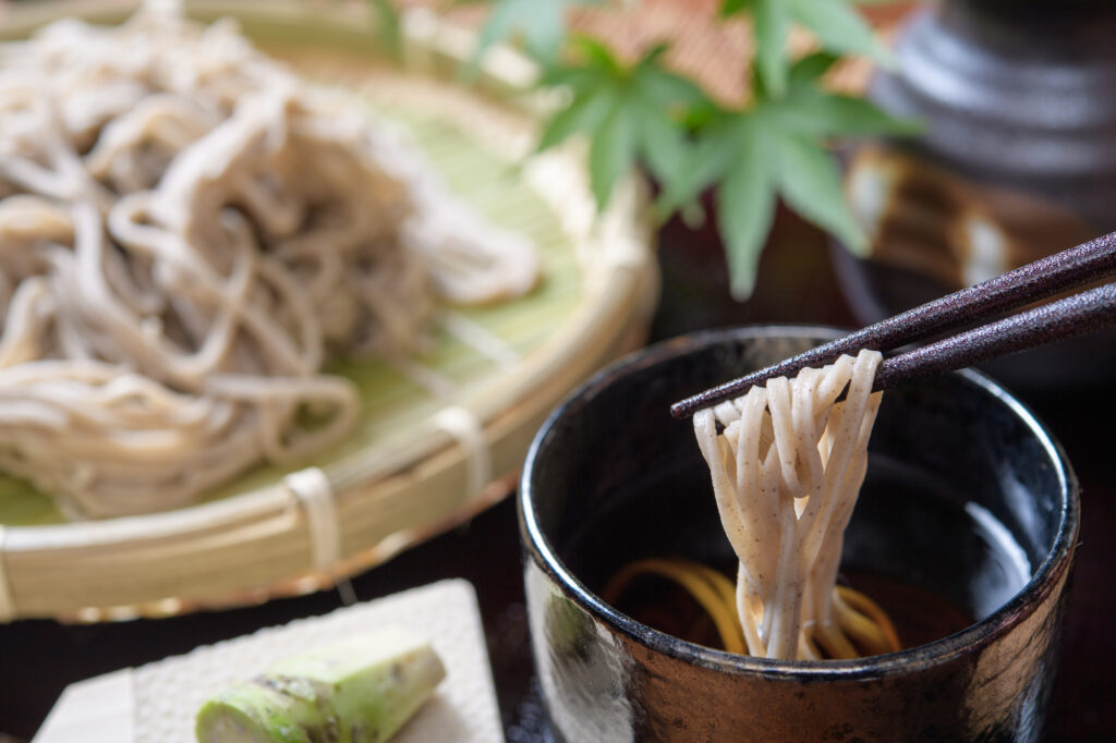
There are not many restaurants in Takachiho, but please refer to the driving map for recommended soba restaurants and Takachiho beef restaurants.
3
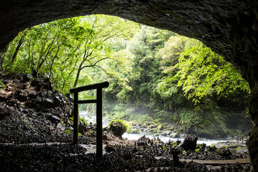
Amanoiwato Shrine-天岩戸神社
Parking MAPCODE:
🔒Book rental car or hotelWhat is MAPCODE?
12:45
10km away from Takachiho Gorge, the “Amanoiwato Shrine” is also recommended. A 10-minute walk along a riverside path called “Amanoyasukawara” will lead you to a fantastic torii gate in a cave.
After that, drive east toward the ocean. The long drive after lunch will make you sleepy, so take a break at one of the roadside stations along the way.
80min
4
Umagase-馬ヶ背
Parking MAPCODE:
🔒Book rental car or hotelWhat is MAPCODE?

15:00
“Umagasa” is a long, narrow cape jutting out into the Pacific Ocean, offering a panoramic view.
“The Sea of Cross”, a lookout point where the sea looks like a cross, is also close by and should be visited together.

It is 80 km from Miyazaki. There are not many spots in between, so you can take the expressway (E10) all the way.
80min
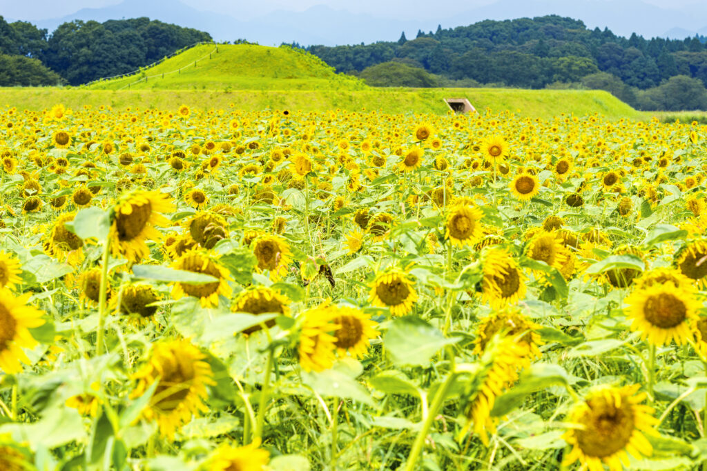
The Saitobaru Kofun, located before Miyazaki City, is one of the best flower spots in Kyushu. Especially the cherry blossoms and rape blossoms in spring, sunflowers in summer, and cosmos in fall makes this spot a must-see! If you are traveling during the best time for flowers, give priority to this area.

5
Inn in Miyazaki
Parking MAPCODE:
Please head to the hotel you reserved.What is MAPCODE?
Rest early because the next day will be another long drive.
The driving map will show additional 10-20 sightseeing spots and local restaurants for the day!
You can travel freely, choosing only the spots you like!
Check pin color and MAPCODE usage.
On this day, you will stay in Miyazaki city(宮崎). The inns are concentrated on the west side of Miyazaki station. “Nishitachi(ニシタチ)” area is downtown of the city and convenient for dinner.
Additionally, there is “Sheraton Grande Ocean Resort” by far the largest hotel in the city, with 700 rooms. If you are looking for a relaxing stay, this is also a good choice.
- Inn Type
Most of these inns are 3 to 4-star western-style hotels. - Parking
Some inns have official parking but in addition to the accommodation fee, the parking lot fee will be charged separately. - Onsen
There is no Onsen in this town. If you would like to enjoy an Onsen, “Sheraton” is recommended. - Meal Plan Reservations
As many restaurants are open till midnight, it is recommended to book your inns with breakfast only or without meals.
Miyazaki – Kagoshima🔒
Start :Miyazaki(宮崎)
Finish:Kagoshima(鹿児島)
Mileage:200km
Travel Pace: Fast
On this day, you will go from Miyazaki to Kagoshima.
The driving distance on this day is very long, approximately 200 km.
1
Inn in Miyazaki
Parking MAPCODE:
🔒Book rental car or hotelWhat is MAPCODE?
9:00
Because of the long driving and many attractive spots along the route, we recommend that you leave by 8-9 am.
30min
2
Aoshima Island-青島 鬼の洗濯板
Parking MAPCODE:
🔒Book rental car or hotelWhat is MAPCODE?

9:30
The first destination is Aoshima Island, one of Miyazaki’s most popular tourist destinations. You can walk around the island with its unique scenery, called “Oni no Sentakuita” (washing board of demons).
30min
From Aoshima, head south along the Pacific Ocean. From the Horikiri Pass, the “Nichinan Phoenix Road” is a scenic driving course. The drive along the coastline where palm trees grow along the precipitous cliffs is the best way to feel the tropical area of Miyazaki.
3
Udo Shrine-鵜戸神宮
Parking MAPCODE:
🔒Book rental car or hotelWhat is MAPCODE?

11:00
Heading south along the Nichinan coastline, you will arrive at [Udo Jingu Shrine].
The shrine is located in an incredible place in a cave between steep cliffs, and the contrast between the blue of the sea and the red of the shrine is magnificent. The shrine is dedicated to Emperor Jinmu, the first emperor in Japanese mythology, and is especially blessed with children.
110min
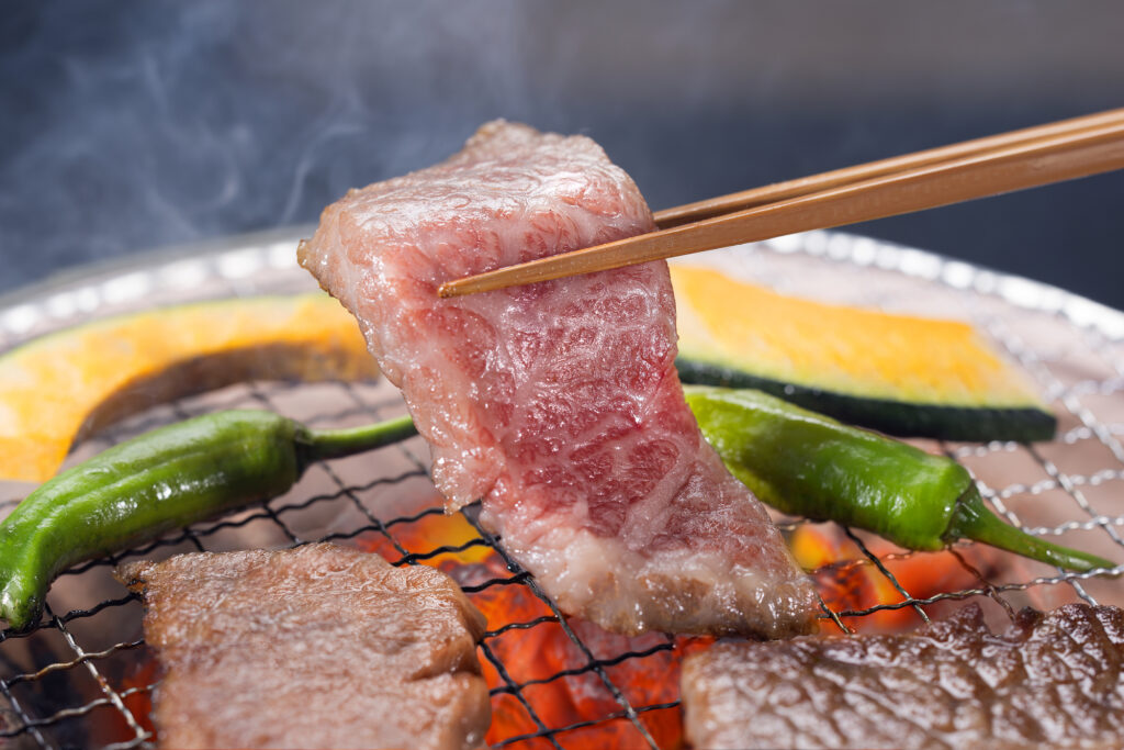
For lunch, grilled meat is recommended in Miyakonojo City, which produces the largest amount of meat in Japan, but if you are short on time, Miyazaki’s specialty, “Chicken Nanban(チキン南蛮)”, is also recommended at the roadside station along the way. Please refer to the driving map.
4
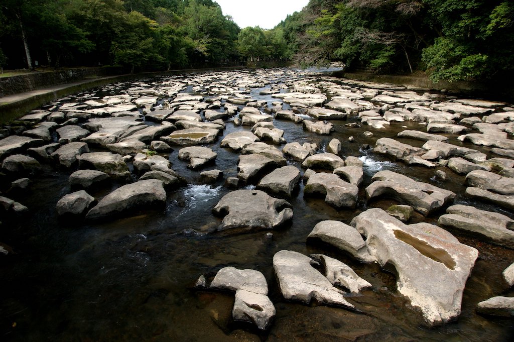
Sekinoo Falls-関之尾の滝 甌穴群
Parking MAPCODE:
🔒Book rental car or hotelWhat is MAPCODE?
15:00
After lunch, you will visit “Sekinoo Falls”.
You can take a 30-minute walk along the river with its mysterious scenery of waterfalls and potholes.
30min
5
Kirishima Shrine-霧島神宮
Parking MAPCODE:
🔒Book rental car or hotelWhat is MAPCODE?
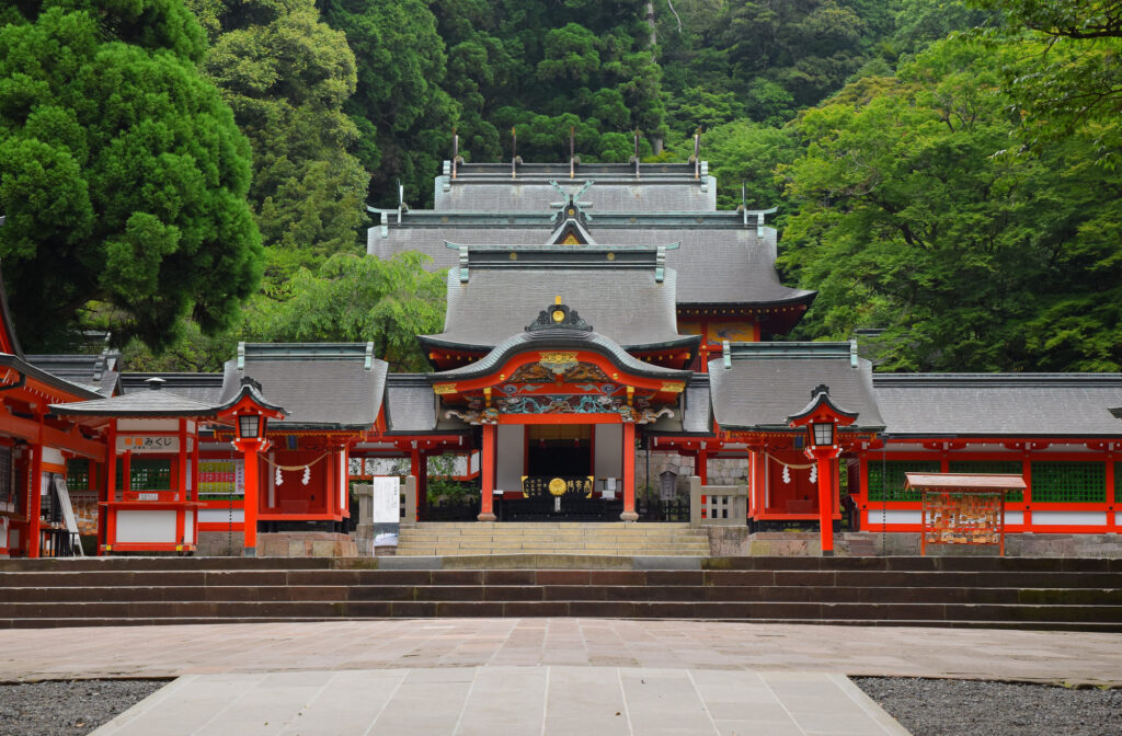
16:30
The final destination is Kirishima Jingu Shrine, which was built over 1,000 years ago. The shrine is especially beautiful during the season of fresh green leaves and autumn foliage.
Since there are few tourist attractions from Kirishima to Kagoshima, it is recommended to drive on the expressway (E3).
6
Inn in Kagoshima
The driving map will show additional 10-20 sightseeing spots and local restaurants for the day!
You can travel freely, choosing only the spots you like!
Check pin color and MAPCODE usage.
On this day, you will stay in Kagoshima city(鹿児島). The inns are concentrated around “Kagoshima Chuo station” and the downtown “Tenmonkan(天文館)” area.
- Inn Type
Most of these inns are 3 to 5-star western-style hotels. - Parking
Some inns have official parking but in addition to the accommodation fee, the parking lot fee will be charged separately. - Onsen
Most inns don’t have Onsens. If you would like to enjoy it, “Shiroyama hotel”, one of Kagoshima’s most prestigious hotels is recommended. - Meal Plan Reservations
As many restaurants are open till midnight, it is recommended to book your inns with breakfast only or without meals.
Kagoshima – Kumamoto🔒
Start: Kagoshima(鹿児島)
Finish : Kumamoto(熊本)
Mileage:200km
Travel Pace: Fast
On this day, you will head from Kagoshima to Kumamoto.
The driving distance on this day is very long, approximately 200 km.
1
Inn in Kagoshima
Parking MAPCODE:
9:00
Because of the long driving, we recommend you to leave by 8-9 am if you want to travel without rushing.
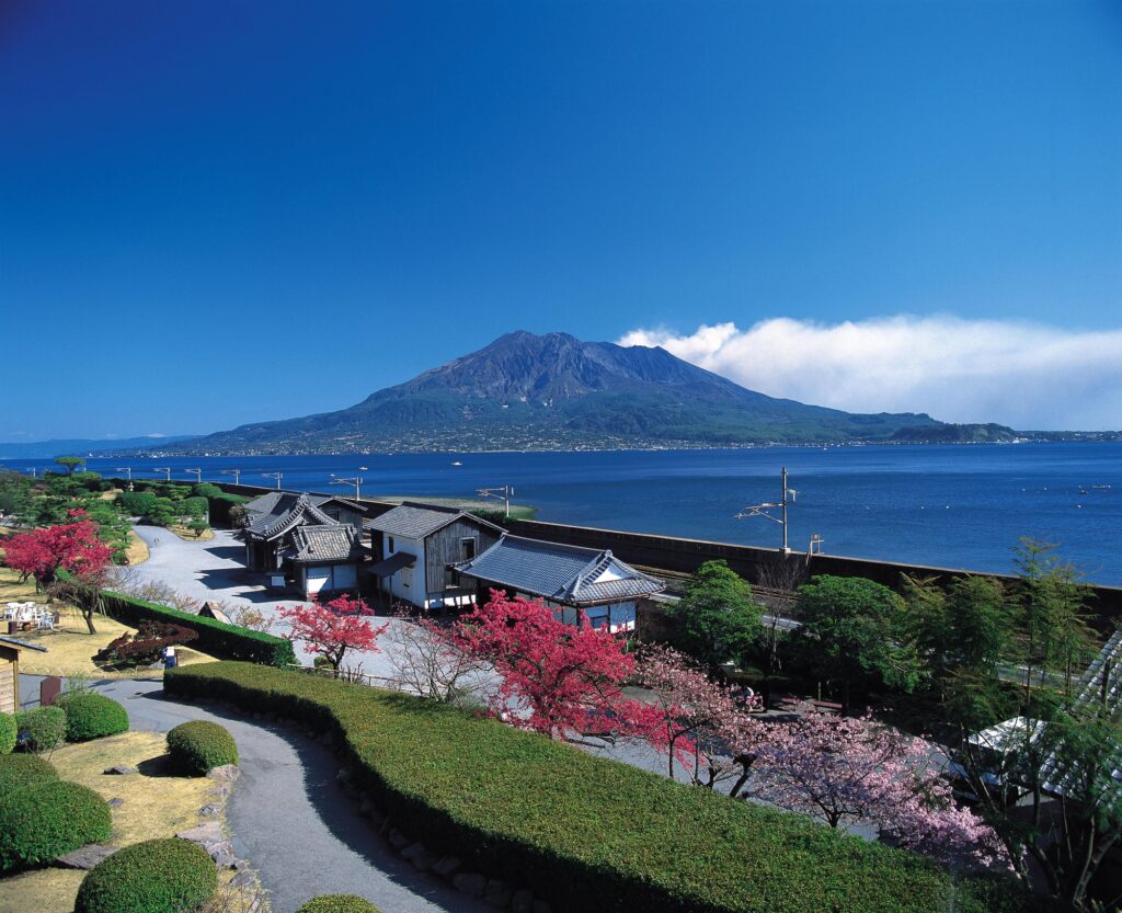
If you have not already been, you should first visit Senganen Garden, one of Kagoshima’s most famous tourist attractions. It is the residence of the Shimazu family, who contributed greatly to the modernization of Japan, and from the garden, you can enjoy a majestic view of Sakurajima.
50min
2
Maruike Spring Water Park-丸池湧水
Parking MAPCODE:
🔒Book rental car or hotelWhat is MAPCODE?
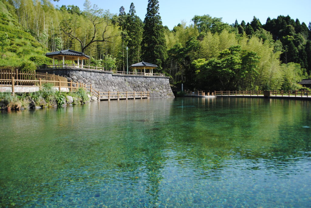
9:50
First, let’s head to Maruike Spring, a beautiful pond made of clean spring water. There are not many tourist attractions from Kagoshima to here, so let’s take the expressway (E3).
30min
3
Sogi Falls-曽木の滝
Parking MAPCODE:
🔒Book rental car or hotelWhat is MAPCODE?
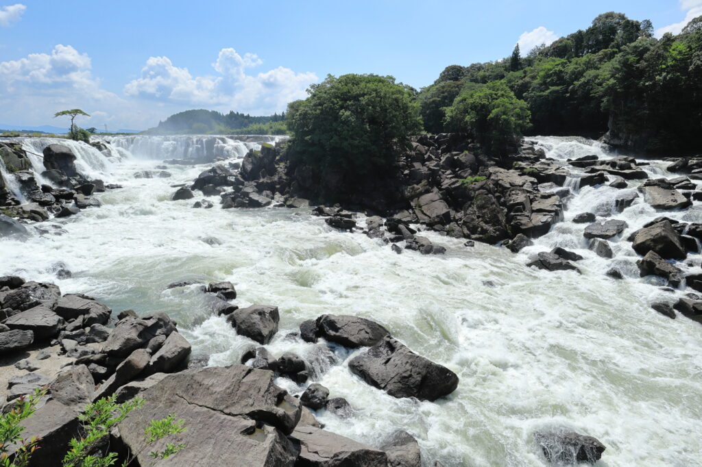
11:00
After driving 20 km or 30 minutes from Maruike Spring, you will arrive at the biggest highlight of the day, Sogi Falls. This 210m wide waterfall is called the Niagara of the Orient and is overwhelmingly powerful. Although it is not well known due to poor accessibility, it is a place that can be enjoyed only on a road trip.
45min
4
Aoi Aso Shrine-青井阿蘇神社
Parking MAPCODE:
🔒Book rental car or hotelWhat is MAPCODE?
12:50
After that, you will arrive in Hitoyoshi City.
Aoi Aso Shrine has five buildings, including the main shrine, designated as national treasures, and the magnificent thatched tower gate is especially not to be missed.
500m east of Aoi Aso Shrine is the center of Hitoyoshi City. Uemura Eel and Black Ramen are famous and recommended for lunch.
There are not too many tourist attractions between Hitoyoshi and Kumamoto, so take the expressway(E3) again to the north.
80min
5
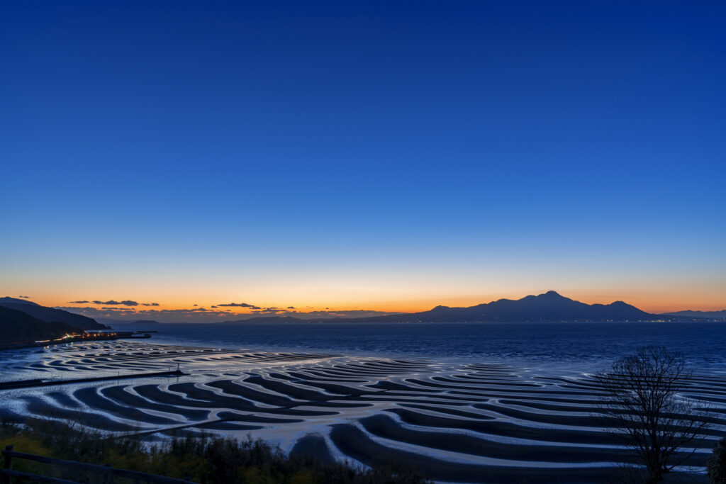
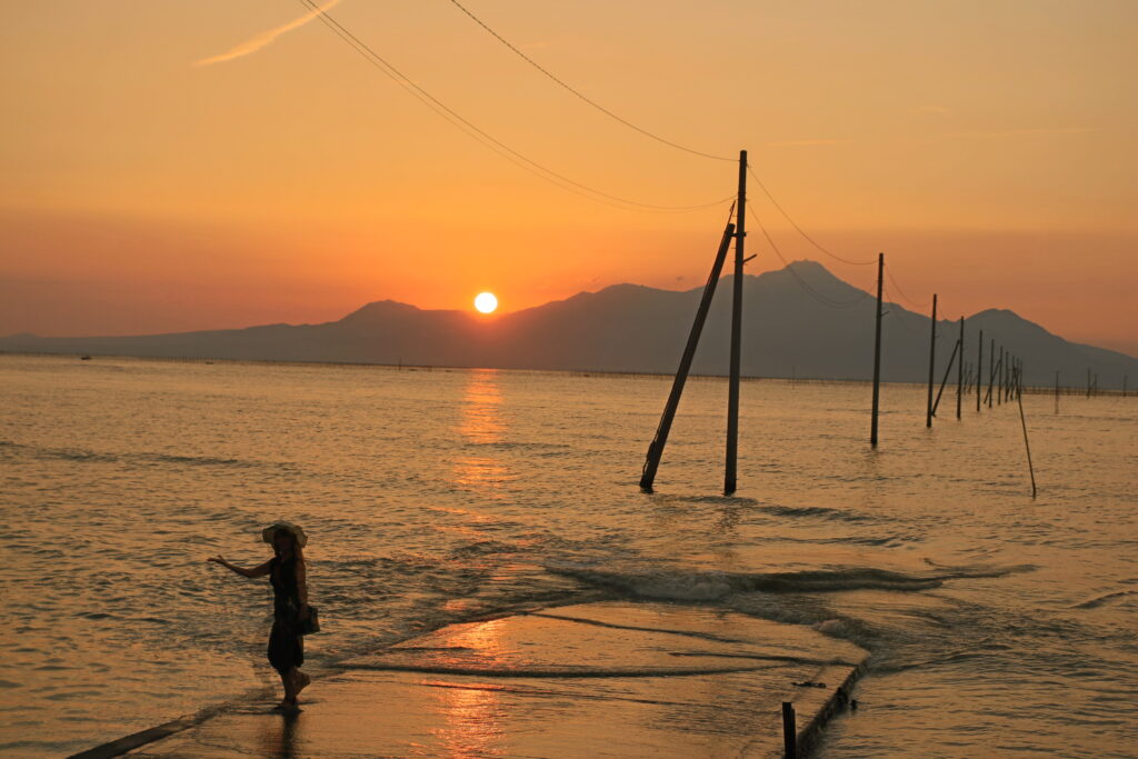
Okoshiki Beach Observatory-御輿来海岸 展望所
Parking MAPCODE:
🔒Book rental car or hotelWhat is MAPCODE?
16:30
The last highlight of the day is Okoshikai Beach. The tidal flat becomes a wave pattern, and you can look over the Ariake Sea to Unzen Fugendake. Please check the time of low tide before visiting. Also, please note that depending on the time of year, the area may be jammed with many photographers.
If your travel timing does not fit into Okoshiki Beach, “Nagabeta Kaishoro-長部田海床路”, 6 km ahead, is also a great sunset spot.
Okoshiki beach tide table
60min
6
Inn in Kumamoto
Parking MAPCODE:
Please head to the hotel you reserved.What is MAPCODE?
It is a long drive and you will arrive in Kumamoto at night. You can visit Kumamoto Castle tomorrow.
The driving map will show additional 10-20 spots for the day! You will travel only to your favorite spots.
Check pin color and MAPCODE usage.
Kumamoto is the 3rd biggest city in Kyushu. The inns are concentrated south on the southeast side of Kumamoto Castle. It is better not to stay around Kumamoto Station due to a few restaurants for dinner.
- Inn Type
Most of these inns are 3 to 4-star western-style hotels. - Parking
Some inns have official parking but in addition to the accommodation fee, the parking lot fee will be charged separately. - Onsen
There are no Onsens in this town and no inns have Onsens. - Meal Plan Reservations
As many restaurants are open till midnight, it is recommended to book your inns with breakfast only or without meals.
Kumamoto – Fukuoka🔒
Start: Kumamoto(熊本)
Finish: Fukuoka(福岡)
Mileage:150km
Travel Pace: Normal
On this day, we will return to Fukuoka from Kumamoto.
The driving distance is about 150 km. The second half of the trip will be on the expressway for about 50 km.
1
Inn in Kumamoto
Parking MAPCODE:
🔒Book rental car or hotelWhat is MAPCODE?
9:00
If you are not staying in Fukuoka today and will be taking the Shinkansen or airplane, please arrange your schedule so that you can return the rental car to the rental store at least one and a half hours before your flight.
10min
2
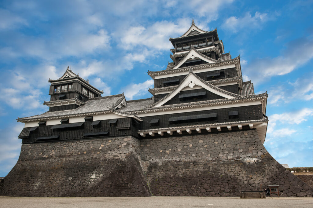
Kumamoto Castle-熊本城
Parking MAPCODE:
🔒Book rental car or hotelWhat is MAPCODE?
9:10
First, we will head to Kumamoto Castle, the symbol of Kumamoto, which was damaged by the Kumamoto Earthquake in 2016, but restoration work on the castle tower was completed in March 2021.
20min
3
Suizenji Jojuen Garden-水前寺成趣園
Parking MAPCODE:
🔒Book rental car or hotelWhat is MAPCODE?

11:30
Suizenji Jojuen Garden is a Japanese garden with a pond garden style. It is only 4 km away from Kumamoto Castle, so it is recommended to visit there as well.
70min
4
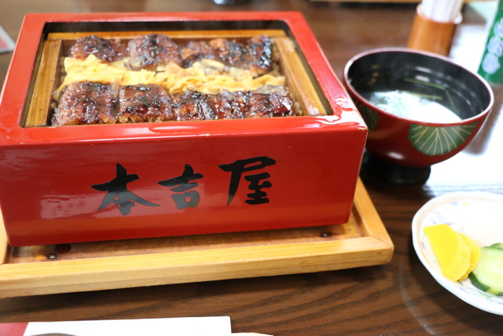
Ganso Motoyoshiya-元祖本吉屋
Parking MAPCODE:
🔒Book rental car or hotelWhat is MAPCODE?
13:20
Yanagawa is famous for its eels. Among them, Motoyoshiya has been in business for 300 years and serves the best eels. There is also a cheap and tasty udon restaurant nearby, which is also recommended.
5min
5
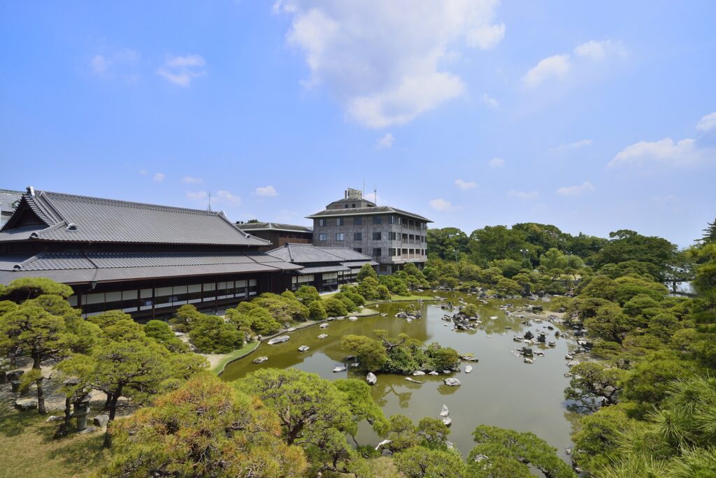
Ohana Shotoen-御花・松涛園
Parking MAPCODE:
🔒Book rental car or hotelWhat is MAPCODE?
14:30
Ohana Shotoen is a former domain lord’s residence and a splendid garden that has been selected as a national place of scenic beauty.
60min
6
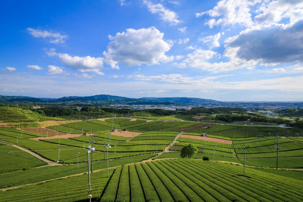
Yame Chuo Tea garden-ハ女中央大茶園 展望所
Parking MAPCODE:
🔒Book rental car or hotelWhat is MAPCODE?
16:30
The last highlight of the day was the Yame Chuo Tea garden. This area is the production area of “Yame-cha”, one of the finest teas in Japan. This is an observatory from which you can look out over the vast tea fields as far as the eye can see. This is a spot that cannot be reached by public transportation or even by bus tours, but only by a road trip.
From here, let’s take the expressway (E3) to Fukuoka. It is about 50 km, or 1 hour and 10 minutes.
70min
7
Rental car branch at Fukuoka airport or Hakata Station
Parking MAPCODE:
Please refer driving mapWhat is MAPCODE?
18:00
This concludes your Kyushu road trip.
When you return to Fukuoka, refuel and then return the car to the car rental branch. Use the MAPCODE on the driving map for the nearest gas stations at Hakata Station and Fukuoka Airport.
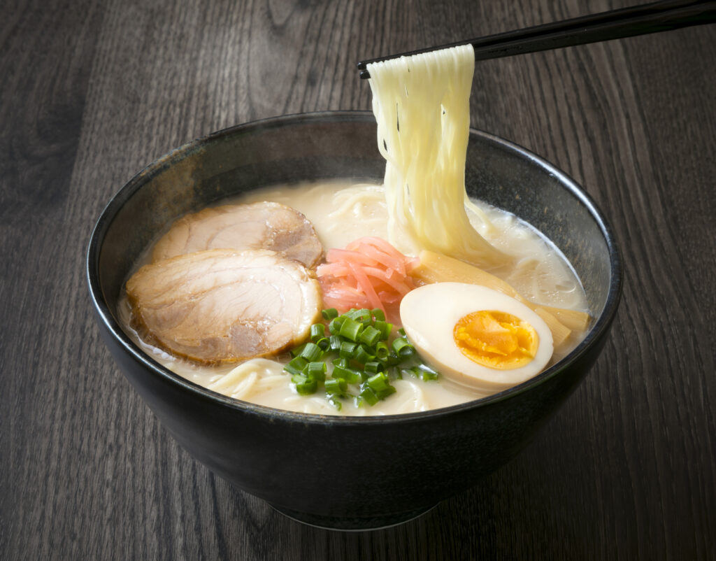
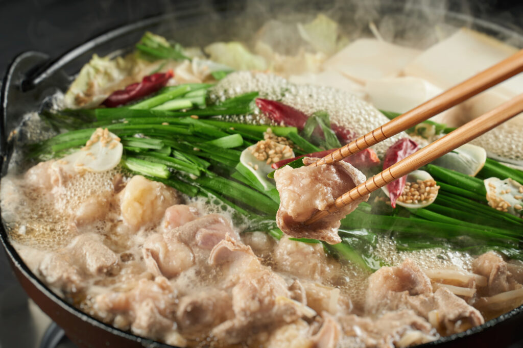
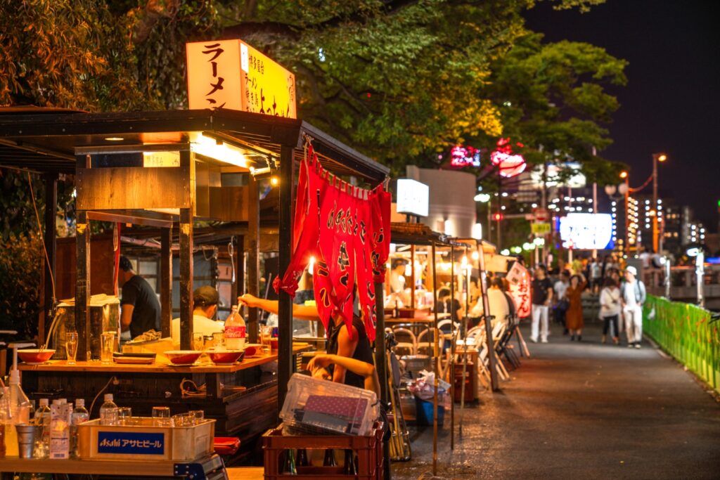
Fukuoka offers a wide variety of culinary delights. For dinner, try Hakata ramen, Motsu nabe (Motsu hot pot), and other local Fukuoka foods, or even try one of the famous Yatai stalls.
The driving map will show additional 10-20 sightseeing spots and local restaurants for the day!
You can travel freely, choosing only the spots you like!
Check pin color and MAPCODE usage.
Fukuoka is the biggest city in Kyushu and the gateway of Kyushu Travel. It takes 15 min to Fukuoka Airport by subway. There are hundreds of accommodations around “Hakata Station”, Nakasu downtown area, and “Tenjin Station”.
- Inn Type
Most of these inns are 2 to 5-star western-style hotels. - Parking
Some inns have official parking but in addition to the accommodation fee, the parking lot fee will be charged separately. - Onsen
There is no Onsen in this town and no inns have Onsens. - Meal Plan Reservations
As many restaurants are open till midnight, it is recommended to book your inns with breakfast only or without meals.
Unlock MAPCODE & Maps
We provide “Travel Kit” to make your journey much more attractive.
- Get “Hidden Gems” info along this itinerary
- Maximize travel time by parking MAPCODE for all spots
- Discover local delicacies with Restaurants List
Hotel&Car Booking
- Highly recommended to book a rental car first to book hotels with special discounts.
- Book hotels. Recommend hotels have parking and convenient locations for dining and strolling. Selected hotels can be booked with a single payment.
With rental car booking number, you can book hotels with exclusive discounts(Avg.18%, Max45% OFF)!
Rental Car Booking
Please rent a car with below “Rentalcars.com” link.
- The abundant number of rental cars
- Price comparisons with several major car rental companies
- Free cancellation

Pick-up & Drop-off Location Guide
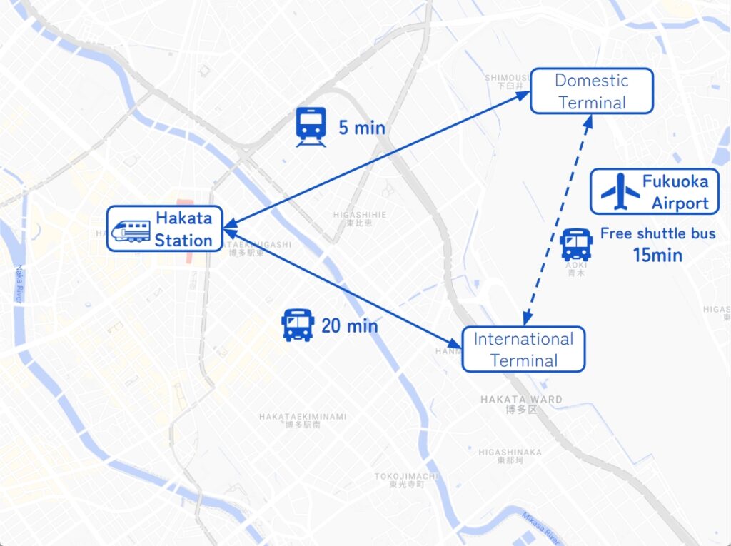
- Fukuoka Airport
The main international airport in Kyushu. Recommended for Pick-up.
If you arrive after 14:00, consider staying overnight in Fukuoka City and departing the next morning.
It takes 5-20min to Hakata station by metro or bus. - Fukuoka City
The biggest and gateway city in Kyushu. Most car rental shops are located around Hakata Station.
Important reminder for renting a car
- GPS(Car Navigation System)
MAPCODE from Drive Japan navigates you precisely to the parking lot. GPS from major car rental companies(Nippon, ORIX, Nissan, Times) are always MAPCODE compatible. However, if you are renting a car from another company, we recommend that you check with the rental company after making a reservation, just to be sure. - One-way Rental
You can rent at Fukuoka Airport and return to Fukuoka city, and vice versa. Normally, the one-way charge is free of charge. - Child Seat
In Japan, the use of a child safety seat or baby seat is mandatory for children under 5 years old.
Be sure to request one from “Extras”. - Snow Tire
Kyushu rarely gets much snow, even in winter. However, if you drive around Aso from December to February, recommend requesting it.