Summary
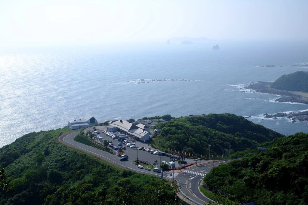
- Start
Fukuoka Airport or Hakata Station - Finish
Fukuoka Airport or Hakata Station - Mileage
Total 1890km
150km per day - Travel Pace
Relaxing - Onsen Stay
Max.9 nights - Recommended Seasons
All year round
This itinerary takes 13 days to circle the whole of Kyushu island.
By staying consecutive nights in 3 cities and standard daily mileage, you can travel at a pace that is not too rushed.
Fukuoka – Yufuin/Beppu(Sample)
Start : Fukuoka (福岡)
Finish :Yufuin(湯布院) or Beppu(別府)
Mileage:160km
Travel Pace: Fast
On this day, you will head from Fukuoka to Yufuin or Beppu.
1
Rental car branch at Fukuoka airport or Hakata Station
Parking MAPCODE:
9:00
There are many highlight sites along today’s route. And most of the shops at Yufuin are the biggest highlight of the day close around 17:00. Therefore, we strongly recommend leaving from 8:00 to 9:00.
If your departure time is late, such as leaving in the afternoon, adjust your schedule by taking the expressway or skipping some spots.
30min
2
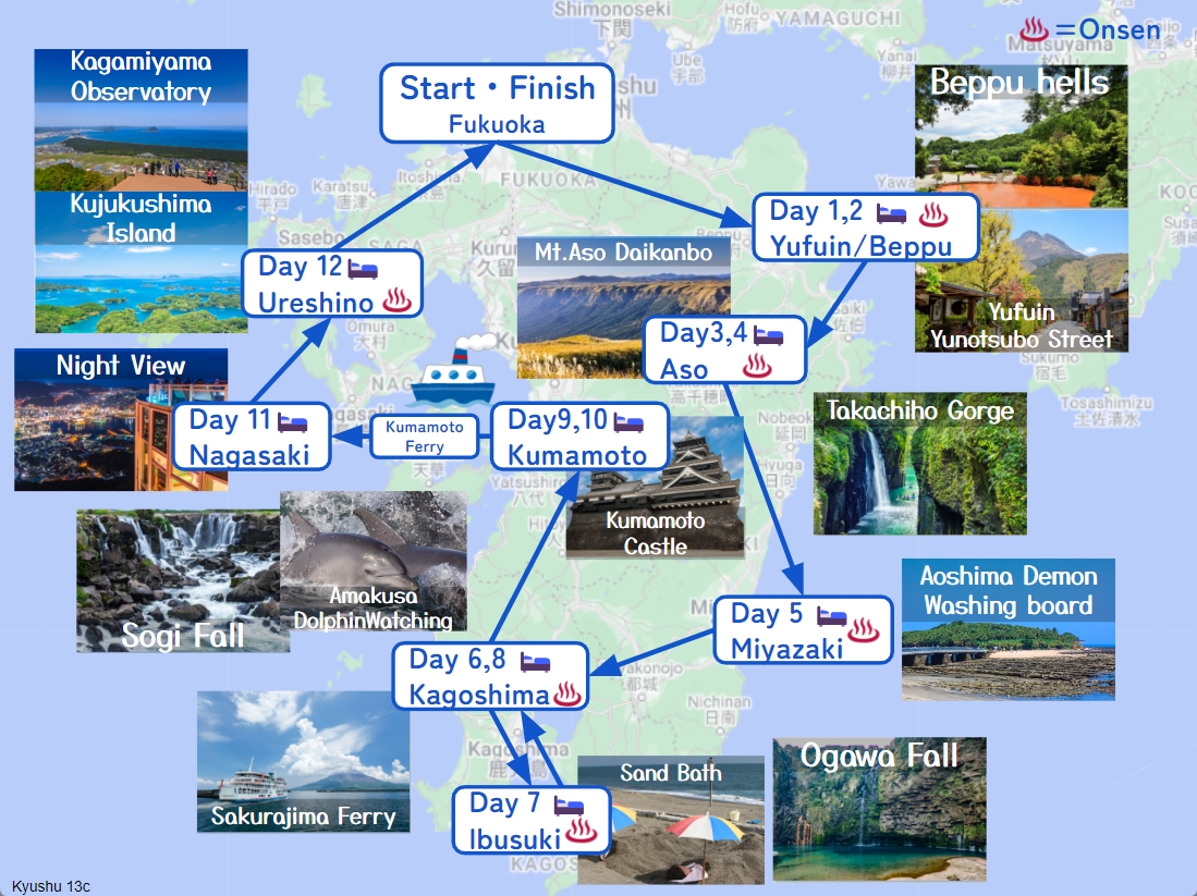
Dazaifu Tenmangu shrine-太宰府天満宮
Parking MAPCODE:
55 333 771*40What is MAPCODE?
9:30
The first destination is “Dazaifu Tenmangu Shrine”, nationally famous throughout Japan as the god of learning.
The approach from the parking lot to Tenmangu Shrine is called “Tenjin-sama-dori” avenue, which is crowded with many souvenir stores and restaurants.
If you like sweets and fruits, you can also enjoy fruit picking after visiting Tenmangu Shrine. Please refer to the driving map.
70min
3
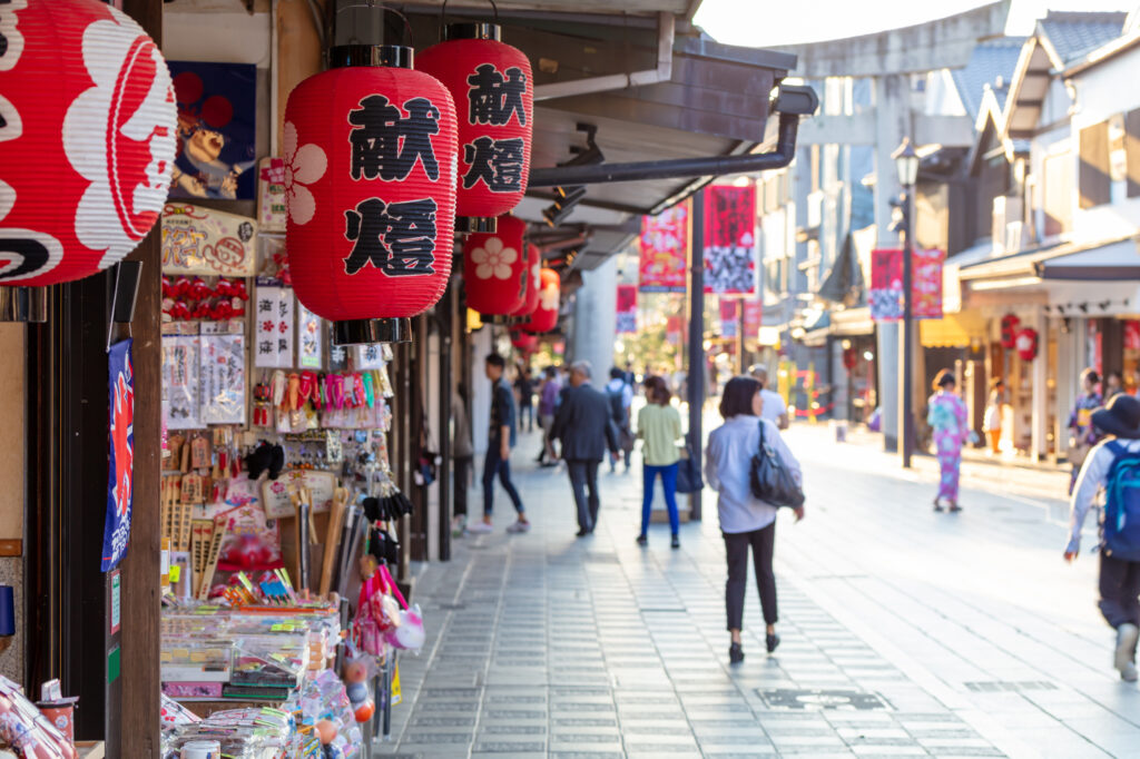
Sofuren-想夫恋本店
Parking MAPCODE:
202 788 789What is MAPCODE?
12:00
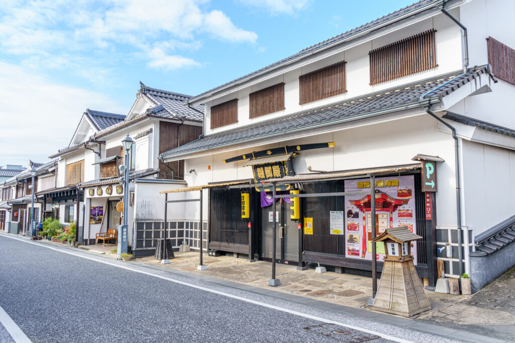
Recommended lunch is “Hita Yakisoba”, a local grilled noodle. If you have time, stop by the nearby “Hita Old Town” as it has a charming atmosphere.
After that, let’s head to Yufuin.
There are no spots between Hita and Yufuin. It is recommended to drive on the highway (E34).
50min
4
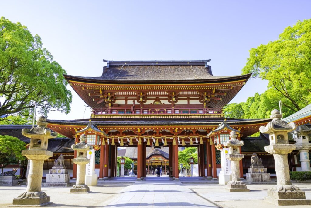
Yufuin Yunotsubo Street-湯布院湯の坪街道
Parking MAPCODE:
269 359 660*80What is MAPCODE?

13:45
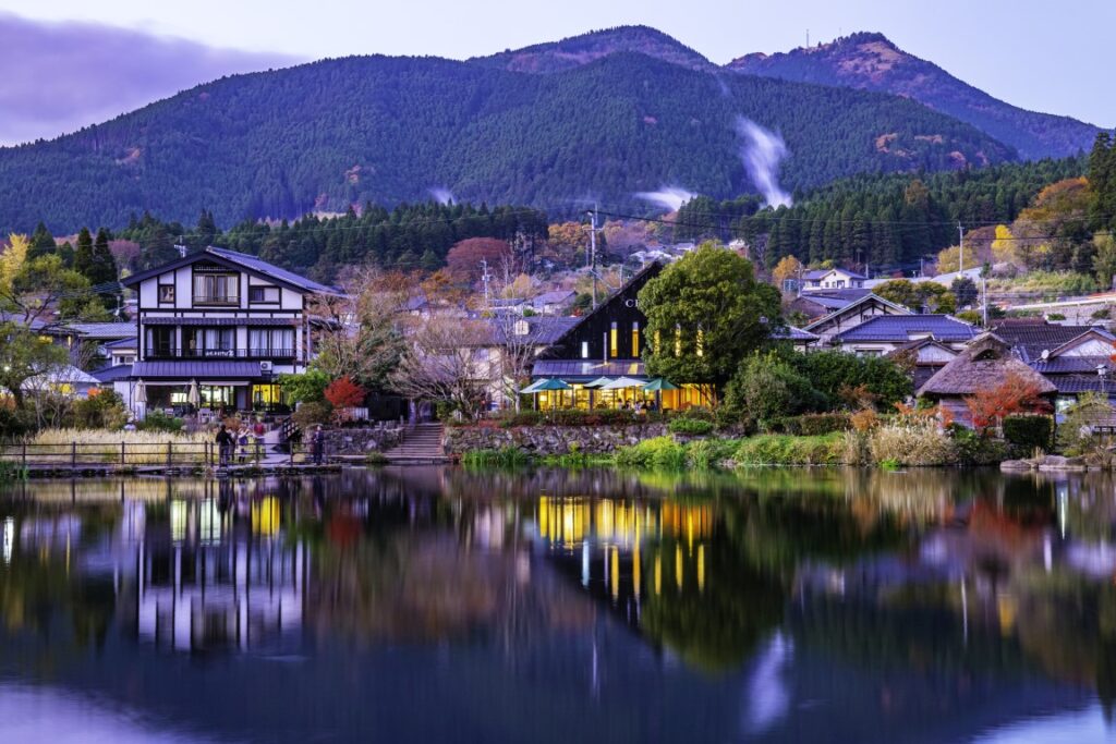
Once you arrive in Yufuin, we recommend strolling along the Yufuin Yunotsubo Kaido (Yufuin Yunotsubo Street), lined with souvenir stores and cute little sweet stores. Enjoy eating and walking to Kinrin-ko Lake at the road’s eastern end.
Another highlight of the day, the “Beppu Jigoku Hells”, will close at 17:00. If you wish to visit it, leave Yufuin by 3:30 p.m. at the latest.
30min
It is a 25-km, 30-minute drive from Yufuin to Beppu. The drive through the foot of Mt. Yufudake is exhilarating.

5
Beppu Jigoku Hells-べっぷ地獄めぐり
Parking MAPCODE:
46 521 411*30(Umi Jigoku)What is MAPCODE?
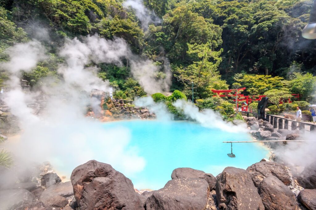
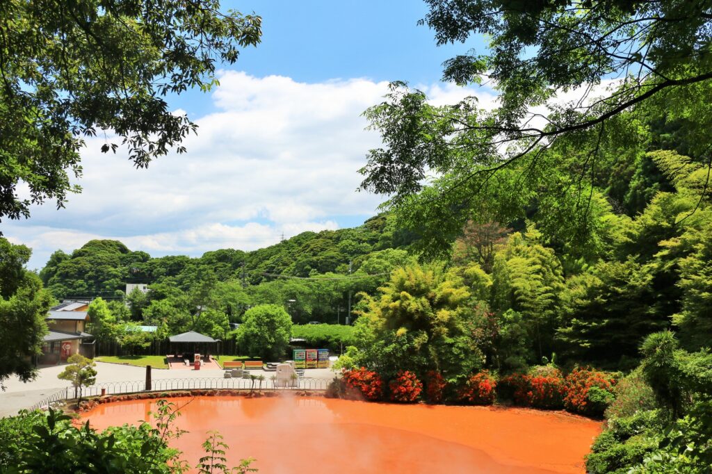
Onsen town Beppu symbolizes the “Beppu Jigoku Hells”, where hot water of various colors boils over! Five of the seven hells are within walking distance.
Be aware that the tour closes at 17:00 p.m.
15min
6
Inn in Yufuin or Beppu
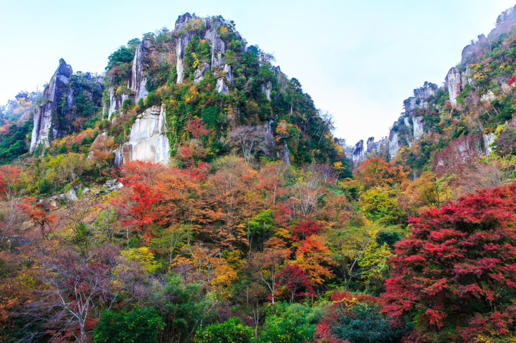
In addition, there are [Shin Yabakei Gorge(HitomeHakkei)] one of the best autumn-colored leave spot in Kyushu along the route of the day.
If you are traveling from end Oct-Mid Nov, we strongly recommend visiting.
The driving map will show additional 10-20 spots for the day! You will travel only to your favorite spots.
Check pin color and MAPCODE usage.
On this day, you will stay in either Yufuin town or Beppu city. It is 20km and takes about 30min. Both of them are nationally famous Onsen areas.
①Yufuin(湯布院)
Yufuin is small but has many luxury Onsen Ryokans.
- Inn Type
Most of these inns are 4 to 5-star Japanese-style Ryokans with Onsen facilities. - Parking
Most inns will offer free parking. - Onsen
This town is famous for Onsens and most of the inns have one. - Meal Plan Reservations
There are a few restaurants in this area, so be sure to make a reservation with a plan that includes dinner and breakfast.
②Beppu(別府)
Beppu is a Bigger City and has More Inexpensive Inns.
- Inn Type
Most of these inns are 3 to 5-star Japanese-style Ryokans with Onsen facilities. - Parking
Most inns have official parking but in addition to the accommodation fee, the parking lot fee will be charged separately. - Onsen
Beppu is famous for Onsens and most of the inns have one. - Meal Plan Reservations
As many restaurants are open till midnight, it is recommended to book your inns with breakfast only or without meals.
Yufuin/Beppu – Yufuin/Beppu🔒
Start:Yufuin/Beppu (由布院/別府)
Finish:Yufuin/Beppu (由布院/別府)
Mileage:70km
Travel Pace: Relaxed
The mileage on this day is about 70km, so you can relax and enjoy the sights.
1
Inn in Yufuin/Beppu
Parking MAPCODE:
🔒Book rental car or hotelWhat is MAPCODE?
9:00
On this day, though you will leisurely explore the city of Beppu and Yufuin, we recommend that you leave around 9:00.
20min
2
Beppu Jigoku Meguri
Parking MAPCODE:
🔒Book rental car or hotelWhat is MAPCODE?
9:20

We recommend the Beppu Jigoku Meguri (Beppu Hell Tour) at the beginning of the day. It is a tour where you can feel the hot spring power of Beppu Onsen. By using a car, you can efficiently visit the following seven sites.
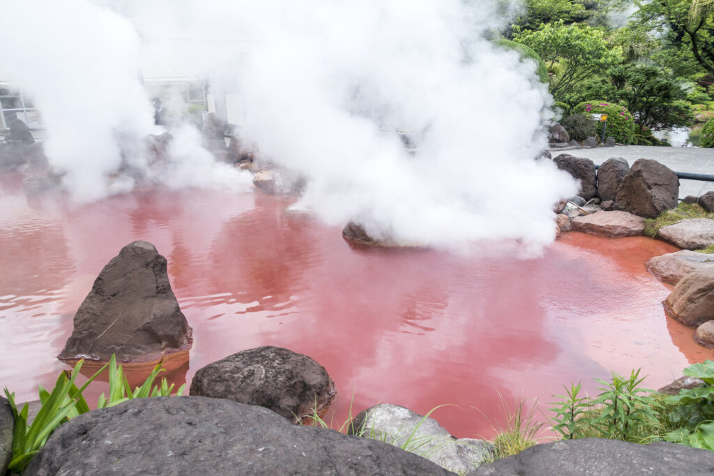
●Umi Jigoku (Time required: 40 minutes) MAPCODE: 46 521 411
●Oniishibozu Jigoku (Time required:15 minutes) You can walk since it’sLocated between Umi Jigoku and the parking lot.
Kamado Jigoku (Time required: 15 minutes) MAPCODE: 46 522 481
●Oniyama Jigoku (Time required: 20 minutes) You can walk from Kamado Jigoku since it’s located about 100m there.
●Shiraike Jigoku (Time required: 20 minutes) MAPCODE: 46 522 396
●Chinoike Jigoku (Time required: 10 minutes) MAPCODE: 46 552 802
●Tatsumaki Jigoku (Time required: 10 minutes) You can walk from Chinoike Jigoku since it’s located about 100m there.
15min
3
Lunch
Parking MAPCODE:
🔒Book rental car or hotelWhat is MAPCODE?
12:30
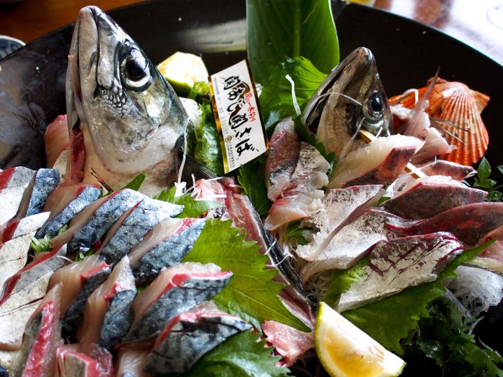
We recommend ‘Seki-saba’ for lunch on this day. There are many restaurants on the east side of Beppu Station. Mackerel and horse mackerel caught in the Bungo Channel, where the tide flows quickly, are called ‘Seki-saba’ and ‘Seki-aji’. Because of its deliciousness and crunchiness, it is valued as a luxury fish.
15min
4
Beppu Ropeway
Parking MAPCODE:
🔒Book rental car or hotelWhat is MAPCODE?
13:50
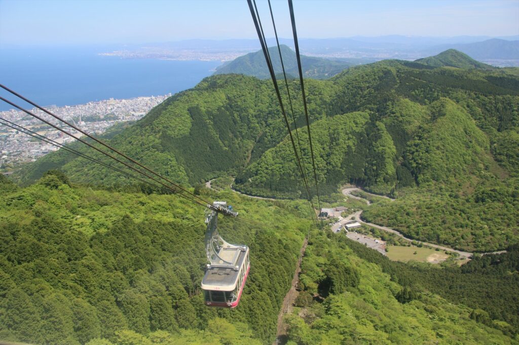
Next, you will head to Beppu Ropeway. It takes about 10 minutes from the foot of the mountain to the summit of Mt. Tsurumi, where you can enjoy a 360-degree panorama at an altitude of 1,375m. From there, you can see Beppu City, Beppu Bay, Lake Shidaka, Kijima Plateau, and the mountains of Shikoku. Cherry blossom season (Bgn Apr-End Apr) and autumn foliage season (End Oct-Mid Nov) are especially recommended.
20min
5
Yunotsubo Kaido
Parking MAPCODE:
🔒Book rental car or hotelWhat is MAPCODE?
15:40
Next, you will head to Yunotsubo Kaido in Yufuin. Yunotsubo Kaido is a very popular spot with many shops where you can enjoy eating while walking and sightseeing. We also recommend walking around Lake Kinrin.
35min
6
Inn in Yufuin/Beppu
Parking MAPCODE:
Please head to the hotel you bookedWhat is MAPCODE?
17:50
Please spend a relaxing second night in Yufuin/Beppu with gorgeous onsen.
The following sites are recommended for travelers with children.
Harmonyland is a theme park where you can meet Sanrio characters, including the popular Hello Kitty. Adults and children alike can enjoy gorgeous live shows such as the daily parade, as well as many attractions.
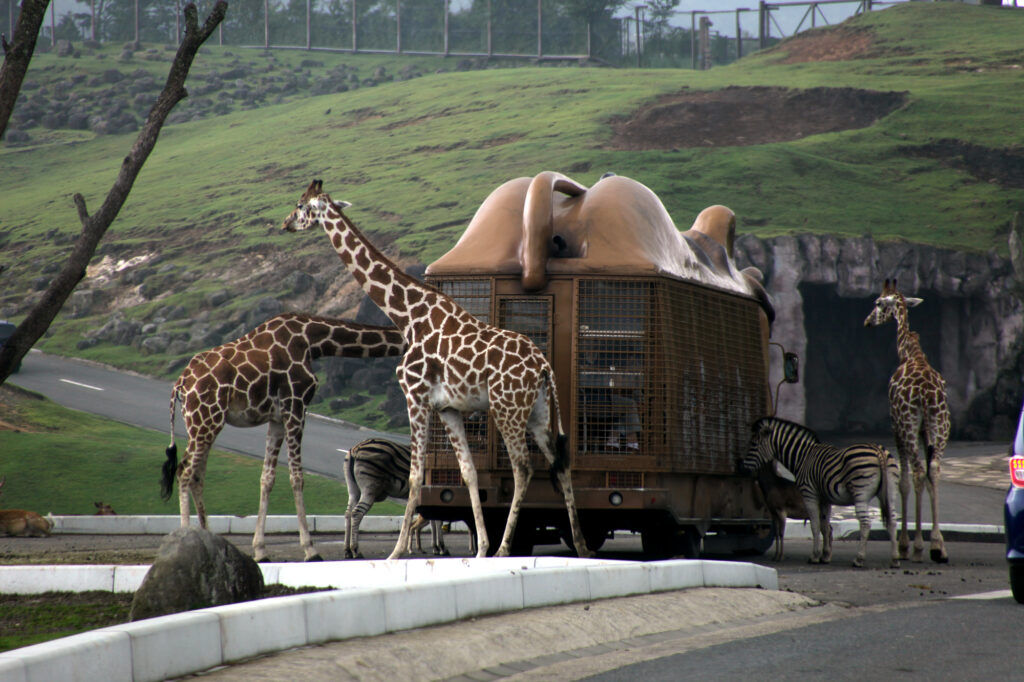
Kyushu Natural Zoological Park African Safari is the only safari park in Kyushu where wild animals live freely in a vast prairie of 1.15 million square meters.
The driving map will show additional 10-20 spots for the day! You will travel only to your favorite spots.
Check pin color and MAPCODE usage.
On this day, you will stay in either Yufuin town or Beppu city. It is 20km and takes about 30min. Both of them are nationally famous Onsen areas.
①Yufuin(湯布院)
Yufuin is small but has many luxury Onsen Ryokans.
- Inn Type
Most of these inns are 4 to 5-star Japanese-style Ryokans with Onsen facilities. - Parking
Most inns will offer free parking. - Onsen
This town is famous for Onsens and most of the inns have one. - Meal Plan Reservations
There are a few restaurants in this area, so be sure to make a reservation with a plan that includes dinner and breakfast.
②Beppu(別府)
Beppu is a Bigger City and has More Inexpensive Inns.
- Inn Type
Most of these inns are 3 to 5-star Japanese-style Ryokans with Onsen facilities. - Parking
Most inns have official parking but in addition to the accommodation fee, the parking lot fee will be charged separately. - Onsen
Beppu is famous for Onsens and most of the inns have one. - Meal Plan Reservations
As many restaurants are open till midnight, it is recommended to book your inns with breakfast only or without meals.
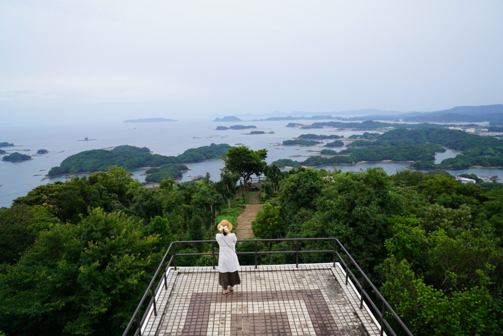
Yufuin/Beppu – Aso🔒
Start:Yufuin(湯布院) or Beppu(別府)
Finish: Aso(阿蘇)
Mileage:140km
Travel Pace: Normal
On this day, you will head from Yufuin/Beppu to Aso.
The driving distance is about 140 km. This is a day where you can enjoy three of Kyushu’s most spectacular driving roads.
1
Inn in Yufuin or Beppu
Parking MAPCODE:
🔒Book rental car or hotelWhat is MAPCODE?
9:00
Because there are so many pots to see, we recommend leaving by 8-9 am if you want to travel without rushing.
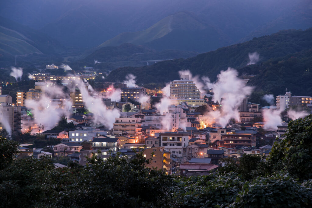
If you are staying in Beppu, go to the “Yukemuri Observatory” first, and you will see the typical Beppu scene of steam rising.
60min
2
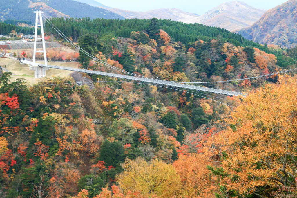
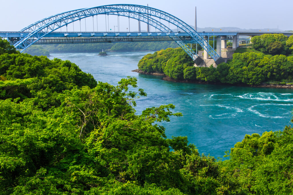
Kokonoe Suspension Bridge-九重夢大吊橋
Parking MAPCODE:
🔒Book rental car or hotelWhat is MAPCODE?
10:20
The first destination is the Kokonoe Suspension Bridge. It is the highest suspension bridge for pedestrians in Japan and is a must-see, especially during the season of fresh green leaves and autumn foliage.
40min
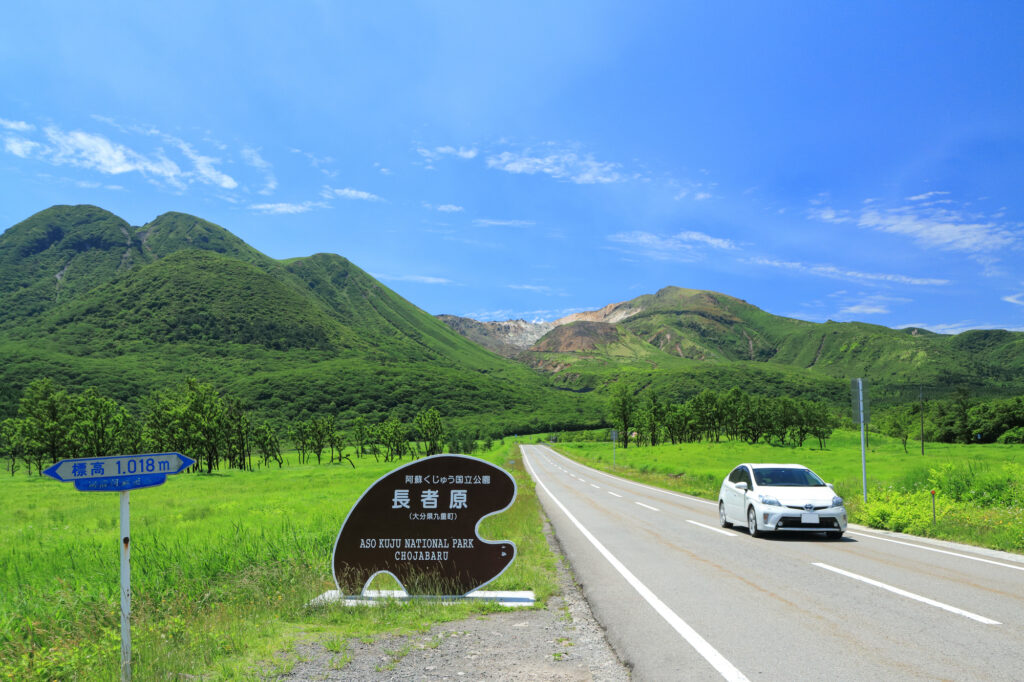
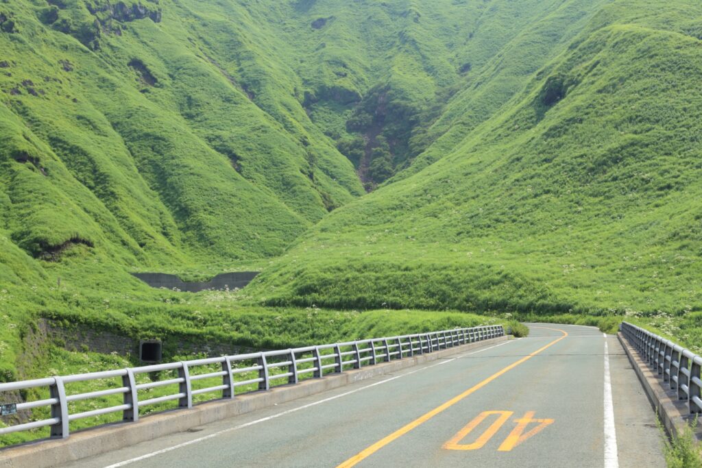
Head south on the Yamanami Highway, the third most popular driving route in Japan. On the way, you can enjoy a fresh yogurt drink at a ranch and a 1km walk in the marshland at Chojabaru. Please refer to the driving map.
Note that Yamanami Highway is a nickname and is actually a public road, not an expressway.
3
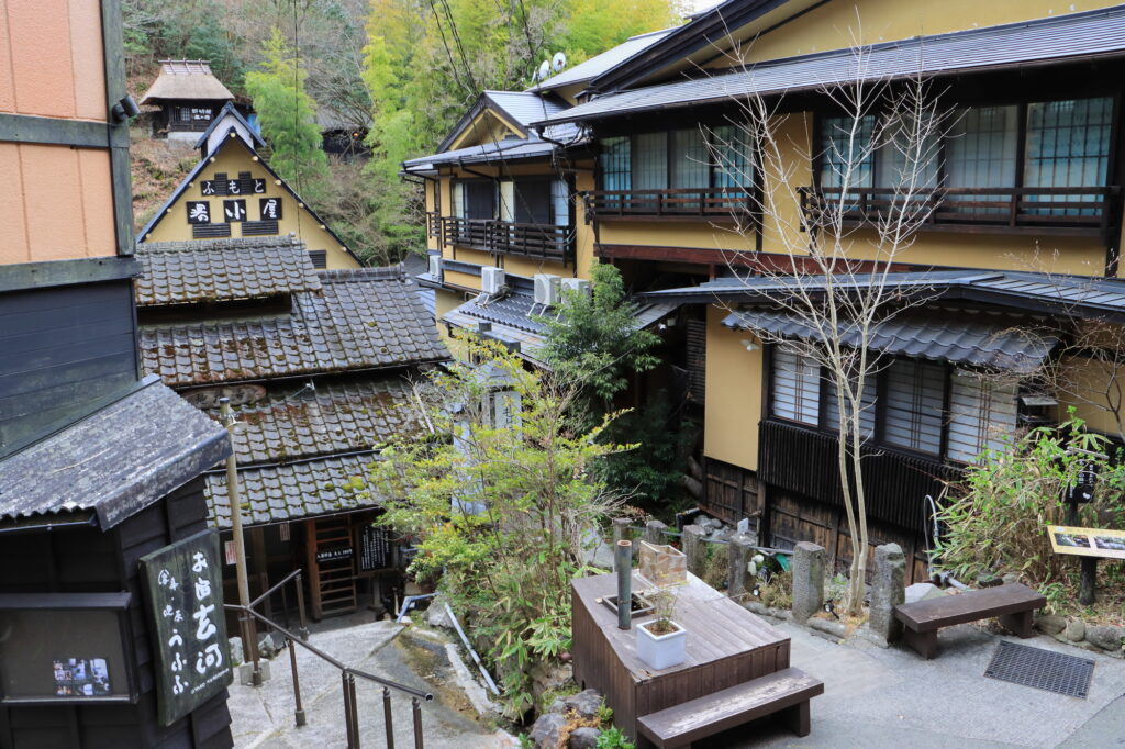
Kurokawa Onsen town-黒川温泉
Parking MAPCODE:
🔒Book rental car or hotelWhat is MAPCODE?
12:00
Kurokawa Onsen is a great place for lunch. There are nice curry shops and excellent cream puffs. This spot is also very crowded on holidays. Beyond Kurokawa Onsen, there are a number of soba noodle shops called Oguni Soba Road, which is also recommended. Please refer to the driving map.
35min
4
Nishiyunouraenchi Observatory-西湯浦園地展望所
Parking MAPCODE:
🔒Book rental car or hotelWhat is MAPCODE?
14:15
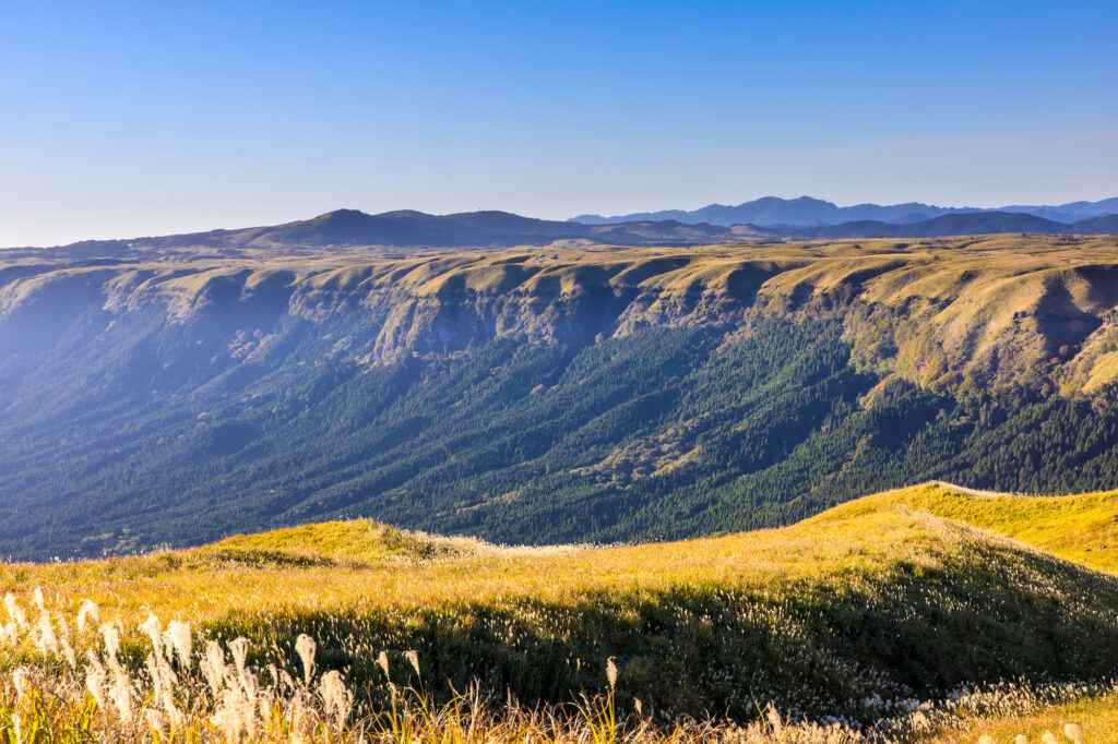
Further south down the Yamanami Highway is the “Nishiyunouraenchi Observatory”. Although not very famous, this is Drive Japan’s best lookout point overlooking the Mt.Aso caldera.
10min
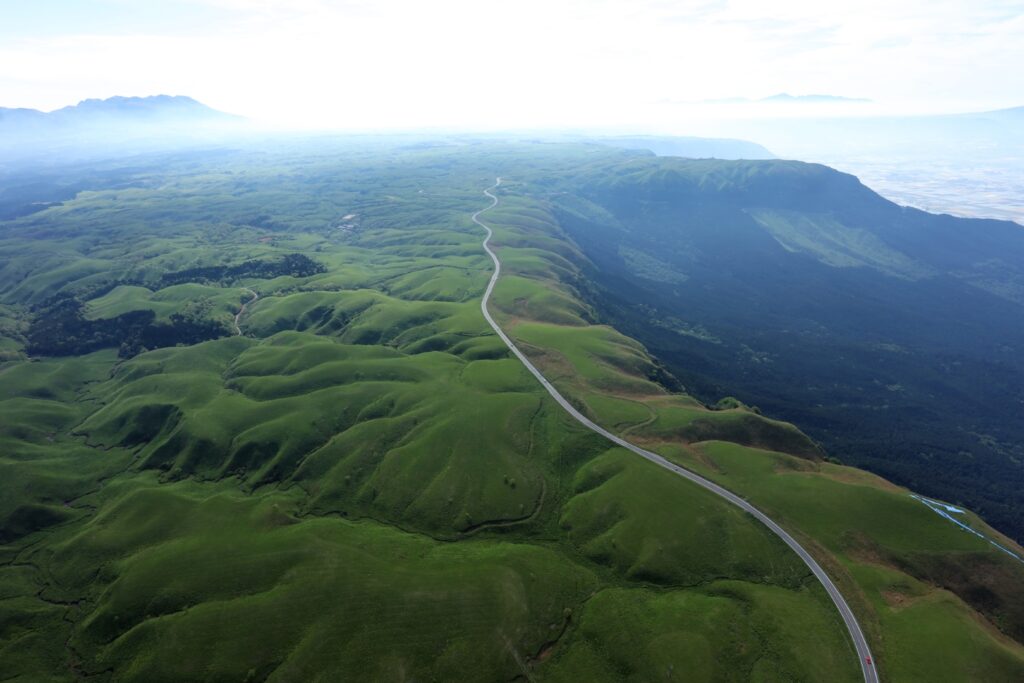
The “Milk Road” from Nishiyunouraenchi Observatory to Daikanbo is the most spectacular road of this road trip, passing by the edge of the caldera of Mt.Aso. The most pleasant drive will make you want to scream, and it will surely be a memory you will cherish forever.
5
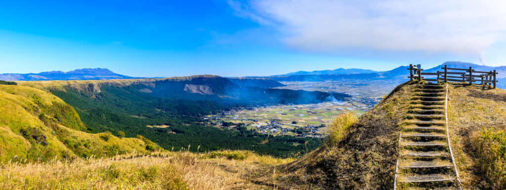
Daikanbo Observatory-大観峰
Parking MAPCODE:
🔒Book rental car or hotelWhat is MAPCODE?
14:45
This is the most famous observatory in the Mt.Aso caldera. Enjoy a 1 km round trip walk on the plateau from the parking lot to the observatory.
30min
6
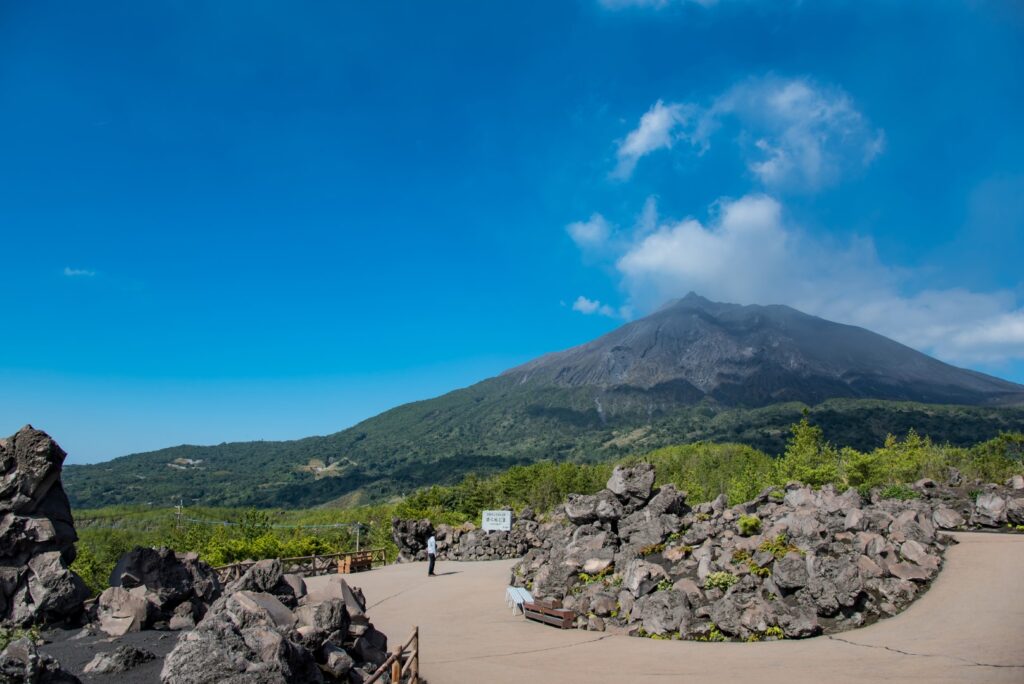
Mt.Aso(Kusasenri)-草千里
Parking MAPCODE:
🔒Book rental car or hotelWhat is MAPCODE?
16:15
If you still have time, head to “Kusasenri” on Mt. Aso.
Panorama Line Road, which was ranked No. 1 in Japan in a motorcycle magazine, will greet you with the sight of vast grasslands.
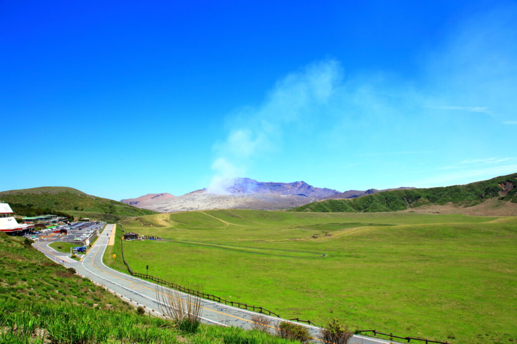
If there are no restrictions on volcanic gases, you can visit the crater. You can take the Aso Park toll road (800 yen) to the parking lot next to the crater.
Please check current restrictions before your visit.
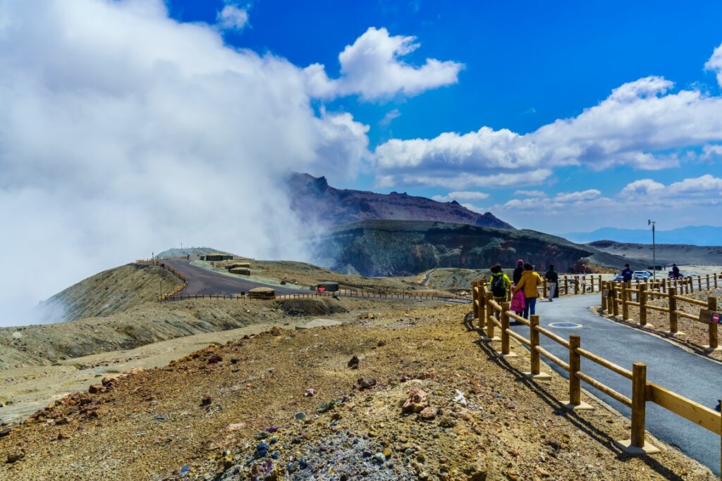
Information on restrictions for the Aso Volcano Center
30min
There are also flower gardens such as “Gandhi Farm” and “Kujyu Flower Park” on this day. If you are traveling during the best time for flowers, give priority to this area.

7
Inn in Aso
The driving map will show additional 10-20 hidden gems and local restaurants for the day!
You can travel freely, choosing only the spots you like!
Check pin color and MAPCODE usage.
Aso town is a small town located inside the vast caldera of Mt.Aso. The inns are spread over a wide area around Mt. Aso.
- Inn Type
There are a variety of inns from 3-star western-style hotels to 5-star Japanese Ryokans. Please book at your preferred type of inn. - Parking
Most inns will offer free parking. - Onsen
Some luxury Ryokans have Onsen. - Meal Plan Reservations
Aso is a rural area and there are few restaurants. Be sure to make a reservation with a plan that includes dinner and breakfast.
Aso – Aso🔒
Start: Aso(阿蘇)
Finish: Aso(阿蘇)
Mileage:90km
Travel Pace: Relax
Today, you will enjoy a day trip around Mt.Aso as you will be staying in Aso for consecutive nights.
The driving distance will vary depending on the destination, but in the case of the recommended round trip to Kikuchi Gorge, it will be about 90 km.
1
Inn in Aso
Parking MAPCODE:
10:00
Due to the short driving distance, it is okay to depart at a leisurely pace.
However, if you did not visit ”Mt.Aso Nakadake Crater” and “Kusasenri” yesterday, leave early and go there first.


10min
2
Fruits Kingdom Couples (Fruit picking) – 果実の国カップルズ
Parking MAPCODE:
🔒Book rental car or hotelWhat is MAPCODE?

10:10
Your first stop of the day is Fruits Kingdom Couples. You can pick fruit all year round while looking out at the majestic Mt. Aso.
40min
3
Oshitoishi Hill-押戸石の丘
Parking MAPCODE:
🔒Book rental car or hotelWhat is MAPCODE?

12:20
Next, you will head to Oshitoishi Hill which is said that it was a place of prayer for ancient people.
There are many artificially arranged stones scattered, such as a ”giant rock” in the shape of a pyramid, a ”mirror stone” inscribed with Sumerian characters, and a ”scissor stone” that is said to have served as a sundial.
30min
4
Kikuchi Gorge-菊池渓谷
Parking MAPCODE:
🔒Book rental car or hotelWhat is MAPCODE?

14:00
You will then head to Kikuchi Gorge, the highlight of the day. The mountain streams create various rapids and waterfalls, and the scenery is truly spectacular. You can enjoy the beautiful scenery in all four seasons, with fresh greenery in spring, a natural cooler in summer, and autumn leaves in fall.

20min
5
Great scenic location on Milk Road-ミルクロード
Parking MAPCODE:
🔒Book rental car or hotelWhat is MAPCODE?

15:30
Milk Road, known for its spectacular views, is located on the way from Kikuchi Gorge to Sugi Bee Garden. The scenery is truly spectacular, so stop your car and enjoy the scenery.
20min
6
Sugi Bee Garden Aso Farm Store -杉養蜂園みつばち牧場
Parking MAPCODE:
🔒Book rental car or hotelWhat is MAPCODE?

16:10
Your last destination for the day is Sugi Bee Garden, Japan’s largest beekeeping company with over 70 years of history, but this is a special store with an actual apiary in the back. You can enjoy an overwhelming selection of products and bee soft serve ice cream more than any other store.
This place closes at 17:00, so be careful of the time.
20min
There are some cherry blossom viewing spots along the route on this day. If you visit during the cherry blossom season, please refer to the driving map.
7
Inn in Aso
Parking MAPCODE:
Please head to the hotel you reserved.What is MAPCODE?
Please return to the same inn in Aso as the previous day.
The driving map will show an additional 10-20 spots for the day! You will travel only to your favorite spots.
Check pin color and MAPCODE usage.
Aso town is a small town located inside the vast caldera of Mt.Aso. The inns are spread over a wide area around Mt. Aso.
- Inn Type
There are a variety of inns from 3-star western-style hotels to 5-star Japanese Ryokans. Please book at your preferred type of inn. - Parking
Most inns will offer free parking. - Onsen
Some luxury Ryokans have Onsen. - Meal Plan Reservations
Aso is a rural area and there are few restaurants. Be sure to make a reservation with a plan that includes dinner and breakfast.
Aso – Miyazaki🔒
Start: Aso(阿蘇)
Finish: Miyazaki(宮崎)
Mileage:210km
Travel Pace: Fast
The driving distance on this day is very long, approximately 210 km.
The second half of that 70 km will be on the expressway.
1
Inn in Aso
Parking MAPCODE:
🔒Book rental car or hotelWhat is MAPCODE?
9:00
This is a long drive on this day, so if you want to travel without rushing, we recommend leaving by 8-9 am.
75min
2
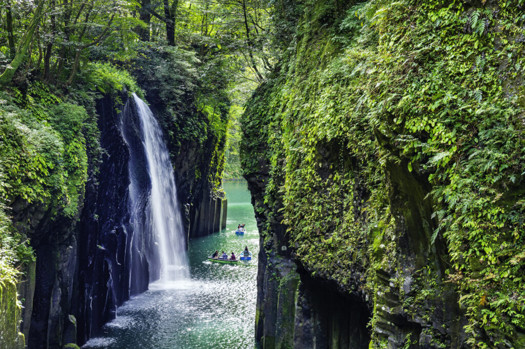
Takachiho Gorge-高千穂峡
Parking MAPCODE:
🔒Book rental car or hotelWhat is MAPCODE?
11:15
First, let’s move on at once to visit “Takachiho Gorge”. It is one of the most beautiful gorges all over Japan and one of the most recommended spots on this entire road trip.
Boat rentals are very popular and sometimes crowded, but highly recommended!
10min
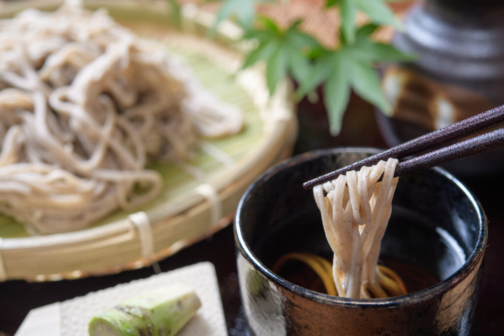
There are not many restaurants in Takachiho, but please refer to the driving map for recommended soba restaurants and Takachiho beef restaurants.
3
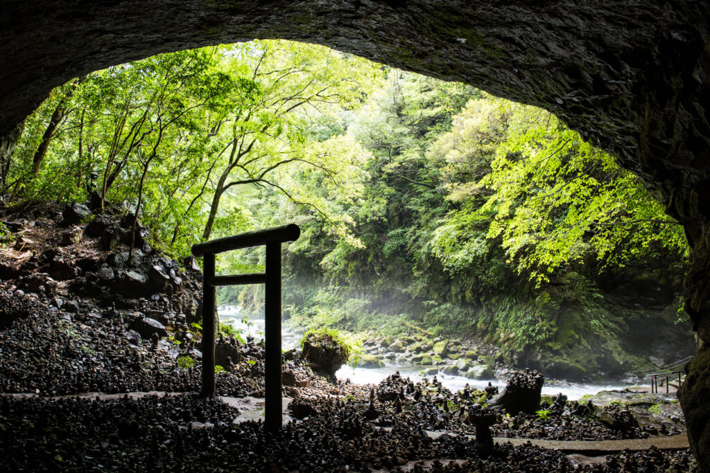
Amanoiwato Shrine-天岩戸神社
Parking MAPCODE:
🔒Book rental car or hotelWhat is MAPCODE?
12:45
10km away from Takachiho Gorge, the “Amanoiwato Shrine” is also recommended. A 10-minute walk along a riverside path called “Amanoyasukawara” will lead you to a fantastic torii gate in a cave.
After that, drive east toward the ocean. The long drive after lunch will make you sleepy, so take a break at one of the roadside stations along the way.
80min
4
Umagase-馬ヶ背
Parking MAPCODE:
🔒Book rental car or hotelWhat is MAPCODE?

15:00
“Umagasa” is a long, narrow cape jutting out into the Pacific Ocean, offering a panoramic view.
“The Sea of Cross”, a lookout point where the sea looks like a cross, is also close by and should be visited together.

It is 80 km from Miyazaki. There are not many spots in between, so you can take the expressway (E10) all the way.
80min
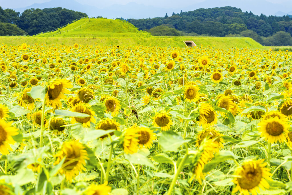
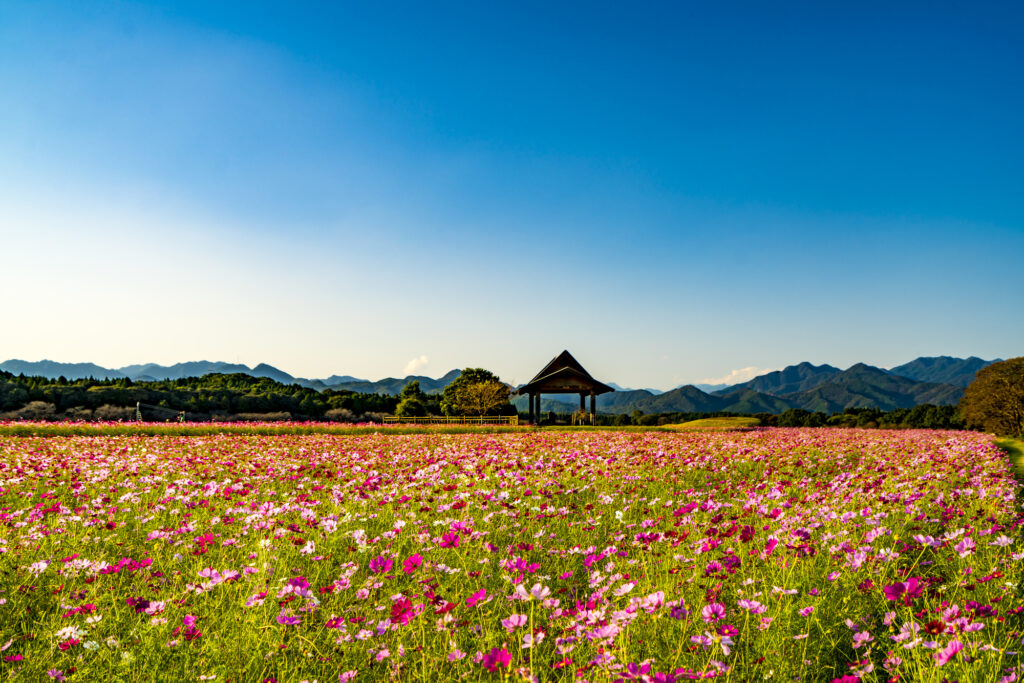
The Saitobaru Kofun, located before Miyazaki City, is one of the best flower spots in Kyushu. Especially the cherry blossoms and rape blossoms in spring, sunflowers in summer, and cosmos in fall makes this spot a must-see! If you are traveling during the best time for flowers, give priority to this area.

5
Inn in Miyazaki
Parking MAPCODE:
Please head to the hotel you reserved.What is MAPCODE?
Rest early because the next day will be another long drive.
The driving map will show additional 10-20 sightseeing spots and local restaurants for the day!
You can travel freely, choosing only the spots you like!
Check pin color and MAPCODE usage.
On this day, you will stay in Miyazaki city(宮崎). The inns are concentrated on the west side of Miyazaki station. “Nishitachi(ニシタチ)” area is downtown of the city and convenient for dinner.
Additionally, there is “Sheraton Grande Ocean Resort” by far the largest hotel in the city, with 700 rooms. If you are looking for a relaxing stay, this is also a good choice.
- Inn Type
Most of these inns are 3 to 4-star western-style hotels. - Parking
Some inns have official parking but in addition to the accommodation fee, the parking lot fee will be charged separately. - Onsen
There is no Onsen in this town. If you would like to enjoy an Onsen, “Sheraton” is recommended. - Meal Plan Reservations
As many restaurants are open till midnight, it is recommended to book your inns with breakfast only or without meals.
Miyazaki – Kagoshima🔒
Start :Miyazaki(宮崎)
Finish:Kagoshima(鹿児島)
Mileage:200km
Travel Pace: Fast
On this day, you will go from Miyazaki to Kagoshima.
The driving distance on this day is very long, approximately 200 km.
1
Inn in Miyazaki
Parking MAPCODE:
🔒Book rental car or hotelWhat is MAPCODE?
9:00
Because of the long driving and many attractive spots along the route, we recommend that you leave by 8-9 am.
30min
2
Aoshima Island-青島 鬼の洗濯板
Parking MAPCODE:
🔒Book rental car or hotelWhat is MAPCODE?

9:30
The first destination is Aoshima Island, one of Miyazaki’s most popular tourist destinations. You can walk around the island with its unique scenery, called “Oni no Sentakuita” (washing board of demons).
30min
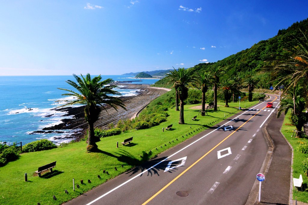
From Aoshima, head south along the Pacific Ocean. From the Horikiri Pass, the “Nichinan Phoenix Road” is a scenic driving course. The drive along the coastline where palm trees grow along the precipitous cliffs is the best way to feel the tropical area of Miyazaki.
3
Udo Shrine-鵜戸神宮
Parking MAPCODE:
🔒Book rental car or hotelWhat is MAPCODE?

11:00
Heading south along the Nichinan coastline, you will arrive at [Udo Jingu Shrine].
The shrine is located in an incredible place in a cave between steep cliffs, and the contrast between the blue of the sea and the red of the shrine is magnificent. The shrine is dedicated to Emperor Jinmu, the first emperor in Japanese mythology, and is especially blessed with children.
110min
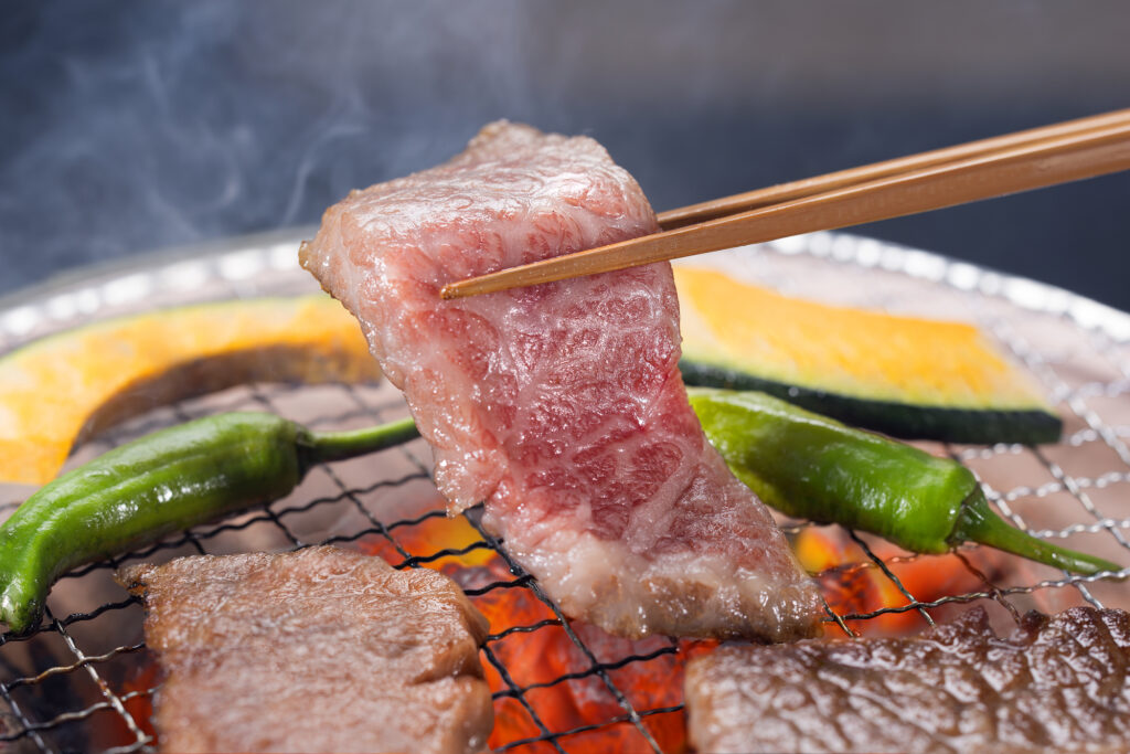
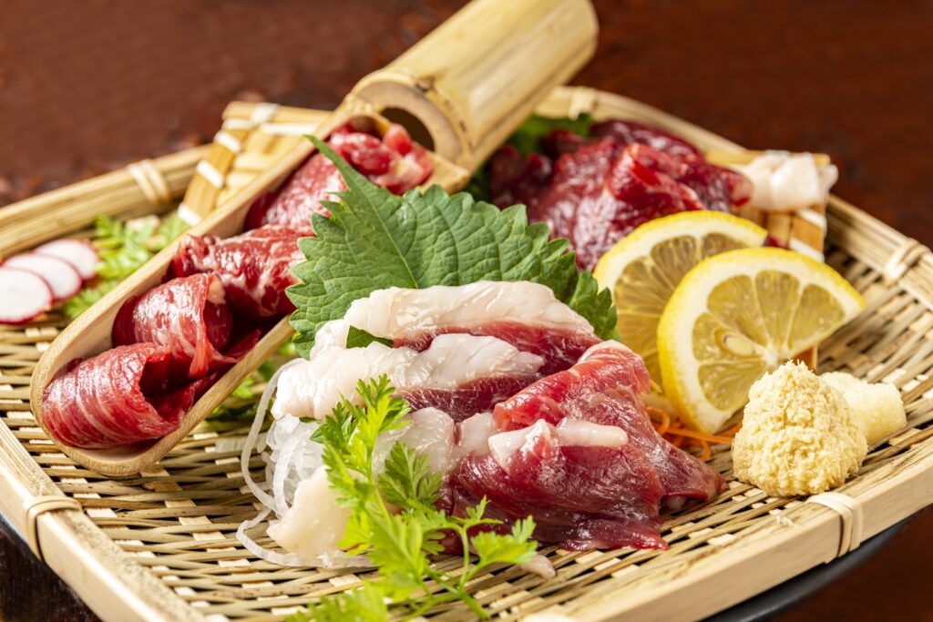
For lunch, grilled meat is recommended in Miyakonojo City, which produces the largest amount of meat in Japan, but if you are short on time, Miyazaki’s specialty, “Chicken Nanban(チキン南蛮)”, is also recommended at the roadside station along the way. Please refer to the driving map.
4
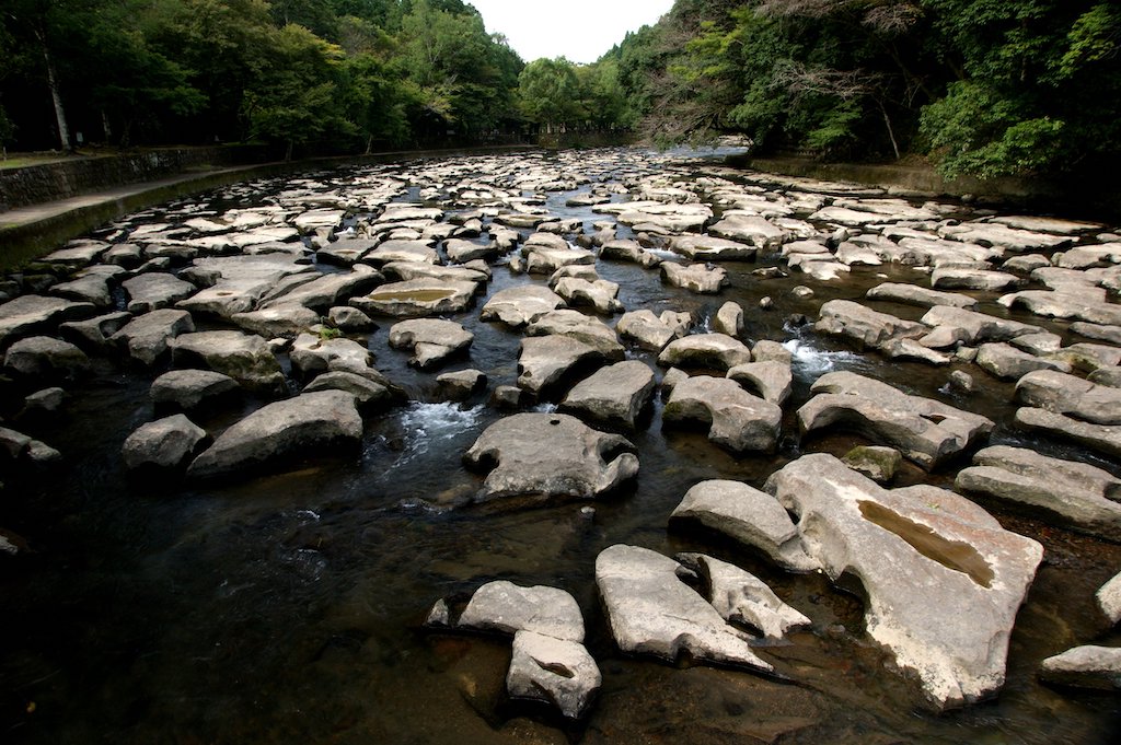
Sekinoo Falls-関之尾の滝 甌穴群
Parking MAPCODE:
🔒Book rental car or hotelWhat is MAPCODE?
15:00
After lunch, you will visit “Sekinoo Falls”.
You can take a 30-minute walk along the river with its mysterious scenery of waterfalls and potholes.
30min
5
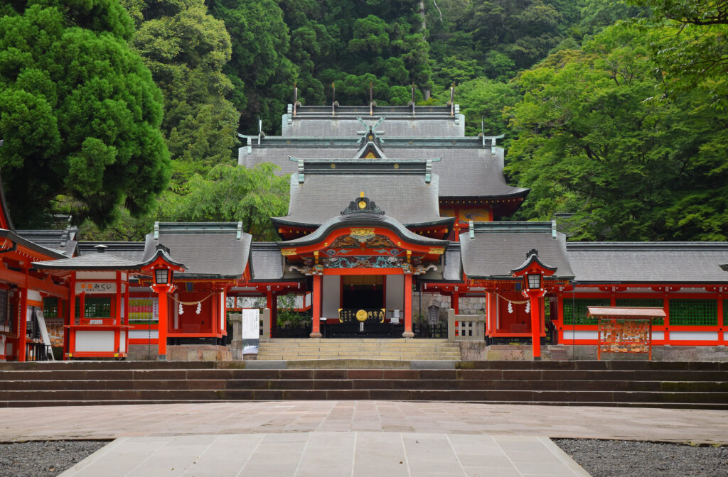
Kirishima Shrine-霧島神宮
Parking MAPCODE:
🔒Book rental car or hotelWhat is MAPCODE?
16:30
The final destination is Kirishima Jingu Shrine, which was built over 1,000 years ago. The shrine is especially beautiful during the season of fresh green leaves and autumn foliage.
Since there are few tourist attractions from Kirishima to Kagoshima, it is recommended to drive on the expressway (E3).
6
Inn in Kagoshima
The driving map will show additional 10-20 sightseeing spots and local restaurants for the day!
You can travel freely, choosing only the spots you like!
Check pin color and MAPCODE usage.
On this day, you will stay in Kagoshima city(鹿児島). The inns are concentrated around “Kagoshima Chuo station” and the downtown “Tenmonkan(天文館)” area.
- Inn Type
Most of these inns are 3 to 5-star western-style hotels. - Parking
Some inns have official parking but in addition to the accommodation fee, the parking lot fee will be charged separately. - Onsen
Most inns don’t have Onsens. If you would like to enjoy it, “Shiroyama hotel”, one of Kagoshima’s most prestigious hotels is recommended. - Meal Plan Reservations
As many restaurants are open till midnight, it is recommended to book your inns with breakfast only or without meals.
Kagoshima – Ibusuki🔒
Start: Kagoshima(鹿児島)
Finish : Ibusuki (指宿)
Mileage:100km
Travel Pace: Relax
On this day, you will head from Kagoshima to Ibusuki.
1
Inn in Kagoshima
Parking MAPCODE:
Car Ferry Booking for tomorrow
Before checking out of your accommodation, make a reservation for the ferry you plan to take the next morning. You’ll need to call, so it’s a good idea to ask the staff at your inn to make a reservation. The reservation details are as follows.
- Company:
- Ferry Nankyu(フェリーなんきゅう)
- TEL
- +81‐993-34-0012 (Office Hours 8:00-16:30)
- Reservation Detail
- Tomorrow Morning10am departure
- From Yamakawa Port(山川港) to Nejime Port(根占港)
- Reservations are not accepted during the following peak periods.
In that case, please give up on making advance reservations and try to arrive at the port early next mornin- Year-end and New Year holidays(Around 24Dec to 5Jan)
- Golden Week (End April-Bgn May)
- Obon (Mid August)

9:00
The distance traveled on this day is relatively short at approximately 100km, so you can spend your time relaxing at each spot.
10min
2
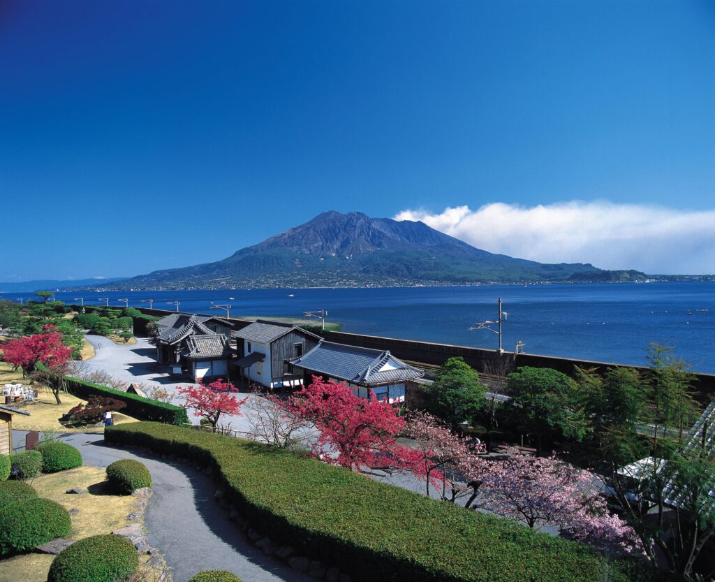
Shiroyama Park Observation Deck-城山公園展望台
Parking MAPCODE:
🔒Book rental car or hotelWhat is MAPCODE?
9:10
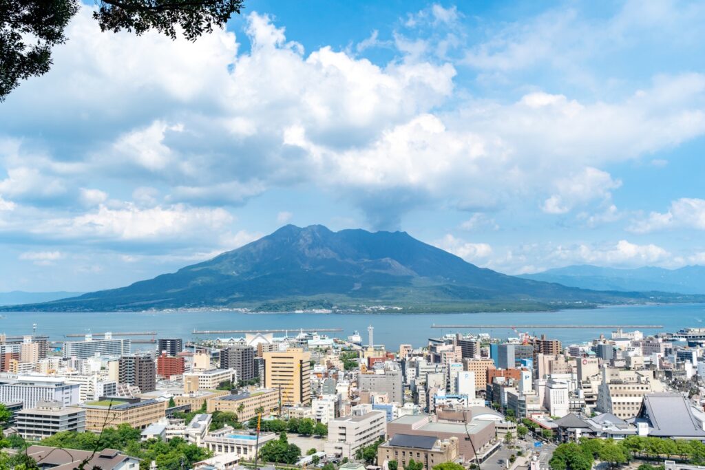
If you haven’t yet, go to “Shiroyama Park Observation Deck” first thing in the morning. You can see the majestic view of Sakurajima, the symbol of Kagoshima.
60min
3
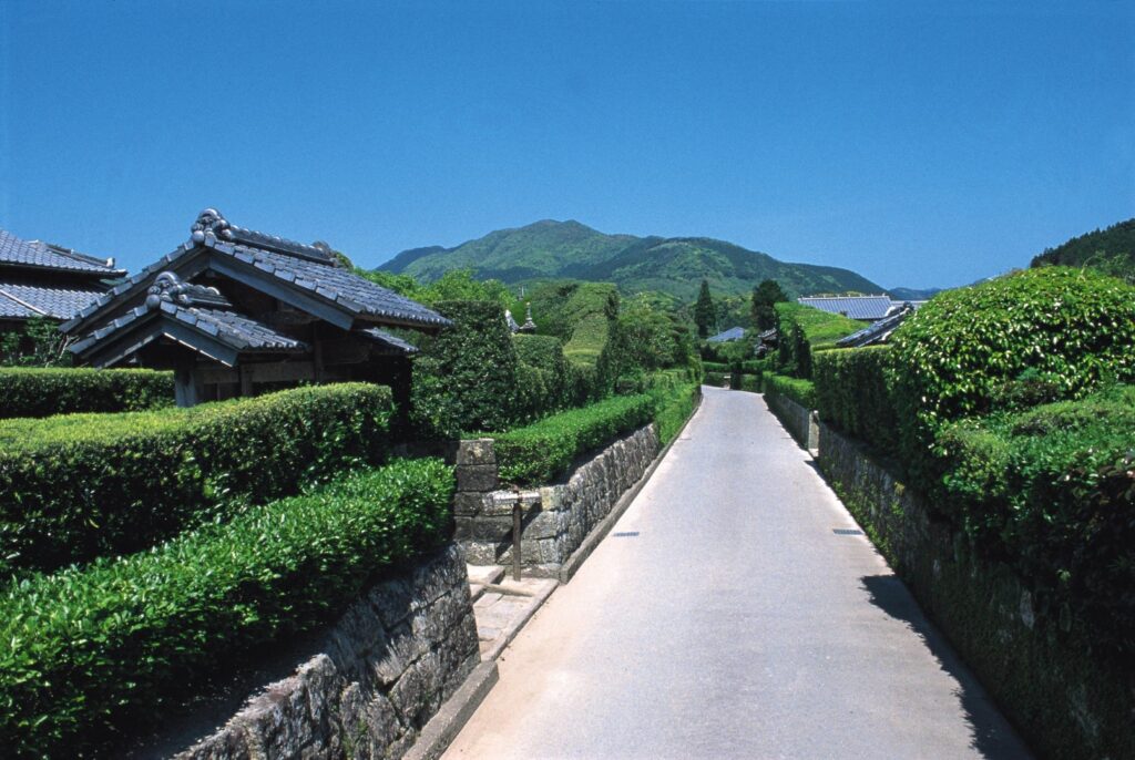
Chiran Samurai house district – 知覧武家屋敷群
Parking MAPCODE:
🔒Book rental car or hotelWhat is MAPCODE?
10:40
Next, you will head to the “Chiran Samurai Residences“. Take a leisurely stroll through the samurai residences known as Kagoshima’s Little Kyoto. There are several cafes and restaurants here that have been renovated samurai residences and old folk houses, so be sure to enjoy lunch there.
10min
4
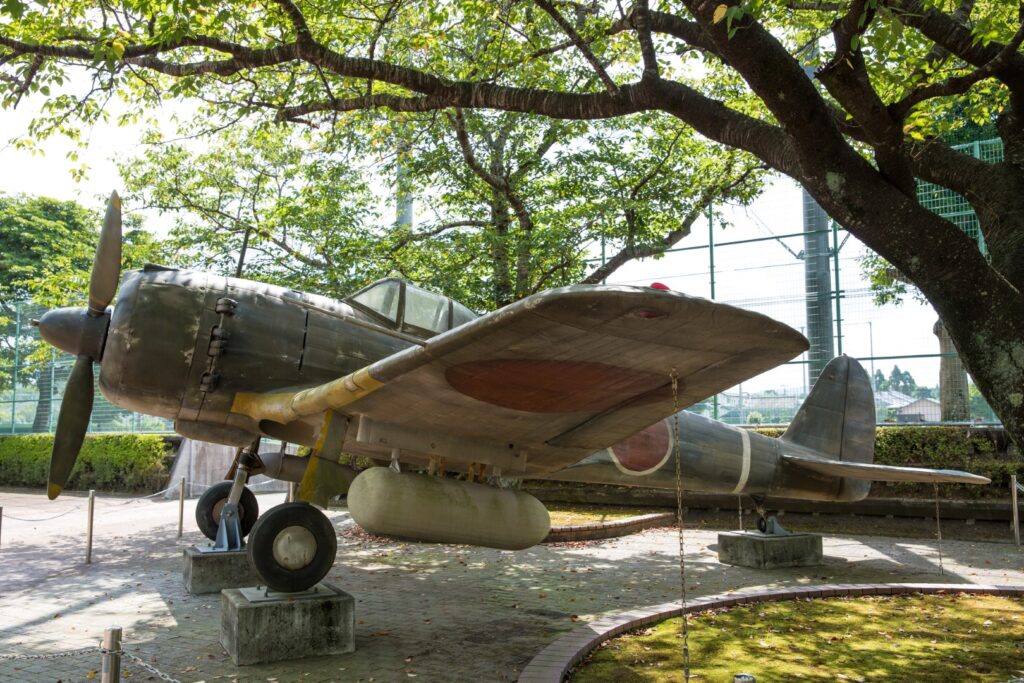
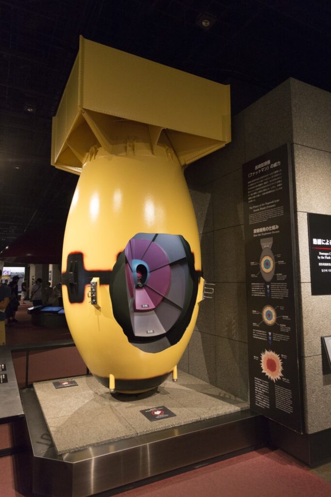
Chiran Peace(Kamikaze) Museum – 知覧特攻平和会館
Parking MAPCODE:
🔒Book rental car or hotelWhat is MAPCODE?
12:50
After enjoying the Chiran Samurai Residences, you will head to the ”Chiran Peace(Kamikaze) Museum”. Chiran is a town where a former army special attack base was located at the end of World War II. Here, valuable materials such as photographs, belongings, and records of Kamikaze Suicide Attack Team members are preserved and exhibited, and they teach us about the misery of war and the preciousness of peace and life.
-大-1024x680.jpg)
15min
5
Chabakken oka-茶ばっけん丘
Parking MAPCODE:
🔒Book rental car or hotelWhat is MAPCODE?
14:00
After feeling the horrors of war, you will head to ”Chabakken Hill”. Chiran is one of Japan’s leading tea producing areas. A wide expanse of tea fields spreads out below you, and you can see Mt. Kaimondake beyond the dark green tea fields. You can enjoy a refreshing drive through the tea plantations around this area.
5min
6
Nishitarumizu Chagyo-西垂水茶業
Parking MAPCODE:
🔒Book rental car or hotelWhat is MAPCODE?
14:30
The next destination is “Nishitarumizu Chagyo (Tea Industry)“. The matcha soft-serve ice cream made with Chiran tea, said to be the most delicious tea in Japan, is the best.
15min
7
Kamafuta Shrine-釜蓋神社
Parking MAPCODE:
🔒Book rental car or hotelWhat is MAPCODE?
15:45
The last place you will visit on this day is “Kamafuta Shrine“. This shrine is located on a place that juts out into the reef of a cove, and is known for the unique “Kamafuta Wishing”, where you pray by placing a pot lid on your head, and the “Kamafuta Throwing,” where you throw an unglazed pot lid.
45min
8
Inn in Ibusuki
Parking MAPCODE:
Please head to the hotel you reserved.What is MAPCODE?

17:30
Ibusuki, where you will be staying on this day, is known for its sand steam baths. After checking in, enjoy the inn’s sand steam bath.
If you’re traveling with children, we recommend ”Kaimon Sanroku Nature Park”, the largest subtropical botanical garden in Japan. The Tokara horses, a native species of Japan and designated as a natural monument by the prefecture, are kept free in the park, and you can even touch them.
The driving map will show an additional 10-20 spots for the day! You will travel only to your favorite spots.
Check pin color and MAPCODE usage.
On this day, you will stay in Ibusuki, a town nationally famous for its sand baths.
- Inn Type
Most of these inns are 3 to 5-star Japanese-style Ryokans with Onsen facilities. - Parking
Most inns will offer free parking. - Onsen
It is highly recommended to stay in with not only onsen but also sand bath facilities . - Meal Plan Reservations
There are a few restaurants in this area and be sure to make a reservation with a plan that includes dinner and breakfast.
Ibusuki- Kagoshima🔒
Start: Ibusuki (指宿)
Finish:Kagoshima(鹿児島)
Mileage:160km
Travel Pace: Normal
On this day, you will take the ferry to the Osumi Peninsula first thing in the morning, heading north on the Osumi Peninsula towards Kagoshima.
The driving distance on this day is 160km, which is normal, but there are some risks, such as not being able to book the ferry or being unable to depart due to stormy weather. If you cannot take the ferry, head north on the Satsuma Peninsula towards Kagoshima.
1
Inn in Ibusuki
Parking MAPCODE:
9:00
Please leave the inn at 9am to board the ferry departing from Yamakawa Port at 10am.
15min
2
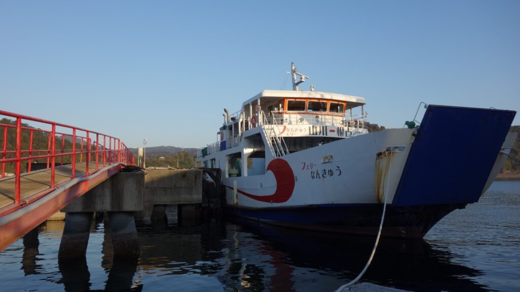
Ferry Nankyu(Yamakawa Port) – フェリーなんきゅう山川営業所
Parking MAPCODE:
🔒Book rental car or hotelWhat is MAPCODE?
9:15
You will head to Yamakawa Port. Even if you have a reservation, you must arrive at Yamakawa Port 30 minutes before the scheduled departure. Once you arrive at the port, park your car, tell the reservation name at the counter, and pay the fare.
The ferry leaves at 10 am. Enjoy the scenery from the ferry along the way. It is a 50-minute boat trip from Yamakawa Port to Nejime Port.

65min
3
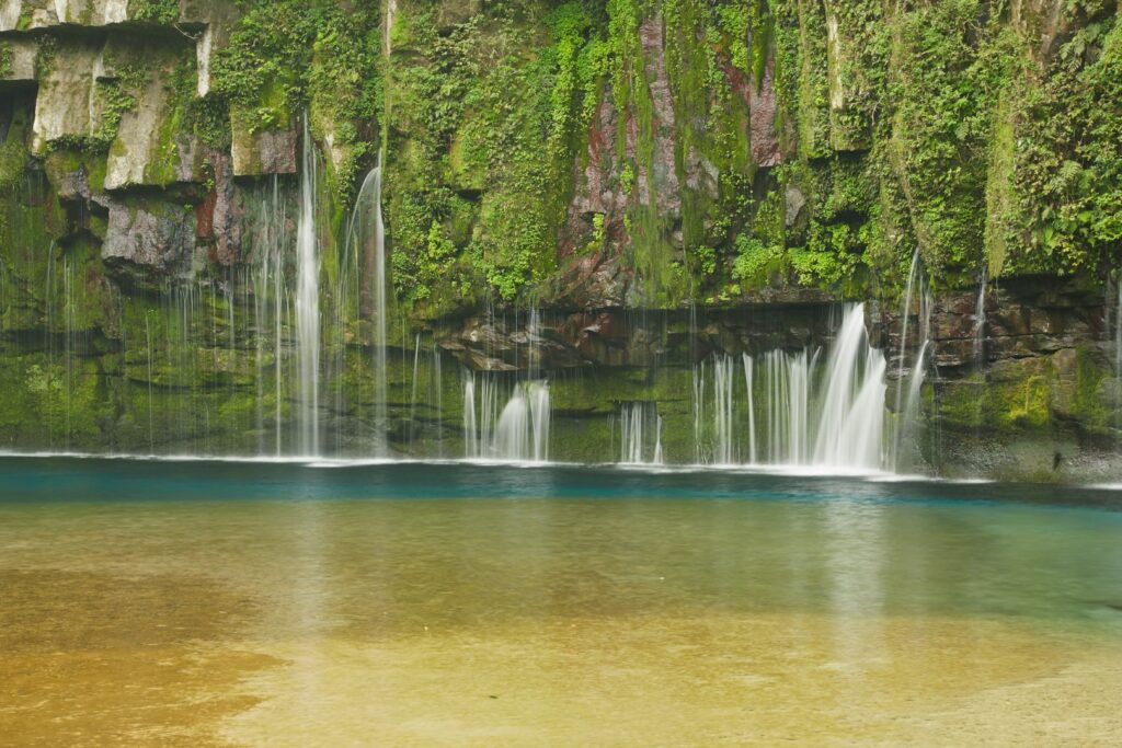
Ogawa Falls-雄川の滝
Parking MAPCODE:
🔒Book rental car or hotelWhat is MAPCODE?
11:15
After disembarking at Nejime Port, you will head to Ogawa Falls, beautiful emerald green waterfalls. It takes 15 minutes by car from Nejime Port to Ogawa Falls.
The distance from the parking lot to the waterfall is 1.2 km, but there is a promenade so you can walk comfortably. If you have time, enjoy a soft serve ice cream at a cafe near the parking lot after viewing the waterfall.
15min
4
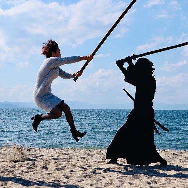
Kamikawa Beach-神川ビーチ
Parking MAPCODE:
🔒Book rental car or hotelWhat is MAPCODE?
12:30
Next, you will head to “Kamikawa Beach“, known for its shadow puppet. You can enjoy the art created by shadow puppets, the sea, and the blue sky. Please try to take unique photos using shadow puppets.
45min
5
Okan-味処桜勘
Parking MAPCODE:
🔒Book rental car or hotelWhat is MAPCODE?
13:45
After enjoying the art, you head to ”Okan” for a late lunch. This restaurant is run by the wives of fishermen, and we highly recommend it, as you can enjoy sashimi, simmered, and grilled amberjack, which is a local specialty.

10min
6
Arimura Observatory – 有村溶岩展望所
Parking MAPCODE:
🔒Book rental car or hotelWhat is MAPCODE?
15:00
After lunch, you will head to “Arimura Observatory” to feel the breath of Kagoshima’s symbol Sakurajima. The expanse of lava field and the black pine trees that spread their roots over it create an extraordinary scenery. It is not uncommon to hear a rumbling sound or the sound of an explosion accompanying an eruption.
25min
7
Black Vinegar Kakuida – 黒酢本舗桷志田
Parking MAPCODE:
🔒Book rental car or hotelWhat is MAPCODE?

16:10
Next, please check out the “Black Vinegar Kakuida” shop. Brown rice black vinegar and black vinegar dressing are on sale. Black vinegar is a specialty of this area, and you can enjoy the rare sight of large pots lined up here.

20min
8
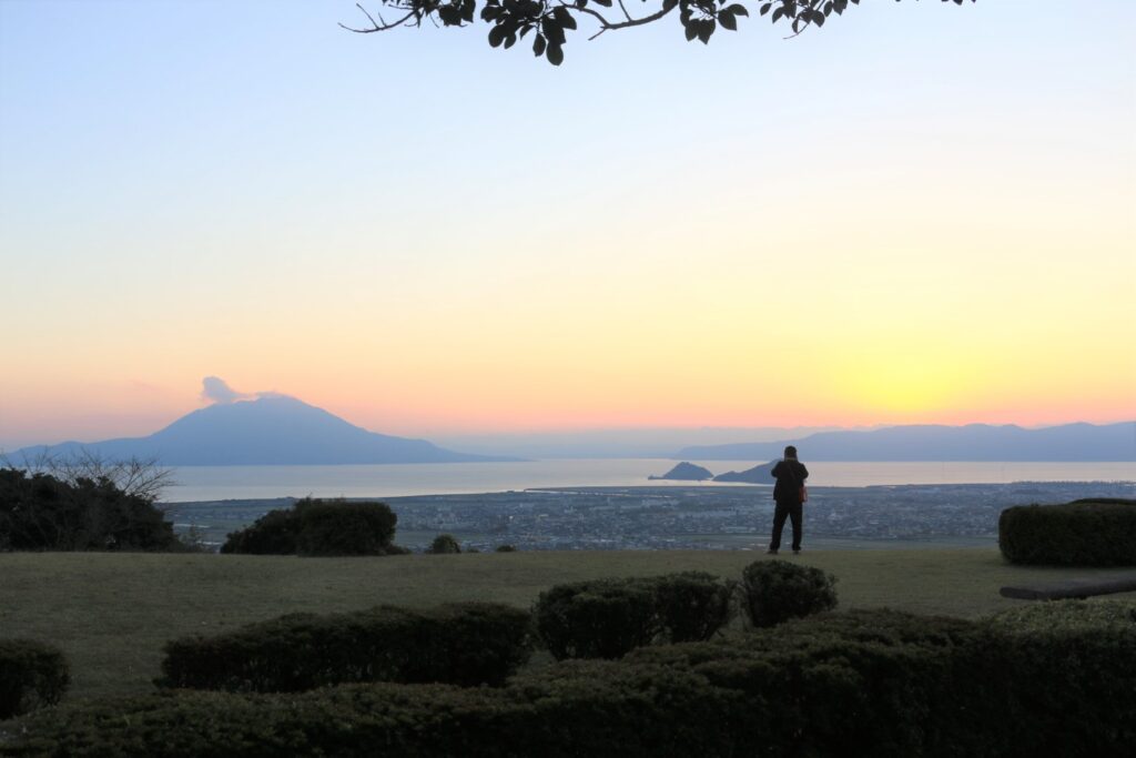
Kokubushiroyama Park – 国分城山公園
Parking MAPCODE:
🔒Book rental car or hotelWhat is MAPCODE?
17:00
The last stop of the day is “Kokubushiroyama Park“. It is a park with a spectacular view, overlooking the Kirishima Mountain Range to the north, the majesty of Sakurajima to the south, and the calm waters of Kinko Bay. The sunset view from here is especially recommended.
60min
9
Inn in Kagoshima
The following botanical gardens are on this day’s driving route.
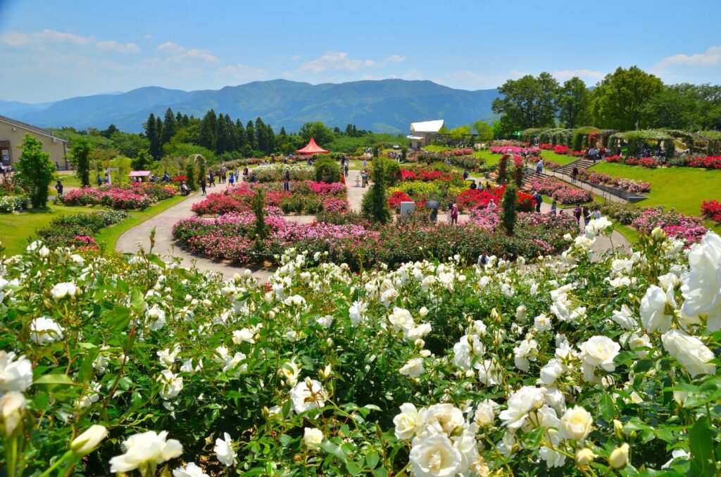
・Kanoya Rose Garden, one of the largest rose gardens in Japan (best viewing times are late April to mid-June and late October to November)
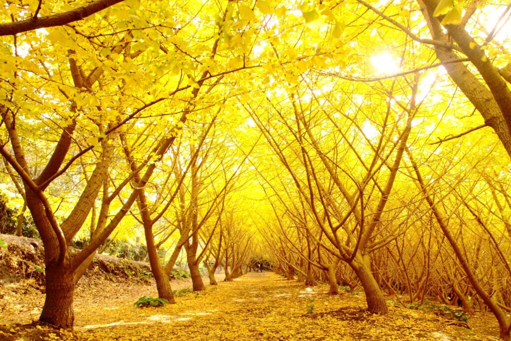
・Tarumizu 1000 Ginkgo Park with beautiful autumn leaves (best viewing period is from late November to early December)
Recommended if you are traveling during this period.
The driving map will show an additional 10-20 spots for the day! You will travel only to your favorite spots.
Check pin color and MAPCODE usage.
On this day, you will stay in Kagoshima city(鹿児島). The inns are concentrated around “Kagoshima Chuo station” and the downtown “Tenmonkan(天文館)” area.
- Inn Type
Most of these inns are 3 to 5-star western-style hotels. - Parking
Some inns have official parking but in addition to the accommodation fee, the parking lot fee will be charged separately. - Onsen
Most inns don’t have Onsens. If you would like to enjoy one, “Shiroyama Hotel”, one of Kagoshima’s most prestigious hotels is recommended. - Meal Plan Reservations
As many restaurants are open till midnight, it is recommended to book your inns with breakfast only or without meals.
Kagoshima – Kumamoto🔒
Start: Kagoshima(鹿児島)
Finish : Kumamoto(熊本)
Mileage:200km
Travel Pace: Fast
On this day, you will head from Kagoshima to Kumamoto.
The driving distance on this day is very long, approximately 200 km.
1
Inn in Kagoshima
Parking MAPCODE:
9:00
Because of the long driving, we recommend you to leave by 8-9 am if you want to travel without rushing.
If you have not already been, you should first visit Senganen Garden, one of Kagoshima’s most famous tourist attractions. It is the residence of the Shimazu family, who contributed greatly to the modernization of Japan, and from the garden, you can enjoy a majestic view of Sakurajima.
50min
2
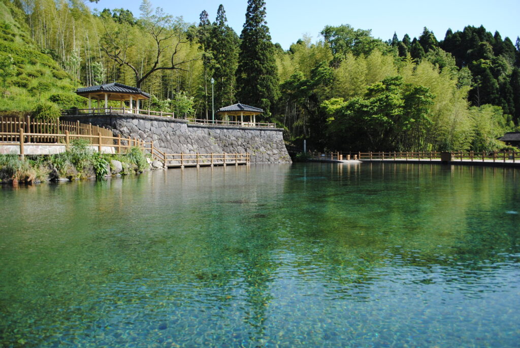
Maruike Spring Water Park-丸池湧水
Parking MAPCODE:
🔒Book rental car or hotelWhat is MAPCODE?
9:50
First, let’s head to Maruike Spring, a beautiful pond made of clean spring water. There are not many tourist attractions from Kagoshima to here, so let’s take the expressway (E3).
30min
3
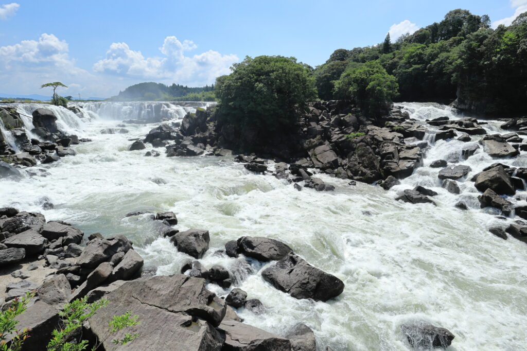
Sogi Falls-曽木の滝
Parking MAPCODE:
🔒Book rental car or hotelWhat is MAPCODE?
11:00
After driving 20 km or 30 minutes from Maruike Spring, you will arrive at the biggest highlight of the day, Sogi Falls. This 210m wide waterfall is called the Niagara of the Orient and is overwhelmingly powerful. Although it is not well known due to poor accessibility, it is a place that can be enjoyed only on a road trip.
45min
4
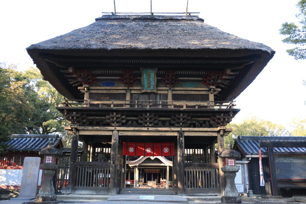
Aoi Aso Shrine-青井阿蘇神社
Parking MAPCODE:
🔒Book rental car or hotelWhat is MAPCODE?
12:50
After that, you will arrive in Hitoyoshi City.
Aoi Aso Shrine has five buildings, including the main shrine, designated as national treasures, and the magnificent thatched tower gate is especially not to be missed.
500m east of Aoi Aso Shrine is the center of Hitoyoshi City. Uemura Eel and Black Ramen are famous and recommended for lunch.
There are not too many tourist attractions between Hitoyoshi and Kumamoto, so take the expressway(E3) again to the north.
80min
5
Okoshiki Beach Observatory-御輿来海岸 展望所
Parking MAPCODE:
🔒Book rental car or hotelWhat is MAPCODE?
16:30
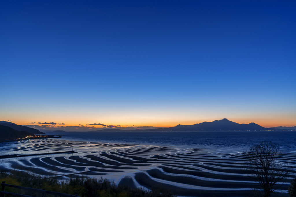
The last highlight of the day is Okoshikai Beach. The tidal flat becomes a wave pattern, and you can look over the Ariake Sea to Unzen Fugendake. Please check the time of low tide before visiting. Also, please note that depending on the time of year, the area may be jammed with many photographers.
If your travel timing does not fit into Okoshiki Beach, “Nagabeta Kaishoro-長部田海床路”, 6 km ahead, is also a great sunset spot.
Okoshiki beach tide table
60min
6
Inn in Kumamoto
Parking MAPCODE:
Please head to the hotel you reserved.What is MAPCODE?
It is a long drive and you will arrive in Kumamoto at night. You can visit Kumamoto Castle tomorrow.
The driving map will show additional 10-20 spots for the day! You will travel only to your favorite spots.
Check pin color and MAPCODE usage.
Kumamoto is the 3rd biggest city in Kyushu. The inns are concentrated south on the southeast side of Kumamoto Castle. It is better not to stay around Kumamoto Station due to a few restaurants for dinner.
- Inn Type
Most of these inns are 3 to 4-star western-style hotels. - Parking
Some inns have official parking but in addition to the accommodation fee, the parking lot fee will be charged separately. - Onsen
There are no Onsens in this town and no inns have Onsens. - Meal Plan Reservations
As many restaurants are open till midnight, it is recommended to book your inns with breakfast only or without meals.
Kumamoto – Kumamoto🔒
Start:Kumamoto(熊本)
Finish:Kumamoto(熊本)
Mileage:120km
Travel Pace: Relax
On this day, you will be staying in Kumamoto for consecutive nights and have a day trip to the beautiful Amakusa area.
1
Inn in Kumamoto
Parking MAPCODE:
9:00
The drive distance on this day is relatively short, but dolphin watching will take some time, so it’s best to leave your hotel by 9am.
50min
2
Roadside Station Udo Marina Okoshikikan-道の駅 宇土マリーナ おこしき館
Parking MAPCODE:
🔒Book rental car or hotelWhat is MAPCODE?
9:50
Your first destination of the day is a bit far, so head to Roadside Station Udo Marina Okoshikikan first. Please take a short break here while looking out at the sea.
45min
3
Mt. Takabuto Observatory Lot-高舞登山展望台
Parking MAPCODE:
🔒Book rental car or hotelWhat is MAPCODE?
11:00
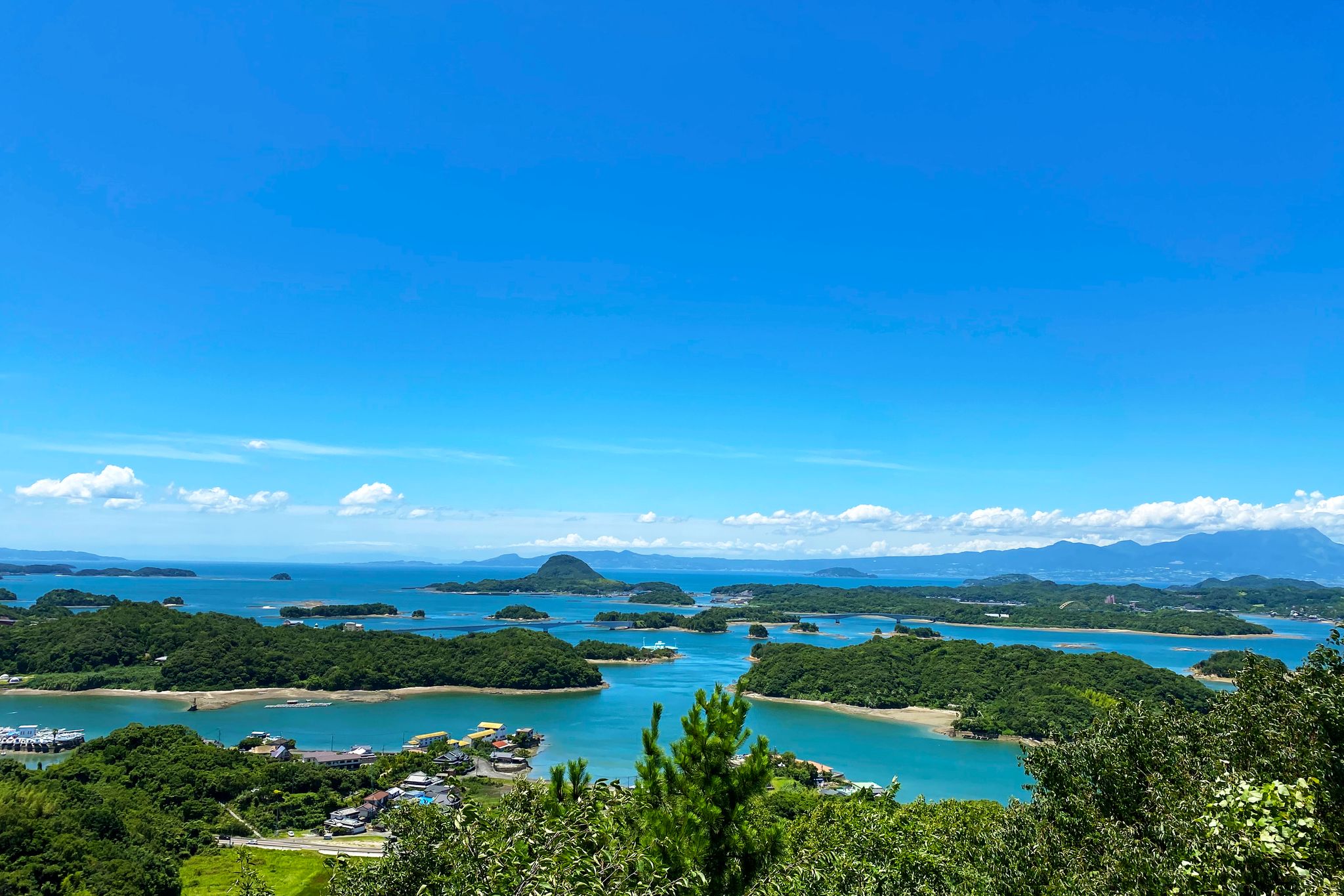
The first sightseeing spot of the day is Mt. Takabuto Observatory. This is a view spot where you can not only get a panoramic view of Unzen and Amakusa Matsushima, but also the Amakusa Gokyo Bridge that connects the islands of Amakusa.
15min
4
Fukushin-海鮮家 福伸
Parking MAPCODE:
🔒Book rental car or hotelWhat is MAPCODE?
11:40
Next, you will head to Fukushin for lunch, which serves seafood dishes made mainly from fresh seafood from Amakusa. Expecially, “Tokujo Nigiri(Sushi)-特上にぎり” and “Kurumaebi Tenju-車海老天重” is recommended.
5min
5
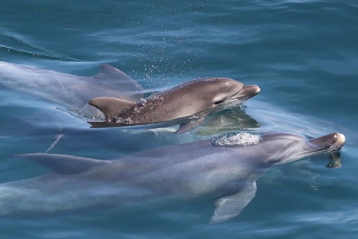
Sea Cruise Dolphin Watching-シークルーズドルフィンウォッチング
Parking MAPCODE:
🔒Book rental car or hotelWhat is MAPCODE?
12:40
After enjoying a delicious seafood lunch, head to Sea Cruise Dolphin Watching. Dolphin cruises can be enjoyed throughout the year, and you will cruise elegantly through the spectacular scenery of countless islands, the blue sea, and the Five Bridges.
Departure Time
- 1st 10:00
- 2nd 13:00
- 3rd 15:00

Sea Cruise Dolphin Watching
20min
6
Misumi West Port-三角西港
Parking MAPCODE:
🔒Book rental car or hotelWhat is MAPCODE?
16:00
Next you will head to Misumi West Port, a World Heritage Site with remnants of the Meiji period (1868-1912), is known as a tourist spot for its retro scenery and townscape.
25min
7
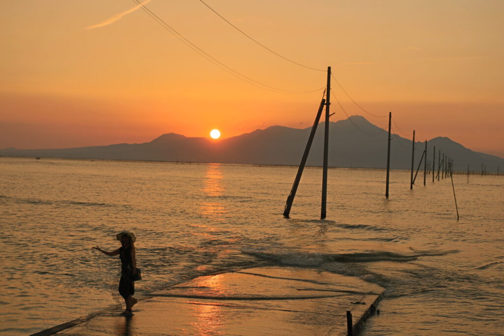
Nagabeta Kaishoro-長部田海床路
Parking MAPCODE:
🔒Book rental car or hotelWhat is MAPCODE?
17:10
The last stop of the day is Nagabeta Kaishoro. This place is known for its path to the sea. The Ariake Sea is the sea with the highest tidal range in Japan, and this path appears from the sea at low tide. The sunset from here is also famous.
45min
8
Inn in Kumamoto
Parking MAPCODE:
Please head to the hotel you bookedWhat is MAPCODE?
18:45
Please spend a relaxing night in Kumamoto.
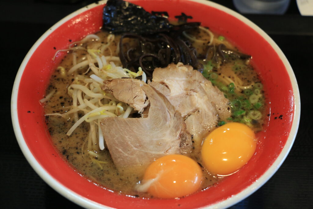
“Kumamoto Ramen” and “Basashi(Horse Sashimi)”.
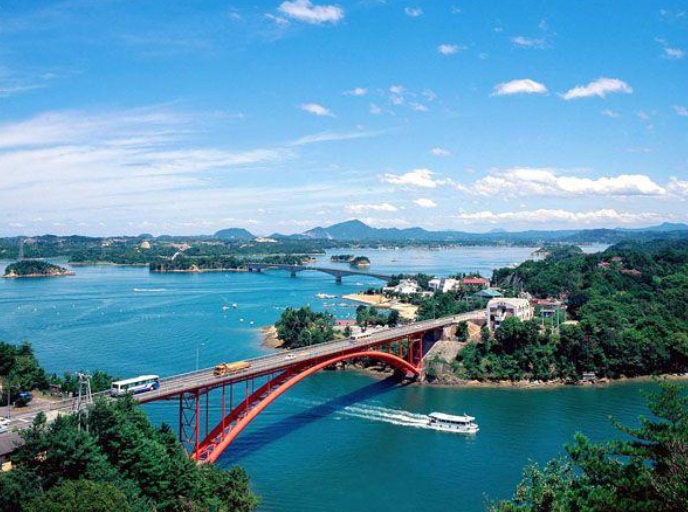
The part of Amakusa Gokyo (five bridges) on National Route 266 in Kami-Amakusa City, which you will pass on this day, is called the “Amakusa Pearl Line”, and you can enjoy landscapes similar to Matsushima, one of Japan’s three most scenic views.
If you are traveling with kids, “Amakusa Pearl Garden & Sea Donut Aquarium” is the place for you. This complex is a popular spot for adults and children, with shops including a pearl specialty store, restaurants, and an aquarium.

The driving map will show an additional 10-20 spots for the day! You will travel only to your favorite spots.
Check pin color and MAPCODE usage.
Kumamoto is the 3rd biggest city in Kyushu. The inns are concentrated south on the southeast side of Kumamoto Castle. It is better not to stay around Kumamoto Station due to a few restaurants for dinner.
- Inn Type
Most of these inns are 3 to 4-star western-style hotels. - Parking
Some inns have official parking but in addition to the accommodation fee, the parking lot fee will be charged separately. - Onsen
There is no onsen in this town and no inns have onsens. - Meal Plan Reservations
As many restaurants are open till midnight, it is recommended to book your inns with breakfast only or without meals.
Kumamoto – Nagasaki🔒
Start: Kumamoto(熊本)
Finish: Nagasaki(長崎)
Mileage:110km
Travel Pace: Normal
On this day, you will head from Kumamoto to Nagasaki.
The distance traveled is only about 110 km, but you need to be careful with the schedule as you will be traveling by car ferry from Kumamoto Port to Shimabara Port.
1
Inn in Kumamoto
2
Kumamoto Castle-熊本城
Parking MAPCODE:
🔒Book rental car or hotelWhat is MAPCODE?
9:10
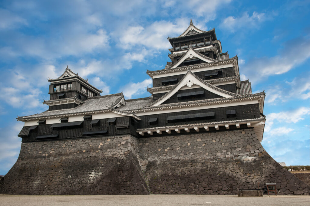
First, we will head to Kumamoto Castle, the symbol of Kumamoto, which was damaged by the Kumamoto Earthquake in 2016, but restoration work on the castle tower was completed in March 2021.
20min
3
Suizenji Jojuen Garden-水前寺成趣園
Parking MAPCODE:
🔒Book rental car or hotelWhat is MAPCODE?

11:30
Suizenji Jojuen Garden is a Japanese garden with a pond garden style. It is only 4 km away from Kumamoto Castle, so it is recommended to visit there as well.
Please leave here by 12:00 p.m. to catch the ferry. Depending on the time, please consider skipping this spot.
40min
4
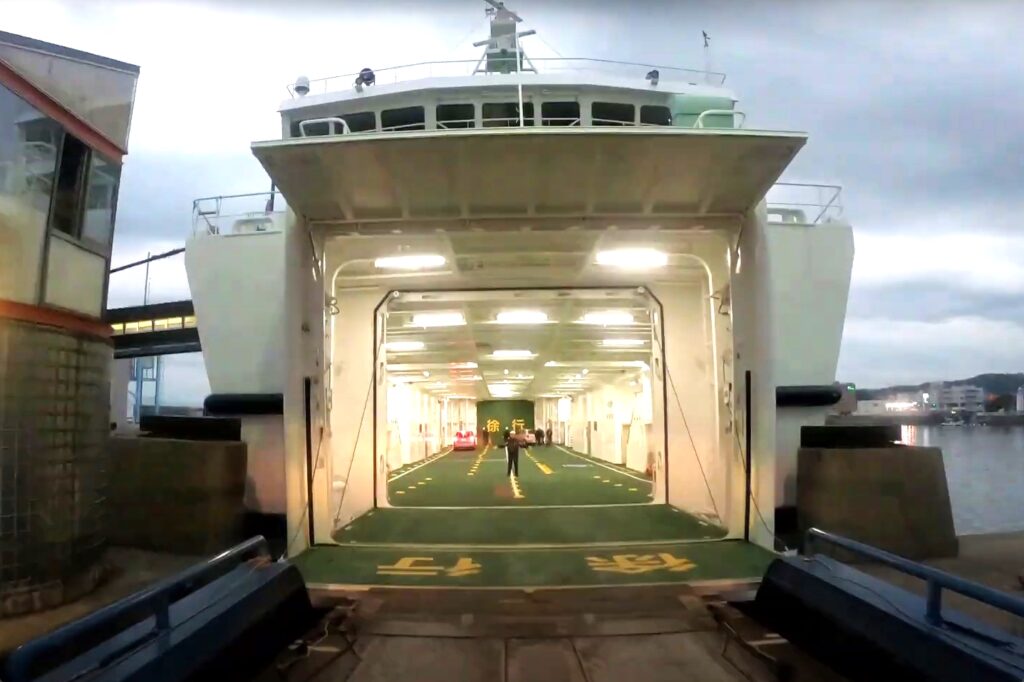
Kumamoto Ferry
Parking MAPCODE:
🔒Book rental car or hotelWhat is MAPCODE?
12:30
On this day, you will cross the Ariake Sea by car ferry from Kumamoto Port to Shimabara Port.
There are two ferry companies, Kumamoto Ferry(熊本フェリー) and Kyusho Ferry(九商フェリー). Kumamoto Ferry is slightly more expensive but takes half the time.
Drive Japan recommends the Kumamoto ferry which departs at 13:00.
Be sure to catch the 13:40 departure of the Kyushu Sho Ferry at the latest.
For passenger cars, please complete the boarding procedure 20 minutes before departure.
| Kumamoto Ferry | Kyusho Ferry | |
| Fare | JPY3,980 | JPY3,690 |
| Cruise time | 30min | 60min |
| Departure Time | 13:00 | 12:25 or 13:40 |
Kumamoto Ferry(熊本フェリー)
Kyusho Ferry(九商フェリー)
5
Himematsuya-姫松屋 本店
Parking MAPCODE:
🔒Book rental car or hotelWhat is MAPCODE?
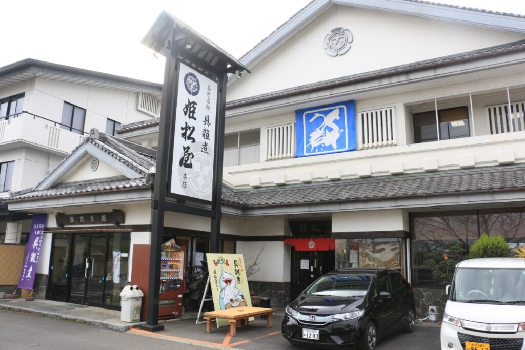
Once you arrive at Shimabara Port, let’s have lunch.
We recommend Shimabara’s traditional dish, Guzoni(具雑煮), a healthy hot pot with 13 different ingredients.
40min
6
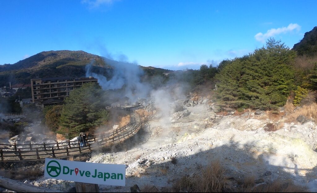
Unzen Jigoku Hell-雲仙地獄
Parking MAPCODE:
🔒Book rental car or hotelWhat is MAPCODE?
15:15
After that, let’s head to Unzen Jigoku Hell. In the center of Unzen, famous for its volcanoes and hot springs, you can stroll through the fantastic sight of steam erupting.
If the weather is fine, it is also recommended to drive along the nearby Nitatoge Circular Road(仁田峠循環道路) and visit the NitaPass 2nd Observatory. You can enjoy a spectacular view overlooking Shimabara City and the Ariake Sea.
The journey from Unzen Hell to Nagasaki is about 50 km, or 1 hour and 10 minutes.
70min
7
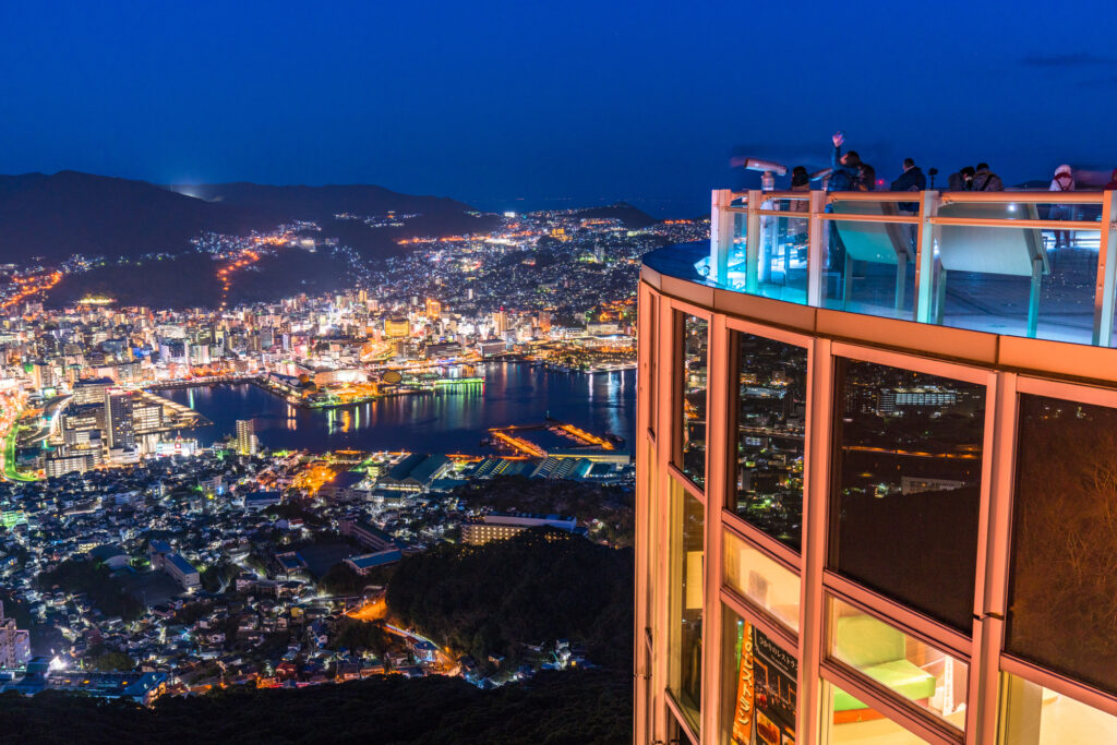
Mt.Inasayama observatory-稲佐山展望台
Parking MAPCODE:
Please refer driving mapWhat is MAPCODE?
17:30
Mt.Inasa is one of Japan’s top three nightscapes along with Mt.Hakodate in Hokkaido and Mt. Rokko in Kobe.
Please remember that general vehicles are not allowed to enter the summit park between 18:00 and 22:00 on Saturdays, Sundays, national holidays, and during peak season. If you wish to climb the mountain during these hours, use the ropeway.
You can refer to MAPCODE for parking for both the summit and the ropeway on the driving map.
20min
8
Inn in Nagasaki
Parking MAPCODE:
Please head to the hotel you reserved.What is MAPCODE?
You can visit Peace Park, Dejima, and the rest of the city tomorrow.
Also, if you stay only one night in Nagasaki, you will not have enough time to explore the city. If you want to visit Atomic Bomb Museum, Dejima, or the famous Gunkanjima (Battleship Island), we recommend you stay one more night in Nagasaki.
The driving map will show additional 10-20 sightseeing spots and local restaurants for the day!
You can travel freely, choosing only the spots you like!
Check pin color and MAPCODE usage.
On this day, you will stay in Nagasaki city(長崎) which is famous for its night view and the atomic bomb.
The inns are concentrated in between “Nagasaki Station” and “China Town”. If you prefer luxury inns, it is also recommended to stay on Mt.Inasayama side.
- Inn Type
Most of these inns are 3 to 5-star western-style hotels. - Parking
Some inns have official parking but in addition to the accommodation fee, the parking lot fee will be charged separately. - Onsen
There is no Onsen in this town and no inns have Onsens. - Meal Plan Reservations
As many restaurants are open till midnight, it is recommended to book your inns with breakfast only or without meals.
Nagasaki – Ureshino🔒
Start:Nagasaki(長崎)
Finish:Ureshino(嬉野) or Takeo(武雄) or Huis Ten Bosch
Mileage:170km
Travel Pace: Fast
On this day, you will leave Nagasaki for Ureshino Onsen town or Takeo Onsen town.
The two towns are only about 15 km apart, so you can stay in either town. It is also a good idea to stay in “Huis Ten Bosch”.
The driving distance on this day is long, approximately 170 km, and there is no expressway so you need to travel at a slightly faster pace.
1
Inn in Nagasaki
Parking MAPCODE:
🔒Book rental car or hotelWhat is MAPCODE?
9:00
If you want to take your time in Nagasaki city, it is recommended to leave early.
The opening hours of major sightseeing spots in the city are as follows.
| Open | |
| Glover Garden | 8:00 |
| Atomic Bomb Museum | 8:30 |
| Dejima | 8:00 |
2
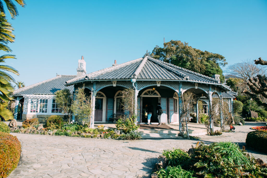
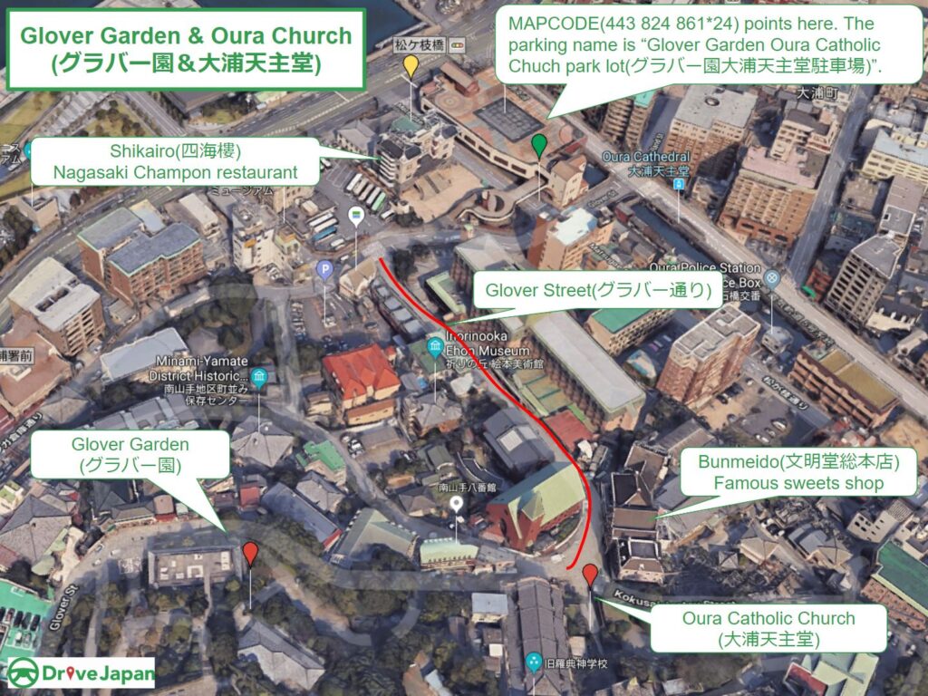
Glover Garden&Oura Catholic Church-グラバー園&大浦天主堂
Parking MAPCODE:
🔒Book rental car or hotelWhat is MAPCODE?
9:10
Glover Garden and Oura Tenshudo are very close by, so park in the public parking lot and walk.
The slope is very steep, so comfortable walking shoes are recommended.
From Glover Garden, you can enjoy a panoramic view of Nagasaki’s harbor.
15min
3
Nagasaki Atomic Bomb Museum-長崎原爆資料館
Parking MAPCODE:
🔒Book rental car or hotelWhat is MAPCODE?
This is a museum about the atomic bomb dropped on Nagasaki in 1945. There is also a Peace Park 500 meters away, but the museum is more recommended.
40min
4
Roadside Station Yuhigaoka Sotome-道の駅 夕陽が丘そとめ
Parking MAPCODE:
🔒Book rental car or hotelWhat is MAPCODE?
12:30
After 40 minutes from Nagasaki City, you will arrive at “Roadside Station Yuhigaoka Sotome”.
40min
From here, you can enjoy an exhilarating drive along the beautiful coastal road, Nagasaki Sunset Road, to the north.

5
Saikaibashi Bridge-西海橋
Parking MAPCODE:
🔒Book rental car or hotelWhat is MAPCODE?
13:20
At Saikai Bridge, you can see the whirlpools if the timing is right. There are also souvenir stores and restaurants, perfect for a rest stop.
40min
Huis Ten Bosch, Kyushu’s largest theme park, is located 15 minutes from Saikai Bridge.
It offers seasonal flowers, attractions, and a variety of events. You will need at least half a day to visit Huis Ten Bosch, so it is recommended that you stay directly in the park or at an inn in the area.
6
Ishidake Observatory-石岳展望台
Parking MAPCODE:
🔒Book rental car or hotelWhat is MAPCODE?
The biggest highlight of the day was the Ishidake Observatory.
Generally speaking, the other observatory “Tenkaiho observatory” is more famous, but Ishidake Observatory, which is not accessible by bus, is higher in elevation and is by far the best place to enjoy a truly 360-degree panoramic view of Kujuku Islands and the city of Sasebo with its huge shipbuilding yard.
Tenkaiho observatory is also a famous place for flowers. The rape blossoms and cosmos season are especially recommended.
50min
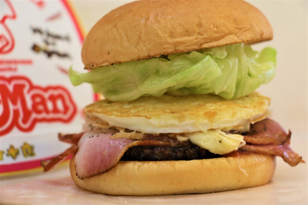
The Sasebo area is also nationally famous for its Sasebo Burger. The famous shop is listed on the driving map, so why don’t you try?
7
Inn in Ureshino Onsen or Takeo Onsen
Parking MAPCODE:
Please head to the hotel you reserved.What is MAPCODE?
In the evening, relieve your fatigue in the hot springs of Ureshino and Takeo.
The driving map will show additional 10-20 sightseeing spots and local restaurants for the day!
You can travel freely, choosing only the spots you like!
Check pin color and MAPCODE usage.
On this day, you will stay in either Takeo Onsen town or Ureshino Onsen town. It is 15km and takes about 30min. Both of them are famous for their Onsen. Takeo has more luxury inns.
- Inn Type
Most of these inns are 3 to 5-star Japanese-style Ryokans with Onsen facilities. - Parking
Most inns will offer free parking. - Onsen
This town is famous for Onsen and most of the inns have one. - Meal Plan Reservations
There are some restaurants around the hotel for dinner but most inns also provide dinner plans, so please make reservations according to your preference.
Ureshino – Fukuoka🔒
Start:Ureshino(嬉野) or Takeo(武雄) or Huis Ten Bosch
Finish: Fukuoka(福岡)
Mileage:160km
Travel Pace: Normal
On this day, we will return to Fukuoka from Ureshino.
The driving distance is about 160 km.
1
Inn in Ureshino Onsen
Parking MAPCODE:
🔒Book rental car or hotelWhat is MAPCODE?
Because there are so many spots to see, we recommend that you leave by 8-9 am if you want to travel without rushing.
If you are not staying in Fukuoka today and will be taking the Shinkansen or airplane, please arrange your schedule so that you can return the rental car to the rental store at least one and a half hours before your flight.
20min
2
Mifuneyama Rakuen garden-御船山楽園
Parking MAPCODE:
🔒Book rental car or hotelWhat is MAPCODE?
9:20
First, stop by Mifuneyama Rakuen, located near Takeo Onsen.
This garden was created in 1845 and offers a variety of seasonal scenery including cherry blossoms, wisteria, azaleas, and autumn leaves.
35min
3
Imari Okawa Uchiyama-伊万里大川内山
Parking MAPCODE:
🔒Book rental car or hotelWhat is MAPCODE?
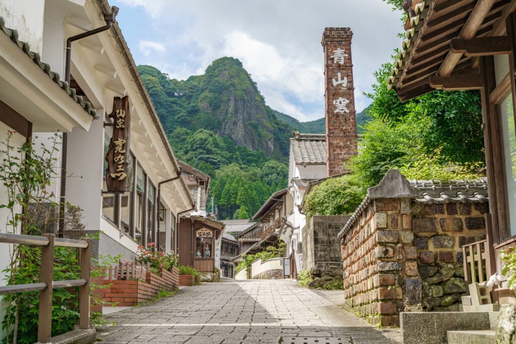
10:45
Imari and Arita are world-famous for porcelain, and here in Okawauchiyama, the official kiln of the Saga Clan was located. The scene of many kilns quietly lined up in the mountains was to prevent the leakage of advanced technology to the outside world and it truly makes this place a hidden village.
60min
4
Under Water restaurant Manbo-海中魚処萬坊
Parking MAPCODE:
🔒Book rental car or hotelWhat is MAPCODE?
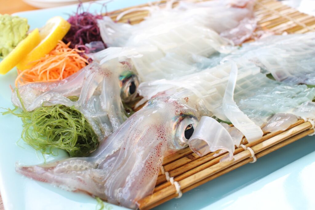
12:45
If you have enough time for lunch, it is highly recommended to go to Yobuko town for squid. You can enjoy wonderfully fresh and delicious squid that is as good as Hakodate’s.
50min
5
Kagamiyama Observatory-鏡山展望台
Parking MAPCODE:
🔒Book rental car or hotelWhat is MAPCODE?
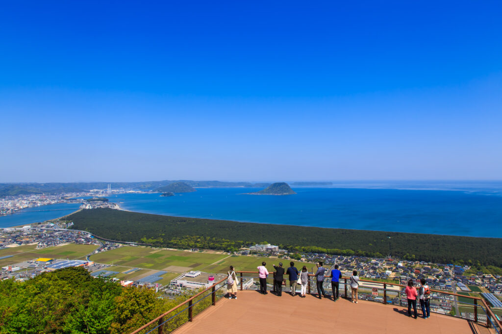
15:10
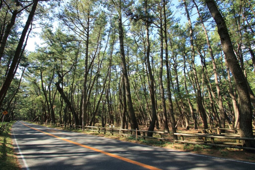
The biggest highlight of the day is the Kagamiyama Observatory. It is one of the most beautiful observatories in Kyushu with a panoramic view of Niji-no-Matsubara pine forest, Karatsu Castle, and Karatsu Bay, and it is a wonder that it is not more famous.
At the foot of the observatory is a 4.5 km-long pine forest of one million pine trees called “Niji-no-Matsubara. You can also enjoy driving through the pine forest, so please refer to the driving map.
60min
6
Sakurai Futamigaura Couple Rock-桜井二見ヶ浦の夫婦岩
Parking MAPCODE:
🔒Book rental car or hotelWhat is MAPCODE?
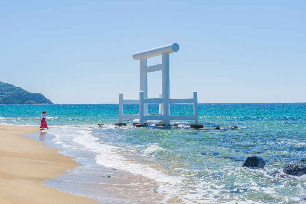
16:50
If you still have time, stop by the “Sakurai Futamigaura Couple Rock” in Itoshima before returning to Fukuoka.
The sight of a pure white torii gate facing the husband and wife rocks offshore is very popular as a great photo spot. There are also stylish cafes and Instagram spots scattered around the area.
50min
7
Rental car branch at Fukuoka airport or Hakata Station
Parking MAPCODE:
Please head to the rental car branchWhat is MAPCODE?
18:10
This concludes your Kyushu road trip.
When you return to Fukuoka, refuel and then return the car to the car rental branch. Use the MAPCODE on the driving map for the nearest gas stations at Hakata Station and Fukuoka Airport.
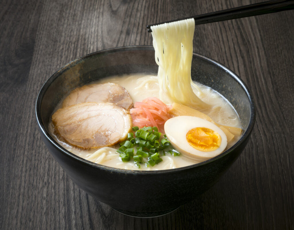
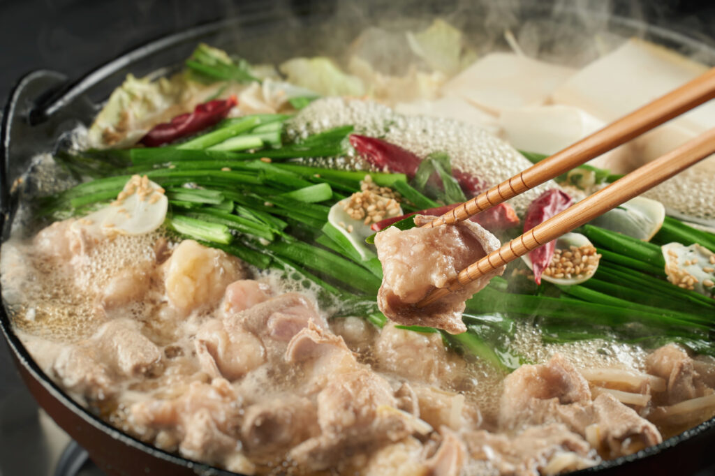
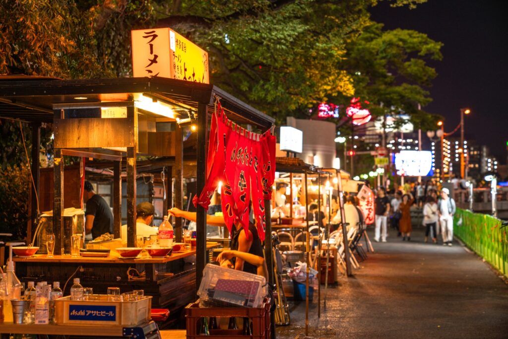
Fukuoka offers a wide variety of culinary delights. For dinner, try Hakata ramen, Motsu nabe (Motsu hot pot), and other local Fukuoka foods, or even try one of the famous Yatai stalls.
The driving map will show additional 10-20 sightseeing spots and local restaurants for the day!
You can travel freely, choosing only the spots you like!
Check pin color and MAPCODE usage.
Fukuoka is the biggest city in Kyushu and the gateway of Kyushu Travel. It takes 15min to Fukuoka Airport by subway. There are hundreds of accommodations around “Hakata Station”, Nakasu downtown area, and Tenjin Station.
- Inn Type
Most of these inns are 2 to 5-star western-style hotels. - Parking
Some inns have official parking but in addition to the accommodation fee, the parking lot fee will be charged separately. - Onsen
There is no Onsen in this town and no inns have Onsens. - Meal Plan Reservations
As many restaurants are open till midnight, it is recommended to book your inns with breakfast only or without meals.
Unlock MAPCODE & Maps
We provide “Travel Kit” to make your journey much more attractive.
- Get “Hidden Gems” info along this itinerary
- Maximize travel time by parking MAPCODE for all spots
- Discover local delicacies with Restaurants List
Hotel&Car Booking
- Highly recommended to book a rental car first to book hotels with special discounts.
- Book hotels. Recommend hotels have parking and convenient locations for dining and strolling. Selected hotels can be booked with a single payment.
With rental car booking number, you can book hotels with exclusive discounts(Avg.18%, Max45% OFF)!
Rental Car Booking
Please rent a car with below “Rentalcars.com” link.
- The abundant number of rental cars
- Price comparisons with several major car rental companies
- Free cancellation

Pick-up & Drop-off Location Guide
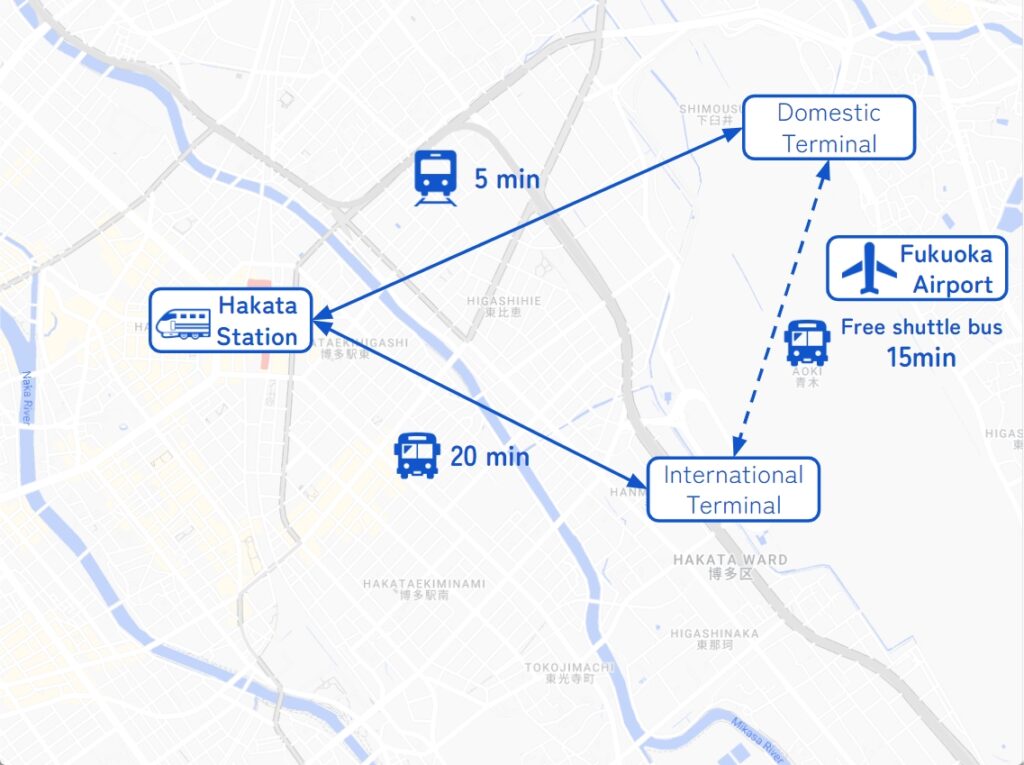
- Fukuoka Airport
The main international airport in Kyushu. Recommended for Pick-up.
If you arrive after 14:00, consider staying overnight in Fukuoka City and departing the next morning.
It takes 5-20min to Hakata station by metro or bus. - Fukuoka City
The biggest and gateway city in Kyushu. Most car rental shops are located around Hakata Station.
Important reminder for renting a car
- GPS(Car Navigation System)
MAPCODE from Drive Japan navigates you precisely to the parking lot. GPS from major car rental companies(Nippon, ORIX, Nissan, Times) are always MAPCODE compatible. However, if you are renting a car from another company, we recommend that you check with the rental company after making a reservation, just to be sure. - One-way Rental
You can rent at Fukuoka Airport and return to Fukuoka city, and vice versa. Normally, the one-way charge is free of charge. - Child Seat
In Japan, the use of a child safety seat or baby seat is mandatory for children under 5 years old.
Be sure to request one from “Extras”. - Snow Tire
Kyushu rarely gets much snow, even in winter. However, if you drive around Aso from December to February, recommend requesting it.